Llangoed / Llangourda
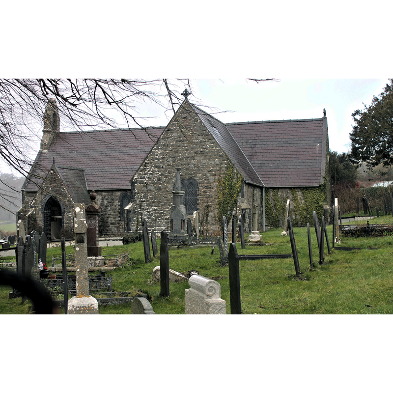
Image copyright © Llywelyn2000, 2015
CC-BY-SA-4.0
Results: 2 records
view of church exterior - south view
Copyright Statement: Image copyright © Llywelyn2000, 2015
Image Source: digital photograph taken 24 February 2015 by Llywelyn2000 [https://commons.wikimedia.org/wiki/File:Eglwys_Sant_St_Cawrdaf_Church_(misspelt_as_St_Cawdraf),_Llangoed,_Ynys_Môn,_Cymru,_North_Wales_03.JPG] [accessed 22 January 2020]
Copyright Instructions: CC-BY-SA-4.0
view of stoup
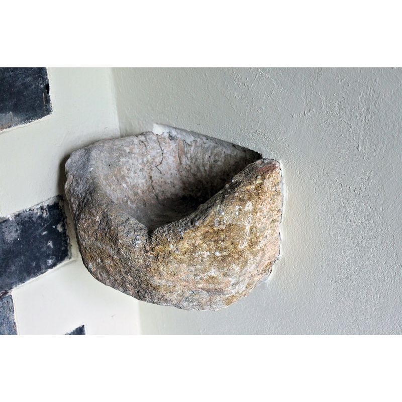
Copyright Statement: Image copyright © Llywelyn2000, 2015
Image Source: digital photograph taken 24 February 2015 by Llywelyn2000 [https://commons.wikimedia.org/wiki/File:Eglwys_Sant_St_Cawrdaf_Church_(misspelt_as_St_Cawdraf),_Llangoed,_Ynys_Môn,_Cymru,_North_Wales_04.JPG] [accessed 22 January 2020]
Copyright Instructions: CC-BY-SA-4.0
INFORMATION
Font ID: 12403LLA
Object Type: Baptismal Font1
Font Century and Period/Style: Medieval [composite]
Church / Chapel Name: Parish Church of St. Cawrdaf and St. Tangwn / Eglwys Sant Cawrdaf
Font Location in Church: Inside the church
Church Patron Saint(s): St. Cawrdaf [aka Cwrda, Cawrdav]& St. Tangwn
Church Address: B5109, Llangoed, Beaumaris LL58 8NF, UK
Site Location: Gwynedd, Anglesey, Wales, United Kingdom
Directions to Site: Located off (W) the B5109, 2 km ESE of Penmon, 4-5 km N of Beaumaris, in Anglesey
Font Notes:
Click to view
Lewis' Dictionary of 1849 reports: "The font, a relic of an older building, is a small circular basin, placed at the western end of the nave". [NB: this same source suggests that some parts of the building date from the reign of James I [i.e., 1603-1625] but the font must have been passed on from an earlier building on the site or brought from elsewhere]. The entry for this parish in the RCAHM's An Inventory of the Ancient Monuments in Anglesey (vol. 2, 1960: 92-93) reports a modern church but for a 1612 north transept, and a font "a plain octagonal bowl on a modern pedestal, 14th-century". The brief entry for this church in COFLEIN [https://coflein.gov.uk/en/site/27467/details/st-cawrdafs-church-llangoed] [accessed 22 January 2020] reads: "Rebuilt in 1881, except for original transcept [sic] 1612." There is also a wall-mountedholy-water stoup that may go back to the original church here.
COORDINATES
UTM: 30U 427465 5905464
Latitude & Longitude (Decimal): 53.293422, -4.088245
Latitude & Longitude (DMS): 53° 17′ 36.32″ N, 4° 5′ 17.68″ W
MEDIUM AND MEASUREMENTS
Material: stone
Font Shape: cf. Font Notes
Basin Interior Shape: round
Basin Exterior Shape: cf. Font Notes
REFERENCES
- Lewis, Samuel, A Topographical Dictionary of Wales, Comprising the Several Counties, Cities, Boroughs, Corporate and Market Towns, Parishes, Chapelries, and Townships, with Historical and Statistical Descriptions [...], London: S. Lewis, 1833, [www.british-history.ac.uk/report.asp?compid=47851] [accessed 14 December 2006]