Ratcliffe-on-the-Wreake / Radeclive
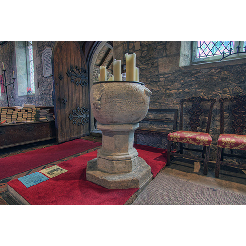
Image copyright © Christopher Jones, 2015
Standing permission
Results: 5 records
design element - motifs - unidentified
Scene Description: the broken off motifs are no longer identifiable; notice the crude workmanship of the basin, and the later-date base
Copyright Statement: Image copyright © Christopher Jones, 2015
Image Source: digital photograph taken by Christopher Jones [www.leicestershirechurches.co.uk/ratcliffe-on-the-wreake-st-botolphs/] [accessed 19 August 2015]
Copyright Instructions: Standing permission
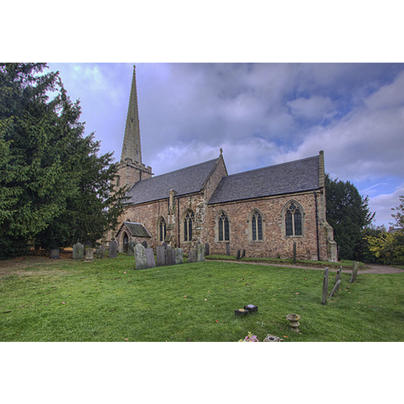
view of church exterior - southeast view
Copyright Statement: Image copyright © Christopher Jones, 2015
Image Source: digital photograph taken by Christopher Jones [www.leicestershirechurches.co.uk/ratcliffe-on-the-wreake-st-botolphs/] [accessed 19 August 2015]
Copyright Instructions: Standing permission
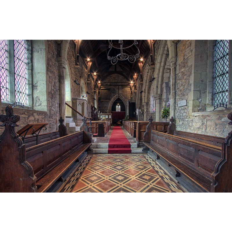
view of font and cover in context
Copyright Statement: Image copyright © Christopher Jones, 2015
Image Source: digital photograph taken by Christopher Jones [www.leicestershirechurches.co.uk/ratcliffe-on-the-wreake-st-botolphs/] [accessed 19 August 2015]
Copyright Instructions: Standing permission
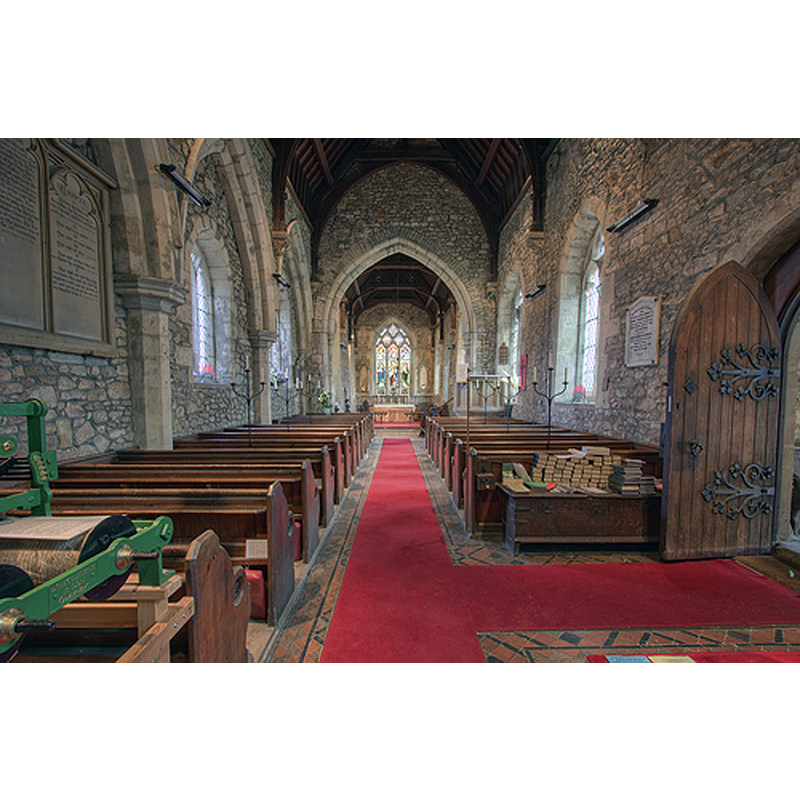
view of church interior - nave - looking west
Copyright Statement: Image copyright © Christopher Jones, 2015
Image Source: digital photograph taken by Christopher Jones [www.leicestershirechurches.co.uk/ratcliffe-on-the-wreake-st-botolphs/] [accessed 19 August 2015]
Copyright Instructions: Standing permission
view of church interior - nave - looking east
Copyright Statement: Image copyright © Christopher Jones, 2015
Image Source: digital photograph taken by Christopher Jones [www.leicestershirechurches.co.uk/ratcliffe-on-the-wreake-st-botolphs/] [accessed 19 August 2015]
Copyright Instructions: Standing permission
INFORMATION
Font ID: 12380RAT
Object Type: Baptismal Font1
Font Century and Period/Style: 12th - 13th century [basin only] -- 19th century [base only], Medieval [composite]
Church / Chapel Name: Parish Church of St. Botolph
Font Location in Church: Inside the church, W end, S side
Church Patron Saint(s): St. Botulph [aka St. Botolph, Botolph of Thorney, Botulf]
Church Address: 32 Church Lane, Ratcliffe on the Wreake, Leics. LE7 4SF, UK
Site Location: Leicestershire, East Midlands, England, United Kingdom
Directions to Site: Located off (E) the A46, SE of Melton Mowbray, 15 km NE of Leicester
Ecclesiastic Region: Diocese of Leicester
Historical Region: Hundred of Goscote
Additional Comments: composite font / altered font: the basin is now mounted on a 19th-cent base
Font Notes:
Click to view
There is an entry for Ratcliffe [on-the-Wreake] [variant spelling] in the Domesday survey [http://opendomesday.org/place/SK6314/ratcliffe-on-the-wreake/] [accessed 19 August 2015] but it mentions neither cleric nor church in it. English Heritage [Listing NGR: SK6304614534] (1966) reports a "C12/C13 round font on probably C19 octagonal base". A font here is noted in Pevsner (1984): "Font. C12 or C13, bowl-shaped, with four knobs originally no doubt carved with motifs."
Credit and Acknowledgements: We are grateful to Christopher Jones, of Leicestershire Churches [www.leicestershirechurches.co.uk], for his photographs of this church and font
COORDINATES
UTM: 30U 630462 5843373
Latitude & Longitude (Decimal): 52.724484, -1.068186
Latitude & Longitude (DMS): 52° 43′ 28.14″ N, 1° 4′ 5.47″ W
MEDIUM AND MEASUREMENTS
Material: stone
Font Shape: hemispheric, mounted
Basin Interior Shape: round
Basin Exterior Shape: round
LID INFORMATION
Date: modern
Material: wood
Apparatus: no
Notes: round, flat and plain; modern
REFERENCES
- Pevsner, Nikolaus, Leicestershire and Rutland, Harmondsworth: Penguin Books, 1984, p. 359