Croxton Kerrial / Crohtone / Croxton Kyiel
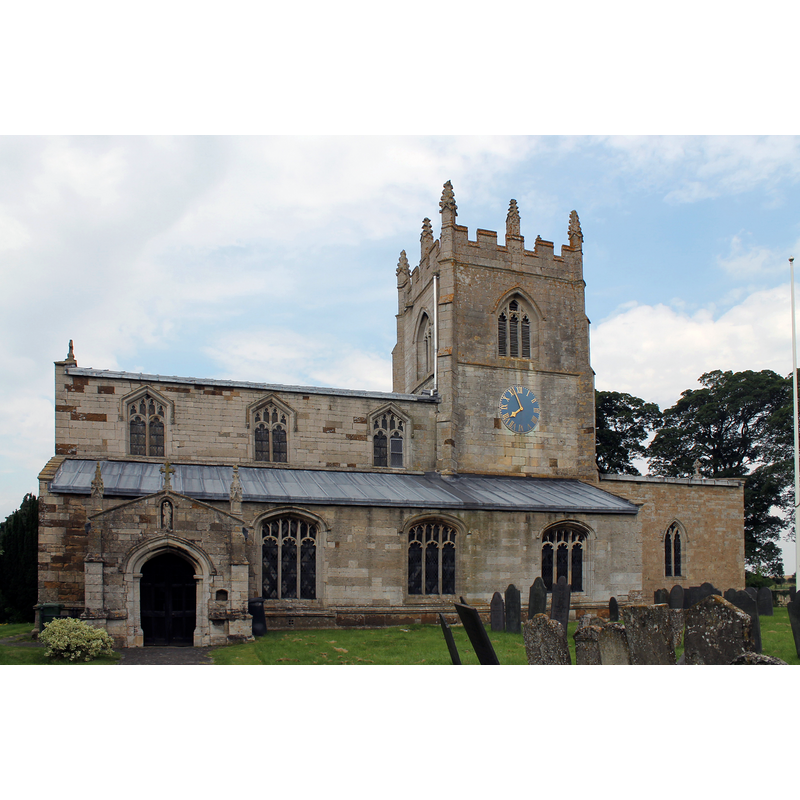
Image copyright © J. Hannan-Briggs, 2012
CC-BY-SA-2.0
Results: 8 records
view of church exterior - south view
Scene Description: Source caption: "Ss Botolph & John the Baptist Church, Croxton Kerrial. 15th C. church restored in 1866-68 by Scott. Has a central tower (although more eastern than central) on diagonal stepped buttresses with 8 pinnacles. North and south aisles with 3 bay arcades. The pews date from 1534 when they were donated by Crowson Abbey at the time of dissolution. There are 42 unique pew ends. The organ is by Nicholson of Worcester 1849."
Copyright Statement: Image copyright © J. Hannan-Briggs, 2012
Image Source: digital photograph taken 11 August 2012 by J.Hannan-Briggs [www.geograph.org.uk/photo/3108695] [accessed 28 April 2016]
Copyright Instructions: CC-BY-SA-2.0
view of font and cover in context
Scene Description: at the west end of the nave
Copyright Statement: Image copyright © Kate Jewell, 2008
Image Source: digital photograph taken 8 October 2008 by Kate Jewell [www.geograph.org.uk/photo/999913] [accessed 28 Aprl 2016]
Copyright Instructions: CC-BY-SA-2.0
view of church interior - bench-end
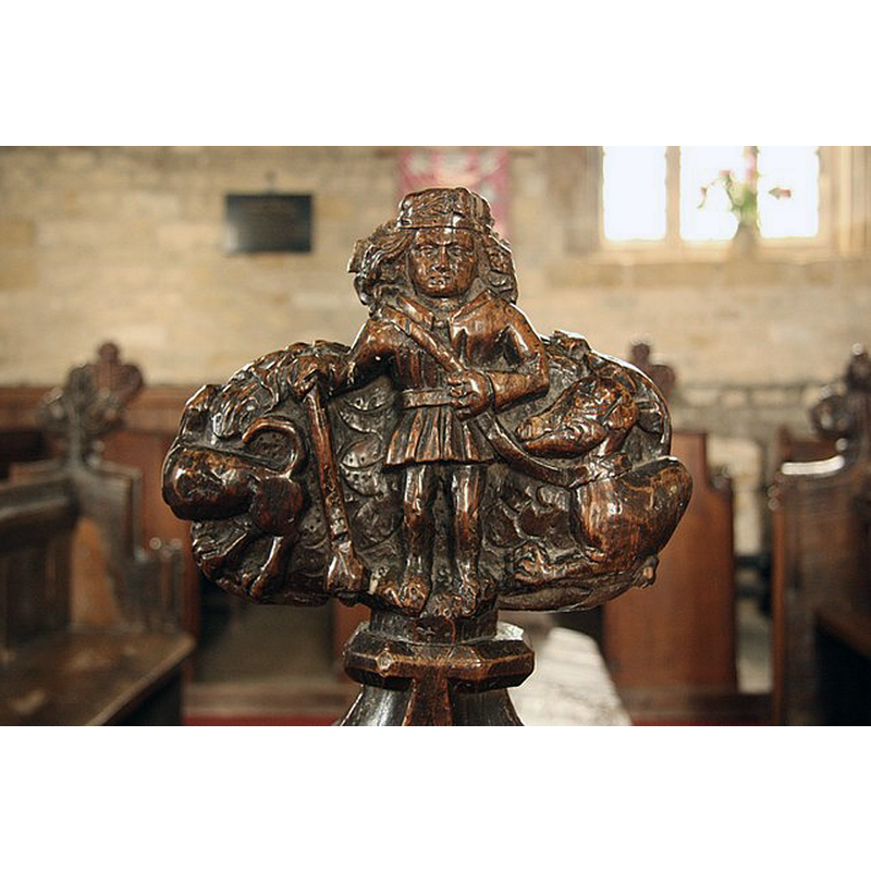
Scene Description: Source caption: "Detail of one of the mid-15th century poppyhead bench ends in St.Botolph & St.John the Baptist's church, of a late Medieval nobleman with stick and two dogs, popularly thought to be Nicholas de Crioll, patron of Croxton Abbey and the origin of the Kerrial (Crioll) part of the village name."
Copyright Statement: Image copyright © Richard Croft, 2009
Image Source: digital photograph taken 25 April 2009 by Richard Croft [www.geograph.org.uk/photo/1276372] [accessed 28 April 2016]
Copyright Instructions: CC-BY-SA-2.0
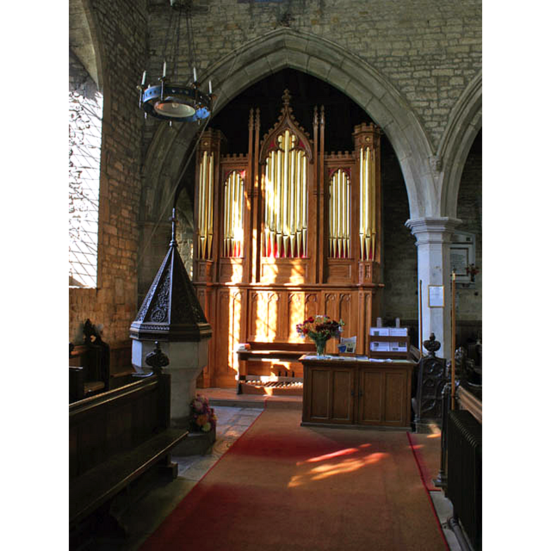
view of church interior - nave - looking west
![Source caption: "Looking west through the crossing to the nave of St.Botolph & St.John the Baptist's church." -- the font and cover at the far [west] end](/static-50478a99ec6f36a15d6234548c59f63da52304e5/compressed/1160428006_compressed.png)
Scene Description: Source caption: "Looking west through the crossing to the nave of St.Botolph & St.John the Baptist's church." -- the font and cover at the far [west] end
Copyright Statement: Image copyright © Richard Croft, 2009
Image Source: digital photograph taken 25 April 2009 by Richard Croft [www.geograph.org.uk/photo/1276288] [accessed 28 April 2016]
Copyright Instructions: CC-BY-SA-2.0
view of church interior - nave - looking east
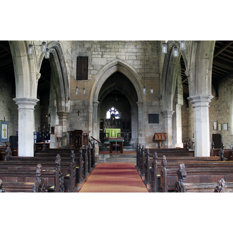
Copyright Statement: Image copyright © J. Hannan-Briggs, 2012
Image Source: digital photograph taken 11 August 2012 by J.Hannan-Briggs [www.geograph.org.uk/photo/3108704] [accessed 28 April 2016]
Copyright Instructions: CC-BY-SA-2.0
view of font cover
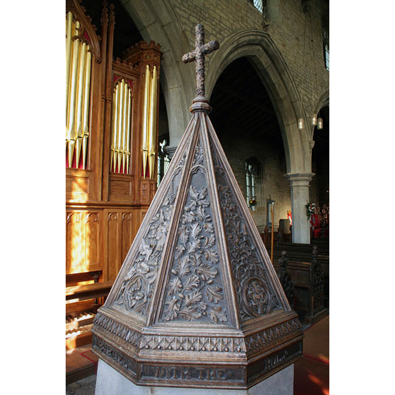
Copyright Statement: Image copyright © Kate Jewell, 2008
Image Source: digital photograph taken 8 October 2008 by Kate Jewell [www.geograph.org.uk/photo/999919] [accessed 28 Aprl 2016]
Copyright Instructions: CC-BY-SA-2.0
view of stoup
Scene Description: located in the south porch
Copyright Statement: Image copyright © Richard Croft, 2009
Image Source: digital photograph taken 25 April 2009 by Richard Croft [www.geograph.org.uk/photo/1275454] [accessed 28 April 2016]
Copyright Instructions: CC-BY-SA-2.0
view of font and cover

Copyright Statement: Image copyright © jmc4, 2006
Image Source: digital photograph taken 18 October 2006 by jmc4 [www.flickr.com/photos/52219527@N00/6275640977] [accessed 28 April 2016]
Copyright Instructions: PERMISSION NOT AVAILABLE -- IMAGE NOT FOR PUBLIC USE
INFORMATION
Font ID: 12353CRO
Object Type: Baptismal Font1
Font Century and Period/Style: Medieval
Church / Chapel Name: Parish Church of St. John the Baptist [and St. Botolph?]
Font Location in Church: Inside the church, at the W end of the nave
Church Patron Saint(s): St. John the Baptist [and St. Botolph?]
Church Address: Church Lane, Croxton Kerrial, Leicestershire NG32 1PZ, UK
Site Location: Leicestershire, East Midlands, England, United Kingdom
Directions to Site: Located off (N) the A607, halfway between Grantham and Melton Mowbray, 15 km NE of the latter
Ecclesiastic Region: Diocese of Leicester
Historical Region: Hundred of Framland [in Domesday]
Font Notes:
Click to view
There is an entry for Croxton [Kerrial] [variant spelling] in the Domesday survey [http://opendomesday.org/place/SK8329/croxton-kerrial/] [accessed 28 April 2016], but it mentions neither cleric nor church in it. White's 1877 Directory reports: "The font stands in the nave, and is crowned by a magnificent carved oak cover, representing ivy, woodbine, wheat, &c." [source: [http://freepages.genealogy.rootsweb.com/framland/Sg/maps/cke.htm] [accessed 19 November 2006]]
COORDINATES
UTM: 30U 650744 5858659
Latitude & Longitude (Decimal): 52.856524, -0.761045
Latitude & Longitude (DMS): 52° 51′ 23.48″ N, 0° 45′ 39.76″ W
MEDIUM AND MEASUREMENTS
Material: stone
Font Shape: octagonal, mounted
Basin Interior Shape: round
Basin Exterior Shape: octagonal
LID INFORMATION
Material: wood, oak
Notes: [cf. FontNotes]
REFERENCES
- White, William, History, Gazetteer, and Directory of Leicester and Rutland, [s.l.]: [Printed for the author], 1877, [http://freepages.genealogy.rootsweb.com/framland/Sg/maps/cke.htm]