Lowick nr. Kettering / Lofwyc / Ludewic / Luffewyk / Luffwyke / Lufwik / Lufwyc / Lufwyk / Luhwic
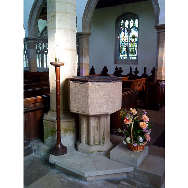
Image copyright © Lambert, 2010
CC-BY-SA-2.0
Results: 5 records
view of font and cover in context
Copyright Statement: Image copyright © Lambert, 2010
Image Source: digital photograph taken 20 June 2010 by Lambert [www.geograph.org.uk/photo/1948695] [accessed 24 May 2012]
Copyright Instructions: CC-BY-SA-2.0
view of church exterior - northwest view
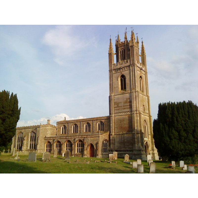
Copyright Statement: Image copyright © Lambert, 2010
Image Source: digital photograph taken 20 June 2010 by Lambert [www.geograph.org.uk/photo/1948757] [accessed 24 May 2012]
Copyright Instructions: CC-BY-SA-2.0
view of church exterior - southwest view
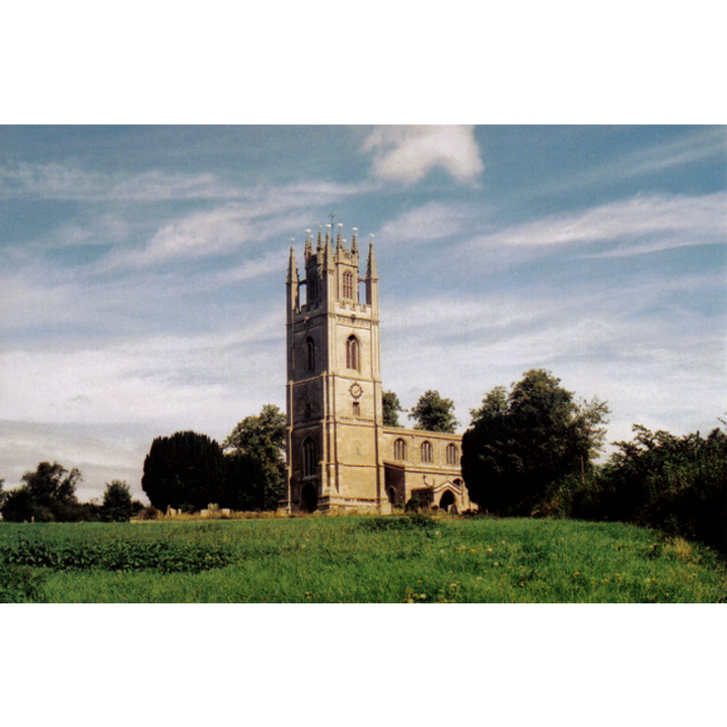
Copyright Statement: Image copyright © Lambert, 1997
Image Source: photograph taken in 1997 by Lambert [www.geograph.org.uk/photo/1791560] [accessed 24 May 2012]
Copyright Instructions: CC-BY-SA-2.0
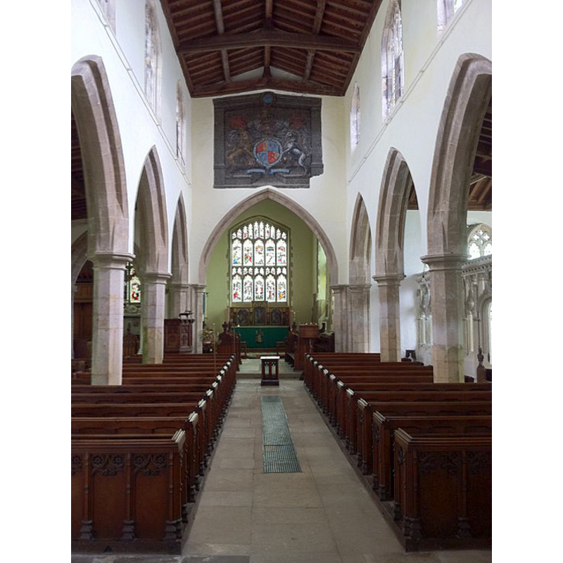
view of church interior - looking southeast
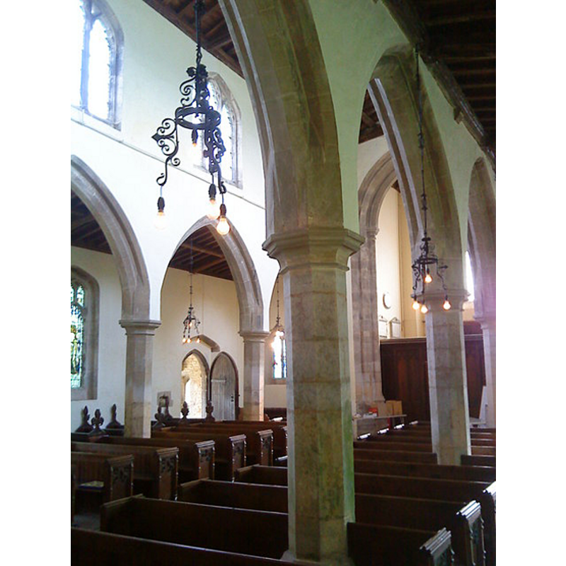
Scene Description: across the aisles and nave
Copyright Statement: Image copyright © Lambert, 2010
Image Source: digital photograph taken 29 June 2010 by Lambert [www.geograph.org.uk/photo/1940876] [accessed 24 May 2012]
Copyright Instructions: CC-BY-SA-2.0
view of church interior - nave - looking east
Copyright Statement: Image copyright © Andrewrabbott, 2011
Image Source: digital photograph taken 21 August 2011 by Andrewrabbott [http://en.wikipedia.org/wiki/File:Lowick_nave.jpg] [accessed 24 May 2012]
Copyright Instructions: CC-BY-SA-2.0
INFORMATION
Font ID: 12322LOW
Object Type: Baptismal Font1
Font Century and Period/Style: 13th century, Early English
Church / Chapel Name: Parish Church of St. Peter
Font Location in Church: Inside the church, by one of the pillars of the arcade that separates the nave from the south aisle, towards the west end
Church Patron Saint(s): St. Peter
Church Address: Main Rd, Lowick, Kettering NN14 3BH, UK
Site Location: Northamptonshire, East Midlands, England, United Kingdom
Directions to Site: Located off (NW) the A14-A6116 crossroads, 3 km NNW of Thrapston, 8-9 km ENE of Kettering
Ecclesiastic Region: Diocese of Peterborough
Historical Region: Hundred of Huxloe
Font Notes:
Click to view
There are two entries for this Lowick [varied spellings] in the Domesday survey [https://opendomesday.org/place/SP9780/lowick/] [accessed 9 April 2019] neither of which mentions cleric or church in it. The entry for this parish in the Victoria County History (Northampton, vol. 3, 1930) notes: "The church was almost entirely rebuilt at the end of the 14th century, but on the north side of the chancel are an aumbry and a small blocked doorway of the 13th century [...] The font is of the 13th century and consists of a plain octagonal bowl on a pedestal of clustered keelshaped shafts." Noted in Mee (1945): "The font is 13th century." The Parish web site [http://lowickchurch.com/history.html] [accessed 20 April 2009] notes: "The font is of uncertain date though the stem seems to be 14th century". Not mentioned in Pevsner & Cherry (1973)
COORDINATES
UTM: 30U 666154 5809630
Latitude & Longitude (Decimal): 52.41163, -0.55706
Latitude & Longitude (DMS): 52° 24′ 41.87″ N, 0° 33′ 25.42″ W
MEDIUM AND MEASUREMENTS
Material: stone
Font Shape: octagonal, mounted
Basin Interior Shape: round
Basin Exterior Shape: octagonal
Drainage Notes: lead-lined
LID INFORMATION
Material: wood, oak?
Apparatus: no
Notes: octagonal and flat, with metal decoration and ring handle
REFERENCES
- Victoria County History [online], University of London, 1993-. URL: https://www.british-history.ac.uk.
- Mee, Arthur, The King's England: Northamptonshire, country of spires and stately homes, London: Hodder & Stoughton, 1945, [http://northamptoncastle.homeip.net/northampton/books/Arthur%20Mee.htm] [accessed 26 October 2006]