Normanton-on-Trent No. 1 / Normanton-upon-Trent / Normentune
Results: 3 records
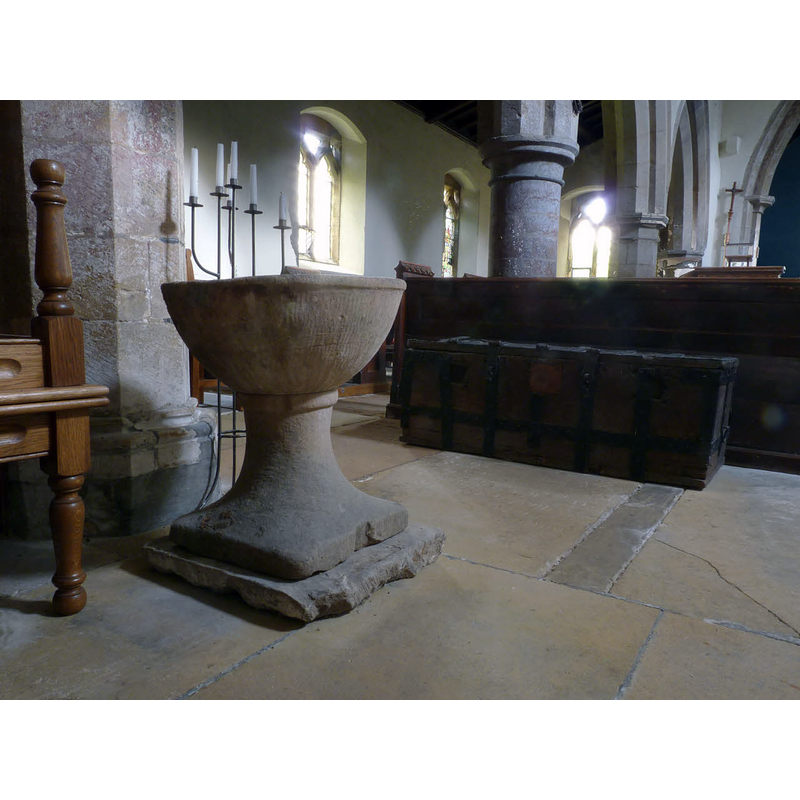
view of font in context
Scene Description: OLD FONT digital photograph taken 1 August 2014 by Alan Murray-Rust [www.geograph.org.uk/photo/4104534] [accessed 14 July 2015] Source caption: "Church of St Matthew, Normanton-on-Trent. The disused bowl font and parish chest."
design element - motifs - roll moulding
design element - motifs - roll moulding
INFORMATION
Font ID: 12254NOR
Object Type: Baptismal Font1
Font Century and Period/Style: 12th century, Late Norman
Church / Chapel Name: Parish Church of St. Matthew
Font Location in Church: Inside the church after spending many years in the churchyard
Church Patron Saint(s): St. Matthew
Church Address: Tuxford Road, Normanton-upon-Trent, Nottinghamshire, NG23 6RN, UK
Site Location: Nottinghamshire, East Midlands, England, United Kingdom
Directions to Site: Located 6 km ESE of Tuxford, 15 km SE of Retford
Ecclesiastic Region: Diocese of Southwell & Nottingham
Historical Region: Hundred of Lythe [in Domesday]
Additional Comments: disused font / re-cycled font / garden flower pot (in the churchyard ca. 1927?)
Font Notes:
Click to view
There are two entries for Notmanton [-on-Trent] [variant spelling] in the Domesday survey [http://opendomesday.org/place/SK7969/normanton-on-trent/] [accessed 14 July 2015], neither of which mention cleric or church in it. Two fonts here are noted in Cox : "near it [i.e., the south porch] in churchyard circular Norm[an] font, now a flower-pot; mean modern font." Guilford (1927) notes: "The old font does duty as a flower-pot in the churchyard."
COORDINATES
UTM: 30U 645673 5898098
Latitude & Longitude (Decimal): 53.2122, -0.818495
Latitude & Longitude (DMS): 53° 12′ 43.92″ N, 0° 49′ 6.58″ W
MEDIUM AND MEASUREMENTS
Material: stone
Font Shape: hemispheric, mounted
Basin Interior Shape: round
Basin Exterior Shape: round
REFERENCES
- Cox, John Charles, Nottinghamshire, London: Allen, 1912, p. 150 / [http://ia301109.us.archive.org/3/items/nottinghamsh00coxuoft/nottinghamsh00coxuoft.pdf] [accessed 19 October 2009]
- Guilford, Everard Leaver, Nottinghamshire, London: Methuen, 1927, p. 129