Keyham / Caiham / Keame
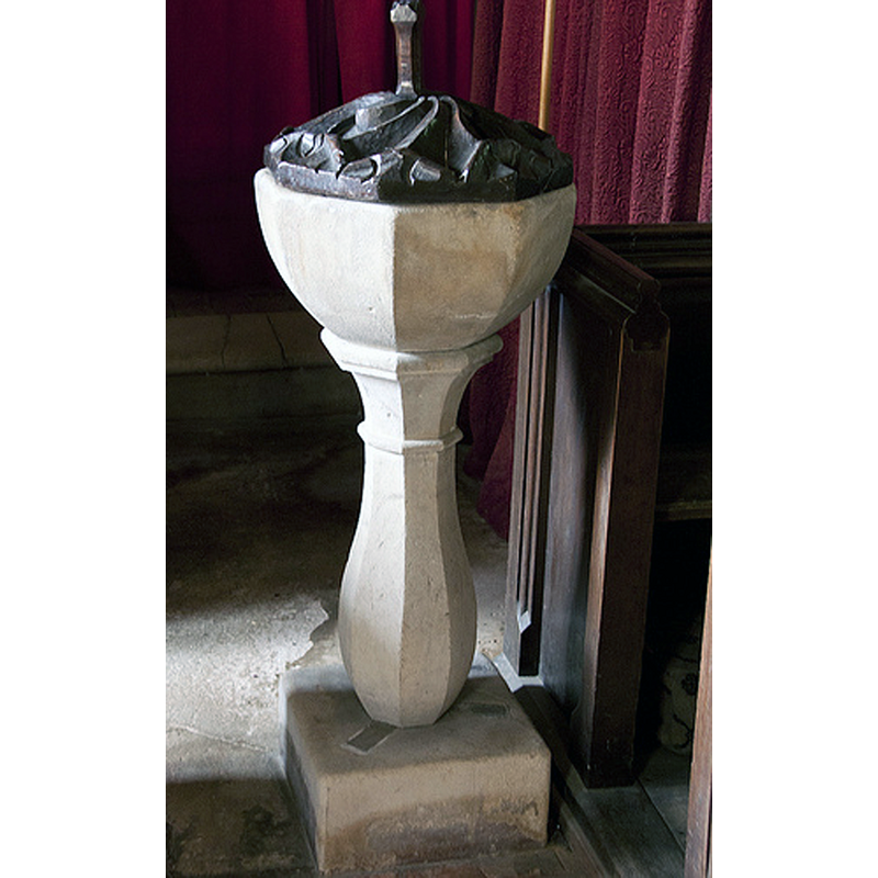
Image copyright © Christopher Jones, 2015
Standing permission
Results: 4 records
view of font and cover
Scene Description: the modern font
Copyright Statement: Image copyright © Christopher Jones, 2015
Image Source: digital photograph taken by Christopher Jones [www.leicestershirechurches.co.uk/keyham-church-ingarsby-deserted-village/] [accessed 13 August 2015]
Copyright Instructions: Standing permission
view of church exterior - south view
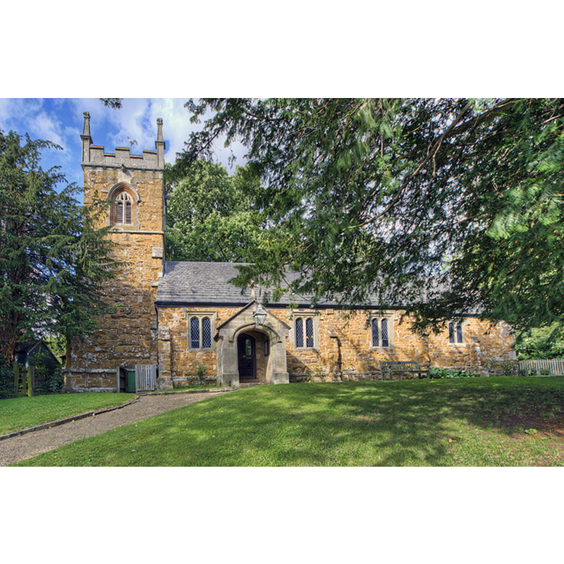
Copyright Statement: Image copyright © Christopher Jones, 2015
Image Source: digital photograph taken by Christopher Jones [www.leicestershirechurches.co.uk/keyham-church-ingarsby-deserted-village/] [accessed 13 August 2015]
Copyright Instructions: Standing permission
view of church interior - nave - looking west
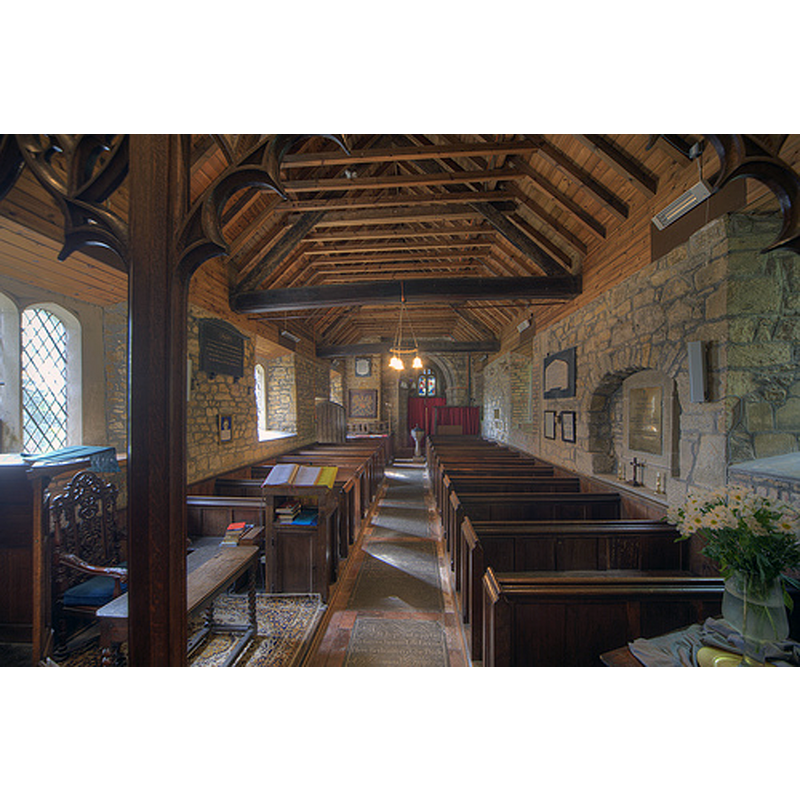
Copyright Statement: Image copyright © Christopher Jones, 2015
Image Source: digital photograph taken by Christopher Jones [www.leicestershirechurches.co.uk/keyham-church-ingarsby-deserted-village/] [accessed 13 August 2015]
Copyright Instructions: Standing permission
view of church interior - nave - looking east
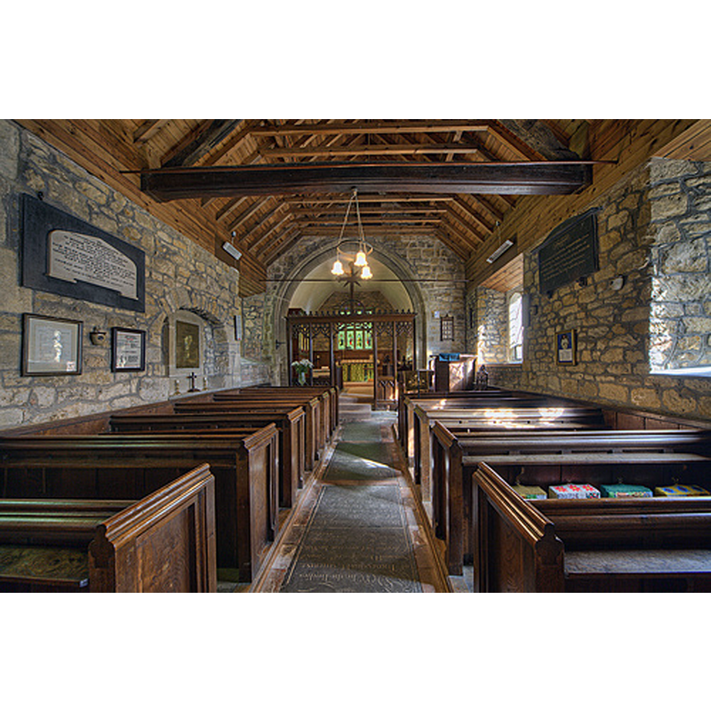
Copyright Statement: Image copyright © Christopher Jones, 2015
Image Source: digital photograph taken by Christopher Jones [www.leicestershirechurches.co.uk/keyham-church-ingarsby-deserted-village/] [accessed 13 August 2015]
Copyright Instructions: Standing permission
INFORMATION
Font ID: 12233KEY
Object Type: Baptismal Font1?
Font Century and Period/Style: 11th century, Pre-Conquest? / Norman
Church / Chapel Name: Parish Church of All Saints
Church Patron Saint(s): All Saints
Church Address: Main Street, Keyham, Leicestershire LE7 9JP, United Kingdom -- Tel.: +44 116 259 6321
Site Location: Leicestershire, East Midlands, England, United Kingdom
Directions to Site: Located 12 km ENE of Leicester
Ecclesiastic Region: Diocese of Leicester
Historical Region: Hundred of Goscote
Additional Comments: disappeared font? (the one from the Domesday-time church here)
Font Notes:
Click to view
There is an entry for Keyham [variant spelling] in the Domesday survey [http://opendomesday.org/place/SK6706/keyham/] [accessed 13 August 2015]; it mentions a priest, but not a church in it, though there probably was one there. A font here is noted and illustrated in Upcott (1818) [NB: Upcott uses old spelling 'Keame']. Described in Pevsner (1984): "Font. C18. Stone baluster." {NB: according to the same source the original church is 13th- or 14th-century, but we have no information on the earlier font of this church]
COORDINATES
UTM: 30U 634563 5835478
Latitude & Longitude (Decimal): 52.652548, -1.010733
Latitude & Longitude (DMS): 52° 39′ 9.17″ N, 1° 0′ 38.64″ W
REFERENCES
- Pevsner, Nikolaus, Leicestershire and Rutland, Harmondsworth: Penguin Books, 1984, p. 187
- Upcott, William, A bibliographical account of the principal works relating to English topography, London: Printed by Richard and Arthur Taylor, 1818, [vol. III, part II, p. 520 and pl. cxxxi / [http://books.google.com/books?id=gLwuAAAAMAAJ&pg=PA228&lpg=PA228&dq=upcott+1818&source=web&ots=lJwT-K00zU&sig=oVT6Kc6G03vqjYf4Synuk_Aek9w#PPP15,M1] [accessed 30 September 2007]