Horninghold / Horniwale
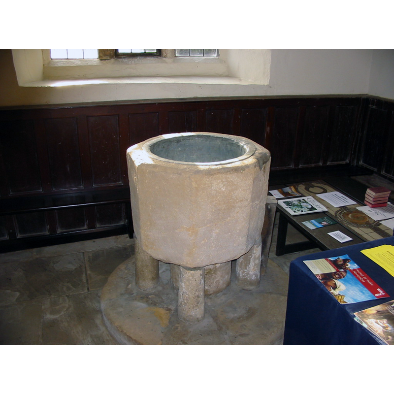
Image copyright © Martin Griffin, 2006
Permission received (e-mail of 2 December 2006)
Results: 12 records
view of font
Copyright Statement: Image copyright © Martin Griffin, 2006
Image Source: digital photograph in www.horninghold.org.uk/church.htm
Copyright Instructions: Permission received (e-mail of 2 December 2006)
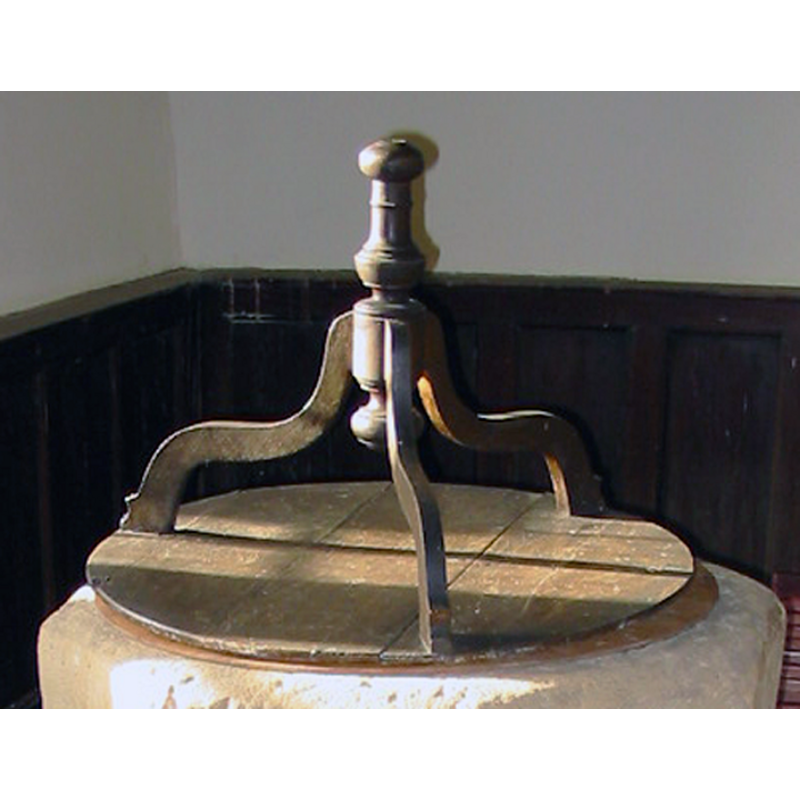
view of font and cover
Copyright Statement: Image copyright © Martin Griffin, 2006
Image Source: digital photograph in www.horninghold.org.uk/church.htm
Copyright Instructions: Permission received (e-mail of 2 December 2006)
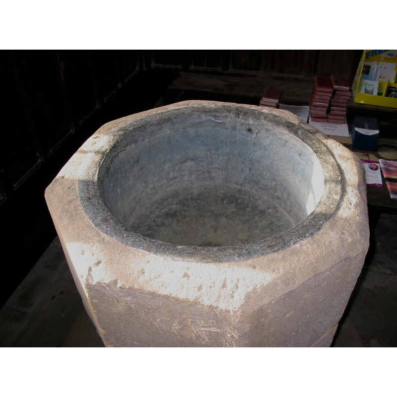
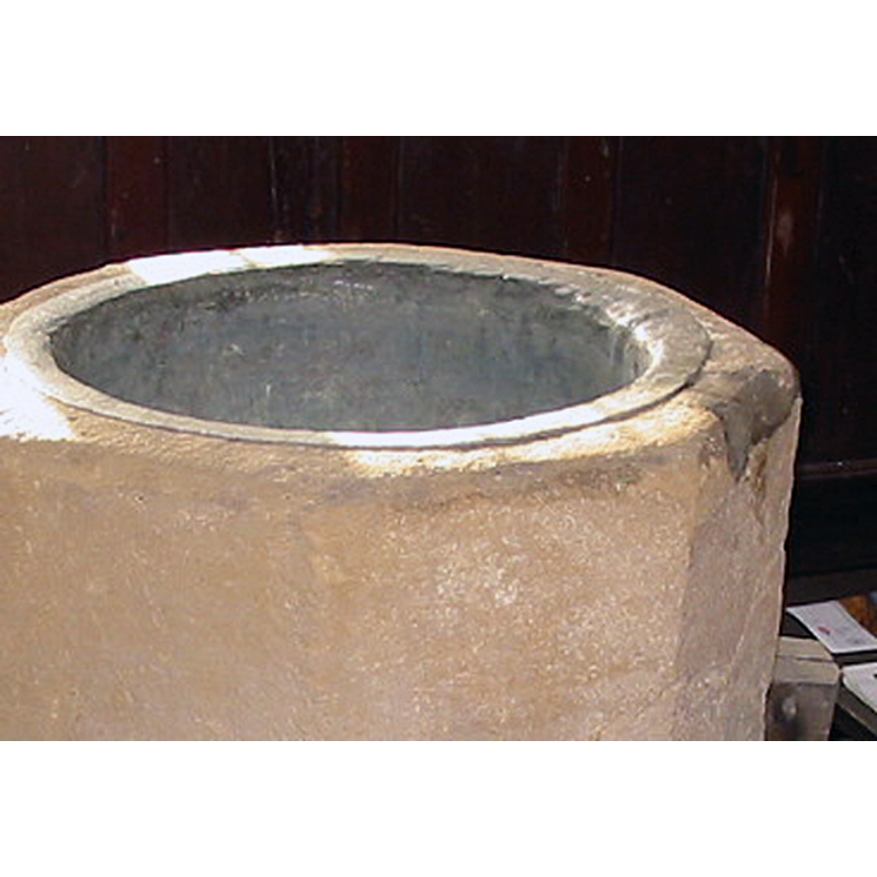
view of basin - interior
Copyright Statement: Image copyright © Martin Griffin, 2006
Image Source: digital photograph in www.horninghold.org.uk/church.htm
Copyright Instructions: Permission received (e-mail of 2 December 2006)
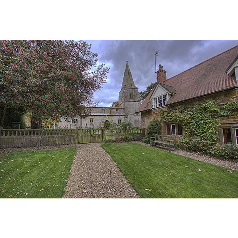
view of church exterior in context - north view
Copyright Statement: Image copyright © Christopher Jones, 2015
Image Source: digital photograph taken by Christopher Jones [www.leicestershirechurches.co.uk/horninghold-church-st-peter/] [accessed 13 August 2015]
Copyright Instructions: Standing permission
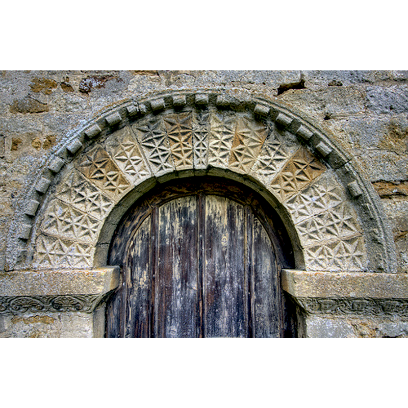
view of church exterior - south portal - detail
Copyright Statement: Image copyright © Christopher Jones, 2015
Image Source: digital photograph taken by Christopher Jones [www.leicestershirechurches.co.uk/horninghold-church-st-peter/] [accessed 13 August 2015]
Copyright Instructions: Standing permission
view of church exterior - south view - detail
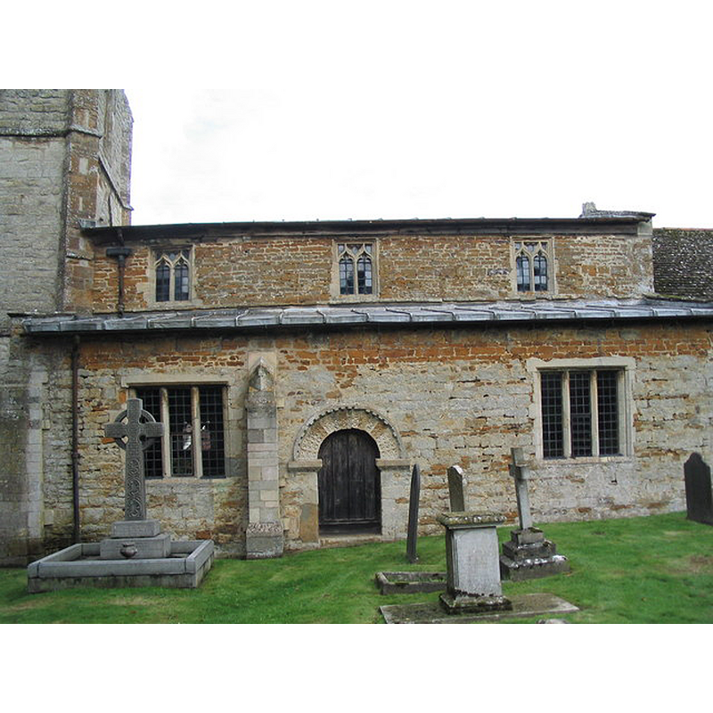
Scene Description: Source caption: "Church of St Peter, Horninghold; south side. A mixture of limestone and ironstone, with a fine Norman doorway."
Copyright Statement: Image copyright © Tim Heaton, 2006
Image Source: digital photograph taken 20 August 2006 by Tim Heaton [www.geograph.org.uk/photo/222513] [accessed 13 August 2015]
Copyright Instructions: CC-BY-SA-2.0
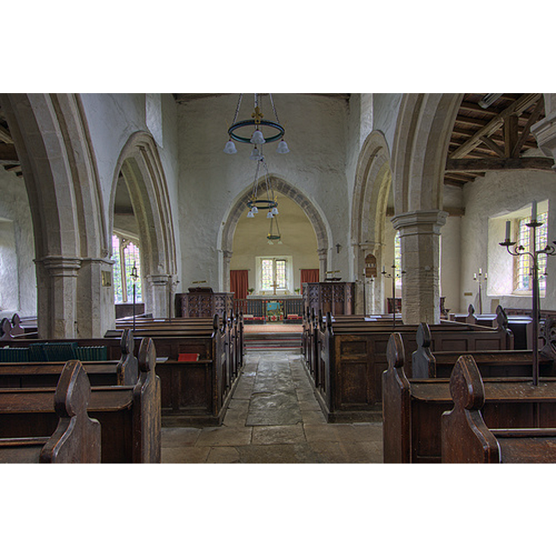
view of church interior - nave - looking west
Copyright Statement: Image copyright © Christopher Jones, 2015
Image Source: digital photograph taken by Christopher Jones [www.leicestershirechurches.co.uk/horninghold-church-st-peter/] [accessed 13 August 2015]
Copyright Instructions: Standing permission
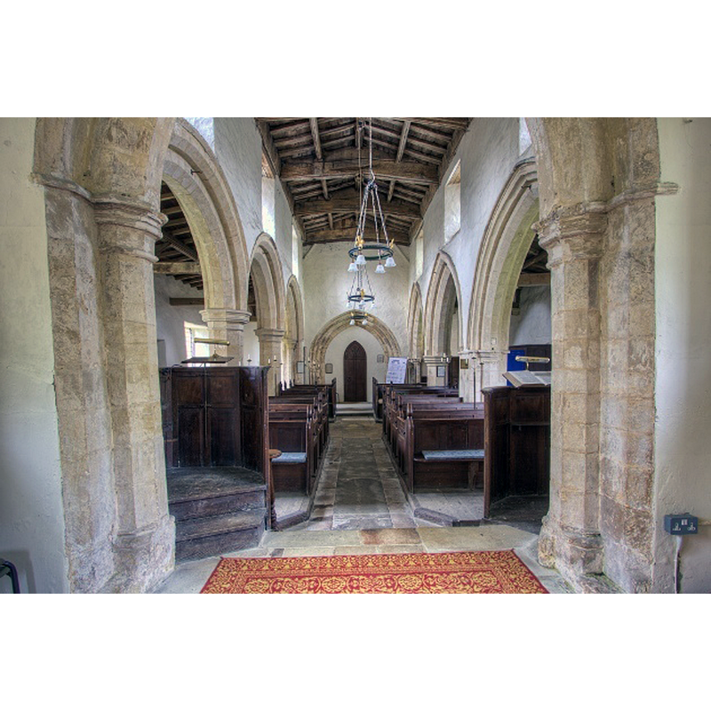
view of church interior - nave - looking east
Copyright Statement: Image copyright © Christopher Jones, 2015
Image Source: digital photograph taken by Christopher Jones [www.leicestershirechurches.co.uk/horninghold-church-st-peter/] [accessed 13 August 2015]
Copyright Instructions: Standing permission
view of church interior
Copyright Statement: Image copyright © Martin Griffin, 2006
Image Source: digital photograph in www.horninghold.org.uk/church.htm
Copyright Instructions: Permission received (e-mail of 2 December 2006)
view of church interior
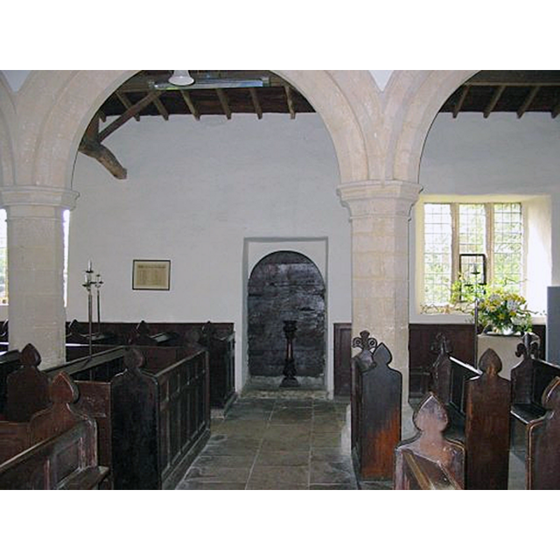
Scene Description: the font on the right, by the window
Copyright Statement: Image copyright © Martin Griffin, 2006
Image Source: digital photograph in www.horninghold.org.uk/church.htm
Copyright Instructions: Permission received (e-mail of 2 December 2006)
view of font cover
Copyright Statement: Image copyright © Martin Griffin, 2006
Image Source: digital photograph in www.horninghold.org.uk/church.htm
Copyright Instructions: Permission received (e-mail of 2 December 2006)
view of basin - detail
Scene Description: damage and repair on the upper rim
Copyright Statement: Image copyright © Martin Griffin, 2006
Image Source: digital photograph in www.horninghold.org.uk/church.htm
Copyright Instructions: Permission received (e-mail of 2 December 2006)
INFORMATION
Font ID: 12225HOR
Object Type: Baptismal Font1
Font Century and Period/Style: 13th century (early?), Transitional / Early English
Church / Chapel Name: Parish Church of St. Peter
Font Location in Church: Inside the church, at the W end
Church Patron Saint(s): St. Peter
Church Address: Hallaton Road, Horninghold, Leicestershire LE16 8DQ, UK
Site Location: Leicestershire, East Midlands, England, United Kingdom
Directions to Site: Located just N of Blaston, 7 km SW of Uppingham 13 km NE of Market Harborough ESE of Leicester, near the Rutland border
Ecclesiastic Region: Diocese of Leicester
Historical Region: Hundred of Gartree
Additional Comments: disappeared font? (the one from te early-12thC church here)
Font Notes:
Click to view
There is an entry for Horninghold [variant spelling] in the Domesday survey [http://opendomesday.org/place/SP8097/horninghold/] [accessed 13 August 2015], but it mentions neither cleric nor church in it. The Victoria County History (Leicestershire, 1964) notes: "Horninghold church seems, on the architectural evidence, to have been built in the early 12th century. In or shortly before 1151 it was confirmed to Belvoir Priory by Archbishop Theobald [...] The early church dated from the first half of the 12th century when it probably consisted of nave, chancel, and tower. The base of the tower and portions of the nave walls survive. [...] Its most striking feature is the early-12th-century south doorway. [...] The plain octagonal font bowl stands on circular supports and is probably of the 13th century. The cover may be the one supplied in response to an archdeacon's request in 1777 [footnote: 'Leic. City Mun. Room, 1 D.41/18/21']".
Credit and Acknowledgements: We are grateful to Martin Griffin, of www.horninghold.org.uk, and to Christopher Jones, of Leicestershire Churches [www.leicestershirechurches.co.uk] for their photographs of this church and font
COORDINATES
UTM: 30U 648376 5826117
Latitude & Longitude (Decimal): 52.564855, -0.810883
Latitude & Longitude (DMS): 52° 33′ 53.48″ N, 0° 48′ 39.18″ W
MEDIUM AND MEASUREMENTS
Material: stone
Font Shape: octagonal, mounted
Basin Interior Shape: round
Basin Exterior Shape: octagonal
LID INFORMATION
Date: 18th century?
Material: wood, oak?
Apparatus: no
Notes: flat round platform with three (?) raised scroll ribs and turned finial
REFERENCES
- Victoria County History [online], University of London, 1993-. URL: https://www.british-history.ac.uk.