Glooston / Glorstone
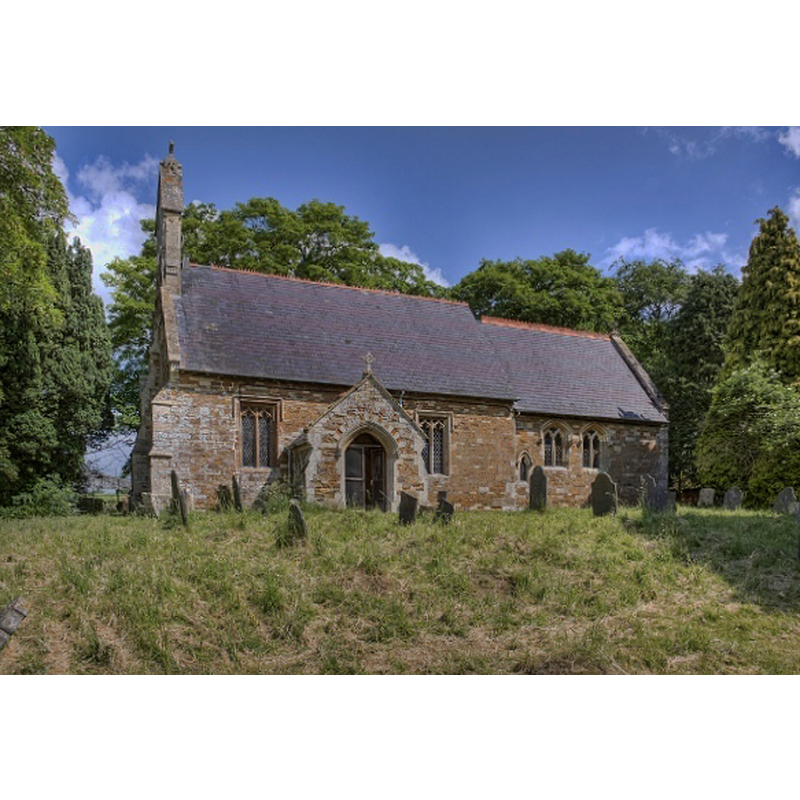
Image copyright © Christopher Jones, 2015
Standing permission
Results: 4 records
view of church exterior - south view
Copyright Statement: Image copyright © Christopher Jones, 2015
Image Source: digital photograph taken by Christopher Jones [www.leicestershirechurches.co.uk/glooston-st-john-the-baptist/] [accessed 12 August 2015]
Copyright Instructions: Standing permission
view of font and cover in context
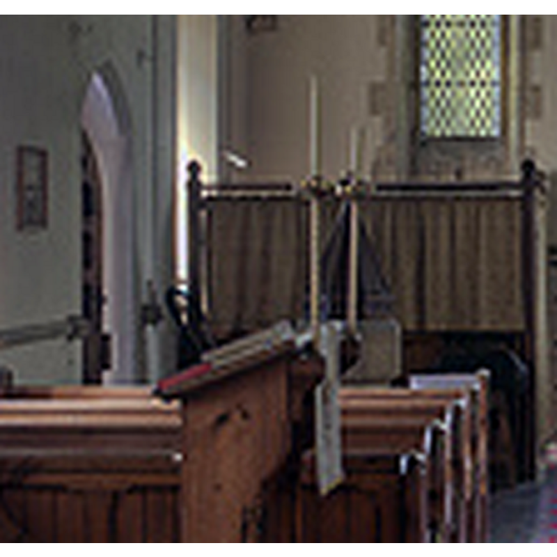
Scene Description: at the west end of the nave, by the south doorway
Copyright Statement: Image copyright © Christopher Jones, 2015
Image Source: detail of a digital photograph taken by Christopher Jones [www.leicestershirechurches.co.uk/glooston-st-john-the-baptist/] [accessed 12 August 2015]
Copyright Instructions: Standing permission
view of church interior - nave - looking west
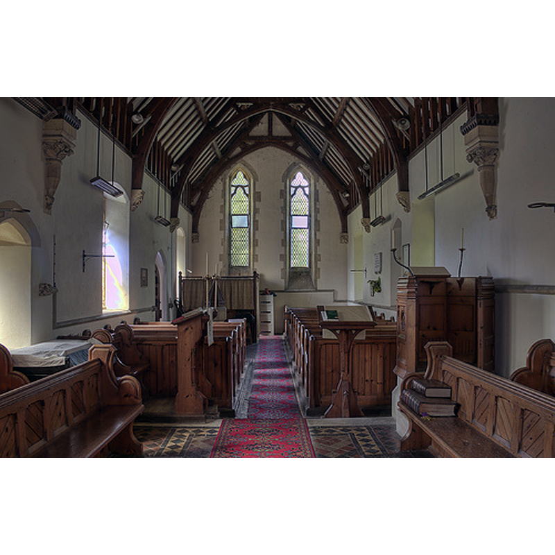
Copyright Statement: Image copyright © Christopher Jones, 2015
Image Source: digital photograph taken by Christopher Jones [www.leicestershirechurches.co.uk/glooston-st-john-the-baptist/] [accessed 12 August 2015]
Copyright Instructions: Standing permission
view of church interior - nave - looking east
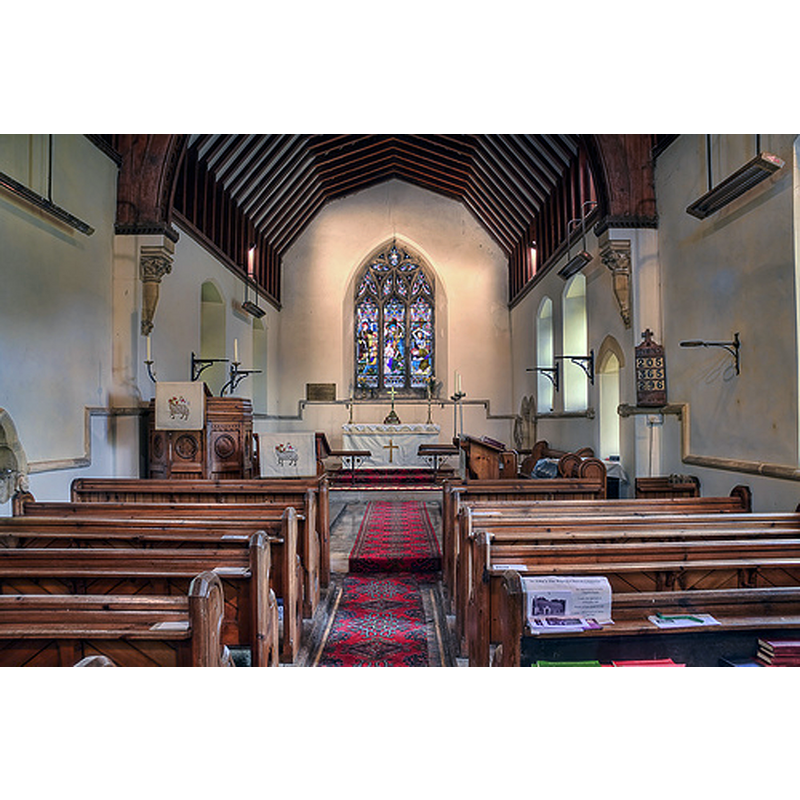
Copyright Statement: Image copyright © Christopher Jones, 2015
Image Source: digital photograph taken by Christopher Jones [www.leicestershirechurches.co.uk/glooston-st-john-the-baptist/] [accessed 12 August 2015]
Copyright Instructions: Standing permission
INFORMATION
Font ID: 12216GLO
Object Type: Baptismal Font1
Font Date: ca. 1300?
Font Century and Period/Style: 14th century, Decorated
Church / Chapel Name: Parish Church of St. John the Baptist
Font Location in Church: Inside the church, at the W end, by the S entranceway
Church Patron Saint(s): St. John the Baptist
Church Address: Andrew's Lane, Glooston, Leicestershire LE16 7ST, UK
Site Location: Leicestershire, East Midlands, England, United Kingdom
Directions to Site: Located 10 km N of Market Harborough, 17-18 SE of Leicester
Ecclesiastic Region: Diocese of Leicester
Additional Comments: disappeared font? (the one from the 12th-13thC church here)
Font Notes:
Click to view
There is an entry for Glooston [variant spelling] in the Domesday survey [http://opendomesday.org/place/SP7595/glooston/] [accessed 12 August 2015], but it mentions neither cleric nor church in it. The Victoria County History (Leicestershire, vol. 5, 1964) notes: "The earliest mention of Glooston church is about 1220, but it was probably founded in the 12th century. It may, like Cranoe, have been a chapelry of Welham, where burials still took place about 1220, although in other respects Glooston was independent. [...] The church was almost entirely rebuilt by the architect Joseph Goddard of Leicester in 1866–7 [...] The plain octagonal font may date from the 14th century". In Pevsner (1984): "Font. Plain, octagonal. Probably c. 1300".
Credit and Acknowledgements: We are grateful to Christopher Jones, of Leicestershire Churches [www.leicestershirechurches.co.uk], for his photographs of this church and font
COORDINATES
UTM: 30U 642592 5824837
Latitude & Longitude (Decimal): 52.554897, -0.896702
Latitude & Longitude (DMS): 52° 33′ 17.63″ N, 0° 53′ 48.13″ W
MEDIUM AND MEASUREMENTS
Material: stone
Font Shape: octagonal, mounted
Basin Interior Shape: round
Basin Exterior Shape: octagonal
LID INFORMATION
Material: wood, oak?
Apparatus: no
Notes: octagonal pyramid with carved side panels; foliated cross finial
REFERENCES
- Victoria County History [online], University of London, 1993-. URL: https://www.british-history.ac.uk.
- Pevsner, Nikolaus, Leicestershire and Rutland, Harmondsworth: Penguin Books, 1984, p. 163