Frisby on the Wreake / Frisby on the Wreak
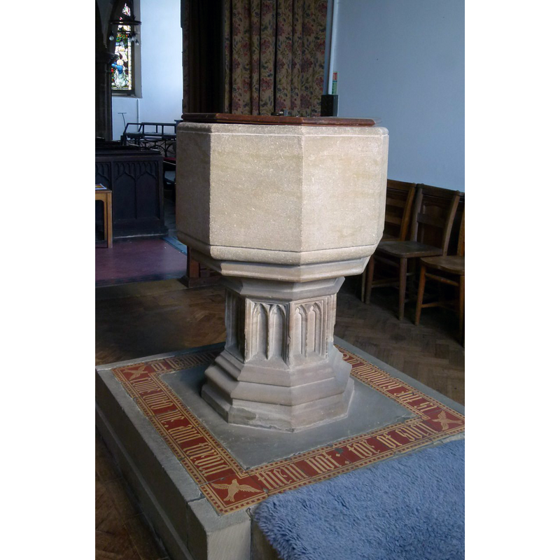
Image copyright © Alan Murray-Rust, 2015
CC-BY-SA-2.0
Results: 4 records
view of font and cover
Scene Description: Source caption: "Church of St Thomas of Canterbury, Frisby on the Wreake. The font dates from the 1848 restoration and is surprisingly restrained for the period."
Copyright Statement: Image copyright © Alan Murray-Rust, 2015
Image Source: digital photograph taken 28 April 2015 by Alan Murray-Rust [www.geograph.org.uk/photo/4462852] [accessed 11 August 2015]
Copyright Instructions: CC-BY-SA-2.0
view of church exterior - west view
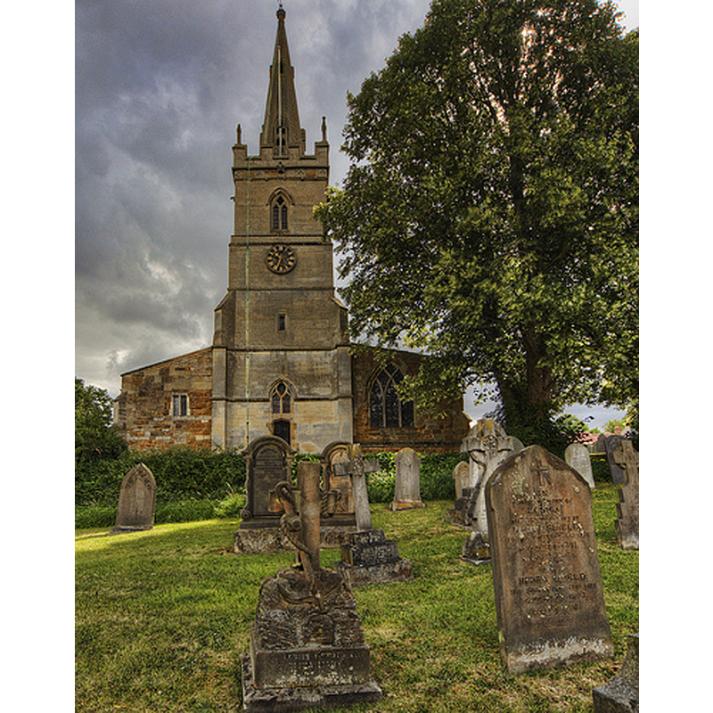
Copyright Statement: Image copyright © Christopher Jones, 2015
Image Source: digital photograph taken by Christopher Jones [www.leicestershirechurches.co.uk/frisby-on-the-wreake-st-thomas-of-canterbury/] [accessed 11 August 2015]
Copyright Instructions: Standing permission
view of church exterior - south view
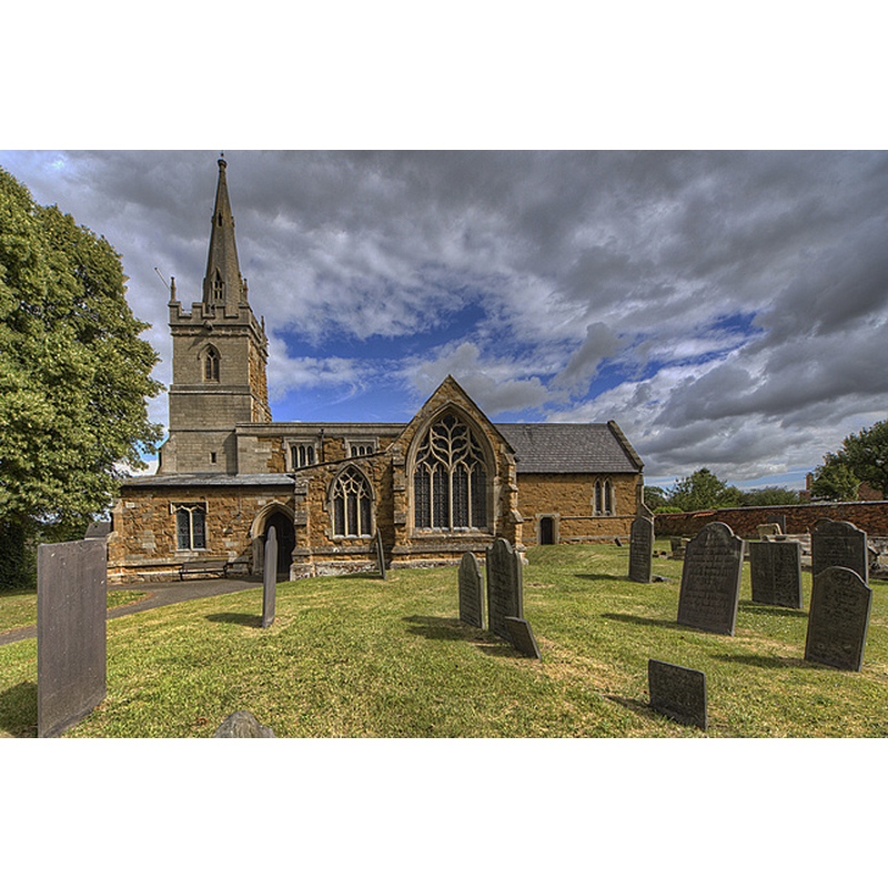
Copyright Statement: Image copyright © Christopher Jones, 2015
Image Source: digital photograph taken by Christopher Jones [www.leicestershirechurches.co.uk/frisby-on-the-wreake-st-thomas-of-canterbury/] [accessed 11 August 2015]
Copyright Instructions: Standing permission
view of church interior - nave - looking east
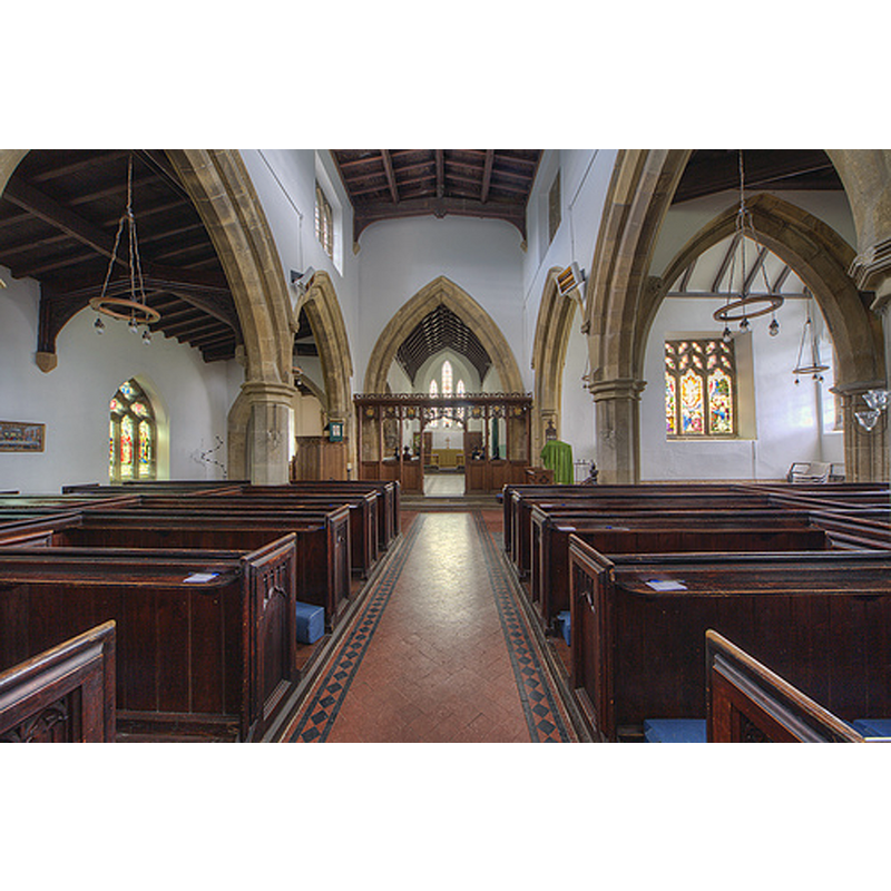
Copyright Statement: Image copyright © Christopher Jones, 2015
Image Source: digital photograph taken by Christopher Jones [www.leicestershirechurches.co.uk/frisby-on-the-wreake-st-thomas-of-canterbury/] [accessed 11 August 2015]
Copyright Instructions: Standing permission
INFORMATION
Font ID: 12202FRI
Object Type: Baptismal Font1?
Font Century and Period/Style: 12th century, Norman
Church / Chapel Name: Parish Church of St. Thomas of Canterbury
Church Patron Saint(s): St. Thomas of Canterbury [aka St. Thomas à Becket]
Church Address: Church Lane, Frisby-on-the-Wreake, Leicestershire LE14 2NR, UJ
Site Location: Leicestershire, East Midlands, England, United Kingdom
Directions to Site: Located off (N) the A607, SW of Asfordby, 7 km WSW of Melton Mowbray
Ecclesiastic Region: Diocese of Leicester
Historical Region: Hundred of Goscote [in Domesday] -- Hundred of East Goscote
Additional Comments: disappeared font? (the one from the 12thC church here)
Font Notes:
Click to view
There is an entry for Frisby [on-the-Wreake] [variant spelling] in the Domesday survey [http://opendomesday.org/place/SK6917/frisby-on-the-wreake/] [accessed 11 August 2015], but it mentions niether cleric nor church in it. The English Heritage entry for this church [Listing NGR: SK6958117801] reports and illustrates an 18th-century octagonal font in it; the original fabric of the church is dated to the 12th century.
COORDINATES
UTM: 30U 636966 5846764
Latitude & Longitude (Decimal): 52.753343, -0.970521
Latitude & Longitude (DMS): 52° 45′ 12.04″ N, 0° 58′ 13.88″ W