Selborne / Lesborne / Salebourne / Saleburne / Salesbourne / Selesburne
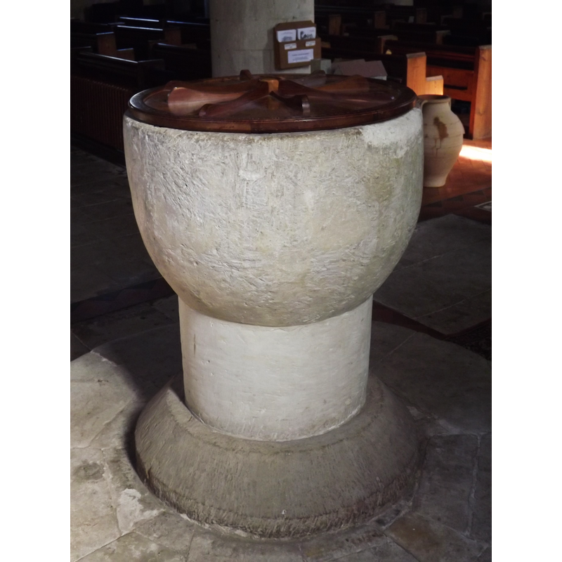
Image copyright © Colin Smith, 2012
Image and permission received (e-mail of 19 March 2012)
Results: 4 records
view of font and cover
Copyright Statement: Image copyright © Colin Smith, 2012
Image Source: digital photograph taken 6 March 2012 by Colin Smith
Copyright Instructions: Image and permission received (e-mail of 19 March 2012)
view of church exterior - southwest view
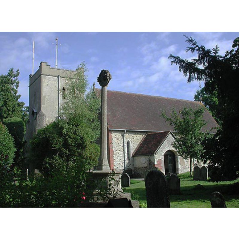
Copyright Statement: Image copyright © Allan Soedring, 2011
Image Source: digital photograph taken by Allan Soedring [www.astoft.co.uk/selbornechurch.htm] [accessed 9 August 2011]
Copyright Instructions: Standing permission
view of church interior - chancel
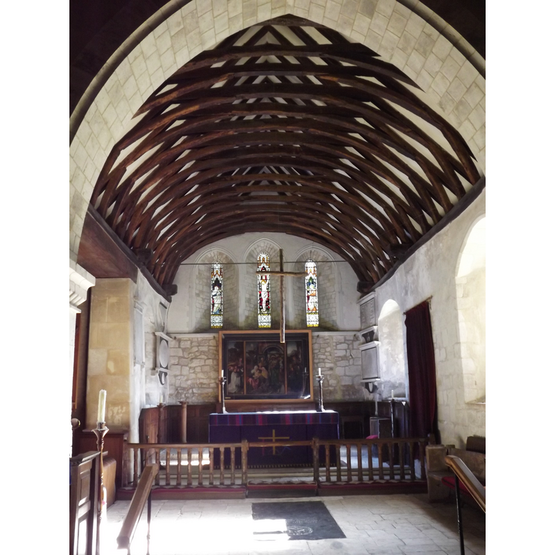
Copyright Statement: Image copyright © Colin Smith, 2012
Image Source: digital photograph taken 6 March 2012 by Colin Smith
Copyright Instructions: Image and permission received (e-mail of 19 March 2012)
view of church interior - nave - west end
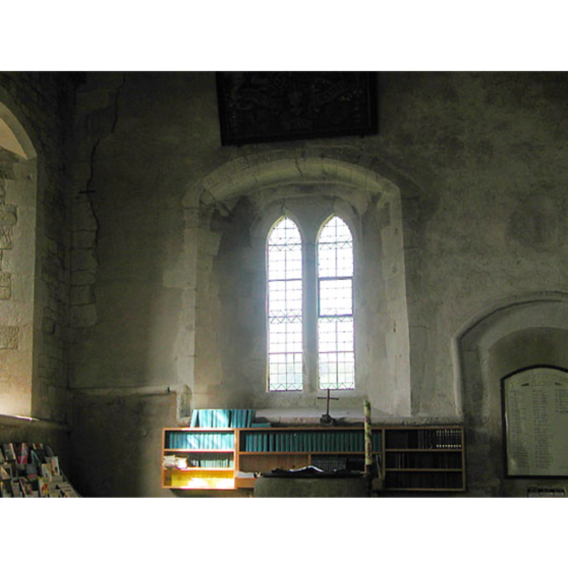
Scene Description: the top of the font and the cover, are just visible in the foreground, centre of the image
Copyright Statement: Image copyright © Allan Soedring, 2011
Image Source: digital photograph taken by Allan Soedring [www.astoft.co.uk/selbornechurch.htm] [accessed 9 August 2011]
Copyright Instructions: Standing permission
INFORMATION
Font ID: 12198SEL
Object Type: Baptismal Font1
Font Date: ca. 1180?
Font Century and Period/Style: 12th century (late?), Late Norman? / Transitional?
Church / Chapel Name: Parish Church of Our Lady
Font Location in Church: Inside the church, in the W end, S aisle
Church Patron Saint(s): St. Mary the Virgin
Church Address: The Vicarage/The Plestor, Selborne, Alton GU34 3JQ, United Kingdom -- Tel.: +44 1420 588398
Site Location: Hampshire, South East, England, United Kingdom
Directions to Site: Located off the B3006, halfway (6 km) between Alton and Petersfield
Ecclesiastic Region: Diocese of Winchester
Historical Region: Hundred of Selborne -- Hundred of Neathan (in Domesday)
Additional Comments: altered font? (the stem may be a replacement) -- disappeared font? (the font of the Domesday-time church here?)
Font Notes:
Click to view
There are two entries for Selborne [variant spelling] in the Domesday survey [http://opendomesday.org/place/SU7433/selborne/] [accessed 19 June 2018], neither of which mentions priest or church in it. The Victoria County History (Hampshire, vol. 3, 1908) notes: "A church existed at Selborne at the time of Domesday, and it was held by Radfred the priest [...] The arcades of the nave are the oldest part of the building, dating from 1170 to 1180 [...] The font stands at the west end of the south aisle and is plain, with a cup-shaped bowl on a thick round stem". The entry for this church in Historic England [Listing NGR: SU7409433703] reports a "Plain round font (C12)" in it. The font consists of a plain hemispherical basin raised on a plain cylindrical pedestal base, a splaying lower base and a round plinth; the stem may be a modern replacement. The wooden cover is round; modern.
Credit and Acknowledgements: We are grateful to Allan Soedring, of www.astoft.co.uk, and to Colin Smith for their photographs of this church and font
COORDINATES
UTM: 30U 644020 5662791
Latitude & Longitude (Decimal): 51.0985, -0.9431
Latitude & Longitude (DMS): 51° 5′ 54.6″ N, 0° 56′ 35.16″ W
MEDIUM AND MEASUREMENTS
Material: stone
Font Shape: hemispheric, mounted
Basin Interior Shape: round
Basin Exterior Shape: round
LID INFORMATION
Date: Modern
Material: wood, oak?
Apparatus: no
Notes: [cf. FontNotes]
REFERENCES
- Victoria County History [online], University of London, 1993-. URL: https://www.british-history.ac.uk.