Knossington / Nossitone
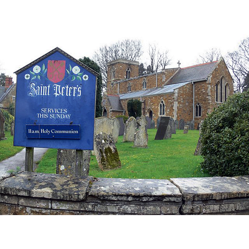
Image copyright © Mat Fascione, 2008
CC-BY-SA-2.0
Results: 2 records
view of church exterior - southeast view
Scene Description: EXT SE digital photograph taken 5 April 2008 by Mat Fascione [www.geograph.org.uk/photo/761694] [accessed 4 September 2015]
GEORGIAN STOUP digital photograph taken by Andrew Jackson, in [www.britishlistedbuildings.co.uk/images/buildings/en/189/189873-69640-800.jpg] [accessed 4 September 2015] NO KNOWN
Copyright Statement: Image copyright © Mat Fascione, 2008
Image Source: digital photograph taken 5 April 2008 by Mat Fascione [www.geograph.org.uk/photo/761694] [accessed 4 September 2015]
Copyright Instructions: CC-BY-SA-2.0
view of stoup
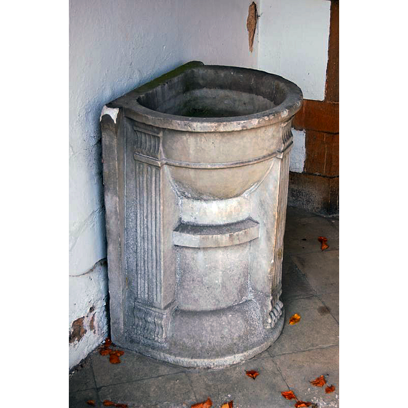
Scene Description: the Georgian stoup in the porch
Copyright Statement: Image copyright © Andrew Jackson, 2015
Image Source: digital photograph taken by Andrew Jackson, in [www.britishlistedbuildings.co.uk/images/buildings/en/189/189873-69640-800.jpg] [accessed 4 September 2015]
Copyright Instructions: No known copyright restriction / Fair Dealing
INFORMATION
Font ID: 12190KNO
Object Type: Baptismal Font1
Font Century and Period/Style: 13th century / 19th century [outer colonnettes of the base only] [composite font], Medieval [composite]
Church / Chapel Name: Parish Church of St. Peter
Font Location in Church: Inside the church
Church Patron Saint(s): St. Peter
Church Address: Somerby Road, Knossington, Leicestershire LE15 8LY, UK
Site Location: Leicestershire, East Midlands, England, United Kingdom
Directions to Site: Located 6 km W of Oakham, 15 km SE of Melton Broway
Ecclesiastic Region: Diocese of Leicester
Historical Region: Hundred of Martinsley [in Domesday]
Additional Comments: altered font / restored font: the outer colonnnettes of the base replaced in the 19th century
Font Notes:
Click to view
There are two entries for Knossington [variant spelling] in the Domesday survey [http://opendomesday.org/place/SK8008/knossington/] [accessed 4 September 2015], neither of which mentions cleric or church in it. The Victoria County History (Leicestershire, vol. 5, 1964) notes: "The church of Knossington was first mentioned in 1199 [...] Throsby, visiting the church in 1790, thought that the chancel was older than the rest and that there were some remains of 'the oldest Gothic'. [...] The font probably dates from the early 13th century. It consists of a curious bulbous bowl having four attached shafts curved to its shape. The bowl is supported on a circular stem and four circular shafts, the latter replaced by red marble in the 19th century". Noted in Pevsner (1984): "Font. C13. Hemispherical bowl with four corner projections." Both the old font and a later-date stoup are noted in a communication from Aidan McRae Thomson: "a plain but attractive old font on restored shafts, and an unusual font-like Georgian water stoup in the porch" [25 January 2012 in https://groups.yahoo.com/neo/groups/churchpictures/conversations/messages/33812 [accessed 4 September 2015].
COORDINATES
UTM: 30U 647513 5837808
Latitude & Longitude (Decimal): 52.670116, -0.81838
Latitude & Longitude (DMS): 52° 40′ 12.42″ N, 0° 49′ 6.17″ W
MEDIUM AND MEASUREMENTS
Material: stone
Font Shape: hemispheric, mounted
Basin Interior Shape: round
Basin Exterior Shape: round
REFERENCES
- Victoria County History [online], University of London, 1993-. URL: https://www.british-history.ac.uk.
- Pevsner, Nikolaus, Leicestershire and Rutland, Harmondsworth: Penguin Books, 1984, p. 196