Church / Chierche / Chiereche / Chirche / Church Kirk, nr. Accrington
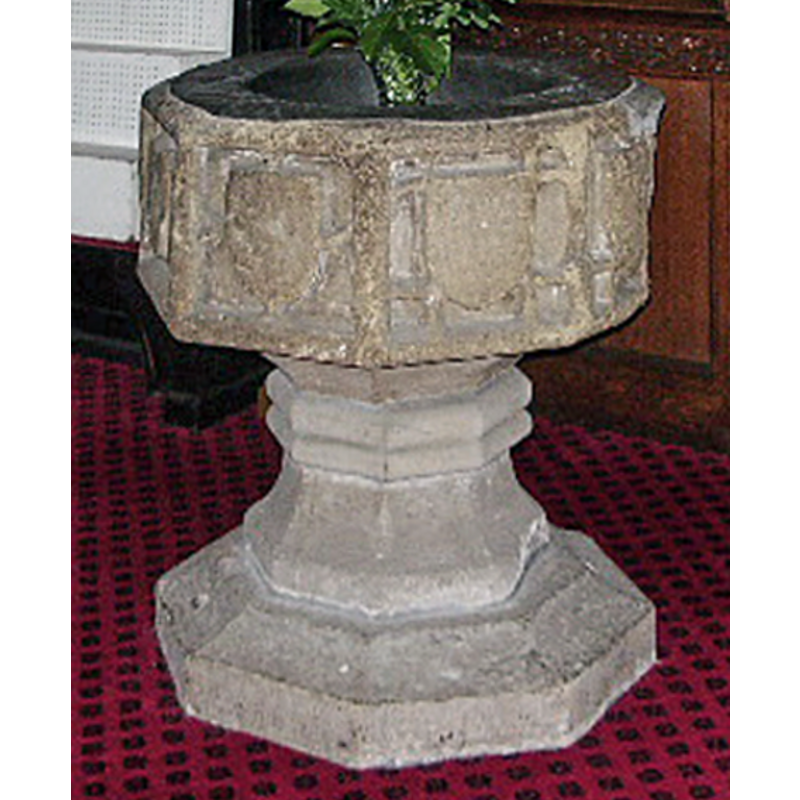
Image copyright © Alexander P Kapp, 2008
CC-BY-SA-2.0
Results: 7 records
view of font
Scene Description: the base and lower base are a later replacement
Copyright Statement: Image copyright © Alexander P Kapp, 2008
Image Source: edited detail of a digital photograph taken 7 January 2008 by Alexander P Kapp [www.geograph.org.uk/photo/655538] [accessed 14 March 2019]
Copyright Instructions: CC-BY-SA-2.0
view of font in context
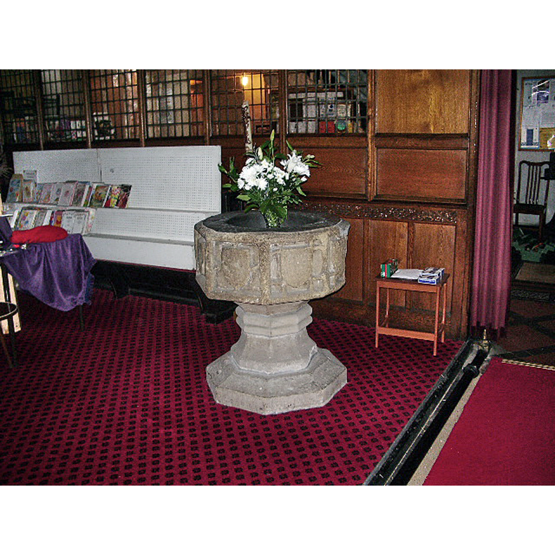
Copyright Statement: Image copyright © Alexander P Kapp, 2008
Image Source: digital photograph taken 7 January 2008 by Alexander P Kapp [www.geograph.org.uk/photo/655538] [accessed 14 March 2019]
Copyright Instructions: CC-BY-SA-2.0
design element - patterns - tracery
Scene Description: [cf. Font notes]
Copyright Statement: Image copyright © Alexander P Kapp, 2008
Image Source: edited detail of a digital photograph taken 7 January 2008 by Alexander P Kapp [www.geograph.org.uk/photo/655538] [accessed 14 March 2019]
Copyright Instructions: CC-BY-SA-2.0
symbol - shield - blank
Scene Description: [cf. Font notes]
Copyright Statement: Image copyright © Alexander P Kapp, 2008
Image Source: edited detail of a digital photograph taken 7 January 2008 by Alexander P Kapp [www.geograph.org.uk/photo/655538] [accessed 14 March 2019]
Copyright Instructions: CC-BY-SA-2.0
view of church exterior - southwest view
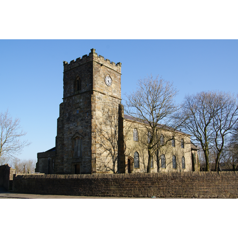
Scene Description: Source caption: "St James, Church Kirk. Still an independent parish on the north west side of Accrington. The building is thought to date from Tudor times."
Copyright Statement: Image copyright © Bill Boaden, 2013
Image Source: digital photograph taken 2 March 2013 by Bill Boaden [www.geograph.org.uk/photo/3368615] [accessed 14 March 2019]
Copyright Instructions: CC-BY-SA-2.0
view of church interior - looking west
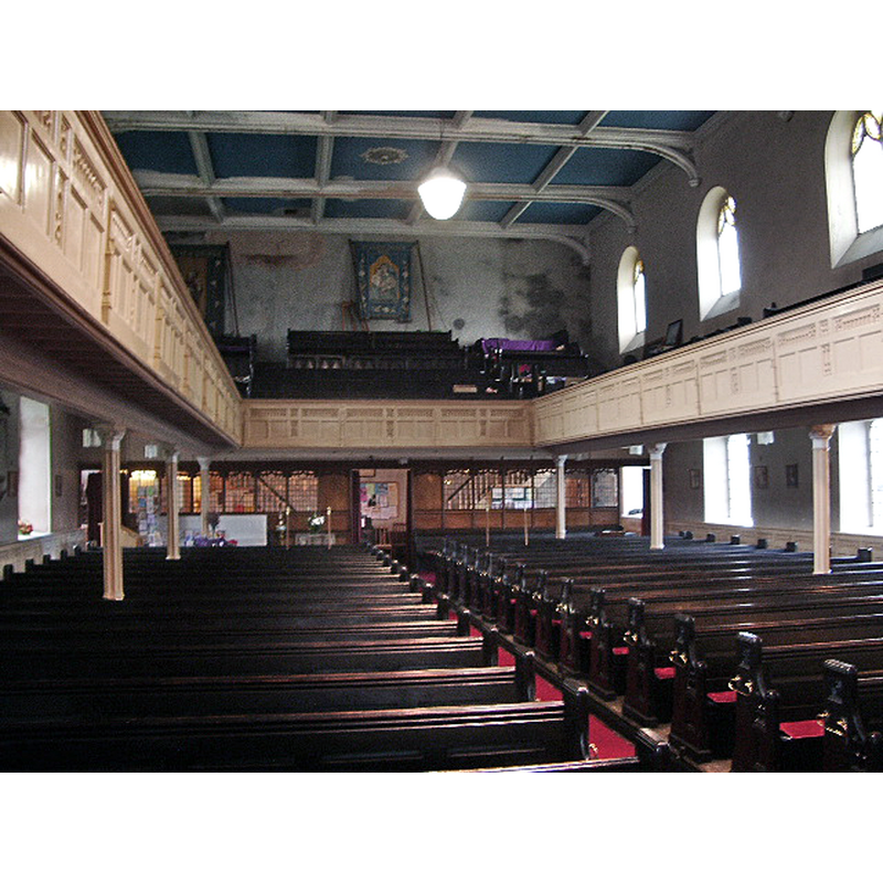
Copyright Statement: Image copyright © Alexander P Kapp, 2008
Image Source: digital photograph taken 7 January 2008 by Alexander P Kapp [www.geograph.org.uk/photo/655551] [accessed 14 March 2019]
Copyright Instructions: CC-BY-SA-2.0
view of church interior - looking east
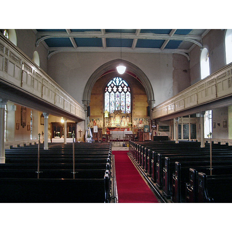
Copyright Statement: Image copyright © Alexander P Kapp, 2008
Image Source: digital photograph taken 7 January 2008 by Alexander P Kapp [www.geograph.org.uk/photo/655537] [accessed 14 March 2019]
Copyright Instructions: CC-BY-SA-2.0
INFORMATION
Font ID: 12158CHU
Object Type: Baptismal Font1
Font Century and Period/Style: 15th - 16th century[basin only] [composite font], Late Medieval [composite]
Workshop/Group/Artisan: heraldic font
Church / Chapel Name: Parish Church of St. James [closed 2015]
Font Location in Church: Inside the church
Church Patron Saint(s): St. James
Church Notes: original church may have been 7thC; present church damaged by a fire in 1983
Church Address: St James Rd, Church, Hyndburn, Lancs, UK
Site Location: Lancashire, North West, England, United Kingdom
Directions to Site: Church is located 2 km NW of Accrington, E of Blacburn
Ecclesiastic Region: Diocese of Blackburn
Historical Region: Hundred of Blackburn
Additional Comments: altered font? (the base of the present font is of a later date) -- disappeared font? (the one from the original church here)
Font Notes:
Click to view
No individual entry found for Church in the Domesday survey. The entry for this township in the Victoria County History (Lancaster, vol. 6, 1911) notes: "From the name of the township it might be supposed that the chapel there was of ancient origin and of independent standing. At the first positive record, however, the Survey of 1296, it was no more than a chapel, served by a priest [...] [of the present church only] the tower is ancient, and belongs probably to the end of the 15th or beginning of the 16th century, the rest of the church having been pulled down in 1805 [...] The font is octagonal and apparently of the same date as the tower, and has a blank shield on each face." Pevsner (1969) writes: "Font. Perp[endicular], with blank tracery." Hartwell & Pevsner (2009) note: "Font. Perp[endicular], with blank tracery and shields on a more recent stem." The entry for this church in Historic England [Listing NGR: SD7412329097] notes: "Church; late medieval tower, nave 1804-5, chancel 1895-6. [...] late-medieval octagonal font with blank shields in faces".
COORDINATES
UTM: 30U 539953 5956779
Latitude & Longitude (Decimal): 53.7581, -2.394
Latitude & Longitude (DMS): 53° 45′ 29.16″ N, 2° 23′ 38.4″ W
MEDIUM AND MEASUREMENTS
Material: stone
Font Shape: octagonal, mounted
Basin Interior Shape: round
Basin Exterior Shape: octagonal
Drainage Notes: lead-lined
REFERENCES
- Victoria County History [online], University of London, 1993-. URL: https://www.british-history.ac.uk.
- Hartwell, Clare, Lancashire North, New Haven; London: Yale University Press, 2009, p. 229
- Pevsner, Nikolaus, Lancashire, Harmondsworth: Penguin Books, 1969, vol. 2: 99