Gillingham nr. Beccles / Kildincham
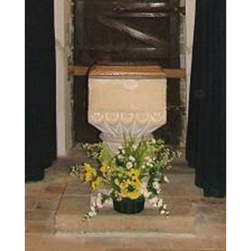
Image copyright © Simon Knott, 2006
Standing permission
Results: 12 records
view of font and cover
Scene Description: a Victorian font?
Copyright Statement: Image copyright © Simon Knott, 2006
Image Source: digital photograph by Simon Knott in www.norfolkchurches.co.uk
Copyright Instructions: Standing permission
view of church exterior - tower
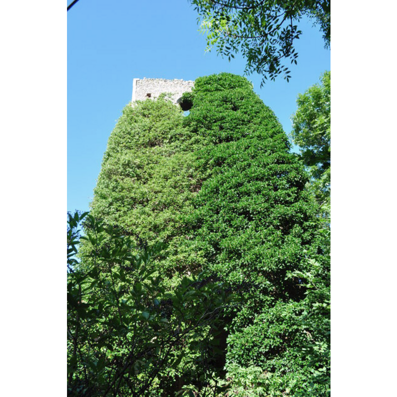
Scene Description: the ruined church of All Saints in 2010
Copyright Statement: Image copyright © Ashley Dace, 2010
Image Source: digital photograph taken 28 August 2010 by Ashley Dace [www.geograph.org.uk/photo/2037463] [accessed 9 September 2013]
Copyright Instructions: CC-BY-SA-3.0
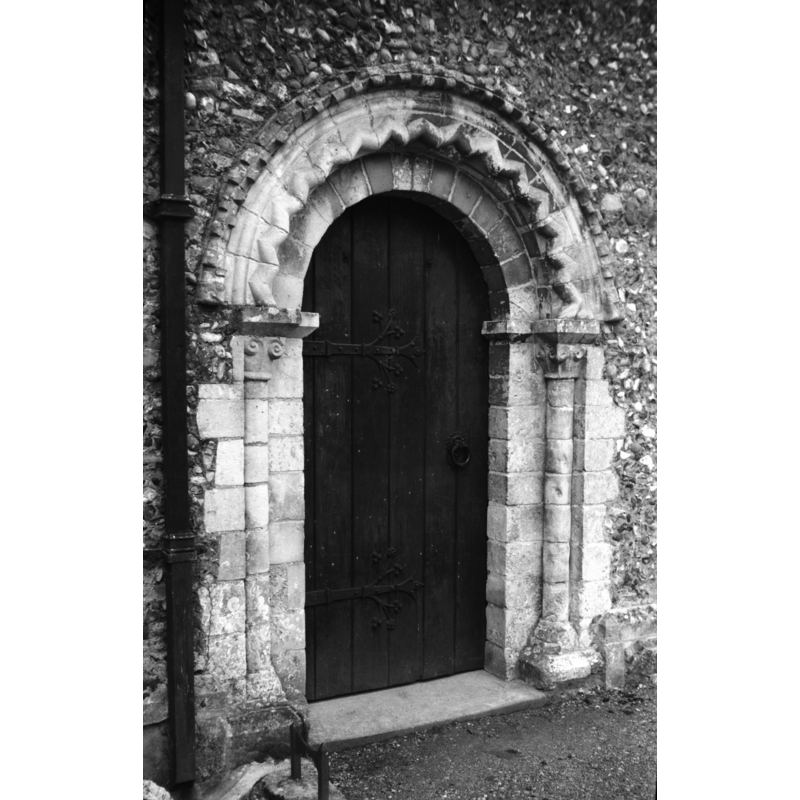
view of church exterior - west portal
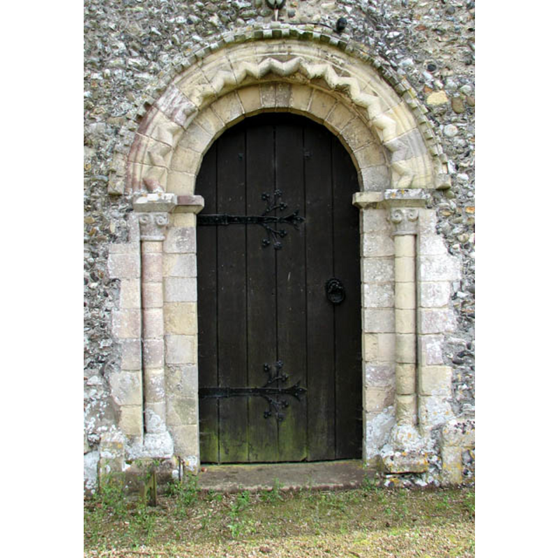
Copyright Statement: Image copyright © Evelyn Simak, 2009
Image Source: digital photograph taken 8 June 2009 by Evelyn Simak [www.geograph.org.uk/photo/1345545] [accessed 9 September 2013]
Copyright Instructions: CC-BY-SA-3.0
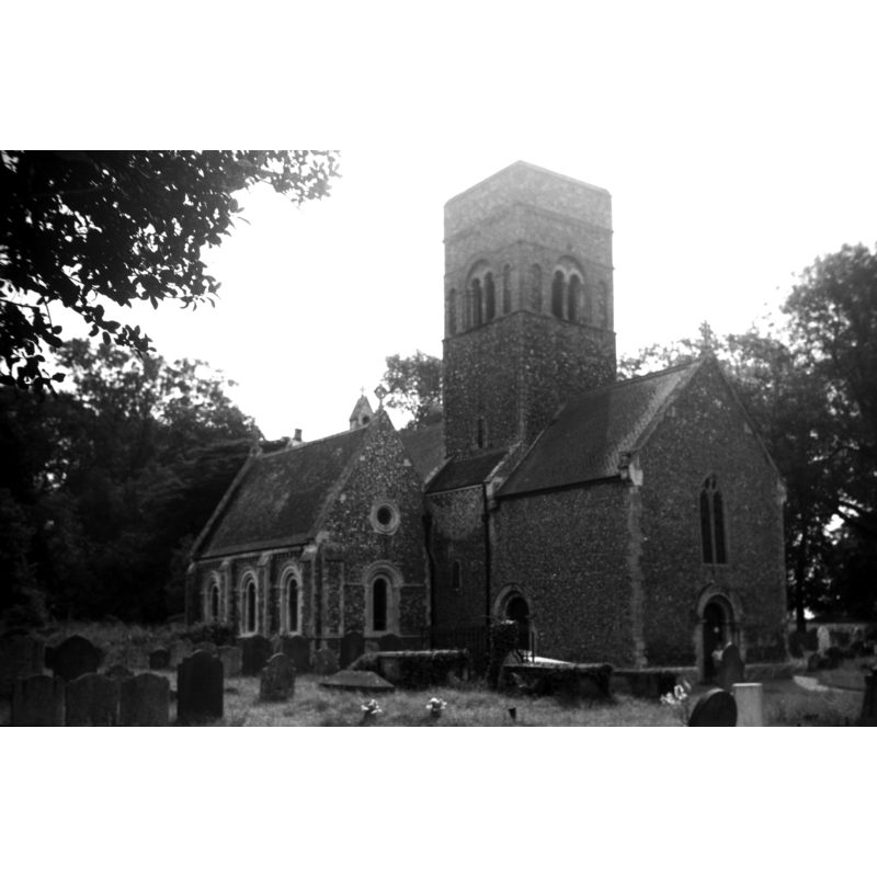
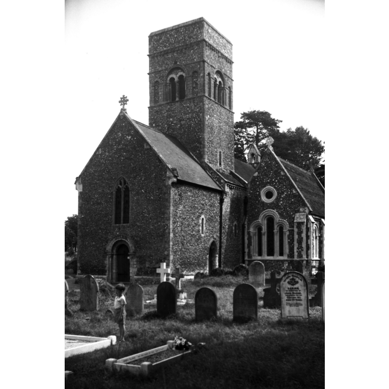
view of church exterior - northeast view
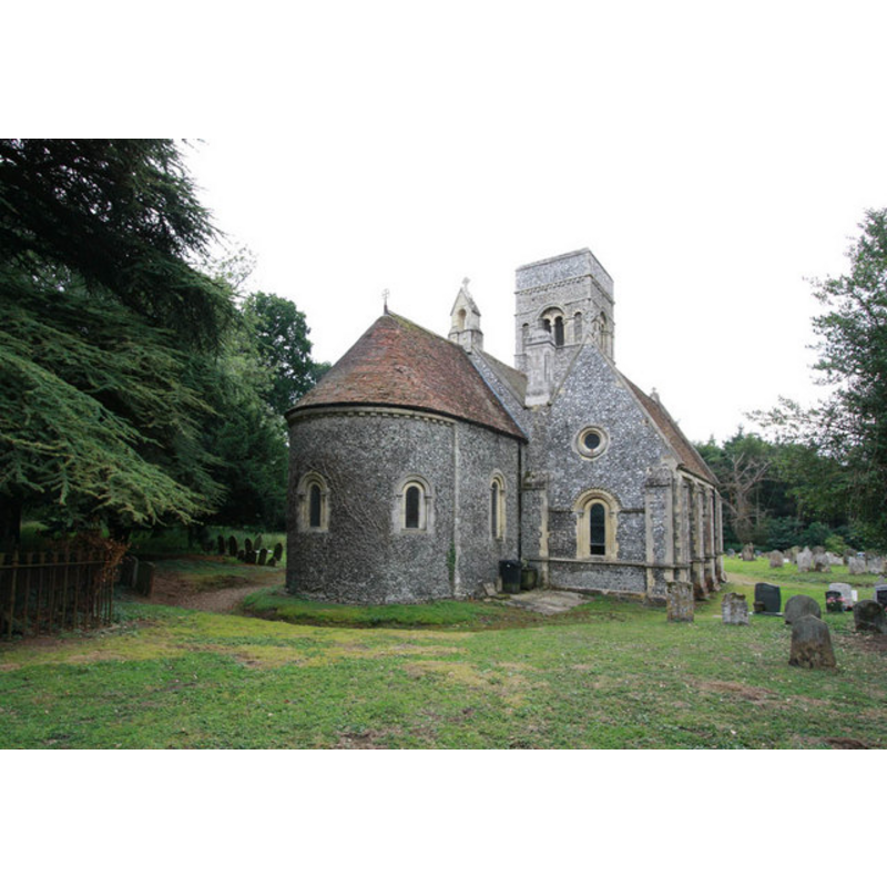
Copyright Statement: Image copyright © John Salmon, 2010
Image Source: digital photograph taken 28 July 2010 by John Salmon [www.geograph.org.uk/photo/1991988] [accessed 9 September 2013]
Copyright Instructions: CC-BY-SA-3.0
view of church exterior - southwest view
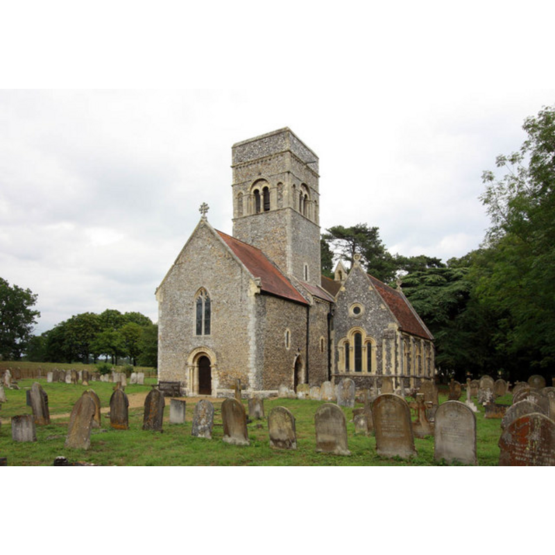
Copyright Statement: Image copyright © John Salmon, 2010
Image Source: digital photograph taken 28 July 2010 by John Salmon [www.geograph.org.uk/photo/1991984] [accessed 9 September 2013]
Copyright Instructions: CC-BY-SA-3.0
view of church exterior - south view
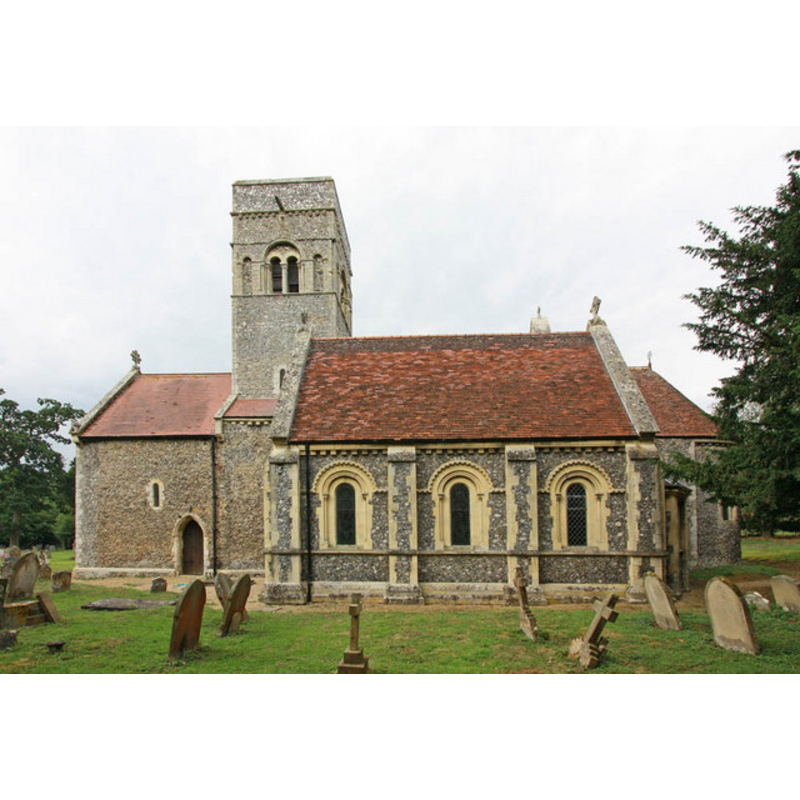
Copyright Statement: Image copyright © John Salmon, 2010
Image Source: digital photograph taken 28 July 2010 by John Salmon [www.geograph.org.uk/photo/1991995] [accessed 9 September 2013]
Copyright Instructions: CC-BY-SA-3.0
view of church exterior - northwest view
Scene Description: Photo caption: "The west wall rebuilt, shortening the nave and forming a west porch"
Copyright Statement: Image copyright © George Plunkett, 2013
Image Source: B&W photograph taken 3 August 1961 by George Plunkett [www.georgeplunkett.co.uk/Norfolk/G/Gillingham St Mary's church from NW [4627] 1961-08-03.jpg] [accessed 9 September 2013]
Copyright Instructions: Standing permission by Jonathan Plunkett
view of church exterior - west portal
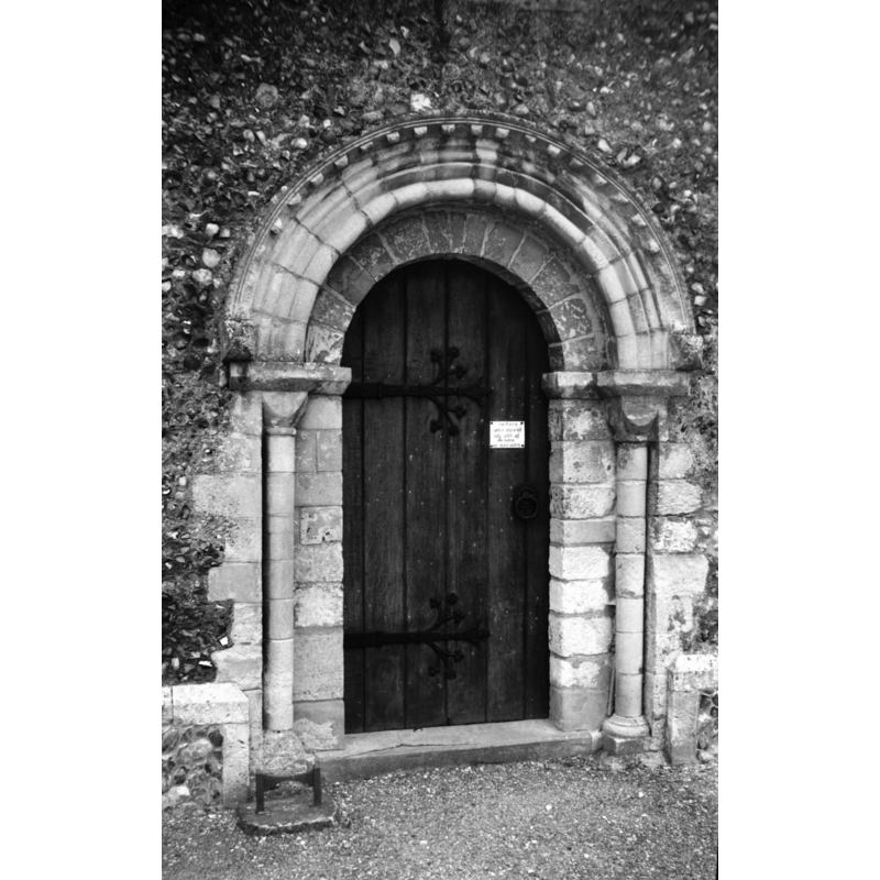
Copyright Statement: Image copyright © George Plunkett, 2013
Image Source: B&W photograph taken 3 August 1961 by George Plunkett [www.georgeplunkett.co.uk/Norfolk/G/Gillingham St Mary's church Norman W door [4625] 1961-08-03.jpg] [accessed 9 September 2013]
Copyright Instructions: Standing permission by Jonathan Plunkett
view of church exterior - north portal
Copyright Statement: Image copyright © George Plunkett, 2013
Image Source: B&W photograph taken 3 August 1961 by George Plunkett [www.georgeplunkett.co.uk/Norfolk/G/Gillingham St Mary's church Norman N door [4626] 1961-08-03.jpg] [accessed 9 September 2013]
Copyright Instructions: Standing permission by Jonathan Plunkett
view of church exterior - southwest view
Copyright Statement: Image copyright © George Plunkett, 2013
Image Source: B&W photograph taken 3 August 1961 by George Plunkett [www.georgeplunkett.co.uk/Norfolk/G/Gillingham St Mary's church from SW [4624] 1961-08-03.jpg] [accessed 9 September 2013]
Copyright Instructions: Standing permission by Jonathan Plunkett
view of church exterior - tower
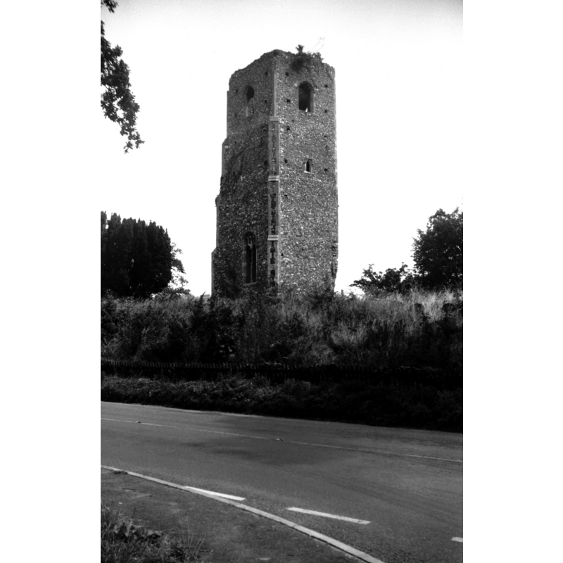
Scene Description: the ruined church of All Saints in 1961 -- Photo caption: "The living consolidated with St Mary's since 1748, when this church was taken down"
Copyright Statement: Image copyright © George Plunkett, 2013
Image Source: B&W photograph taken 3 August 1961 by George Plunkett [ww.georgeplunkett.co.uk/Norfolk/G/Gillingham All Saints church tower ruin [4628] 1961-08-03.jpg] [accessed 9 September 2013]
Copyright Instructions: Standing permission by Jonathan Plunkett
view of font and cover in context
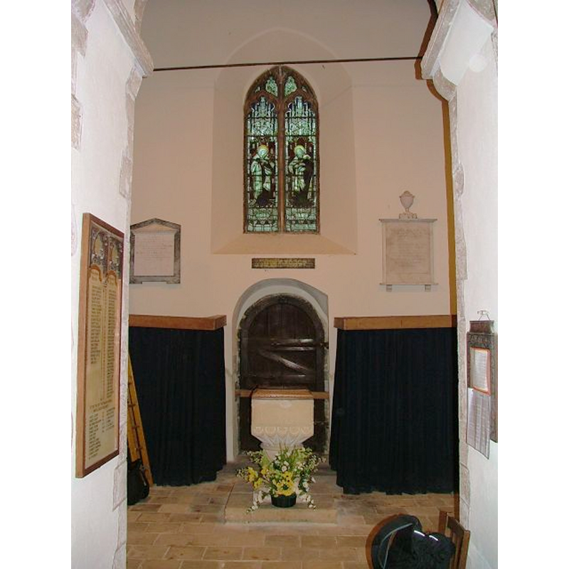
Scene Description: a Victorian font?
Copyright Statement: Image copyright © Simon Knott, 2006
Image Source: digital photograph by Simon Knott in www.norfolkchurches.co.uk
Copyright Instructions: Standing permission
INFORMATION
Font ID: 12096GIL
Object Type: Baptismal Font1, base only?
Font Century and Period/Style: 15th century [base only?] [composite font], Late Medieval
Church / Chapel Name: Parish Church of St. Mary [originally from All Saints?]
Font Location in Church: Inside St. Mary's, at the W end, by the S door
Church Patron Saint(s): St. Mary, All Saints
Church Notes: Gillingham All Saints has been in ruins since the 18thC
Church Address: Church Road, Gillingham, NR34 0ND, UK
Site Location: Norfolk, East Anglia, England, United Kingdom
Directions to Site: Located off the A146, 2 km N of Beccles
Ecclesiastic Region: Diocese of Norwich
Historical Region: Hundred of Clavering
Additional Comments: price of a font / cost of a font: basin said to have sold for a guinea [cf. FontNotes] -- disappeared fonts? [cf. FontNotes]
Font Notes:
Click to view
The Domesday entry for "Kildincham" cited in Blomefield (1805-1810) reports "a church endowed with 30 acres of free land" here; there were actually two churches here, as noted in Blomefield (ibid.): "In this town were 2 churches. All-Saints was a rectory containing two isles, and a chancel thatched, with a square tower and three bells [...] the church was demolished in 1748. [...] The church of St. Mary is a rectory valued, in Edward the First's reign, at 8 marks; the rector had 40 acres of land [...] The Church is a very antique building, a single pile, without any isles; at the west end, is the font; as you proceed is a four-square tower; then the body of the church, with the chancel, about the same breadth with the church, and ends in a semicircle; in the tower are three bells; the west end is tiled, and the rest covered with thatch." The South Norfolk Council web site [www.enterprise-link.co.uk/Gillingham/] notes: "The font at St. Mary's is not as old as the church. Near the south door [by the holy-water stoup?] is the base of a 15th century font belonging to All Saints church. This was found in a cottage garden in the village where it had been used as a garden seat for many years. The bowl of this font is said to have been sold to Kirkley Church, near Lowestoft, for a guinea." The font located in the west end of the nave at St. Mary's consists of a square basin with plain sides, but the underbowl has scalop decoration akin to the one found in the old Norman style [NB: this font may belong to what Knott (2005) describes as the 'camp Romanesque' style of the 19th-century renovation of this church. Pevsner & Wilson (1999) describe this modern font as "Neo-Norman". [cf. Index entry for Kirkley (Suffolk), for the basin of the old font]. [NB: we have no information on the disappeared (?) basin of the nearby church of All Saints' of which only the tower now remains].
Credit and Acknowledgements: We are grateful to Simon Knott, of www.norfolkchurches.co.uk, for the photograph of the new font in this church; we are also grateful to Jonathan Plunkett for the photographs of the two churches here taken by his father, George Plunkett. in 1961
COORDINATES
UTM: 31U 401469 5814836
Latitude & Longitude (Decimal): 52.474779, 1.549305
Latitude & Longitude (DMS): 52° 28′ 29.2″ N, 1° 32′ 57.5″ E
MEDIUM AND MEASUREMENTS
Material: stone
REFERENCES
- Knott, Simon, The Norfolk Churches Site, Simon Knott, 2004. [standing permission to reproduce images received from Simon (February 2005]. URL: www.norfolkchurches.co.uk.
- Pevsner, Nikolaus, Norfolk 2: North-West and South (2nd ed.), London: Penguin, 1999, p. 358