Chevening
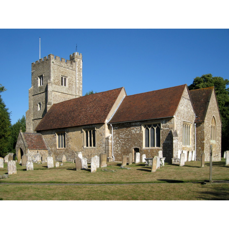
Image copyright © Oast House Archive, 2010
CC-BY-SA-2.0
Results: 4 records
view of church exterior - southeast view
Copyright Statement: Image copyright © Oast House Archive, 2010
Image Source: digital photograph taken 28 July 2010 by Oast House Archive [www.geograph.org.uk/photo/1984235] [accessed 25 April 2019]
Copyright Instructions: CC-BY-SA-2.0
view of church interior - nave - looking west
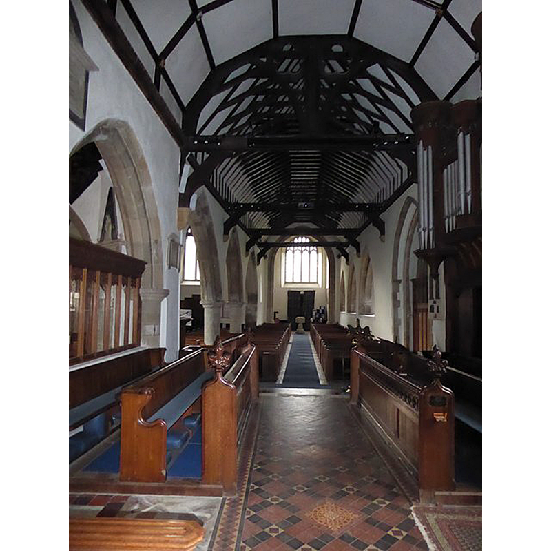
Scene Description: with the modern font at the west end of the aisle
Copyright Statement: Image copyright © Basher Eyre, 2017
Image Source: digital photograph taken 18 March 2017 by Basher Eyre [www.geograph.org.uk/photo/5336929] [accessed 25 April 2019]
Copyright Instructions: CC-BY-SA-2.0
symbol - shield - blank - in a quatrefoil - in a circle - 8

Scene Description: the modern font

design element - architectural - buttress - 8
Scene Description: the modern font
INFORMATION
Font ID: 12087CHE
Object Type: Baptismal Font1?
Font Century and Period/Style: 12th century (early?), Norman
Church / Chapel Name: Parish Church of St. Botolph
Church Patron Saint(s): St. Botulph [aka St. Botolph, Botolph of Thorney, Botulf]
Church Address: Chevening Rd, Sevenoaks TN14 6HG, UK -- Tel.: +44 1732 453555
Site Location: Kent, South East, England, United Kingdom
Directions to Site: Located off the M25, NW of Sevenoaks
Ecclesiastic Region: Diocese of Rochester
Additional Comments: disappeared font? (the one from the Anglo-Saxon church here [cf. FontNotes])
Font Notes:
Click to view
No individual entry found for Chevening in the Domesday survey. Glynne (1877) notes a modern font in this church [NB: he visited the church in 1835 and 1859]. Noted in Newman (1980): "Font. Perp[endicular]. Octagonal. Buttressed stem. Encircled quatrefoils on the bowl." The entry for this church in Historic England [List Entry Number: 1336446] notes: "There was Roman and Anglo-Saxon settlement at Chevening, and the church is first recorded in the early C12 Textus Roffensis (1122-23), although it probably existed before that date as the nave and N transept appear to be Anglo-Saxon in origin. [...] The core of the church is probably Anglo-Saxon, and the N aisle and N transept were added or remodelled in the C12. S aisle and S chapel added C13, but are of different builds. Tower begun after 1518. The S chapel roof is 1584, when it became the Lennard family chapel, S porch remodelled 1858. Church restored 1869, and a major restoration in 1901-2 by W D Caroë".
COORDINATES
UTM: 31U 300288 5686946
Latitude & Longitude (Decimal): 51.298747, 0.135166
Latitude & Longitude (DMS): 51° 17′ 55.49″ N, 0° 8′ 6.6″ E
REFERENCES
- Glynne, Steven Richard, Sir, Notes on the churches of Kent, London: John Murray, 1877, p. 302
- Newman, John, West Kent and the Weald, Harmondsworth: Penguin Books, 1980, p. 209