Whitstable
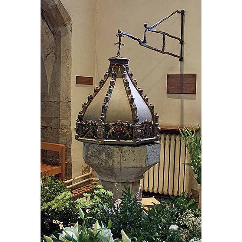
Image copyright © John Salmon, 2008
CC-BY-SA-2.5
Results: 4 records
view of font and cover
Scene Description: Source caption: "All Saints Church, Whitstable, Kent - Font"
Copyright Statement: Image copyright © John Salmon, 2008
Image Source: digital photograph 16 October 2008 by John Salmon [https://www.geograph.org.uk/photo/1010788] [accessed 11 October 2023]
Copyright Instructions: CC-BY-SA-2.5
view of church exterior in context
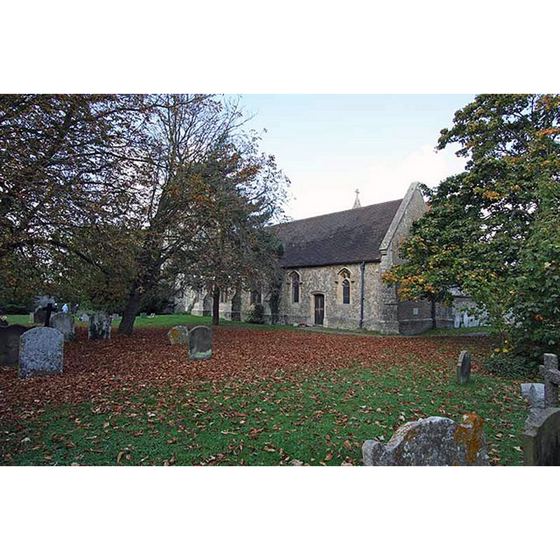
Scene Description: Source caption: "All Saints Church, Whitstable, Kent"
Copyright Statement: Image copyright © John Salmon, 2008
Image Source: digital photograph 16 October 2008 by John Salmon [https://www.geograph.org.uk/photo/1010794] [accessed 11 October 2023]
Copyright Instructions: CC-BY-SA-2.5
view of church interior - looking east
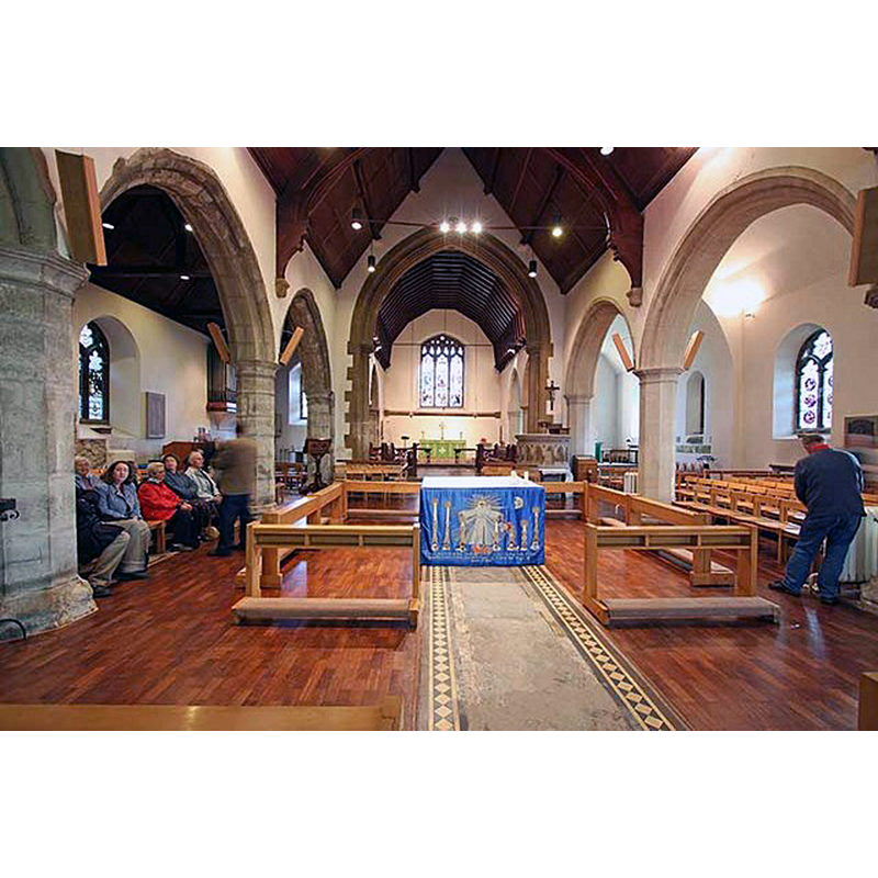
Scene Description: Source caption: "All Saints Church, Whitstable, Kent - East end"
Copyright Statement: Image copyright © John Salmon, 2008
Image Source: digital photograph 16 October 2008 by John Salmon [https://www.geograph.org.uk/photo/1010781] [accessed 11 October 2023]
Copyright Instructions: CC-BY-SA-2.5
view of church interior - looking west
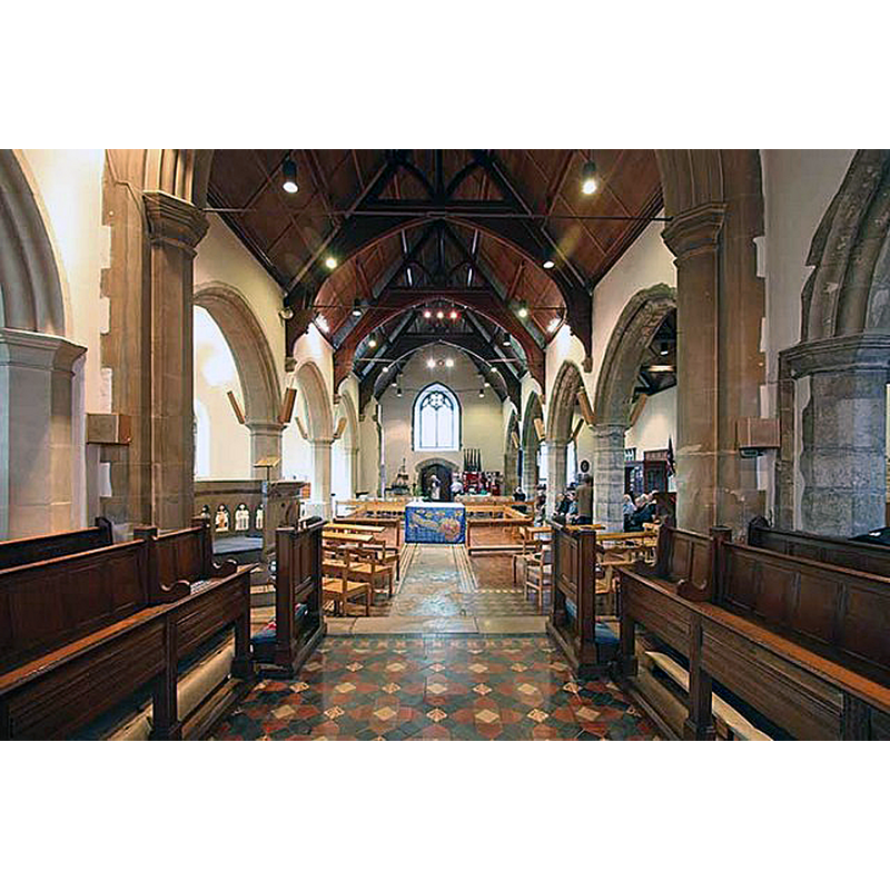
Scene Description: Source caption: "All Saints Church, Whitstable, Kent - West end"
Copyright Statement: Image copyright © John Salmon, 2008
Image Source: digital photograph 16 October 2008 by John Salmon [https://www.geograph.org.uk/photo/1010786] [accessed 11 October 2023]
Copyright Instructions: CC-BY-SA-2.5
INFORMATION
Font ID: 12078WHI
Object Type: Baptismal Font1
Font Century and Period/Style: 15th century, Perpendicular
Church / Chapel Name: Parish Church of All Saints
Font Location in Church: Inside the church, SW corner
Church Patron Saint(s): All Saints
Church Address: Church St, Whitstable CT5 1PG, United Kingdom -- Tel.: +44 7833 448287
Site Location: Kent, South East, England, United Kingdom
Directions to Site: Located N of the A299, 3 km W of Herne Bay, 8 km NE of Canterbury
Ecclesiastic Region: Diocese of Canterbury
Historical Region: Hundred of Whitstable [in Domesday]
Font Notes:
Click to view
There is an entry in the Domesday survey [https://opendomesday.org/place/TR1066/whitstable/] [accessed 11 October 2023] that includes multiple places: Makinbrook; Stourmouth; Minster; Whitstable; it menyions two churches in it. Glynne (1877) writes: "The font has a plain octagonal bowl on plain pedestal and plinth." The font cover is noted in Newman (1976): "Font cover. Early C17. Ogee profile. Crocketed ribs." The entry for this church in Historic England [List Entry Number: 1084932] notes: "Perpendicular C15 south west tower and north aisle arcade. Church otherwise rebuilt in 1875-76 [...] Medieval stone font with hexagonal shaft and basin on moulded base in south west corner has early C17 font cover with ogee profile and crocketed ribs, recently shown to have a painted underside, and featuring coats of arms."
Credit and Acknowledgements: We are grateful to Pol Herman for his help in documenting this font
COORDINATES
UTM: 31U 363507 5691216
Latitude & Longitude (Decimal): 51.3558, 1.0397
Latitude & Longitude (DMS): 51° 21′ 20.88″ N, 1° 2′ 22.92″ E
MEDIUM AND MEASUREMENTS
Material: stone
Font Shape: octagonal, mounted
Basin Interior Shape: round
Basin Exterior Shape: octagonal
LID INFORMATION
Date: 17th century (early)
Material: wood
Notes: [cf. FontNotes]
REFERENCES
- Glynne, Steven Richard, Sir, Notes on the churches of Kent, London: John Murray, 1877, p. 135
- Newman, John, North East and East Kent, Harmondsworth: Penguin Books, 1976, p. 490