Sturry No. 1 / Stour-gau / Esturai
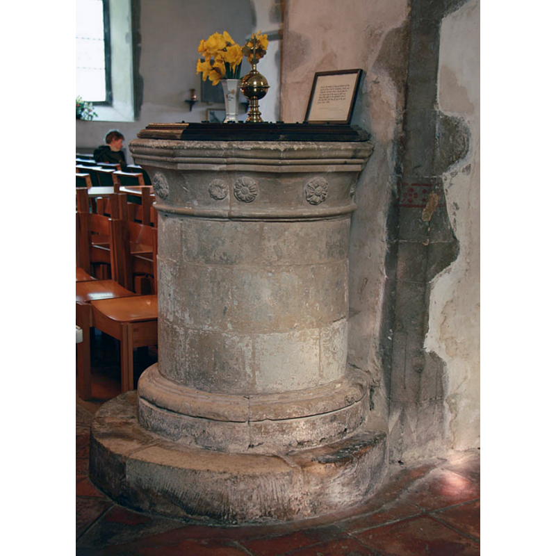
Image copyright © John Salmon, 2011
CC-BY-SA-2.0
Results: 7 records
view of font and cover
Copyright Statement: Image copyright © John Salmon, 2011
Image Source: digital photograph taken 31 March 2011 by John Salmon [www.geograph.org.uk/photo/2341886] [accessed 21 April 2018]
Copyright Instructions: CC-BY-SA-2.0
design element - motifs - floral - rosette - 8
Scene Description: later re-carving?
Copyright Statement: Image copyright © John Salmon, 2011
Image Source: digital photograph taken 31 March 2011 by John Salmon [www.geograph.org.uk/photo/2341886] [accessed 21 April 2018]
Copyright Instructions: CC-BY-SA-2.0
design element - motifs - moulding - parallel - 3
Scene Description: later re-carving?
Copyright Statement: Image copyright © John Salmon, 2011
Image Source: digital photograph taken 31 March 2011 by John Salmon [www.geograph.org.uk/photo/2341886] [accessed 21 April 2018]
Copyright Instructions: CC-BY-SA-2.0
view of church exterior - northeast view
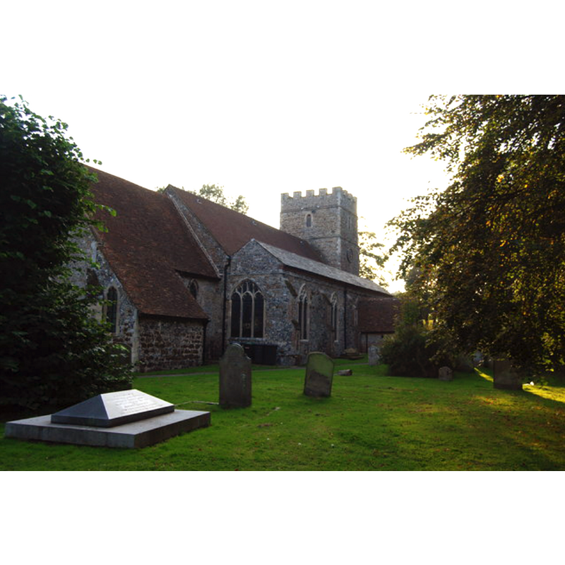
Copyright Statement: Image copyright © Nigel Chadwick, 2008
Image Source: digital photograph taken 27 September 2008 by Nigel Chadwick [www.geograph.org.uk/photo/985501] [accessed 21 April 2018]
Copyright Instructions: CC-BY-SA-2.0
view of church exterior - northwest end
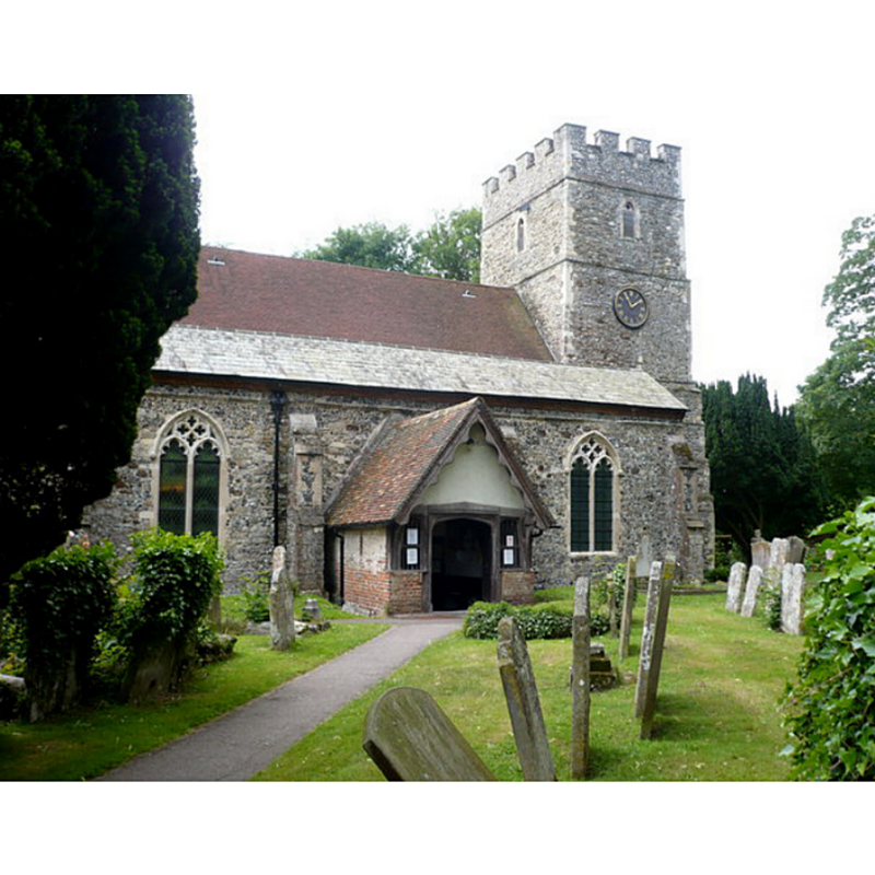
Scene Description: Source caption: "The church of St. Nicholas, Sturry. Approaching the 16th century timber-framed porch of the north door."
Copyright Statement: Image copyright © pam fray, 2009
Image Source: digital photograph taken 12 June 2009 by pam fray [www.geograph.org.uk/photo/1351175] [accessed 21 April 2018]
Copyright Instructions: CC-BY-SA-2.0
view of church interior - nave - looking east
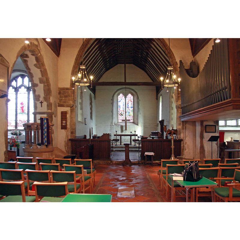
Copyright Statement: Image copyright © John Salmon, 2011
Image Source: digital photograph taken 31 March 2011 by John Salmon [www.geograph.org.uk/photo/2341896] [accessed 21 April 2018]
Copyright Instructions: CC-BY-SA-2.0
design element - motifs - moulding
Copyright Statement: Image copyright © John Salmon, 2011
Image Source: digital photograph taken 31 March 2011 by John Salmon [www.geograph.org.uk/photo/2341886] [accessed 21 April 2018]
Copyright Instructions: CC-BY-SA-2.0
INFORMATION
Font ID: 12074STU
Object Type: Baptismal Font1
Font Century and Period/Style: 15th - 17th century[basin only] -- 13th century [stem] [composite font], Late Medieval [composite]
Church / Chapel Name: Parish Church of St. Nicholas
Font Location in Church: Inside the church [cf. FontNotes]
Church Patron Saint(s): St. Nicholas of Myra
Church Notes: original [wooden?] church ca. 690?
Church Address: The Rectory, 2 The Hamels, Sturry, Canterbury CT2 0BL, UK -- Tel.: +44 1227 710320
Site Location: Kent, South East, England, United Kingdom
Directions to Site: Located off the A28-A291 crossroads, just N of Forwich, 3 km NE of Canterbury
Ecclesiastic Region: Diocese of Canterbury
Historical Region: Hundred of Sturry
Additional Comments: altered font / composite font (the present font [cf. FontNotes]) -- disappeared font? (the one from the pre-Conquest [7thC?] church here)
Font Notes:
Click to view
There is an entry for Sturry [variant spelling] in the Domesday survey [https://opendomesday.org/place/TR1760/sturry/] [accessed 21 April 2018]; it mentions a church in it. Newman (1976) notes: "Font. Thick C13 stem, but with a bowl that may be C15 or of the 1660s." The entry for this church in Historic England [Listing NGR: TR1760960110] notes: "The chancel and the walls of the nave are Norman, Tower in 3 stages with crenellated parapet, the lower stages C12 having clasping buttresses with banding [...] C13 font." The font is an strange-looking composite of a cylindrical body, or stem, and an odd polygonal shallow basin; it rests on a double lower base or plinth. Is the basin a recarved part? Was the stem and base originally part of a font? A photograph of this object can be seen at the St. Nicholas Church website [http://freespace.virgin.net/r.cornish] [NB: this same web site notes that the bulding of a kitchen (!) in 1997 required the move of the baptismal font from its original position "beside the westernmost pillar of the south aisle".
COORDINATES
UTM: 31U 368948 5684698
Latitude & Longitude (Decimal): 51.2985, 1.1202
Latitude & Longitude (DMS): 51° 17′ 54.6″ N, 1° 7′ 12.72″ E
MEDIUM AND MEASUREMENTS
Material: stone
Font Shape: octagonal, mounted
Basin Interior Shape: round
Basin Exterior Shape: octagonal
REFERENCES
- Newman, John, North East and East Kent, Harmondsworth: Penguin Books, 1976, p. 467