Stanford nr. Folkestone
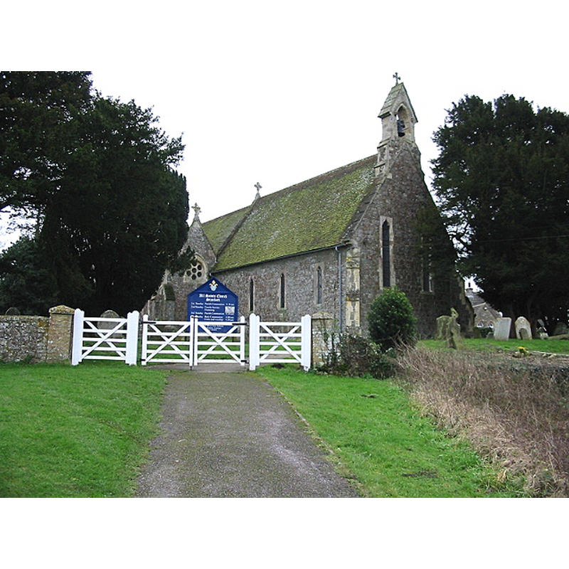
Image copyright © Nick Smith, 2007
CC-BY-SA-2.0
Results: 1 records
view of church exterior in context - southwest view
Copyright Statement: Image copyright © Nick Smith, 2007
Image Source: digital photograph taken 30 December 2007 by Nick Smith [www.geograph.org.uk/photo/643533] [accessed 14 October 2020]
Copyright Instructions: CC-BY-SA-2.0
INFORMATION
Font ID: 12072STA
Object Type: Baptismal Font1
Font Century and Period/Style: 17th century/ 19th century
Church / Chapel Name: Parish Church of All Saints, Stanford
Font Location in Church: Inside the church
Church Patron Saint(s): All Saints
Church Notes: "a small mean building", completely rebuilt in 1841 (chancel) and 1878 (nave)
Church Address: Stanford, Ashford TN25 6DL, UK -- Tel.: +44 1303 892162
Site Location: Kent, South East, England, United Kingdom
Directions to Site: Located off the M20, SE of Monks Horton, 7-8 km W of Folkestone
Ecclesiastic Region: Diocese of Canterbury
Additional Comments: recycled font? replaced font? [cf. FontNotes]
Font Notes:
Click to view
Earliest ref. to church: In Domesday Monachorium it pertains to Lyminge [cf. KAS entry below]. Hasted (1797-1801), writing about the church at nearby Westhanger, notes: "The font, which was in this church, was removed to the church of Stanford, where it now remains." In Newman (1976): "Font. Peculiar, and hard to date, with its miscalculated Perp[endicular] mouldings and a ring of leaves and flowers and looking as if they had squeezed through a cake-icer. Hasted [cf. supra] mentions a font, brought from the demolished church of Westenhanger. But this one looks C19. Might it however be of the 1660s?" The Kent Archaeological Society entry for this church [www.kentarchaeology.org.uk/01/03/STN.htm] [accessed 14 October 2020] notes: "The font from St Mary's, Westenhanger was apparently brought here after the Reformation, when the latter church became disused".
COORDINATES
UTM: 31U 362923 5663041
Latitude & Longitude (Decimal): 51.10245, 1.0421
Latitude & Longitude (DMS): 51° 6′ 09″ N, 1° 2′ 32″ E
MEDIUM AND MEASUREMENTS
Material: stone
REFERENCES
- Hasted, Edward, The History and topographical survey of the County of Kent [...], Canterbury: Printed for the author, by Simmons and Kirkby, 1778-, vol. 8, p. 77
- Newman, John, North East and East Kent, Harmondsworth: Penguin Books, 1976, p. 461