Godmersham
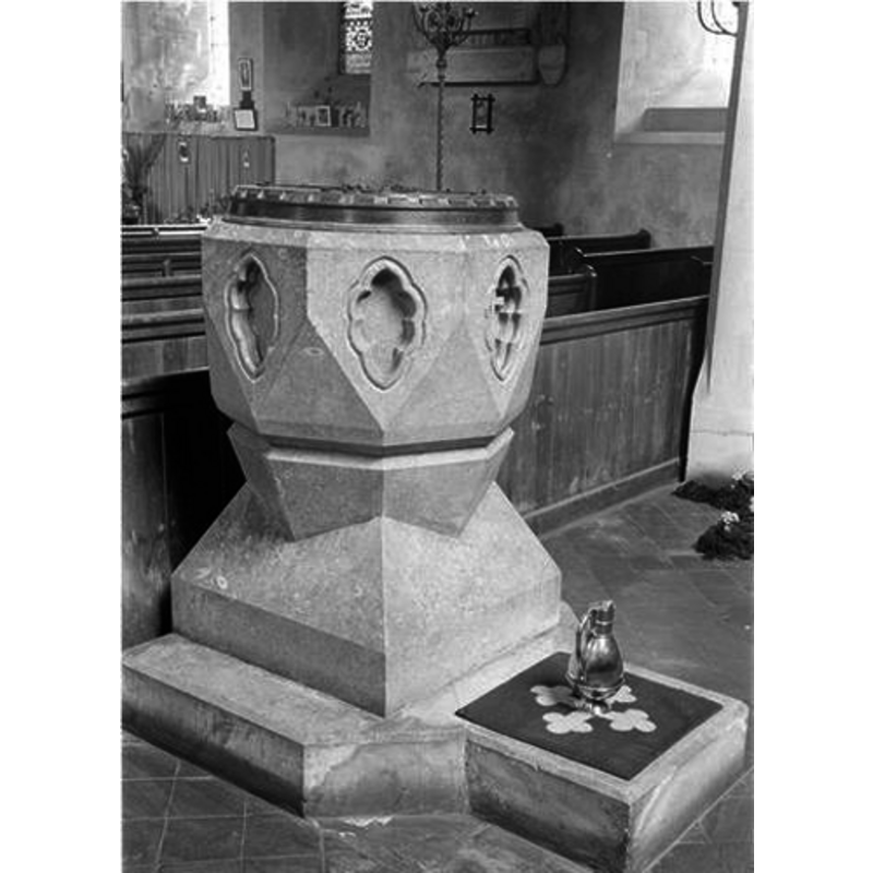
Image copyright © University of Kent, Library Services, Special Collections, 2012
UKC Open Educational User Licence V 1.0.doc [www.kent.ac.uk/library/specialcollections/UKC-Open-Educational-User-Licence-V-1.0.pdf] [accessed 1 August 2012]
Results: 3 records
view of font and cover
Scene Description: the modern font [cf. FontNotes]
Copyright Statement: Image copyright © University of Kent, Library Services, Special Collections, 2012
Image Source: B&W Black and white negative of a Church font, Godmersham, Kent, taken on 10 April 1940 showing a church font [ref.: UKC-RUR-MUG-BW.F223404] University of Kent, Library Services, Special Collections
Copyright Instructions: UKC Open Educational User Licence V 1.0.doc [www.kent.ac.uk/library/specialcollections/UKC-Open-Educational-User-Licence-V-1.0.pdf] [accessed 1 August 2012]
view of church exterior - northeast view
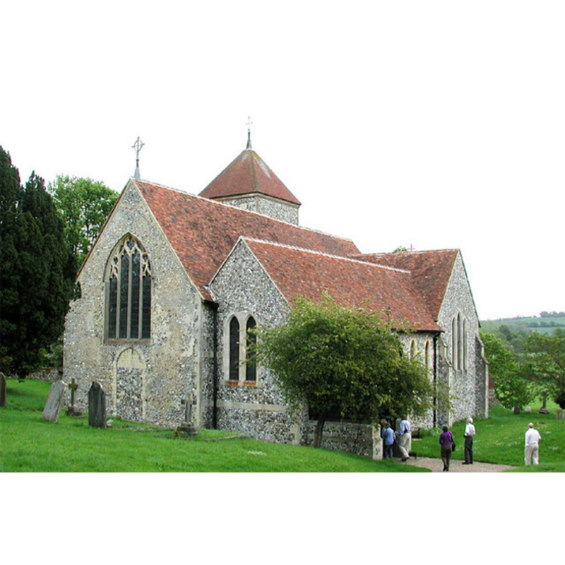
Copyright Statement: Image copyright © John Salmon, 2002
Image Source: digital photograph taken 15 May 2002 by John Salmon [www.geograph.org.uk/photo/324783] [accessed 7 August 2012]
Copyright Instructions: CC-BY-SA-3.0
view of church interior - nave - looking east
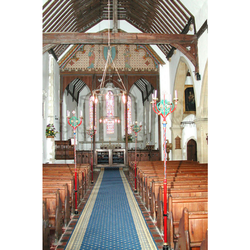
Copyright Statement: Image copyright © John Salmon, 2002
Image Source: digital photograph taken 15 May 2002 by John Salmon [www.geograph.org.uk/photo/324784] [accessed 7 August 2012]
Copyright Instructions: CC-BY-SA-3.0
INFORMATION
Font ID: 12052GOD
Object Type: Baptismal Font1
Font Century and Period/Style: 11th - 12th century, Norman
Church / Chapel Name: Parish Church of St. Lawrence the Martyr
Font Location in Church: [cf. FontNotes]
Church Patron Saint(s): St. Lawrence [aka Laurence]
Church Address: Canterbury Road, Godmersham, Kent, CT4 7DR, UK
Site Location: Kent, South East, England, United Kingdom
Directions to Site: Located on the A28, 7 km NE of Ashford
Ecclesiastic Region: Diocese of Canterbury
Additional Comments: disappeared font? [cf. FontNotes]
Font Notes:
Click to view
Noted in Newman (1976): "Font. by Butterfield." [i.e., William Butterfield (1814-1900), English architect and pioneer of high Victorian Gothic revival architecture, responsible for the enlargement of this church carried out between 1864 and 1866]. Kent Churches [www.kentchurches.info] [accessed 7 August 2006] notes "the angular font of Devonshire marble", referring also to the modern font here. [NB: the original fabric of the church goes back to Norman times, but we have no information on the earlier font(s) here]
COORDINATES
UTM: 31U 356881 5675902
Latitude & Longitude (Decimal): 51.216554, 0.95074
Latitude & Longitude (DMS): 51° 12′ 59.59″ N, 0° 57′ 2.67″ E
REFERENCES
- Newman, John, North East and East Kent, Harmondsworth: Penguin Books, 1976, p. 328