Wivelsfield / Wifelesfeld / Wiuelesfeld / Wyvelesfeld
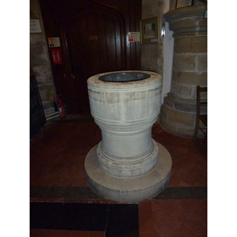
Image copyright © Basher Eyre, 2012
CC-BY-SA-3.0
Results: 4 records
view of font
Scene Description: the modern font
Copyright Statement: Image copyright © Basher Eyre, 2012
Image Source: digital photograph taken 24 March 2012 by Basher Eyre [www.geograph.org.uk/photo/2889843] [accessed 6 November 2012]
Copyright Instructions: CC-BY-SA-3.0
view of church exterior - south view
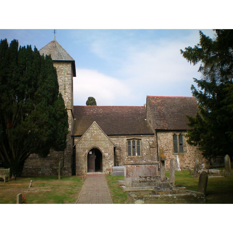
Copyright Statement: Image copyright © Charlesdrakew, 2008
Image Source: digital photograph taken 18 September 2009 by Charlesdrakew [http://en.wikipedia.org/wiki/File:Wivelsfield_Church_2.JPG] [accessed 6 November 2012]
Copyright Instructions: CC-BY-SA-3.0
view of church interior - southwest side
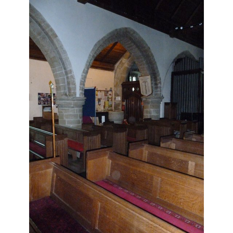
Scene Description: the modern font in context
Copyright Statement: Image copyright © Basher Eyre, 2012
Image Source: digital photograph taken 24 March 2012 by Basher Eyre [www.geograph.org.uk/photo/2889833] [accessed 6 November 2012]
Copyright Instructions: CC-BY-SA-3.0
view of church exterior - south porch - detail

Scene Description: a Sheela-na-gig
Copyright Statement: Image copyright © William Bolitho, 2009
Image Source: digital photograph in [http://williambolitho.blogspot.ca/2009/07/found-sheela-na-gig-in-wivelsfield.html] [accessed 6 November 2012]
Copyright Instructions: PERMISSION NOT AVAILABLE -- IMAGE NOT FOR PUBLIC USE
INFORMATION
Font ID: 12038WIV
Object Type: Stoup
Font Century and Period/Style: 11th century (late?), Norman
Church / Chapel Name: Parish Church of St. Peter and St. John the Baptist
Font Location in Church: Inside the church, by the S doorway
Church Patron Saint(s): St. Peter & St. John the Baptist
Church Notes: a Sheela-na-gig is reported in the porch of this church
Church Address: 3 Church Lane, Wivelsfield, Wivelsfield, West Sussex, RH17 7RD, UK
Site Location: East Sussex, South East, England, United Kingdom
Directions to Site: Located on the B2112, 15 km N pf Brighton and Hove
Ecclesiastic Region: Diocese of Chichester
Historical Region: Hundred of Streat -- Rape of Lewes -- Sussex
Additional Comments: disappeared font: the original font
Font Notes:
Click to view
Hussey (1852) writes: "The old stoup is visible, but damaged, near the south door." There is no mention of a font in Harrison (1920) but he does note a "mutilated stoup in porch". The Victoria County History (Sussex, vol. 7, 1940) notes: "The church of Wivelsfield was given to the priory of St. Pancras at Lewes by the second William de Warenne about 1095. [...] Of the original late-11th-century church, only the north door from the nave remains, built into the modern north aisle." There is no font mentioned in the VCH entry for this church, but a holy-water stoup is reported by the south doorway, "a contemporary stoup with four-centred arch, the bowl has a mutilated outer edge" [ca. 1500]. The church plan displayed in the CRSBI (2008) [originally from Church Plans Online (NOF Digitise Architecture England Consortium], shows the font in the west end of the south aisle, just west of the south entrance and east of the tower. This is a modern, 19th-century, font. [NB: we have no information on the original baptismal font of this 12th-century church]
COORDINATES
UTM: 30U 703901 5650525
Latitude & Longitude (Decimal): 50.970185, -0.095769
Latitude & Longitude (DMS): 50° 58′ 12.67″ N, 0° 5′ 44.77″ W
MEDIUM AND MEASUREMENTS
Material: stone
REFERENCES
- Victoria County History [online], University of London, 1993-. URL: https://www.british-history.ac.uk.
- Corpus of Romanesque Sculpture in Britain and Ireland, The Corpus of Romanesque Sculpture in Britain and Ireland, The Corpus of Romanesque Sculpture in Britain and Ireland. URL: http://www.crsbi.ac.uk.
- Harrison, Frederick, Notes on Sussex churches, Hove: Combridges, 1920, p. 218-219
- Hussey, Arthur, Notes on the churches in the counties of Kent, Sussex, and Surrey mentioned in Domesday Book and those of more recent date [...], London: John Russell Smith, 1852, p. 307