East Wittering / Westringes
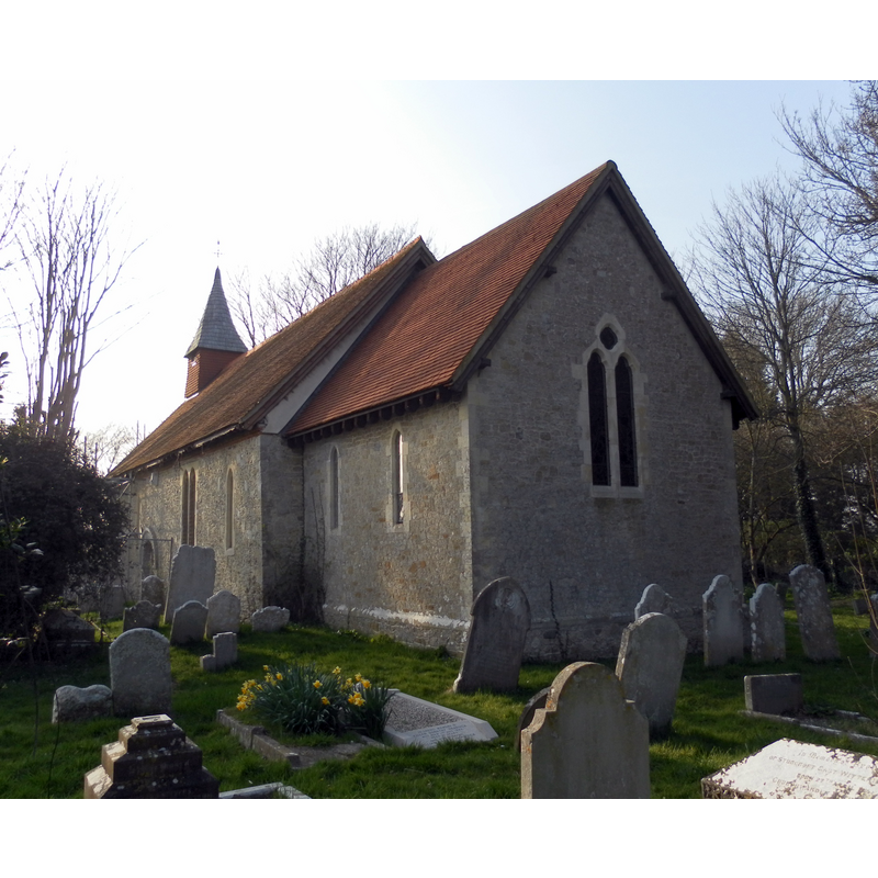
Image copyright © The Voice of Hassocks, 2012
CC-BY-SA-3.0
Results: 1 records
view of church exterior - southeast view
Copyright Statement: Image copyright © The Voice of Hassocks, 2012
Image Source: digital photograph taken 24 March 2012 by The Voice of Hassocks [http://en.wikipedia.org/wiki/File:Former_Church_of_the_Assumption_of_St_Mary_the_Virgin,_East_Wittering.JPG] [accessed 20 September 2012]
Copyright Instructions: CC-BY-SA-3.0
INFORMATION
Font ID: 12037WIT
Object Type: Baptismal Font1
Font Century and Period/Style: 12th century [re-cut] / 19th century, Medieval / Victorian [cf. FontNotes]
Church / Chapel Name: Parish Church of the Assumption of the Blessed Virgin Mary [redundant]
Font Location in Church: [cf. FontNotes]
Church Patron Saint(s): The Assumption of St. Mary
Church Notes: church now redundant; Anglican services now at St. Anne's, near the village centre
Church Address: Church Farm Lane, East Wittering, West Sussex PO20 8PU, UK
Site Location: West Sussex, South East, England, United Kingdom
Directions to Site: Located on the B1179, 12 km SSW of Chichester
Ecclesiastic Region: Diocese of Chichester
Historical Region: Hundred of Manhood [aka La Manwode/Manwood] [previously in the Hundred of Westringes?] -- Rape of Chichester -- Hundred of Somerley [in Domesday]
Additional Comments: altered font: is the present font the original, totally re-cut in the 19th century?
Font Notes:
Click to view
There is an entry for [East] Wittering [variant spelling] in the Domesday survey [https://opendomesday.org/place/SZ7997/east-wittering/] [accessed 13 September 2019] but it mentions neither cleric nor church in it]. Lewis' Dictionary of 1848 reports a Norman font in this church. There is no mention of a font in this church in the entries in Hussey (1852) or in Harrison (1920). The Victoria County History (Sussex, vol. 4, 1953) notes: "The church of the Assumption of the Blessed Virgin Mary [...] consists of a modern chancel and a nave of the 12th century." The VCH (ibid.) shows a 1937 plan of this church with the font located in the west side of the nave, but the text describes it as a modern font. The British Listed Buildings database [www.britishlistedbuildings.co.uk/en-300850-church-of-the-assumption-of-st-mary-the-] [accessed 20 September 2012] notes: "Font probably old but wholly recut in C19." [NB: we have no other recent information on the earlier font]. [NB: the font at St. Anne's is, according to the parish web site [http://stanneschurcheastwittering.btck.co.uk/Links] [accessed 20 September 2012], "believed to come from St Anne's church, Eastbourne"].
COORDINATES
UTM: 30U 649928 5626339
MEDIUM AND MEASUREMENTS
Material: stone
REFERENCES
- Victoria County History [online], University of London, 1993-. URL: https://www.british-history.ac.uk.
- Harrison, Frederick, Notes on Sussex churches, Hove: Combridges, 1920, p. 217
- Lewis, Samuel, A Topographical Dictionary of England, Comprising the Several Counties, Cities, Boroughs, Corporate and Market Towns, Parishes, Chapelries, and Townships, and the Islands of Guernsy, Jersey, and Man, with Historical and Statistical Descriptions [...], London: S. Lewis, 1831, [www.british-history.ac.uk/report.asp?compid=51420] [accessed 21 March 2007]