Plumpton nr. Lewes / Plompton / Plumtona / Pluntune
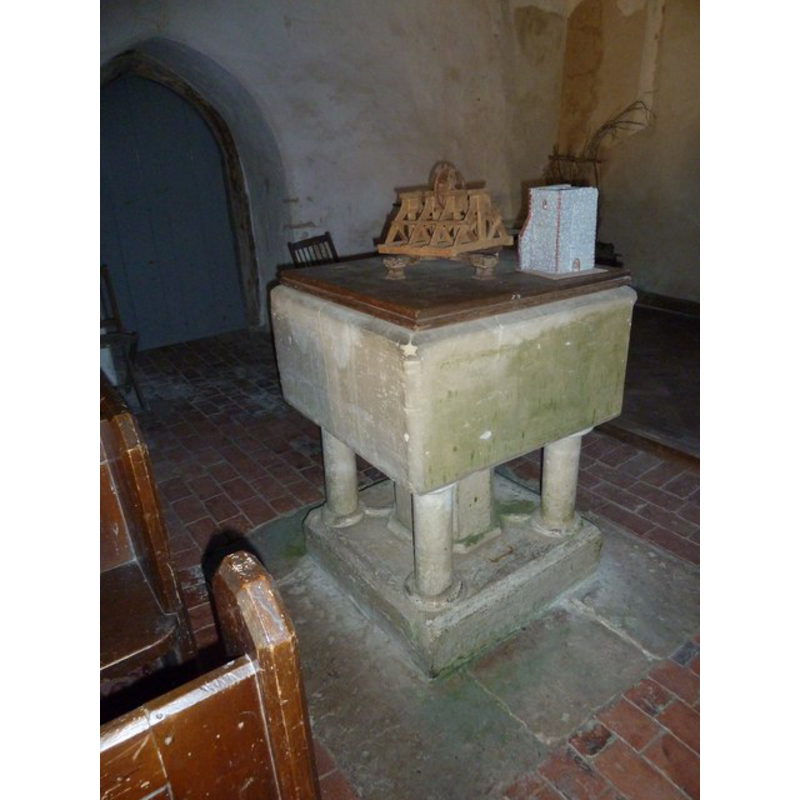
Image copyright © Basher Eyre, 2011
CC-BY-SA-3.0
Results: 3 records
view of font and cover in context
Scene Description: at the west end
Copyright Statement: Image copyright © Basher Eyre, 2011
Image Source: digital photograph taken 17 November 2011 by Basher Eyre [www.geograph.org.uk/photo/2706920] [accessed 5 November 2012]
Copyright Instructions: CC-BY-SA-3.0
view of church exterior - southwest view
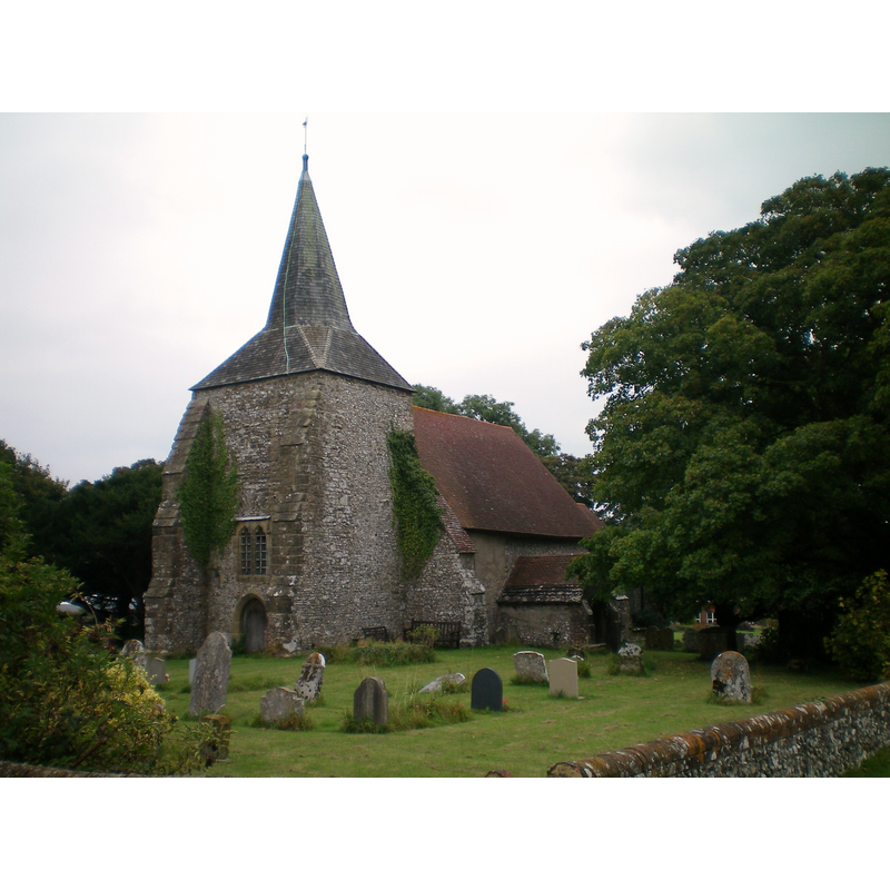
Copyright Statement: Image copyright © [in the public domain]
Image Source: digital photograph taken 20 September 2009 by Charlesdrakew [http://en.wikipedia.org/wiki/File:Plumpton_Church.JPG] [accessed 5 November 2012]
Copyright Instructions: Released by its author into the public domain
design element - motifs - moulding
Scene Description: forminf the capitals and bases of the outer colonnettes of the base [cf. FontNotes]
Copyright Statement: Image copyright © Basher Eyre, 2011
Image Source: digital photograph taken 17 November 2011 by Basher Eyre [www.geograph.org.uk/photo/2706920] [accessed 5 November 2012]
Copyright Instructions: CC-BY-SA-3.0
INFORMATION
Font ID: 12027PLU
Object Type: Baptismal Font1
Font Century and Period/Style: 12th - 13th century [base only] [composite font], Medieval / composite
Church / Chapel Name: Parish Church of St. Michael and All Angels
Font Location in Church: Inside the church, at the W end
Church Patron Saint(s): St. Michael & All Angels [cf. Font Notes]
Church Address: Plumpton, East Sussex BN7 3AF, UK
Site Location: East Sussex, South East, England, United Kingdom
Directions to Site: Located 8 km NW of Lewes
Ecclesiastic Region: Diocese of Chichester
Historical Region: Hundred of Streat -- Rape of Lewes -- Sussex
Additional Comments: composite font (the present one with a late basin on a medieval base) -- disappeared font? (the one from the 11thC church here)
Font Notes:
Click to view
Noted in Hussey (1852): the font is perhaps Tr[ansitional] Norm [an], square, on a large round stem, with small shafts at the angles." Reported in Harrison (1920) as late-Norman. The Victoria County History (Sussex, vol. 7, 1940) notes: "The church of Plumpton is mentioned in Domesday [...] of unknown dedication but associated by tradition with St. Michael. [...] The nave dates from the early 12th century. [...] The font has a square bowl, marked 1710, with a late-12th- or 13th-century base; it has a central octagonal pedestal and angle shafts with roll capitals and bases." [NB: the "marked 1710" appears to refer to a graffito on the basin, the basin itself may be older, but it does not appear to be medieval].
COORDINATES
UTM: 30U 705837 5643337
Latitude & Longitude (Decimal): 50.904941, -0.072302
Latitude & Longitude (DMS): 50° 54′ 17.79″ N, 0° 4′ 20.29″ W
MEDIUM AND MEASUREMENTS
Material: stone
Font Shape: square, mounted
Basin Interior Shape: round
Basin Exterior Shape: square
LID INFORMATION
Date: modern?
Material: wood
Apparatus: no
Notes: square, flat and plain; appears modern
REFERENCES
- Victoria County History [online], University of London, 1993-. URL: https://www.british-history.ac.uk.
- Harrison, Frederick, Notes on Sussex churches, Hove: Combridges, 1920, p. 163
- Hussey, Arthur, Notes on the churches in the counties of Kent, Sussex, and Surrey mentioned in Domesday Book and those of more recent date [...], London: John Russell Smith, 1852, p. 269