Whitchurch / Whitchurch-on-Thames / Witecerce
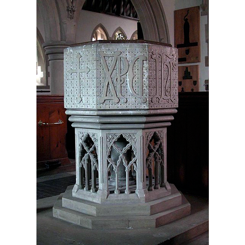
Image copyright © John Salmon, 2018
CC-BY-SA-2.0
Results: 6 records
view of font and cover
Scene Description: the modern font
Copyright Statement: Image copyright © John Salmon, 2018
Image Source: digital photograph taken 13 August 2000 by John Salmon [www.geograph.org.uk/photo/1606435] [accessed 27 August 2018]
Copyright Instructions: CC-BY-SA-2.0
view of font and cover in context
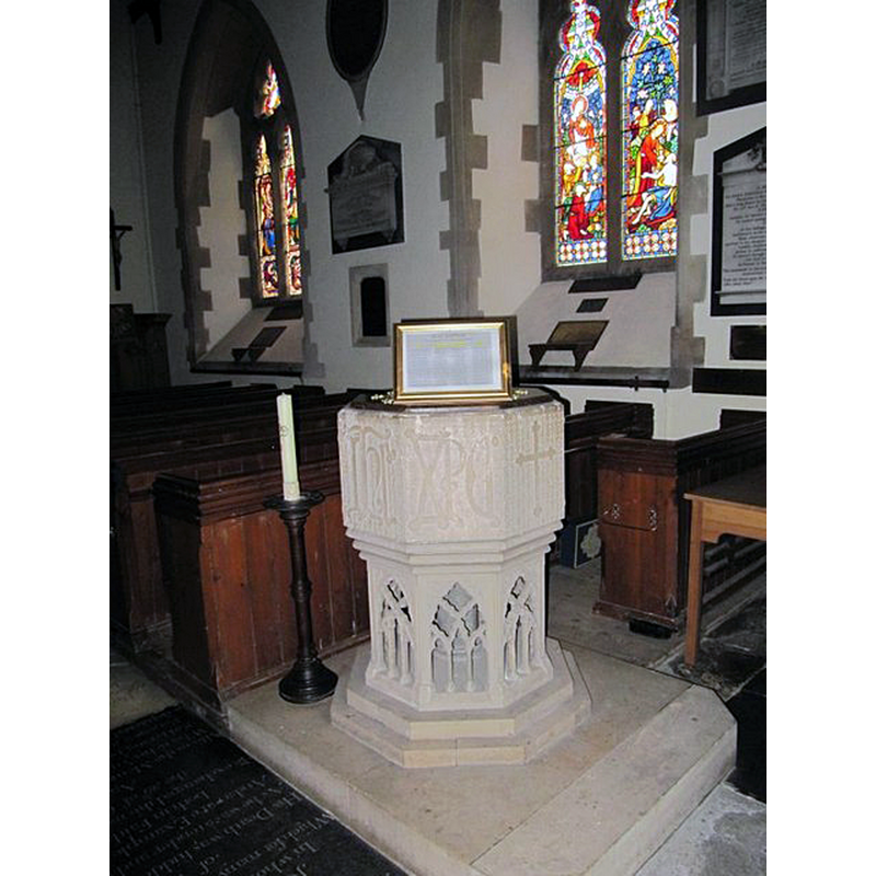
Scene Description: the modern font
Copyright Statement: Image copyright © Bill Nicholls, 2009
Image Source: digital photograph taken 30 August 2009 by Bill Nicholls [www.geograph.org.uk/photo/1490920] [accessed 27 August 2018]
Copyright Instructions: CC-BY-SA-2.0
view of church exterior - south porch and portal
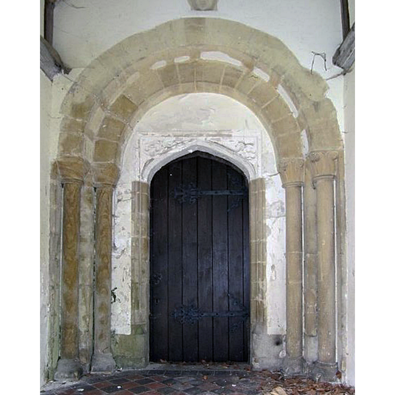
Copyright Statement: Image copyright © Bill Nicholls, 2009
Image Source: digital photograph taken 30 August 2009 by Bill Nicholls [www.geograph.org.uk/photo/1490818] [accessed 27 August 2018]
Copyright Instructions: CC-BY-SA-2.0
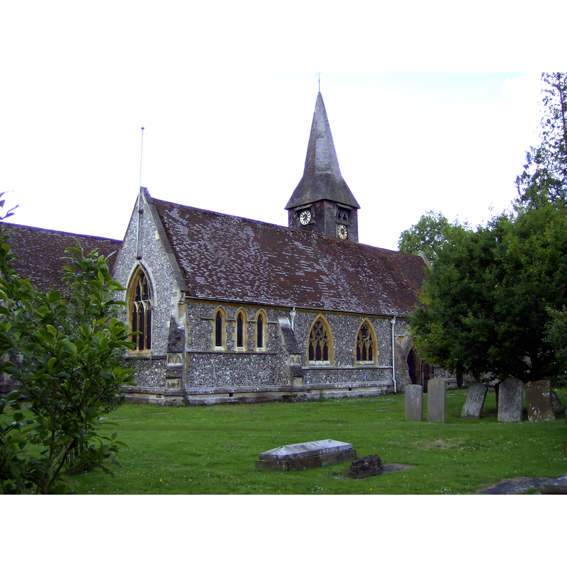
view of church exterior - southeast view
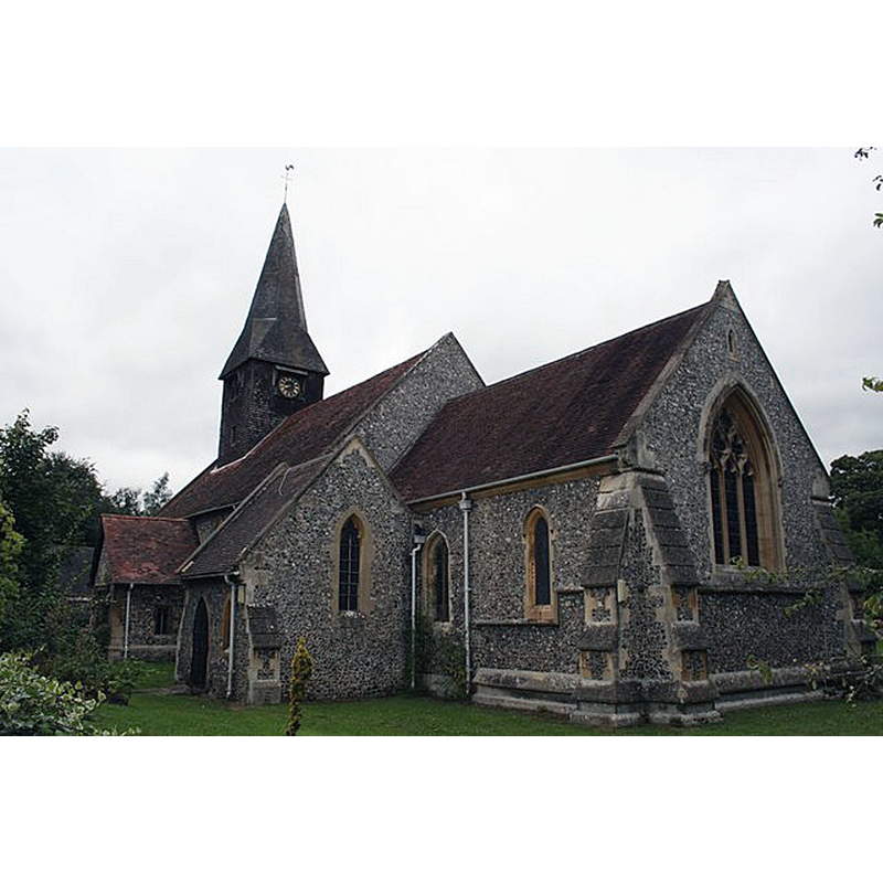
Copyright Statement: Image copyright © Bill Nicholls, 2009
Image Source: digital photograph taken 30 August 2009 by Bill Nicholls [www.geograph.org.uk/photo/1490860] [accessed 27 August 2018]
Copyright Instructions: CC-BY-SA-2.0
view of church exterior - northeast view
Copyright Statement: Image copyright © [in the public domain]
Image Source: digital photograph taken 7 July 2007 by Sealman [https://commons.wikimedia.org/wiki/File:WHITCHURCH_CHURCH.JPG] [accessed 27 August 2018]
Copyright Instructions: PD
view of church interior - nave - looking east
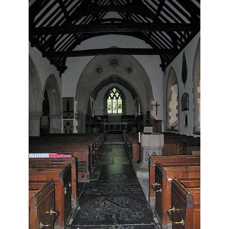
Scene Description: with the modern font by the south entranceway
Copyright Statement: Image copyright © Bill Nicholls, 2009
Image Source: digital photograph taken 30 August 2009 by Bill Nicholls [www.geograph.org.uk/photo/1491247] [accessed 27 August 2018]
Copyright Instructions: CC-BY-SA-2.0
INFORMATION
Font ID: 12023WHI
Object Type: Baptismal Font1
Font Century and Period/Style: 11th - 12th century, Norman
Church / Chapel Name: Parish Church of St. Mary the Virgin
Church Patron Saint(s): St. Mary the Virgin
Church Address: Off High Street, Whitchurch on Thames, Oxfordshire, RG8 7DG, United Kingdom -- Tel.: +44 1491 680252
Site Location: Oxfordshire, South East, England, United Kingdom
Directions to Site: Located A329-B471 crossroads, 8 km WNW of Reading
Ecclesiastic Region: Diocese of Oxford
Historical Region: Hundred of Langtree
Additional Comments: disappeared font(s)? [cf. FontNotes]
Font Notes:
Click to view
There is an entry for this Whitchurch [variant spelling] in the Domesday survey [https://opendomesday.org/place/SU6377/whitchurch/] [accessed 27 August 2018] but it mentions neither cleric nor church in it. The Ecclesiastical and Architectural Topography of England: Oxfordshire (1850) notes: "The font is modern" [NB: this source mentions the Norman origin -and some remains- of this church, but we have no information on the original font]. The present baptismal font is probably of the Victorian period and consists of an octagonal basin with trefoiled crosses and initials decorating the side panels; graded underbowl chamfer; octagonal pedestal base with openwork tracery windows; moulded lower base. Octagonal wooden cover, flat and modern. Sherwood and Pevsner (1974) note a major re-building of the old church by H. Woodyer in 1858, which probably dates the present font. [NB: Sherwood and Pevsner (ibid.) note the use of a Norman doorway and a 15th-century porch from the earlier church in the Victorian re-building of St. Mary's; we have no information on the earlier font(s) of this church]
COORDINATES
UTM: 30U 632843 5705859
Latitude & Longitude (Decimal): 51.48826, -1.0866
Latitude & Longitude (DMS): 51° 29′ 17.74″ N, 1° 5′ 11.76″ W
INSCRIPTION
Inscription Language: initials
Inscription Location: on some of the sides of the basin
Inscription Text: "XPS"
Inscription Notes: on one of the sides
Inscription Source: [cf. Image area]
LID INFORMATION
Date: 19th century?
Material: wood
Apparatus: no
Notes: [cf. FontNotes]
REFERENCES
- Parker, John Henry, The Ecclesiastical and architectural topography of England: Oxfordshire, Oxford, London: Published under the sanction of the Central Commitee of the Archaeological Institute of Great Britain and Ireland [by] John Henry Parker, 1850, [unpaged -- entry 175] / [http://books.google.ca/books?id=maikb1i3wSUC&pg=PT144&lpg=PT144&dq=longcot+church+font&source=web&ots=p3k5tJJE6J&sig=KYjkm8H5wOoAuH7BvnLp7JqMPus&hl=en&sa=X&oi=book_result&resnum=6&ct=result#PPA17,M1] [accessed 31 December 2008]
- Pevsner, Nikolaus, Oxfordshire, Harmondsworth: Penguin Books, 1974, p. 838-839