Yelford / Aieleforde / Celford
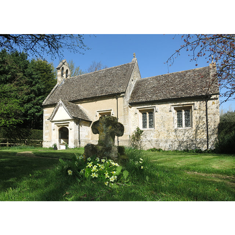
Image copyright © Des Blenkinsopp, 2015
CC-BY-SA-2.0
Results: 4 records
view of church exterior - south view
Copyright Statement: Image copyright © Des Blenkinsopp, 2015
Image Source: digital photograph taken 15 April 2015 by Des Blenkinsopp [www.geograph.org.uk/photo/4464745] [accessed 11 December 2017]
Copyright Instructions: CC-BY-SA-2.0
view of church interior - chancel - rood-screen, choir-screen; iconostasis
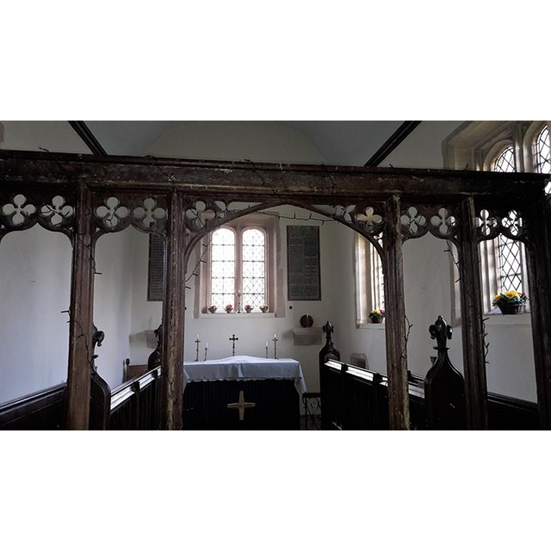
Copyright Statement: Image copyright © Chris Brown, 2017
Image Source: digital photograph taken 24 February 2017 by Chris Brown [www.geograph.org.uk/photo/5451156] [accessed 11 December 2017]
Copyright Instructions: CC-BY-SA-2.0
view of church interior - nave - looking west
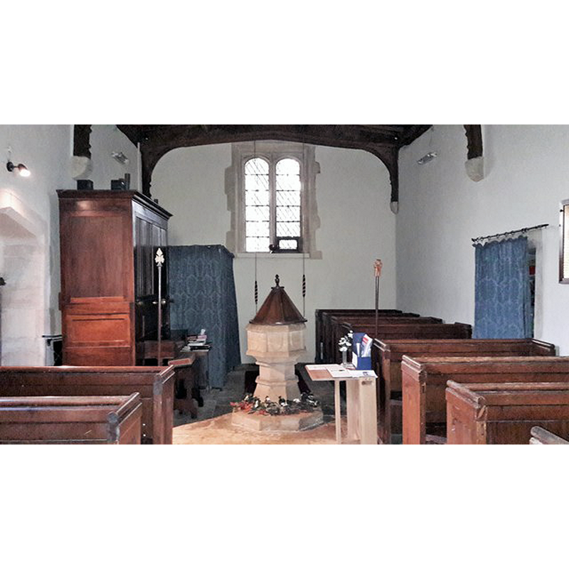
Scene Description: with the font and cover in view
Copyright Statement: Image copyright © Chris Brown, 2017
Image Source: digital photograph taken 24 February 2017 by Chris Brown [www.geograph.org.uk/photo/5451153] [accessed 11 December 2017]
Copyright Instructions: CC-BY-SA-2.0
view of font and cover in context
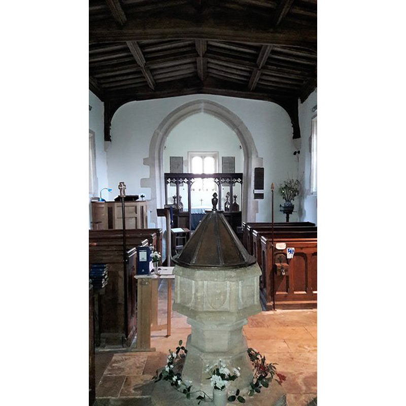
Copyright Statement: Image copyright © Chris Brown, 2017
Image Source: digital photograph taken 24 February 2017 by Chris Brown [www.geograph.org.uk/photo/5451135] [accessed 11 December 2017]
Copyright Instructions: CC-BY-SA-2.0
INFORMATION
Font ID: 12021YEL
Object Type: Baptismal Font1
Font Date: ca. 1500?
Font Century and Period/Style: 15th - 16th century, Perpendicular
Workshop/Group/Artisan: heraldic font
Church / Chapel Name: Parish Church of St. Nicholas and St. Swithun
Font Location in Church: Inside the church, in the W end of the nave
Church Patron Saint(s): St. Nicholas of Myra & St. Swithun [aka Swithin]
Church Address: Yelford, Witney OX29 7QX, UK
Site Location: Oxfordshire, South East, England, United Kingdom
Directions to Site: Located off the A415-B4449 crossroads, just S of Ducklington, 5 km S of Witney, 20 km W of Oxford
Ecclesiastic Region: Diocese of Oxford
Historical Region: Hundred of Bampton
Additional Comments: damaged font (the present font: the basin appears cracked through but repaired) -- disappeared font? (the one from the 13thC church here)
Font Notes:
Click to view
There is an entry for Yelford [variant spelling] in the Domesday survey [http://opendomesday.org/place/SP3604/yelford/] [accessed 11 December 2017], but it mentions neither priest nor church in it. The Ecclesiastical and Architectural Topography of England: Oxfordshire (1850) notes: "the font cup-shaped, panelled". Noted in Sherwood and Pevsner (1974): "Font. Octagonal, c.1500, with plain shields on each face." The entry for this parish in the Victoria County History (Oxford, vol. 13, 1996) notes: "Masonry of the 12th century or earlier re-used in the church porch may be from the chapel in existence at Yelford by 1221. [...] In the later 13th century Yelford's incumbents were called rectors [...] and the living remained a rectory until 1976 [...] The windows, font, piscina, south door, and carved wooden screen are all of c. 1500". The font consists of an octagonal basin the sides of which are decorated with large blank shields in the panels formed by the upper and lower mouldings and yhose at the angles; octagonal stem with mouldings at each end; and splaying lower base, also octagonal; the plinth ia octagonal as well; the basin is damaged with diagonal crack that appears to go through the whole volume; it has been repaired.
COORDINATES
UTM: 30U 604834 5733132
Latitude & Longitude (Decimal): 51.73928, -1.4817
Latitude & Longitude (DMS): 51° 44′ 21.41″ N, 1° 28′ 54.12″ W
MEDIUM AND MEASUREMENTS
Material: stone
Font Shape: octagonal, mounted
Basin Interior Shape: round
Basin Exterior Shape: octagonal
LID INFORMATION
Material: wood, oak?
Apparatus: no
Notes: octagonal pyramid with turned finial; on a round flat base
REFERENCES
- Victoria County History [online], University of London, 1993-. URL: https://www.british-history.ac.uk.
- Parker, John Henry, The Ecclesiastical and architectural topography of England: Oxfordshire, Oxford, London: Published under the sanction of the Central Commitee of the Archaeological Institute of Great Britain and Ireland [by] John Henry Parker, 1850, [unpaged -- entry 205] / [http://books.google.ca/books?id=maikb1i3wSUC&pg=PT144&lpg=PT144&dq=longcot+church+font&source=web&ots=p3k5tJJE6J&sig=KYjkm8H5wOoAuH7BvnLp7JqMPus&hl=en&sa=X&oi=book_result&resnum=6&ct=result#PPA17,M1] [accessed 31 December 2008]
- Pevsner, Nikolaus, Oxfordshire, Harmondsworth: Penguin Books, 1974, p. 869