Widford nr. Burford / Widiforde
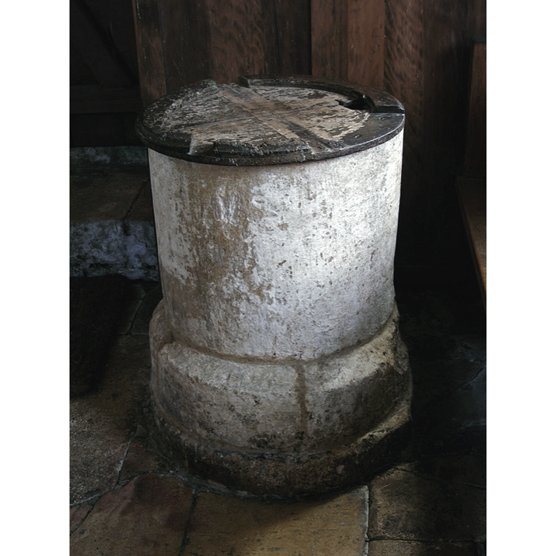
Image copyright © John Ward, 2007
Standing permission
Results: 7 records
view of font and cover
Copyright Statement: Image copyright © John Ward, 2007
Image Source: digital photograph taken 18 September 2007 by John Ward
Copyright Instructions: Standing permission
view of church exterior in context - southeast view
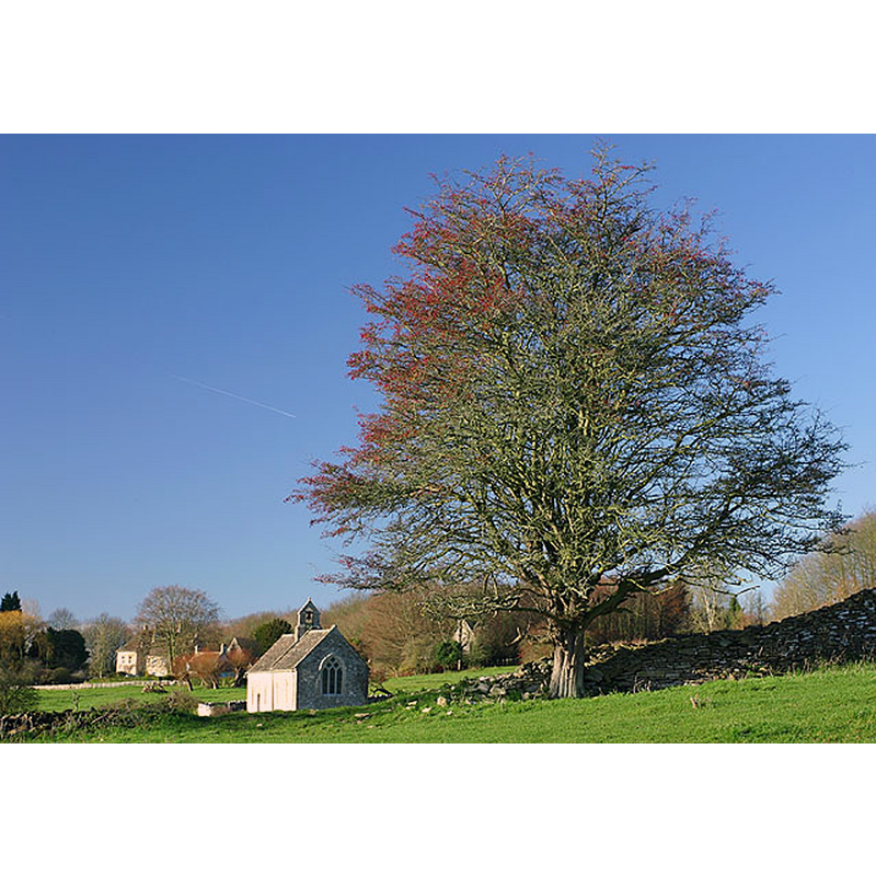
Scene Description: Source caption: "The isolated church of St. Oswald's at Widford, with the Manor House in the background."
Copyright Statement: Image copyright © Martin Loader, 2006
Image Source: digital photograph taken 9 December 2006 by Martin Loader [www.geograph.org.uk/photo/346874] [accessed 31 October 2016]
Copyright Instructions: CC-BY-SA-2.0
view of church exterior - southwest view
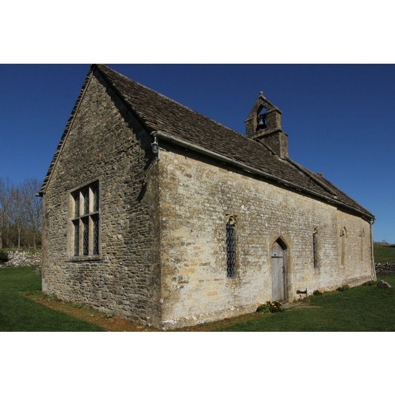
Scene Description: Source caption: "St.Oswald's church. Largely 13th century, grade II* listed church built on the site of a Roman villa, surrounded by the earthworks of the deserted Medieval village of Widford"
Copyright Statement: Image copyright © Richard Croft, 2014
Image Source: digital photograph taken 16 March 2014 by Richard Croft [www.geograph.org.uk/photo/3892341] [accessed 31 October 2016]
Copyright Instructions: CC-BY-SA-2.0
view of church interior - painting
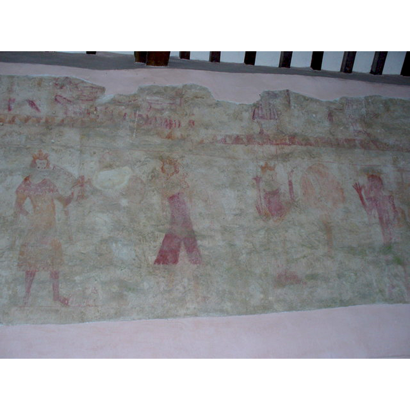
Scene Description: one of the faded mural paintings -- Source caption: "Inside St Oswald's Chapel, Widford. Medieval wall painting of three kings."
Copyright Statement: Image copyright © Colin Smith, 2006
Image Source: digital photograph taken 28 December 2006 by Colin Smith [www.geograph.org.uk/photo/300787] [accessed 31 October 2016]
Copyright Instructions: CC-BY-SA-2.0
view of church interior - nave - looking east
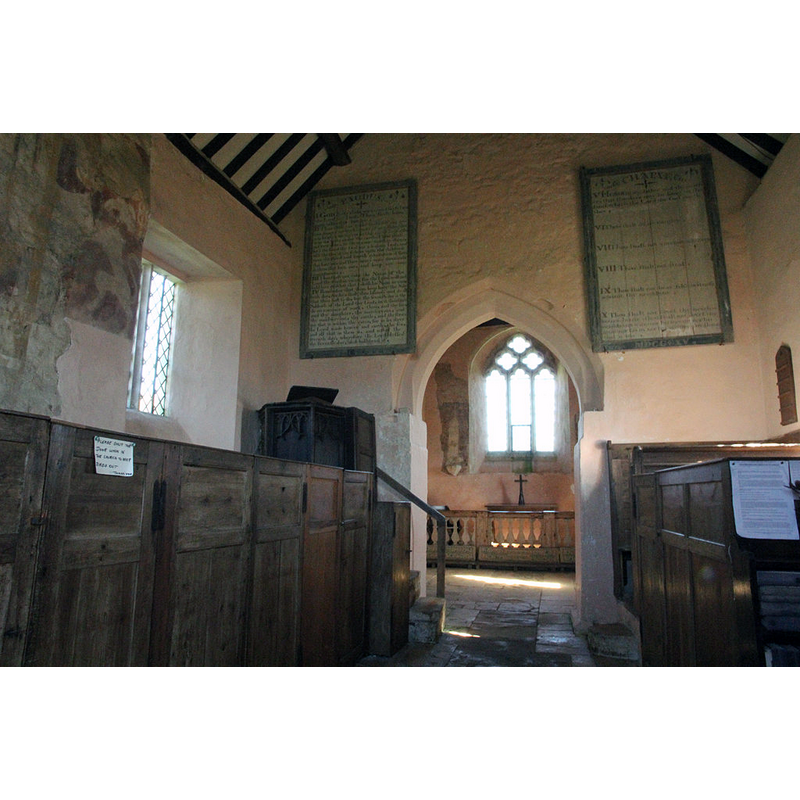
Scene Description: Source caption: "St.Oswald's nave. 13th century nave & chancel arch and 18th century box pews in St.Oswald's church."
Copyright Statement: Image copyright © Richard Croft, 2014
Image Source: digital photograph taken 16 March 2014 by Richard Croft [www.geograph.org.uk/photo/3892351] [accessed 31 October 2016]
Copyright Instructions: CC-BY-SA-2.0
view of church interior - chancel
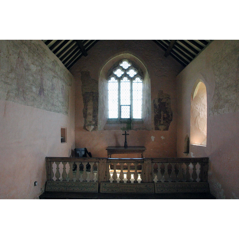
Scene Description: Source caption: "St.Oswald's chancel. 13th century chancel, 17th century communion rail and much-faded medieval wall paintings in St.Oswald's church."
Copyright Statement: Image copyright © Richard Croft, 2014
Image Source: digital photograph taken 16 March 2014 by Richard Croft [www.geograph.org.uk/photo/3892366] [accessed 31 October 2016]
Copyright Instructions: CC-BY-SA-2.0
view of church interior - nave - looking west
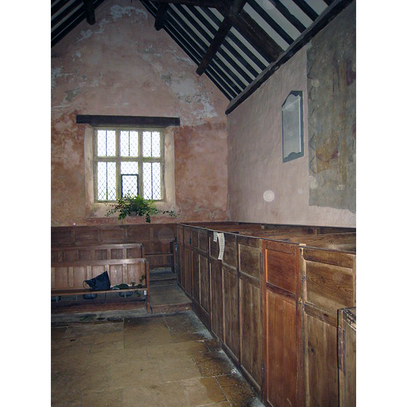
Copyright Statement: Image copyright © Rod Allday, 2008
Image Source: digital photograph taken 2 November 2008 by Rod Allday [www.geograph.org.uk/photo/1031824] [accessed 31 October 2016]
Copyright Instructions: CC-BY-SA-2.0
INFORMATION
Font ID: 12004WID
Object Type: Baptismal Font1
Font Century and Period/Style: 12th - 13th century, Medieval
Church / Chapel Name: Parish Church of St. Oswald
Font Location in Church: Inside the church, at the W end
Church Patron Saint(s): St. Oswald of Nothumbria
Church Address: Widford, Oxfordshire, OX18 4DX, United Kingdom
Site Location: Oxfordshire, South East, England, United Kingdom
Directions to Site: Located off the A40, 2 km ESE of Burford
Ecclesiastic Region: Diocese of Oxford
Historical Region: Hundred of Shipton
Font Notes:
Click to view
There is an entry for this Widford [variant spelling] in the Domesday survey [http://opendomesday.org/place/SP2711/widford/] [accessed 31 October 2016], but it mentions neither cleric nor church in it. The Ecclesiastical and Architectural Topography of England: Oxfordshire (1850) notes: "The north door and the font are N[orman]." Ditto in Murray (1882). In Sherwood & Pevsner (1974): "C13. Tub-shaped." Noted as a "plain rough font" from "an 11th century Saxon or Norman building in the Burford Parish web site [www.burfordparishchurch.co.uk/widford_index.htm]. Plain tub-shaped font, the round basin tapering slightly towards the circular wider base. Round wooden cover, flat; badly damaged, and with parts missing.
Credit and Acknowledgements: We are grateful to John Ward, of Oxfordshire Churches [http://homepage.mac.com/john.ward/oxfordshirechurches], for his photograph of this font
COORDINATES
UTM: 30U 596186 5740479
Latitude & Longitude (Decimal): 51.806875, -1.60487
Latitude & Longitude (DMS): 51° 48′ 24.75″ N, 1° 36′ 17.53″ W
MEDIUM AND MEASUREMENTS
Material: stone
Font Shape: tub-shaped
Basin Interior Shape: round
Basin Exterior Shape: round
LID INFORMATION
Date: unknown
Material: wood
Apparatus: no
Notes: [cf. FontNotes]
REFERENCES
- Murray, John [the firm], Handbook for travellers in Berks. Bucks and Oxfordshire, including a [...], London: John Murray, 1882, p. 287
- Parker, John Henry, The Ecclesiastical and architectural topography of England: Oxfordshire, Oxford, London: Published under the sanction of the Central Commitee of the Archaeological Institute of Great Britain and Ireland [by] John Henry Parker, 1850, [unpaged -- entry 203]
- Pevsner, Nikolaus, Oxfordshire, Harmondsworth: Penguin Books, 1974, p. 841