Stanstead Abbots / Stanstead Abbotts / Stanstede Abbatis / Stanstede Abbotts / Stanstede Abbot
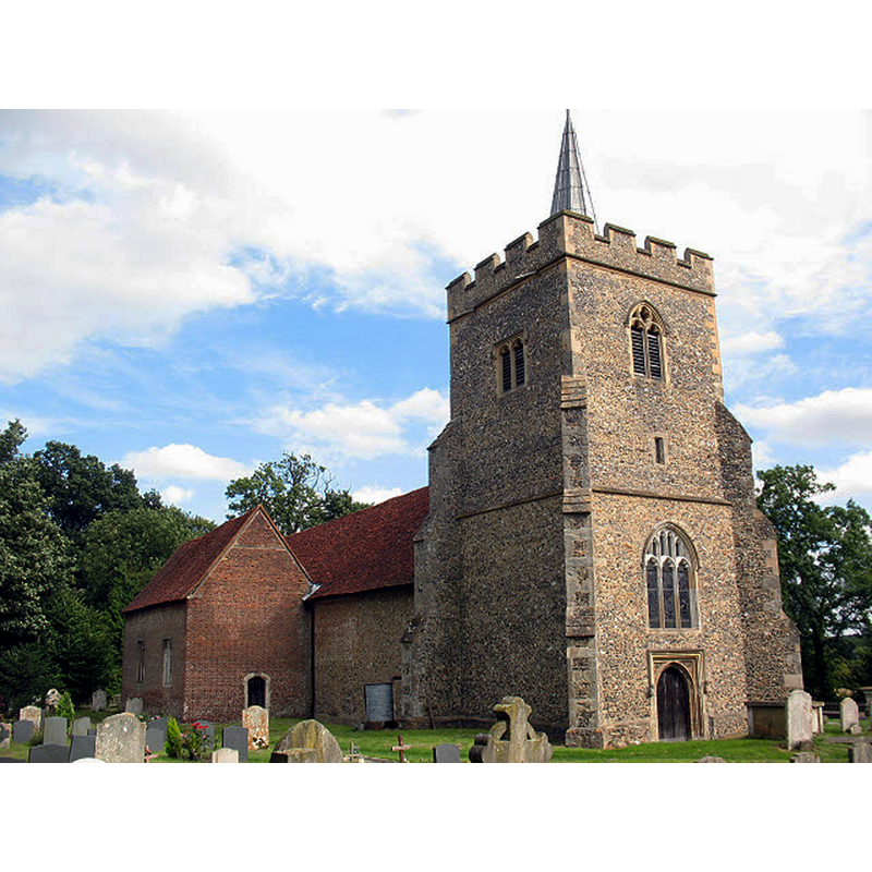
Image copyright © Stephen Craven, 2009
CC-BY-SA-2.0
Results: 3 records
view of church exterior - northwest view
Scene Description: Source caption: "St James, Stanstead Abbotts - north side. The church is now redundant, looked after by the Churches Conservation Trust [...] and only open to the public on Sunday afternoons in summer."
Copyright Statement: Image copyright © Stephen Craven, 2009
Image Source: digital photograph taken 15 August 2009 by Stephen Craven [www.geograph.org.uk/photo/3525100] [accessed 26 October 2016]
Copyright Instructions: CC-BY-SA-2.0
view of church exterior - southwest view
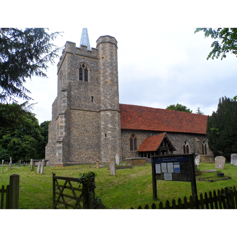
Copyright Statement: Image copyright © Bikeboy, 2013
Image Source: digital photograph taken 9 June 2013 by Bikeboy [www.geograph.org.uk/photo/3525100] [accessed 26 October 2016]
Copyright Instructions: CC-BY-SA-2.0
symbol - cross
![a small incised cross on the west side [cf. FontNotes]](/static-50478a99ec6f36a15d6234548c59f63da52304e5/others/image_not_available.jpg)
Scene Description: a small incised cross on the west side [cf. FontNotes]
![a small incised cross on the west side [cf. FontNotes]](/static-50478a99ec6f36a15d6234548c59f63da52304e5/bsi-testing-site/others/image_not_available.jpg)
INFORMATION
Font ID: 12000STA
Object Type: Baptismal Font1
Font Century and Period/Style: 13th century [basin only] -- 15th century [base only] [composite font], Medieval [composite]
Church / Chapel Name: Old Parish Church of St. James [now redundant]
Font Location in Church: Inside the church
Church Patron Saint(s): St. James
Church Address: B181, Stanstead Abbotts, Hertfordshire SG12 8EZ, UK
Site Location: Hertfordshire, East, England, United Kingdom
Directions to Site: Located off the B181, ESE of Hertford, 8 km NW of Harlow, by the county border with Essex
Ecclesiastic Region: Diocese of St. Albans
Historical Region: Hundred of Braughing [aka Brauging]
Additional Comments: composite font / recycled font [cf. FontNotes] -- disappeared font? (the one from the Domesday-time church here)
Font Notes:
Click to view
There are four entries for Stanstede [Abbots] [variant spelling] in the Domesday survey [http://opendomesday.org/place/TL3811/stanstead-abbots/] [accessed 26 October 2016], one of which mentions a priest but not a church in it, though there probably was one there. The Royal Commission on Historical Monuments, Hertfordshire (1911) report: "Font: circular basin, part of 13th-century base resversed, on 15th-century octagonal stem." The Victoria County Council (Hertford, vol. 3, 1912) notes: "The advowson of the church of St. James was given by Roger de Wancy [ca. 1178?] to the priory of Merton, co. Surrey. [...] The priory also held a carucate of land in right of the church, [...] which in 1291 was assessed at £20. [...] The earliest detail is of the 13th century, but it is probable that the nave walls are older. The chancel was built during that period and windows inserted in the nave. The west tower is of early 15th-century date [...] The basin of the font is of 13th-century date; it is circular, and on the rim are the original iron staples for securing the cover; on the south-west side is a small incised cross. The base appears to be of 13th-century date, reversed, but the octagonal stem belongs to the 15th century." The Church of St. Andrew, which now covers the needs of the parish, is of late-19th century date.
COORDINATES
UTM: 31U 294531 5741299
Latitude & Longitude (Decimal): 51.784777, 0.020982
Latitude & Longitude (DMS): 51° 47′ 5.2″ N, 0° 1′ 15.53″ E
MEDIUM AND MEASUREMENTS
Material: stone
Font Shape: round, mounted
Basin Interior Shape: round
Basin Exterior Shape: round
REFERENCES
- Victoria County History [online], University of London, 1993-. URL: https://www.british-history.ac.uk.
- Great Britain. Royal Commission on Historical Monuments (England), An Inventory of the Historical Monuments in Hertfordshire, London: Printed for His Majesty's Stationary Office by J. Truscott, 1911, p. 210