Salford nr. Chipping Norton
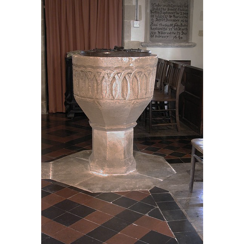
Image copyright © John Salmon, 2002
CC-BY-SA-2.0
Results: 7 records
view of font and cover
Copyright Statement: Image copyright © John Salmon, 2002
Image Source: digital photograph taken 6 September 2002 by John Salmon [www.geograph.org.uk/photo/1609090] [accessed 22 July 2014]
Copyright Instructions: CC-BY-SA-2.0
view of font and cover
Copyright Statement: Image copyright © John Salmon, 2002
Image Source: digital photograph taken 6 September 2002 by John Salmon [www.geograph.org.uk/photo/1609090] [accessed 22 July 2014]
Copyright Instructions: CC-BY-SA-2.0
design element - architectural - arcade - blind - round arches - intersecting arches
Copyright Statement: Image copyright © John Salmon, 2002
Image Source: digital photograph taken 6 September 2002 by John Salmon [www.geograph.org.uk/photo/1609090] [accessed 22 July 2014]
Copyright Instructions: CC-BY-SA-2.0
view of church exterior - south view
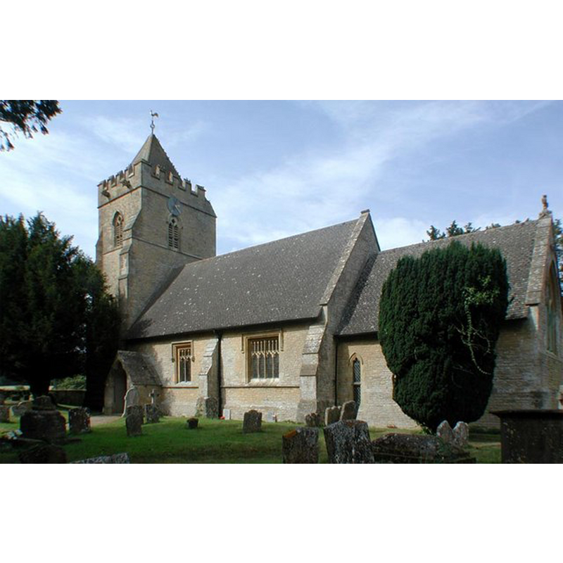
Copyright Statement: Image copyright © John Salmon, 2002
Image Source: digital photograph taken 6 September 2002 by John Salmon [www.geograph.org.uk/photo/1609087] [accessed 22 July 2014]
Copyright Instructions: CC-BY-SA-2.0
view of church exterior - north portal - tympanum
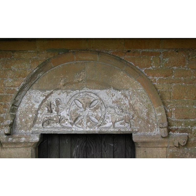
Copyright Statement: Image copyright © John Salmon, 2002
Image Source: digital photograph taken 6 September 2002 by John Salmon [www.geograph.org.uk/photo/1609101] [accessed 22 July 2014]
Copyright Instructions: CC-BY-SA-2.0
view of church exterior - north portal
![EXT N PORTAL digital photograph taken 6 September 2002 by John Salmon [www.geograph.org.uk/photo/1609102] [accessed 22 July 2014]
EXT N PORTAL TYMP digital photograph taken 6 September 2002 by John Salmon [www.geograph.org.uk/photo/1609101] [accessed 22 July 2014]
INT E digital photograph taken 6 September 2002 by John Salmon [www.geograph.org.uk/photo/1609092] [accessed 22 July 2014]
***REPLACE***? FONT digital photograph taken 6 September 2002 by John Salmon [www.geograph.org.uk/photo/1609090] [accessed 22 July 2014]](/static-50478a99ec6f36a15d6234548c59f63da52304e5/compressed/1140727040_compressed.png)
Scene Description: EXT N PORTAL digital photograph taken 6 September 2002 by John Salmon [www.geograph.org.uk/photo/1609102] [accessed 22 July 2014]
EXT N PORTAL TYMP digital photograph taken 6 September 2002 by John Salmon [www.geograph.org.uk/photo/1609101] [accessed 22 July 2014]
INT E digital photograph taken 6 September 2002 by John Salmon [www.geograph.org.uk/photo/1609092] [accessed 22 July 2014]
***REPLACE***? FONT digital photograph taken 6 September 2002 by John Salmon [www.geograph.org.uk/photo/1609090] [accessed 22 July 2014]
Copyright Statement: Image copyright © John Salmon, 2002
Image Source: digital photograph taken 6 September 2002 by John Salmon [www.geograph.org.uk/photo/1609102] [accessed 22 July 2014]
Copyright Instructions: CC-BY-SA-2.0
view of church interior - nave - looking east
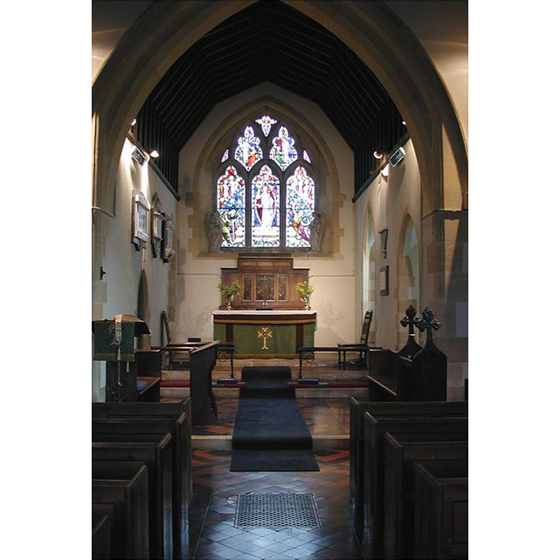
Copyright Statement: Image copyright © John Salmon, 2002
Image Source: digital photograph taken 6 September 2002 by John Salmon [www.geograph.org.uk/photo/1609092] [accessed 22 July 2014]
Copyright Instructions: CC-BY-SA-2.0
INFORMATION
Font ID: 11997SAL
Object Type: Baptismal Font1
Font Century and Period/Style: 12th century [basin only] [re-cut], Medieval [composite]
Church / Chapel Name: Parish Church of St. Mary
Font Location in Church: Inside the church
Church Patron Saint(s): St. Mary the Virgin
Church Address: 1 Chapel Lane, Salford, Oxfordshire OX7 5YL, UK
Site Location: Oxfordshire, South East, England, United Kingdom
Directions to Site: Located off the A44, 3 km WNW of Chipping Norton
Ecclesiastic Region: Diocese of Oxford
Historical Region: Hundred of Shipton
Additional Comments: altered font: round Norman basin altered to octagonal on the lower half MUST USE
Font Notes:
Click to view
There is an entry for this Salford in the Domesday survey [http://domesdaymap.co.uk/place/SP2828/salford/] [accessed 22 July 2014, but it mentions neither church nor cleric in it. A font here is noted in Sherwood and Pevsner (1974): "Font. Norman. A round bowl with an arcade of blind intersecting arches." The font at Salford St. Mary's has suffered the fate of the octagonal fad; the basin was originally cylindrical and probably tub-shaped, the upper half decorated with a simple arcade of intersecting round arches, typical of the Norman period; at some time in the past someone chiseled off part of the lower half and turned it into an ugly octagonal chamfer to match the shape of the stem on which it stands [NB: from the little that is left below the arcade there appears to have been a second level of decoration on the original basin sides]. Octagonal plinth. Flat round wooden cover; appears modern [NB: there appear to be two covers, both flat and round, but one is totally plain while the other has metal ornamentation and a ring handle -- cf. Images area].
COORDINATES
UTM: 30U 597227 5756396
Latitude & Longitude (Decimal): 51.949763, -1.585283
Latitude & Longitude (DMS): 51° 56′ 59.15″ N, 1° 35′ 7.02″ W
MEDIUM AND MEASUREMENTS
Material: stone
Font Shape: tub-shaped
Basin Interior Shape: round
Basin Exterior Shape: round
LID INFORMATION
Date: modern?
Material: wood
Apparatus: no
Notes: [cf. FontNotes]
REFERENCES
- Pevsner, Nikolaus, Oxfordshire, Harmondsworth: Penguin Books, 1974, p. 749