Reed / Estrede / Rede / Rete / Retth / Rode / Roed / Rud / Ruth
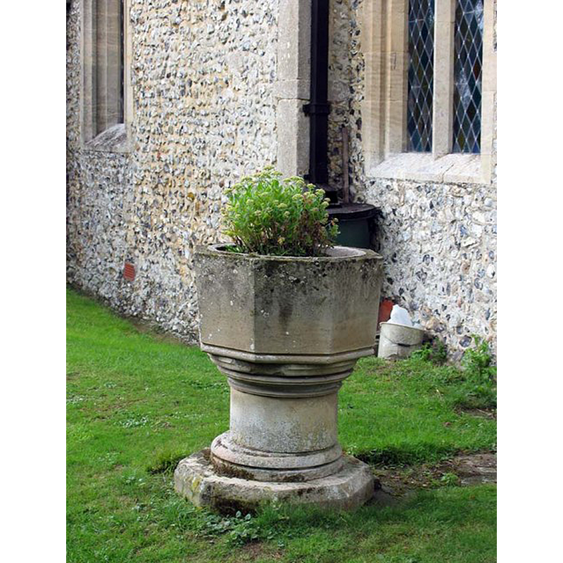
Image copyright © John Salmon, 2007
CC-BY-SA-2.0
Results: 7 records
view of font
Scene Description: redundant font located outside the church, south side; appears modern
Copyright Statement: Image copyright © John Salmon, 2007
Image Source: digital photograph taken 18 August 2006 by John Salmon [www.geograph.org.uk/photo/370490] [accessed 20 October 2016]
Copyright Instructions: CC-BY-SA-2.0
view of church exterior - northeast view
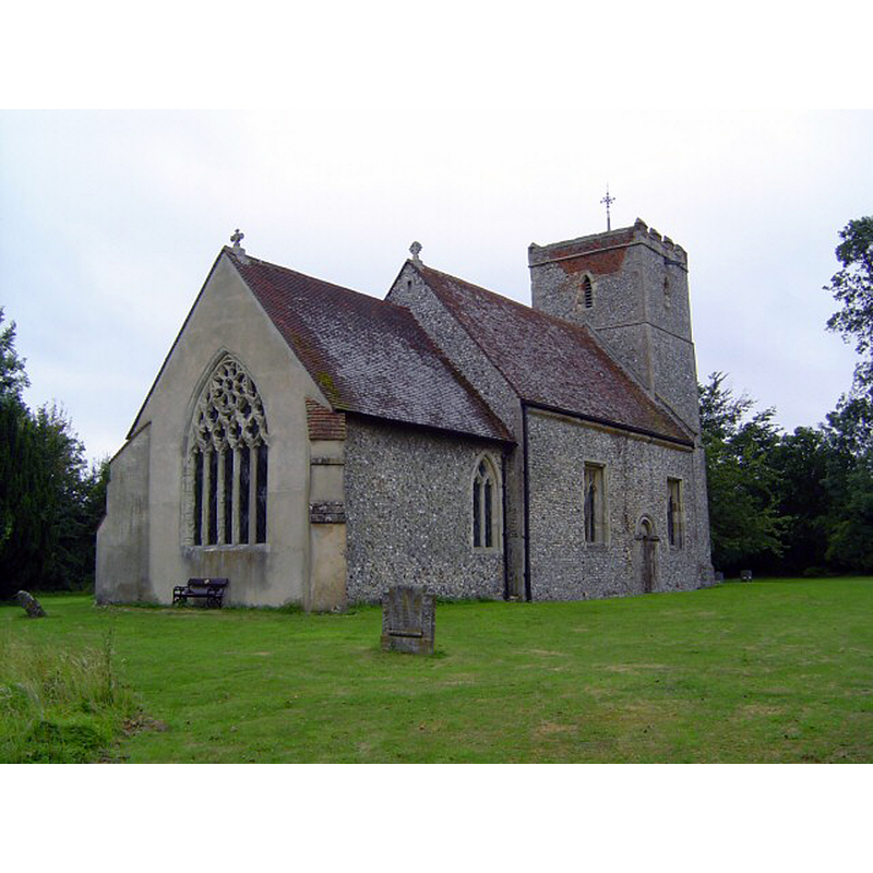
Copyright Statement: Image copyright © Mike Snoswell, 2004
Image Source: digital photograph taken 14 July 2004 by Mike Snoswell [www.geograph.org.uk/photo/198650] [accessed 20 October 2016]
Copyright Instructions: CC-BY-SA-2.0
view of church exterior - southeast view
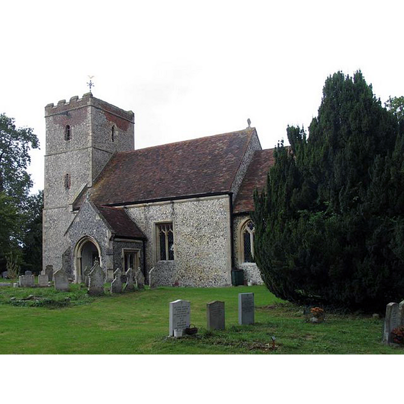
Scene Description: the redundant font is hidden behind the tree in this image
Copyright Statement: Image copyright © John Salmon, 2007
Image Source: digital photograph taken 18 August 2006 by John Salmon [www.geograph.org.uk/photo/370486] [accessed 20 October 2016]
Copyright Instructions: CC-BY-SA-2.0
view of stoup
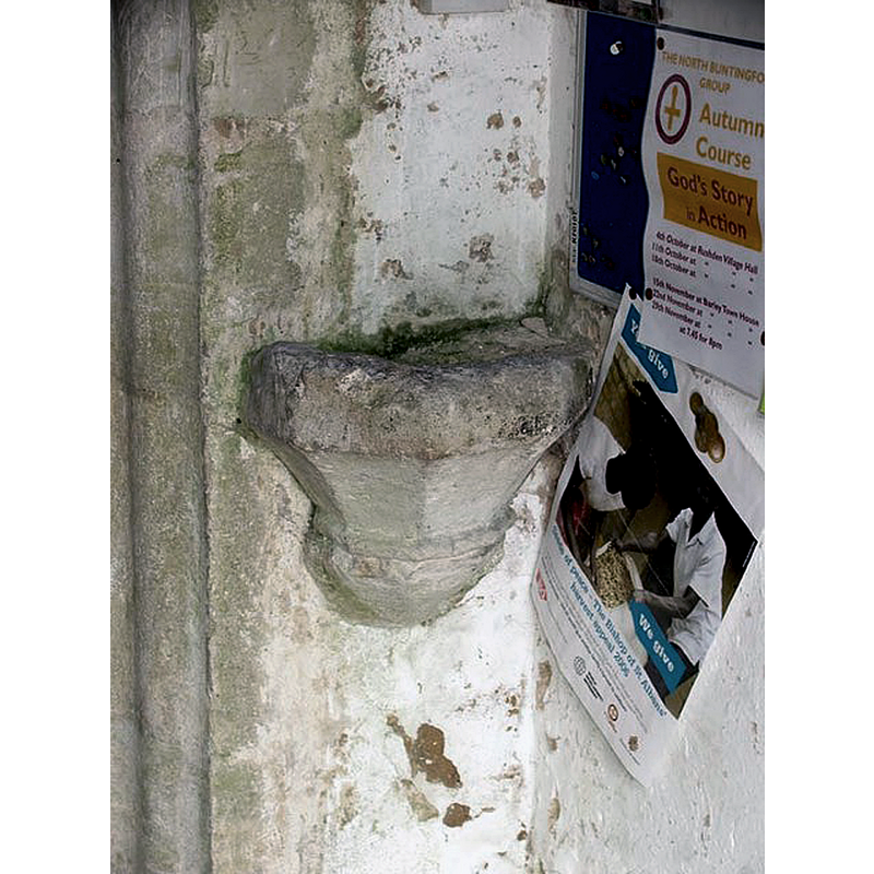
Scene Description: wall-mounted on the northeast pillar of the south porch
Copyright Statement: Image copyright © John Salmon, 2007
Image Source: digital photograph taken 18 August 2006 by John Salmon [www.geograph.org.uk/photo/370495] [accessed 20 October 2016]
Copyright Instructions: CC-BY-SA-2.0
symbol - shield
![[cf. Font notes]](/static-50478a99ec6f36a15d6234548c59f63da52304e5/others/image_not_available.jpg)
Scene Description: [cf. Font notes]
![[cf. Font notes]](/static-50478a99ec6f36a15d6234548c59f63da52304e5/bsi-testing-site/others/image_not_available.jpg)
design element - motifs - floral
Scene Description: [cf. Font notes]
symbol - shield - the instruments of the Passion
Scene Description: [cf. Font notes]
INFORMATION
Font ID: 11973REE
Object Type: Baptismal Font1, fragment?
Font Century and Period/Style: 15th century, Perpendicular
Workshop/Group/Artisan: heraldic font
Church / Chapel Name: Parish Church of St. Mary
Font Location in Church: [cf. FontNotes]
Church Patron Saint(s): St. Mary the Virgin
Church Address: Church Lane, Reed, Hertfordshire SG8 8AP, UK
Site Location: Hertfordshire, East, England, United Kingdom
Directions to Site: Located off (E) the A10, 5 km SSE of Royston
Ecclesiastic Region: Diocese of St. Albans
Historical Region: Hundred of Odsey
Additional Comments: damaged font / abandoned font: fragment (?) of the old font in a nearby farmyard / moved font (now in Barkway) -- disappeared font? (the one from the pre-Conquest church here)
Font Notes:
Click to view
There are six entries for this Reed [variant spelling] in the Domesday survey [http://opendomesday.org/place/TL3636/reed/] [accessed 20 October 2016]; one of these, in the lordship and tenancy of of Hardwin of Scales in 1086, mentions a priest but not a church in it, though there probably was one there; another part appears in 1066 as being in the lordship of "Leofing the priest, Edeva's man", which may suggest the existence of a pre-Conquest church there; the lordship of this part being in the hands of Hardwin of Scales in 1086. The Royal Commission on Historical Monuments, Hertfordshire (1911) reports: "Font: in the church, modern: in adjoining farmyard, remains of font from the church, decorated with shields and roses, 15th-century, defaced." The Victoria County History (Hertford, vol. 3, 1912) notes: "The nave appears to belong to a pre-Conquest period, probably about the middle of the 11th century; part of the chancel dates from about 1350; the west tower is early 15th-century work; the east wall of the chancel, the chancel arch and the south porch were rebuilt in the 19th century [...] The font is modern, but the remains of the 15th-century one formerly in the garden of Reed Hall, are now in Barkway Church; the bowl is octagonal, and underneath are carved flowers and shields and some emblems of the Passion; some fragments of tracery are also at Reed Hall." [NB: also reported in the RCHM (ibid.), a holy-water stoup in the northeast corner of the south porch -- no separate entry in this Index]
COORDINATES
UTM: 30U 704599 5765595
Latitude & Longitude (Decimal): 52.00325, -0.019163
Latitude & Longitude (DMS): 52° 0′ 11.7″ N, 0° 1′ 8.99″ W
MEDIUM AND MEASUREMENTS
Material: stone
Number of Pieces: fragment
Font Shape: octagonal, mounted
Basin Interior Shape: round
Basin Exterior Shape: octagonal
REFERENCES
- Victoria County History [online], University of London, 1993-. URL: https://www.british-history.ac.uk.
- Great Britain. Royal Commission on Historical Monuments (England), An Inventory of the Historical Monuments in Hertfordshire, London: Printed for His Majesty's Stationary Office by J. Truscott, 1911, p. 169-170