Letchworth
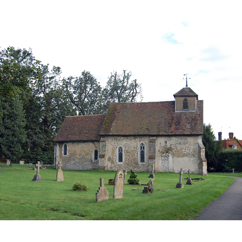
Image copyright © John Myers, 2012
CC-BY-SA-2.0
Results: 1 records
view of church exterior - north view
Scene Description: Source caption: "St. Mary the Virgin. The oldest of Letchworth's two parish churches, St. Mary is rather less impressive than the more modern St. Michael nearer the town centre."
Copyright Statement: Image copyright © John Myers, 2012
Image Source: digital photograph taken 31 August 2012 by John Myers [www.geograph.org.uk/photo/3109473] [accessed 12 October 2016]
Copyright Instructions: CC-BY-SA-2.0
INFORMATION
Font ID: 11969LET
Object Type: Baptismal Font1
Font Century and Period/Style: 14th century [basin only] [composite font], Medieval [composite]
Church / Chapel Name: Parish Church [St. Mary's?]
Font Location in Church: Inside the church
Church Notes: 12thC church; the dedication is unkown but it appears to be known locally as St. Mary's
Church Address: Letchworth Lane, Letchworth, Hertfordshire, SG6 3TX, UK
Site Location: Hertfordshire, East, England, United Kingdom
Directions to Site: Located off the A505, between Luton(SW) and Royston (NE)
Ecclesiastic Region: Diocese of St. Albans
Historical Region: Hundred of Broadwater
Additional Comments: altered font? (the present one has the basin only of the 14thC) -- disappeared font? (the one from the Domesday-time church here)
Font Notes:
Click to view
There is an entry for Letchworth [variable spelling] in the Domesday survey [http://opendomesday.org/place/TL2131/letchworth/] [accessed 12 October 2016]; it mentions a priest but not a church in it, though there probably was one there. The Royal Commission on Historical Monuments, Hertfordshire (1911) notes: "Font: bowl, possibly 14th-century." The Victoria County History (Hertsfordshire, vol. 3, 1912) notes: "There is mention of a priest at Letchworth in 1086. […] The church of Letchworth was granted, with all appurtenances and 12 acres of land in the parish, to the monastery of St. Albans by William de Montfitchet and Rohais his wife and William their son at the beginning of the 12th century […] The original church of the 12th century is represented by the nave, while the chancel of the 13th century appears to have been rebuilt […] The bowl of the font is probably of the 14th century".
COORDINATES
UTM: 30U 690099 5760174
Latitude & Longitude (Decimal): 51.959717, -0.233148
Latitude & Longitude (DMS): 51° 57′ 34.98″ N, 0° 13′ 59.33″ W
MEDIUM AND MEASUREMENTS
Material: stone
REFERENCES
- Victoria County History [online], University of London, 1993-. URL: https://www.british-history.ac.uk.
- Great Britain. Royal Commission on Historical Monuments (England), An Inventory of the Historical Monuments in Hertfordshire, London: Printed for His Majesty's Stationary Office by J. Truscott, 1911, p. 141