Knebworth / Chenepeworde / Cnebbeworth / Knebbesworth /Knebbeworth / Knecbworth / Knybbeworth
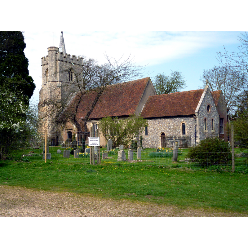
Image copyright © Dr Neil Clifton, 2015
CC-BY-SA-2.0
Results: 2 records
view of church exterior - southeast view
Copyright Statement: Image copyright © Dr Neil Clifton, 2015
Image Source: digital photograph taken 16 April 2015 by Dr Neil Clifton [www.geograph.org.uk/photo/4432986] [accessed 12 October 2016]
Copyright Instructions: CC-BY-SA-2.0
view of church interior - nave - looking east
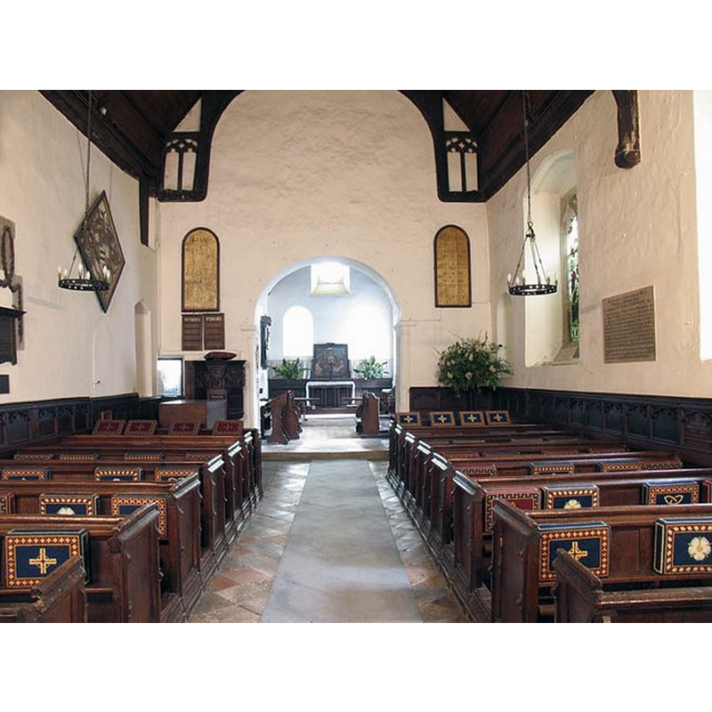
Copyright Statement: Image copyright © John Salmon, 2007
Image Source: digital photograph taken 12 May 2007 by John Salmon [www.geograph.org.uk/photo/433268] [accessed 12 October 2016]
Copyright Instructions: CC-BY-SA-2.0
INFORMATION
Font ID: 11967KNE
Object Type: Baptismal Font1
Font Date: ca. 1480?
Font Century and Period/Style: 15th century (late?), Perpendicular
Church / Chapel Name: Parish Church of St. Mary and St. Thomas of Canterbury
Font Location in Church: Inside the church, in the W end, beneath the tower
Church Patron Saint(s): St. Mary the Virgin & St. Thomas of Canterbury
Church Address: Knebworth, Hertfordshire SG3 6PY, UK
Site Location: Hertfordshire, East, England, United Kingdom
Directions to Site: Located off the A1(M), exit at Junction 7 and follow Knebwirth Park -- the church is located in the grounds of Knebworth House
Ecclesiastic Region: Diocese of St. Albans
Historical Region: Hundred of Broadwater
Additional Comments: disappeared font? (the one from the ca. 1150 original (?) church here)
Font Notes:
Click to view
There is an entry for Knebworth [variant spelling] in the Domesday survey [http://opendomesday.org/place/TL2320/knebworth/] [accessed 12 October 2016], but it mentions neither cleric nor church in it. The Royal Commission on Historical Monuments, Hertfordshire (1911) notes: "Font: octagonal, of limestone, plainly moulded, c. 1480." The Victoria County History (Hertsfordshire, vol. 3, 1912) notes: "The nave was built about the middle of the 12th century and the chancel is probably of the same date. […] The chancel, which is almost wholly modern, still has in the north wall a blocked window with an edge-roll moulding of about 1150 […] The font is octagonal, of limestone and plainly moulded. It dates from about 1480."
COORDINATES
UTM: 30U 691819 5750735
Latitude & Longitude (Decimal): 51.874356, -0.213397
Latitude & Longitude (DMS): 51° 52′ 27.68″ N, 0° 12′ 48.23″ W
MEDIUM AND MEASUREMENTS
Material: stone, limestone
Font Shape: octagonal, mounted
Basin Interior Shape: round
Basin Exterior Shape: octagonal
REFERENCES
- Victoria County History [online], University of London, 1993-. URL: https://www.british-history.ac.uk.
- Great Britain. Royal Commission on Historical Monuments (England), An Inventory of the Historical Monuments in Hertfordshire, London: Printed for His Majesty's Stationary Office by J. Truscott, 1911, p. 136