Barford St. Michael / Bereford / Great Barford
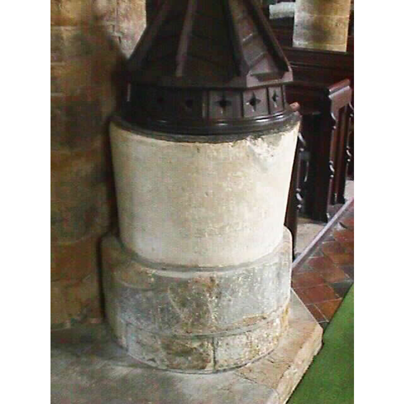
Image copyright © John Wilkes, 2006
Standing permission
Results: 6 records
view of font and cover
Copyright Statement: Image copyright © John Wilkes, 2006
Image Source: digital photograph taken by John Wilkes in June 2006 [www.allthecotswolds.com]
Copyright Instructions: Standing permission
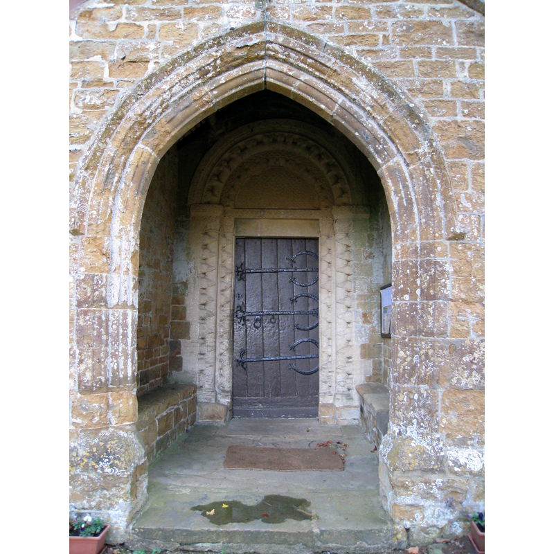
view of church exterior - south portal
Copyright Statement: Image copyright © Motacilla, 2012
Image Source: digital photograph taken 25 July 2012 by Motacilla [https://commons.wikimedia.org/wiki/File:Barford_StMichael_SouthDoor.jpg] [accessed 15 November 2017]
Copyright Instructions: CC-BY-SA-2.0
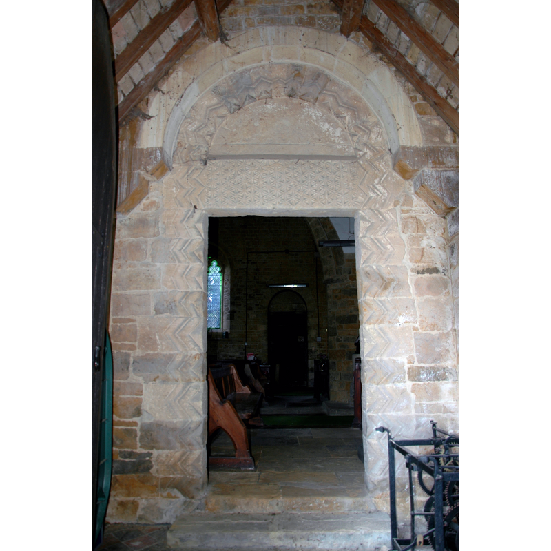
view of church exterior - north porch and portal
Scene Description: Source caption: "North door of church at Barford St. Michael, Oxfordshire. Gothic porch with Norman doorway.".
Copyright Statement: Image copyright © Redrose64, 2009
Image Source: digital photograoh taken 2 November 2009 by Redrose64 [https://commons.wikimedia.org/wiki/File:Barford_St_Michael_Church_North_Door.jpg] [accessed 15 November 2017]
Copyright Instructions: CC-BY-SA-3.0
view of church exterior - tympanum
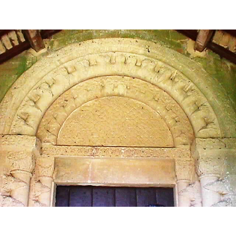
Copyright Statement: Image copyright © John Wilkes, 2006
Image Source: digital photograph taken by John Wilkes in June 2006 [www.allthecotswolds.com]
Copyright Instructions: Standing permission
view of church exterior - west tower
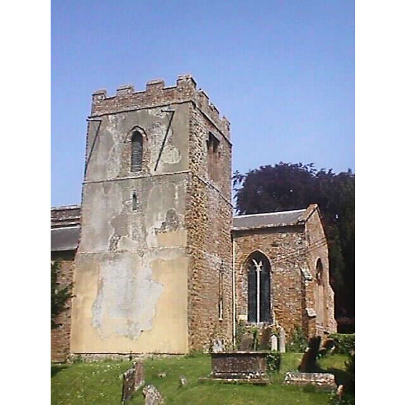
Copyright Statement: Image copyright © John Wilkes, 2006
Image Source: digital photograph taken by John Wilkes in June 2006 [www.allthecotswolds.com]
Copyright Instructions: Standing permission
view of font and cover in context

Copyright Statement: Image copyright © Ontaworld, 2007
Image Source: digital photograph in [http://www.ontaworld.co.uk/england/oxfordshire/barfordstmichael/church5.html]
Copyright Instructions: PERMISSION NOT AVAILABLE -- IMAGE NOT FOR PUBLIC USE
INFORMATION
Font ID: 11964BAR
Object Type: Baptismal Font1
Font Century and Period/Style: 12th century, Late Norman
Church / Chapel Name: Parish Church of St. Michael
Font Location in Church: Inside the church, W end of the nave, by the S aisle
Church Patron Saint(s): St. Michael
Church Address: Church Street, Barford, Oxfordshire, OX15 0RJ, UK
Site Location: Oxfordshire, South East, England, United Kingdom
Directions to Site: Located off the B4031, near Deddington, 3 km S of Bloxham, 8 km S of Banbury
Ecclesiastic Region: Diocese of Oxford
Historical Region: Hundred of Bloxham [in Domesday] -- Hundred of Wootton
Font Notes:
Click to view
There are two entries for Barford [St Michael] in the Domesday survey [http://opendomesday.org/place/SP4332/barford-st-michael/] [accessed 15 November 2017], neither of which mentions priest or church in it. Kelly's Oxford Directory of 1911 reports a Norman font here. Plain bucket-shaped basin mounted on a circular platform made up of several blocks; the upper side of the basin shows damage consistant with the forceful removal of the old cover staple; conical/pyramidal wooden cover, the lower volume polygonal with panels adorned with cross or star motifs, the cone/pyramid proper with protruding arrises. Kelly's Directory (ibid.) notes that part of the church is dated to the 12th century, the period to which the font probably belongs. Not mentioned in Sherwood & Pevsner (1974). The Victoria County History (Oxon., vol. 11, 1983) notes: "The church was probably given to Chacombe priory by Hugh of Chacombe between 1163 and 1176, although the charter recording the gift is somewhat later [...] In the 12th century the church seems to have comprised only a chancel and short nave, with the tower, perhaps because of the nature of the site, built in an unusual position on the south side of the chancel; the continuation of the tower's plinth moulding around the west side shows that there was no aisle. The church was distinguished by ornate north and south doorways of c. 1150 [...] The church contains a 12th-century tub font", and has footnote with reference to "Bodl. MS. Top. Oxon. a 65, no. 75", a drawing (?) in the Bodleian collections.
Credit and Acknowledgements: We are grateful to John Wilkes, of www.allthecotswolds.com, for the photograph of this font.
COORDINATES
UTM: 30U 611825 5761217
Latitude & Longitude (Decimal): 51.99035, -1.3714
Latitude & Longitude (DMS): 51° 59′ 25.26″ N, 1° 22′ 17.04″ W
MEDIUM AND MEASUREMENTS
Material: stone
Font Shape: bucket-shaped, mounted
Basin Interior Shape: round
Basin Exterior Shape: round
LID INFORMATION
Date: unknown
Material: wood
Apparatus: no
Notes: [cf. FontNotes]
REFERENCES
- Victoria County History [online], University of London, 1993-. URL: https://www.british-history.ac.uk.
- Kelly, Kelly's Directory of Oxfordshire, London: Kelly's Directories Ltd., 1911, p. 42 / [http://www.historicaldirectories.org/hd/d.asp] [accessed 30 June 2007]