Redbourn / Redborne / Redburna / Redburne
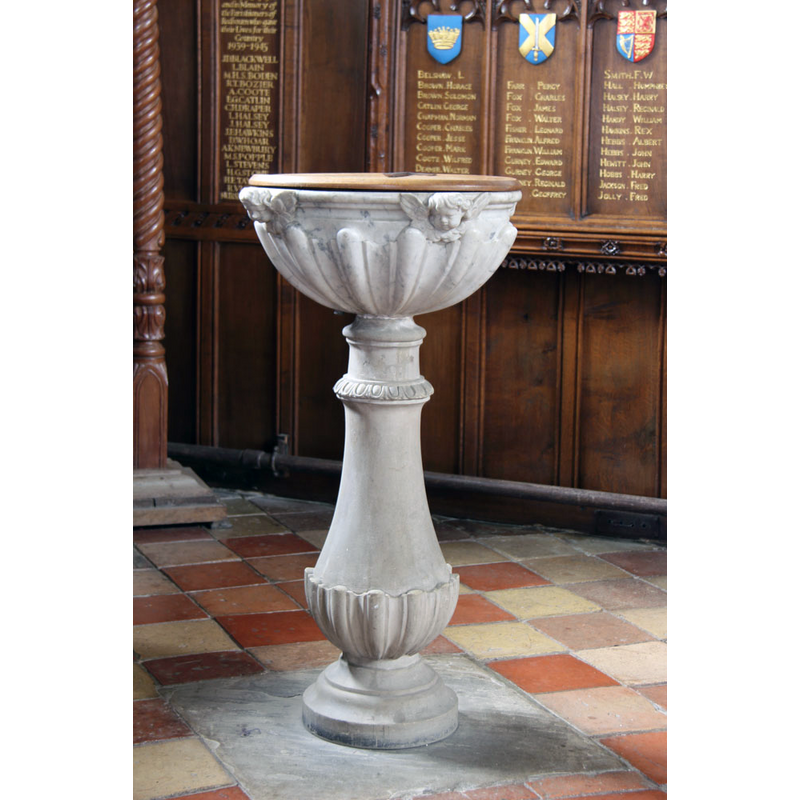
Image copyright © John Salmon, 2013
CC-BY-SA-2.0
Results: 6 records
view of font and cover
Scene Description: the 18thC font in use
Copyright Statement: Image copyright © John Salmon, 2013
Image Source: digital photograph taken 1 March 2013 by John Salmon [www.geograph.org.uk/photo/3362001] [accessed 27 September 2016]
Copyright Instructions: CC-BY-SA-2.0
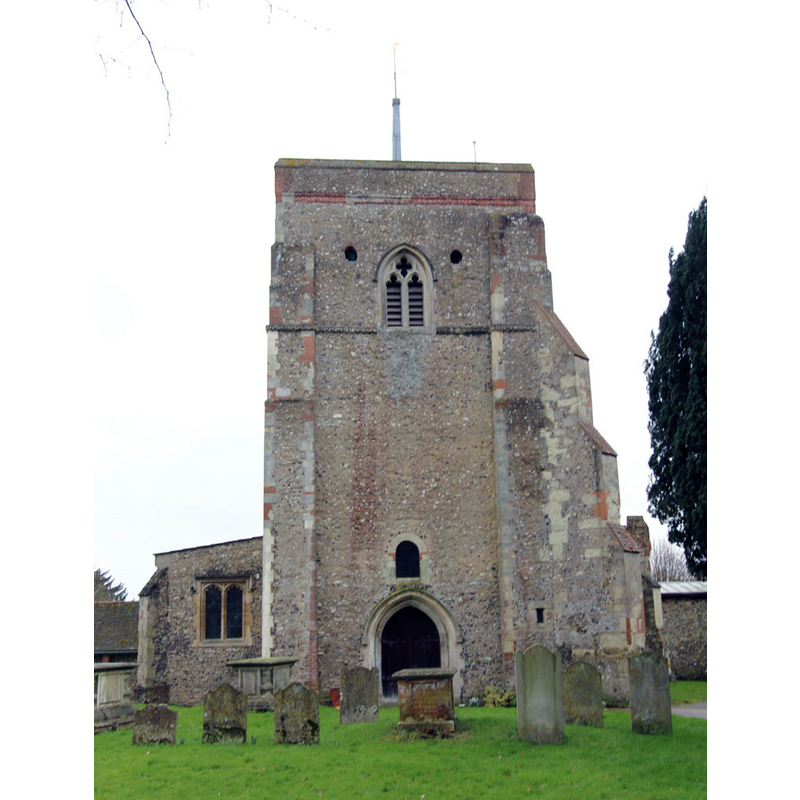
view of church exterior - west view
Copyright Statement: Image copyright © John Salmon, 2013
Image Source: digital photograph taken 1 March 2013 by John Salmon [www.geograph.org.uk/photo/3361988] [accessed 27 September 2016]
Copyright Instructions: CC-BY-SA-2.0
view of church exterior - south view
![EXT S digital photograph taken 1 March 2013 by John Salmon [www.geograph.org.uk/photo/3361986] [accessed 27 September 2016]
EXT W digital photograph taken 1 March 2013 by John Salmon [www.geograph.org.uk/photo/3361988] [accessed 27 September 2016]
INT E digital photograph taken 1 March 2013 by John Salmon [www.geograph.org.uk/photo/3362024] [accessed 27 September 2016]
INT W digital photograph taken 1 March 2013 by John Salmon [www.geograph.org.uk/photo/3362014] [accessed 27 September 2016]
MOD FONT CNTXT digital photograph taken 1 March 2013 by John Salmon [www.geograph.org.uk/photo/3362022] [accessed 27 September 2016]
MOD FONT+COVER digital photograph taken 1 March 2013 by John Salmon [www.geograph.org.uk/photo/3362001] [accessed 27 September 2016]](/static-50478a99ec6f36a15d6234548c59f63da52304e5/compressed/1160928012_compressed.png)
Scene Description: EXT S digital photograph taken 1 March 2013 by John Salmon [www.geograph.org.uk/photo/3361986] [accessed 27 September 2016]
EXT W digital photograph taken 1 March 2013 by John Salmon [www.geograph.org.uk/photo/3361988] [accessed 27 September 2016]
INT E digital photograph taken 1 March 2013 by John Salmon [www.geograph.org.uk/photo/3362024] [accessed 27 September 2016]
INT W digital photograph taken 1 March 2013 by John Salmon [www.geograph.org.uk/photo/3362014] [accessed 27 September 2016]
MOD FONT CNTXT digital photograph taken 1 March 2013 by John Salmon [www.geograph.org.uk/photo/3362022] [accessed 27 September 2016]
MOD FONT+COVER digital photograph taken 1 March 2013 by John Salmon [www.geograph.org.uk/photo/3362001] [accessed 27 September 2016]
Copyright Statement: Image copyright © John Salmon, 2013
Image Source: digital photograph taken 1 March 2013 by John Salmon [www.geograph.org.uk/photo/3361986] [accessed 27 September 2016]
Copyright Instructions: CC-BY-SA-2.0
view of font and cover in context
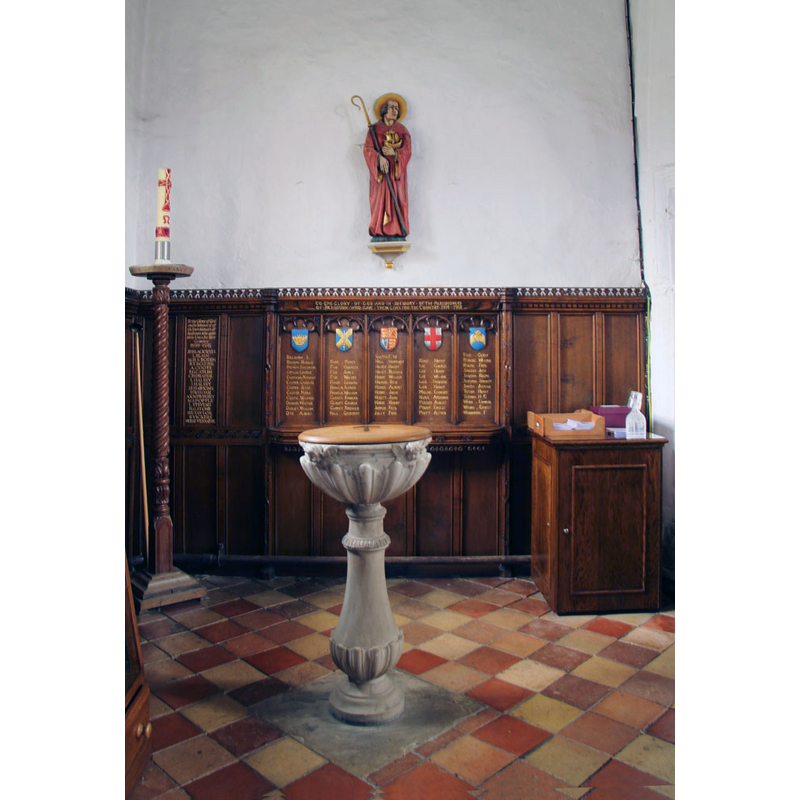
Scene Description: the 18thC font at the west end of the nave, south side
Copyright Statement: Image copyright © John Salmon, 2013
Image Source: digital photograph taken 1 March 2013 by John Salmon [www.geograph.org.uk/photo/3362022] [accessed 27 September 2016]
Copyright Instructions: CC-BY-SA-2.0
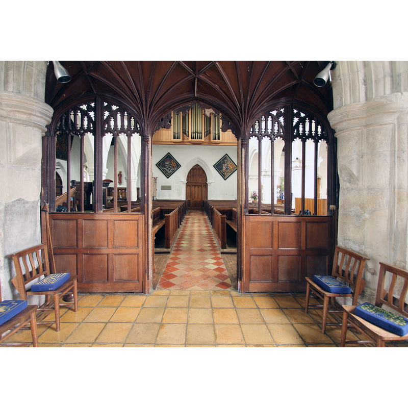
view of church interior - nave - looking west
Copyright Statement: Image copyright © John Salmon, 2013
Image Source: digital photograph taken 1 March 2013 by John Salmon [www.geograph.org.uk/photo/3362014] [accessed 27 September 2016]
Copyright Instructions: CC-BY-SA-2.0
view of church interior - nave - looking east
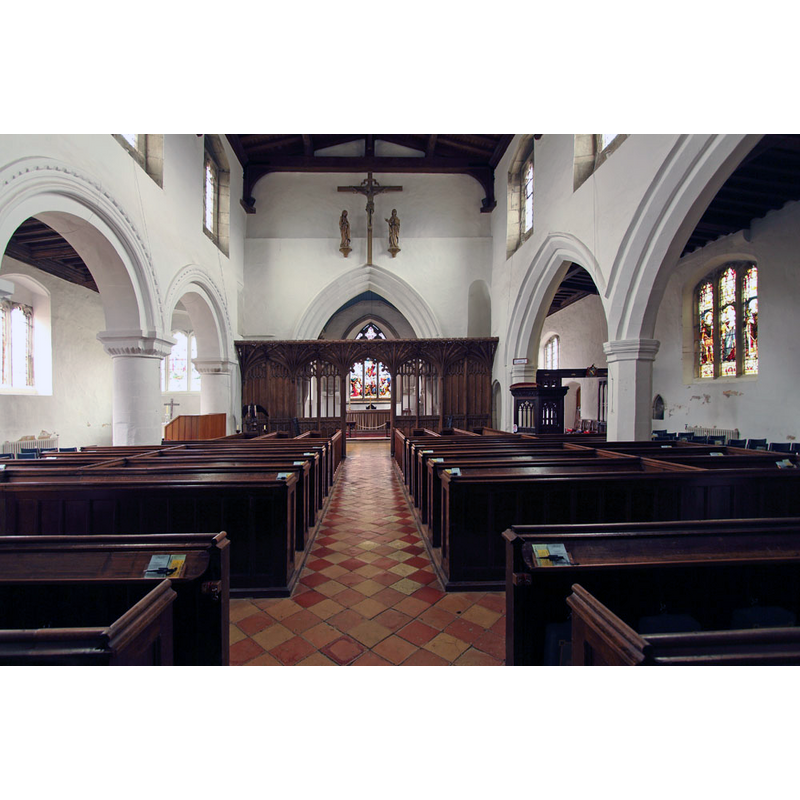
Copyright Statement: Image copyright © John Salmon, 2013
Image Source: digital photograph taken 1 March 2013 by John Salmon [www.geograph.org.uk/photo/3362024] [accessed 27 September 2016]
Copyright Instructions: CC-BY-SA-2.0
INFORMATION
Font ID: 11935RED
Object Type: Baptismal Font1?
Font Century and Period/Style: 11th century, Pre-Conquest? / Norman
Church / Chapel Name: Parish Church of St. Mary
Church Patron Saint(s): St. Mary the Virgin
Church Address: Hemel Hempstead Road, Redbourn, Hertfordshire AL3 7DU, UK
Site Location: Hertfordshire, East, England, United Kingdom
Directions to Site: Located off (W) the A5183, 6 km NE of Hemel Hempstead
Ecclesiastic Region: Diocese of St. Albans
Historical Region: Hundred of Danish [in Domesday] -- Hundred of Cashio
Additional Comments: disappeared font? (the font of the original 11thC (?) church here)
Font Notes:
Click to view
There are four entries for Redbourn [variant spelling] in the Domesday survey [http://opendomesday.org/place/TL1012/redbourn/] [accessed 27 September 2016], none of which mentions cleric or church in it. The Victoria County History (Hertfordshire, vol. 2, 1908) notes: "The church of Redbourn was part of the possessions of the abbey of St. Albans, and to it was annexed the church of Flamstead till the beginning of the twelfth century, when they were separated. […] It was confirmed to the abbey by Henry II and John. […] Abbot Paul (1077–93) assigned part of the tithes of Redbourn for the maintenance of writers in the abbey scriptorium. […] Any Saxon church that may have existed here was replaced in the twelfth century by one which forms the nucleus of the present building, and had an aisleless nave 25 ft. wide, a chancel, and a western tower. Its approximate date is given by the record of the dedication of the church of Redbourn by Herbert Losinga, bishop of Norwich (1094–1119)"; no font mentioned in the VXCH entry. Pevsner & Cherry (1977) write: "Font. Handsome, unpretentious, early C18 design".
COORDINATES
UTM: 30U 678858 5741014
Latitude & Longitude (Decimal): 51.791348, -0.406488
Latitude & Longitude (DMS): 51° 47′ 28.85″ N, 0° 24′ 23.36″ W
REFERENCES
- Victoria County History [online], University of London, 1993-. URL: https://www.british-history.ac.uk.
- Pevsner, Nikolaus, Hertfordshire, Harmondsworth: Penguin Books, 1977, p. 276