East Barnet / La Barnette / La Bernette / Low Barnet [disappeared?]
![Main image for East Barnet / La Barnette / La Bernette / Low Barnet [disappeared?]](/static-50478a99ec6f36a15d6234548c59f63da52304e5/compressed/1160921028_compressed.png)
Image copyright © Philafrenzy, 2015
CC-BY-SA-4.0
Results: 4 records
view of font and cover
Scene Description: the modern font
Copyright Statement: Image copyright © Philafrenzy, 2015
Image Source: digital photograph taken 22 August 2015 by Philafrenzy [https://commons.wikimedia.org/wiki/File:St_Mary_the_Virgin,_East_Barnet_interior_07.JPG] [accessed 21 September 2016]
Copyright Instructions: CC-BY-SA-4.0
view of church exterior - sothwest end
![EXT SW END digital photograph taken 22 August 2015 by Philafrenzy [https://commons.wikimedia.org/wiki/File:St_Mary_the_Virgin,_East_Barnet_13.JPG] [accessed 21 September 2016] CC-BY-SA-4.0
INT E digital photograph taken 22 August 2015 by Philafrenzy [https://commons.wikimedia.org/wiki/File:St_Mary_the_Virgin,_East_Barnet_interior_01.JPG] [accessed 21 September 2016] CC-BY-SA-4.0
INT W digital photograph taken 22 August 2015 by Philafrenzy [https://commons.wikimedia.org/wiki/File:St_Mary_the_Virgin,_East_Barnet_interior_13.JPG] [accessed 21 September 2016] CC-BY-SA-4.0
MOD FONT digital photograph taken 22 August 2015 by Philafrenzy [https://commons.wikimedia.org/wiki/File:St_Mary_the_Virgin,_East_Barnet_interior_07.JPG] [accessed 21 September 2016] CC-BY-SA-4.0](/static-50478a99ec6f36a15d6234548c59f63da52304e5/compressed/1160921025_compressed.png)
Scene Description: EXT SW END digital photograph taken 22 August 2015 by Philafrenzy [https://commons.wikimedia.org/wiki/File:St_Mary_the_Virgin,_East_Barnet_13.JPG] [accessed 21 September 2016] CC-BY-SA-4.0
INT E digital photograph taken 22 August 2015 by Philafrenzy [https://commons.wikimedia.org/wiki/File:St_Mary_the_Virgin,_East_Barnet_interior_01.JPG] [accessed 21 September 2016] CC-BY-SA-4.0
INT W digital photograph taken 22 August 2015 by Philafrenzy [https://commons.wikimedia.org/wiki/File:St_Mary_the_Virgin,_East_Barnet_interior_13.JPG] [accessed 21 September 2016] CC-BY-SA-4.0
MOD FONT digital photograph taken 22 August 2015 by Philafrenzy [https://commons.wikimedia.org/wiki/File:St_Mary_the_Virgin,_East_Barnet_interior_07.JPG] [accessed 21 September 2016] CC-BY-SA-4.0
Copyright Statement: Image copyright © Philafrenzy, 2015
Image Source: digital photograph taken 22 August 2015 by Philafrenzy [https://commons.wikimedia.org/wiki/File:St_Mary_the_Virgin,_East_Barnet_13.JPG] [accessed 21 September 2016]
Copyright Instructions: CC-BY-SA-4.0
view of church interior - nave - looking west
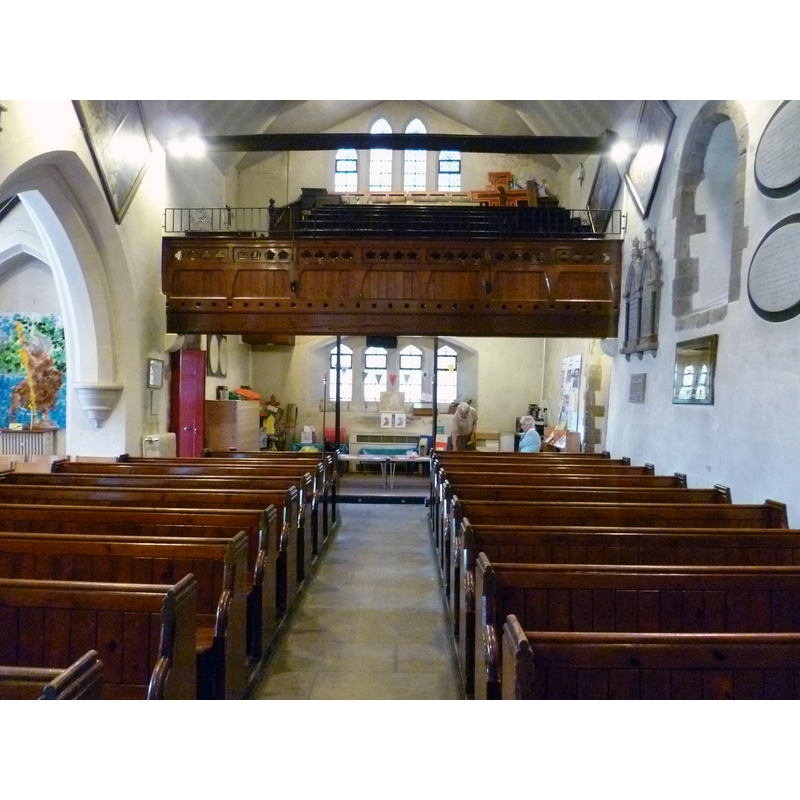
Copyright Statement: Image copyright © Philafrenzy, 2015
Image Source: digital photograph taken 22 August 2015 by Philafrenzy [https://commons.wikimedia.org/wiki/File:St_Mary_the_Virgin,_East_Barnet_interior_13.JPG] [accessed 21 September 2016]
Copyright Instructions: CC-BY-SA-4.0
view of church interior - nave - looking east
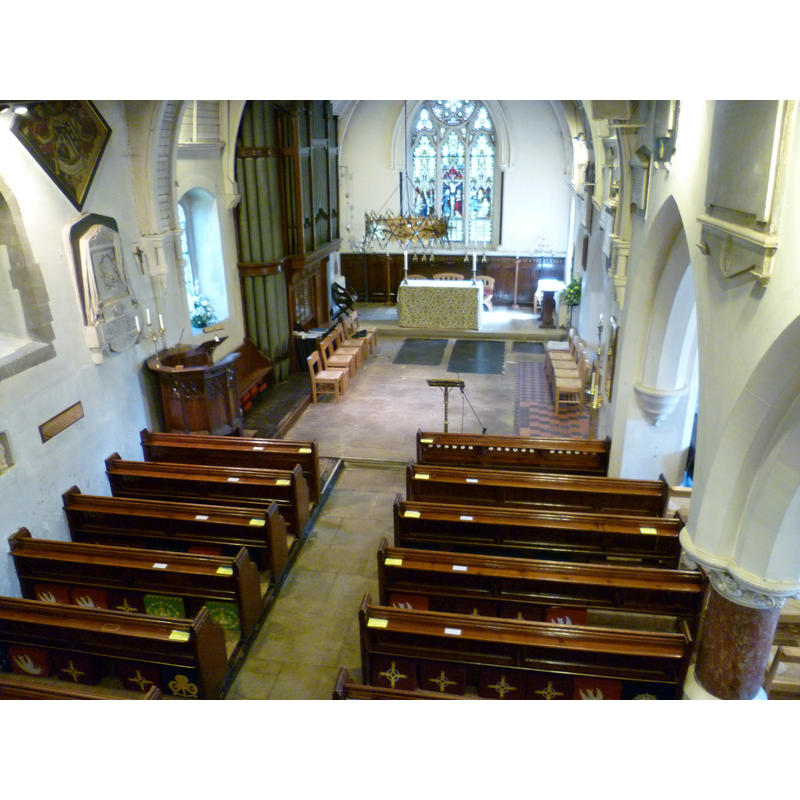
Copyright Statement: Image copyright © Philafrenzy, 2015
Image Source: digital photograph taken 22 August 2015 by Philafrenzy [https://commons.wikimedia.org/wiki/File:St_Mary_the_Virgin,_East_Barnet_interior_01.JPG] [accessed 21 September 2016]
Copyright Instructions: CC-BY-SA-4.0
INFORMATION
Font ID: 11922BAR
Object Type: Baptismal Font1?
Font Century and Period/Style: 12th century (mid?), Late Norman
Church / Chapel Name: Parish Church of St. Mary the Virgin [aka Our Lady's]
Font Location in Church: [cf. FontNotes]
Church Patron Saint(s): St. Mary the Virgin
Church Address: 2A Church Hill Road, Barnet, Greater London EN4 8XE, UK
Site Location: Greater London, South East, England, United Kingdom
Directions to Site: Located on Church Hill Rd., in the London Borough of Barnet
Ecclesiastic Region: Diocese of St. Albans
Historical Region: Hundred of Cashio -- formerly Hertfordshire
Additional Comments: disappeared font? (the one from the 12thC church here)
Font Notes:
Click to view
No entry found for East Barnet in the Domesday survey. Hassell (1817) reports that the church "is without a font" [the earlier font having obviously disappeared from the church prior to his vist]. Noted in Pevsner & Cherry (1977): "Font. A classical vase, removed from the church in 1868." The Victoria County History (Hertfordshire, vol. 2, 1908) notes: "The church of OUR LADY preserves the greater part of an aisleless nave of the second quarter of the twelfth century, 40 ft. by 19 ft. within the walls, which are 3 ft. thick. The rest of the church, consisting of chancel with north vestry and organ chamber, large south aisle, south porch and tower, and west vestry, is modern […] The font is in the south aisle, and dates ftrom 1868, replacing one given in 1807 by the then rector, the Rev. Benjamin Underwood, which is now in the churchyard, and bears a memorial inscription to the children buried in the churchyard who have no ther record." [NB: we have no information of the font of the 12th-century church here].
COORDINATES
UTM: 30U 696805 5724312
Latitude & Longitude (Decimal): 51.63534, -0.15602
Latitude & Longitude (DMS): 51° 38′ 7.22″ N, 0° 9′ 21.67″ W
REFERENCES
- Victoria County History [online], University of London, 1993-. URL: https://www.british-history.ac.uk.
- Hassell, J., Picturesque rides and walks, with excursions by water, thirty miles around the British metropolis [...], London: Printed for J. Hassell [...], 1817-, vol. 1: 193 / [http://books.google.ca/books?id=nQwHAAAAQAAJ&pg=PA45-IA2&lpg=PA45-IA2&dq=thames+ditton+church+font&source=bl&ots=WeTsFOMlo2&sig=ny8TypgecMkFR20zHJ_nmc3czuU&hl=en&ei=CSzZSd-aBpnIM6uP6YcP&sa=X&oi=book_result&ct=result&resnum=5#PPR3,M1] [accessed 5 April 2009]
- Pevsner, Nikolaus, Hertfordshire, Harmondsworth: Penguin Books, 1977, p. 139