Hatfield nr. St. Albans / Bishop's Hatfield / Cecil Hatfield / Haetfeld / Hatfeud / Hetfelle / Old Hatfield
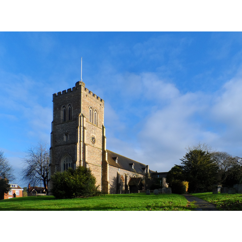
Image copyright © Bikeboy, 2014
CC-BY-SA-2.0
Results: 4 records
view of church exterior - southwest view
Copyright Statement: Image copyright © Bikeboy, 2014
Image Source: edited detail of a digital photograph taken 7 December 2014 by Bikeboy [www.geograph.org.uk/photo/4272388] [accessed 12 October 2016]
Copyright Instructions: CC-BY-SA-2.0
view of church exterior - south view
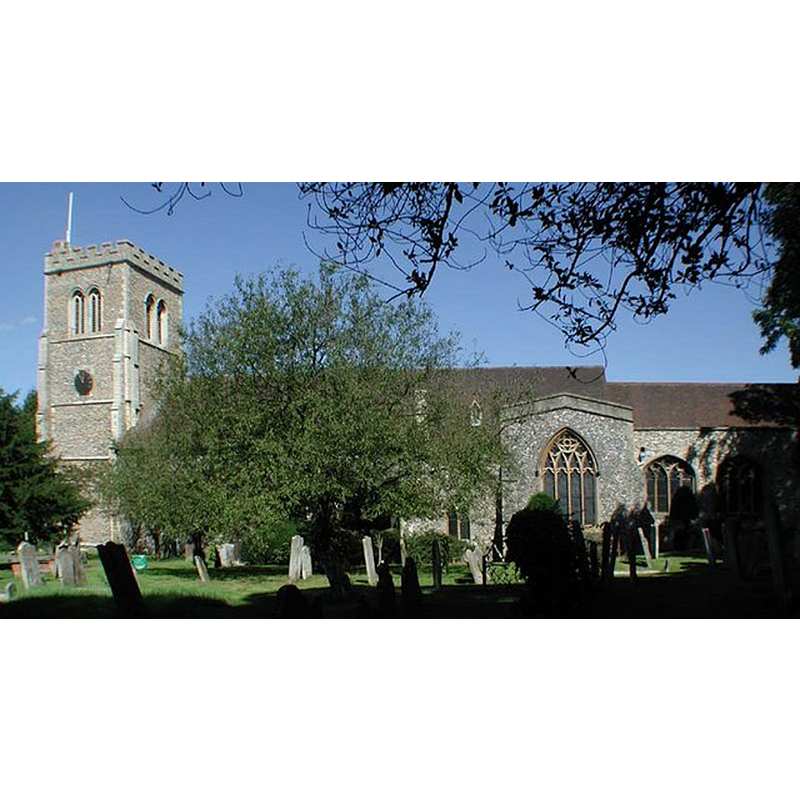
Copyright Statement: Image copyright © John Salmon, 2007
Image Source: digital photograph taken 27 August 2001 by John Salmon [www.geograph.org.uk/photo/348849] [accessed 12 October 2016]
Copyright Instructions: CC-BY-SA-2.0
view of church interior - nave - looking east
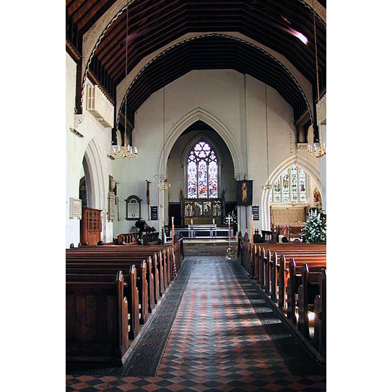
Copyright Statement: Image copyright © John Salmon, 2007
Image Source: digital photograph taken 27 August 2001 by John Salmon [www.geograph.org.uk/photo/348853] [accessed 12 October 2016]
Copyright Instructions: CC-BY-SA-2.0
view of font

Scene Description: the late-19thC font
Copyright Statement: Image copyright © Stiffleaf, 2013
Image Source: digital photograph taken 1 April 2013 by Stiffleaf [www.ipernity.com/doc/stiffleaf/20105689/in/keyword/902842/self] [accessed 12 October 2016]
Copyright Instructions: PERMISSION NOT AVAILABLE -- IMAGE NOT FOR PUBLIC USE
INFORMATION
Font ID: 11920HAT
Object Type: Baptismal Font1?
Font Century and Period/Style: 11th century, Pre-Conquest? / Norman
Church / Chapel Name: Parish Church of St. Etheldreda
Church Patron Saint(s): St. Etheldreda [aka Audrey, Æðelþryð, Æþelðryþe, Æthelthryth, Ediltrudis]
Church Address: Fore Street, Old Hatfield, Hertfordshire, AL9 5AW, UK
Site Location: Hertfordshire, East, England, United Kingdom
Directions to Site: Located on the B6426 [aka St. Albans Rd. East], in the ESE area of Hatfield, E of St. Albans
Ecclesiastic Region: Diocese of St. Albans
Historical Region: Hundred of Broadwater
Additional Comments: disappeared font(s)? (the earlier font(s) from this church, including one at Domesday time)
Font Notes:
Click to view
There is an entry for this Hatfield [variant spelling] in the Domesday survey [http://opendomesday.org/place/TL2308/hatfield/] [accessed 12 October 2016]; it mentions a priest but not a church in it, though there probably was one there. The Victoria County History (Hertfordshire, vol. 3, 1912) notes: "The advowson of the church of St. Etheldreda at Hatfield […] belonged from the earliest times to the Abbots and Bishops of Ely […] The original church of the early 13th century appears to have been cruciform with a central tower, of which evidence remains in the thickened east wall of the nave and a flying arch on the north side"; no font mentioned in the VCH entry. Tompkins (1922) notes "the beautiful clustered shafts of marble on the font of Tisbury stone, the gift of the late Marchioness of Salisbury." [NB: the first Marquess of Salisbury (1748-1823) was Lord Chamberlain to George III, therefore this font must be 18th-century or later. The fabric of the church goes back to the late-13th century, and there probably was a church here by 1086, but we have no information on the earlier font(s) of this church].
COORDINATES
UTM: 30U 692401 5738248
Latitude & Longitude (Decimal): 51.762023, -0.211894
Latitude & Longitude (DMS): 51° 45′ 43.28″ N, 0° 12′ 42.82″ W
REFERENCES
- Victoria County History [online], University of London, 1993-. URL: https://www.british-history.ac.uk.
- Tompkins, Herbert Winckworth, Hertfordshire, London: Methuen & Co., 1922, [www.guttenberg.org/files/18252/18252-8.txt]