Braughing / Brachinges / Bracking / Braughinge / Brauging / Brawyng / Broughhynge
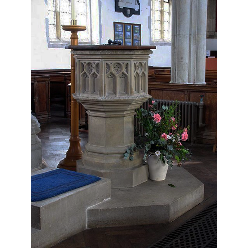
Image copyright © John Salmon, 2007
CC-BY-SA-2.0
Results: 5 records
view of font and cover in context
Scene Description: the modern font with its modern cover [NB: the old disused font has a 17thC (?) cover on it]
Copyright Statement: Image copyright © John Salmon, 2007
Image Source: digital photograph taken 18 August 2006 by John Salmon [www.geograph.org.uk/photo/370475] [accessed 26 October 2016]
Copyright Instructions: CC-BY-SA-2.0
view of church exterior - southeast view
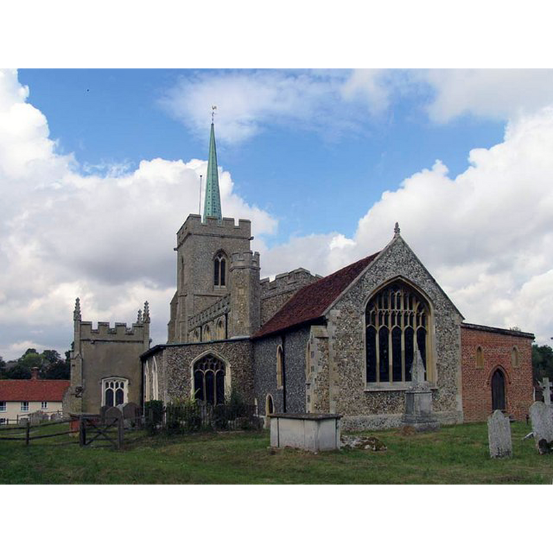
Copyright Statement: Image copyright © John Salmon, 2007
Image Source: digital photograph taken 18 August 2006 by John Salmon [www.geograph.org.uk/photo/370472] [accessed 26 October 2016]
Copyright Instructions: CC-BY-SA-2.0
view of church interior - nave - looking west
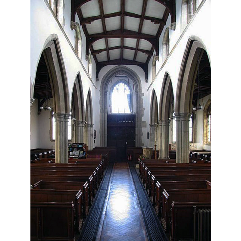
Copyright Statement: Image copyright © John Salmon, 2007
Image Source: digital photograph taken 18 August 2006 by John Salmon [www.geograph.org.uk/photo/370484] [accessed 26 October 2016]
Copyright Instructions: CC-BY-SA-2.0
view of church interior - nave - looking east
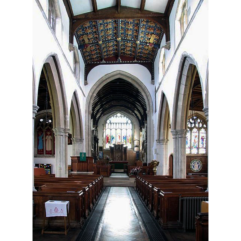
Copyright Statement: Image copyright © John Salmon, 2007
Image Source: digital photograph taken 18 August 2006 by John Salmon [www.geograph.org.uk/photo/370474] [accessed 26 October 2016]
Copyright Instructions: CC-BY-SA-2.0
design element - motifs - panel - cusped
![on the sides of the basin of the old disused font [image not available]](/static-50478a99ec6f36a15d6234548c59f63da52304e5/others/image_not_available.jpg)
Scene Description: on the sides of the basin of the old disused font [image not available]
![on the sides of the basin of the old disused font [image not available]](/static-50478a99ec6f36a15d6234548c59f63da52304e5/bsi-testing-site/others/image_not_available.jpg)
INFORMATION
Font ID: 11918BRA
Object Type: Baptismal Font1
Font Century and Period/Style: 14th century (early?), Decorated
Church / Chapel Name: Parish Church of St. Mary
Font Location in Church: In the N aisle ca. 1967 [cf. FontNotes]
Church Patron Saint(s): St. Mary the Virgin
Church Notes: the present church was consdecrated 1220 [English Heritage, Listing NGR: TL3961925204 (1967)]
Church Address: Church End, Braughing, Hertfordshire SG11 2QA
Site Location: Hertfordshire, East, England, United Kingdom
Directions to Site: Located off (E) the B1368, E of the A10, NNE of Puckeridge, NW of Bishops Stortford
Ecclesiastic Region: Diocese of St. Albans
Historical Region: Hundred of Braughing [aka Brauging]
Additional Comments: damaged font ("mutilated") / abandoned font / disused font (replaced by new one) -- disappeared font? (the one from the Domesday-time church here)
Font Notes:
Click to view
There is an entry for Braughing [variant spelling] in the Domesday survey [http://opendomesday.org/place/TL3925/braughing/] [accessed 26 October 2016]; it mentions a priest but not a church in it, although there probably was one there. The Royal Commission on Historical Monuments, Hertforshire (1911) reports: "Font: modern: at E. end of N. aisle, recently replaced in the church, disused font, early 14th-century, mutilated; with flat wood cover, early 17th-century, much decayed." The Victoria County History (Hertford, vol. 3, 1912) notes: "The church was granted to the priory of Holy Trinity by Queen Maud [+1167] about the same time as the manor [...] The chancel belongs to the early part of the 13th century, about 1220; the nave with its aisles and porch and the west tower were rebuilt about 1416 [...] and the north chapel was added early in the 17th century. In 1888 the church was thoroughly restored [...] The font is modern, but the old one stands at the east end of the north aisle, and is of early 14thcentury date. The sides of the octagonal basin have cusped panels, all much mutilated; the flat oak cover belongs to the early part of the 17th century. [...] In the south-east corner [of the south entranceway] is a stoup with a round basin, slightly broken." Tomplins (1922) mentions as noteworthy in this church a "finely carved font of Caen stone", for which he gives no estimated date, and an "old font outside, near the tower", also without a date. The Official Guide to Braughing Rural District (1971) notes that "the Caen stone font is new, but the original font, 600 years old has been found and brought back into the church." Pevsner & Cherry (1977) mention neither font in their entry for Braughing. [NB: the RCHM (1911) reports also a holy-water stoup, "with a round basin, slightly broken", in the southeast corner of the porch -- no separate entry in this Index]
COORDINATES
UTM: 31U 295606 5755041
Latitude & Longitude (Decimal): 51.908562, 0.028425
Latitude & Longitude (DMS): 51° 54′ 30.82″ N, 0° 1′ 42.33″ E
MEDIUM AND MEASUREMENTS
Material: stone
LID INFORMATION
Date: 17th century?
Material: wood
Apparatus: no
Notes: on the old disused font [cf. FontNotes]
REFERENCES
- Victoria County History [online], University of London, 1993-. URL: https://www.british-history.ac.uk.
- Great Britain. Royal Commission on Historical Monuments (England), An Inventory of the Historical Monuments in Hertfordshire, London: Printed for His Majesty's Stationary Office by J. Truscott, 1911, p. 67
- Pevsner, Nikolaus, Hertfordshire, Harmondsworth: Penguin Books, 1977, p. 108
- Tompkins, Herbert Winckworth, Hertfordshire, London: Methuen & Co., 1922, [www.guttenberg.org/files/18252/18252-8.txt]