West Hendred / Hennarithe / Henret / Henreth
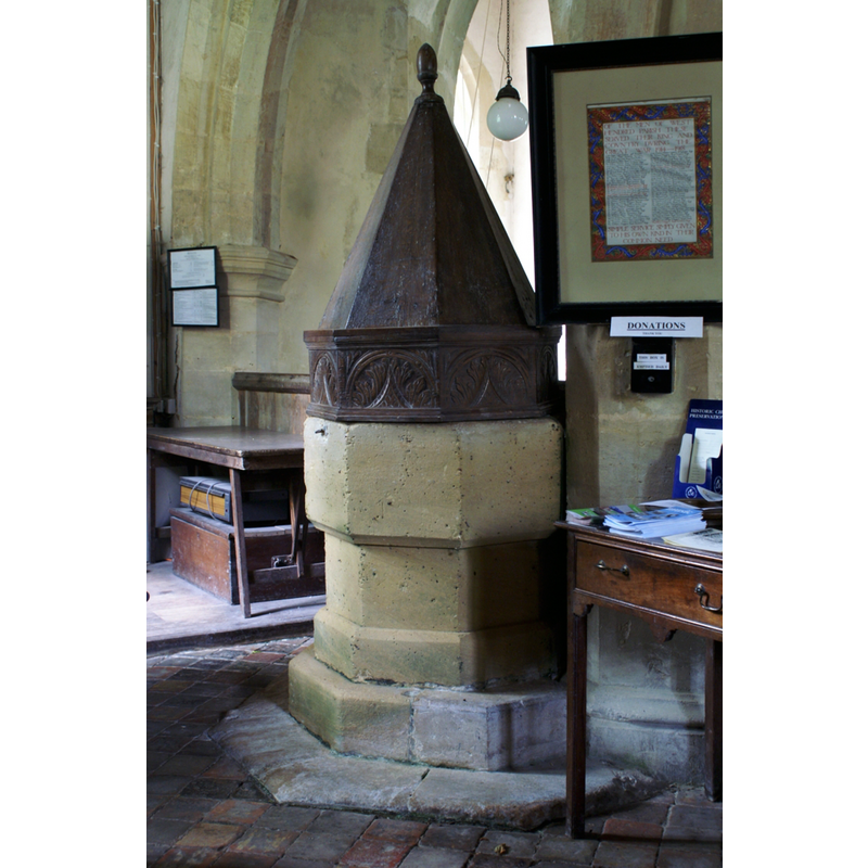
Image copyright © Vitrearum [Alan Barton], 2006
CC-BY-SA-3.0
Results: 4 records
view of font and cover
Copyright Statement: Image copyright © Vitrearum [Alan Barton], 2006
Image Source: digital photograph taken 6 September 2006 by Vitrearum [Alan Barton] [http://www.flickr.com/photos/vitrearum/238402898/] [accessed 8 November 2011]
Copyright Instructions: CC-BY-SA-3.0
view of font and cover
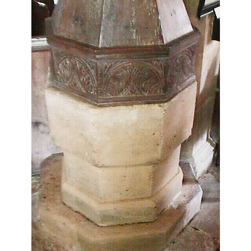
Copyright Statement: Image copyright © John Wilkes, 2006
Image Source: digital photograph by John Wilkes, 2006 [www.allthecotswolds.com]
Copyright Instructions: Standing permission
view of church exterior - southeast view
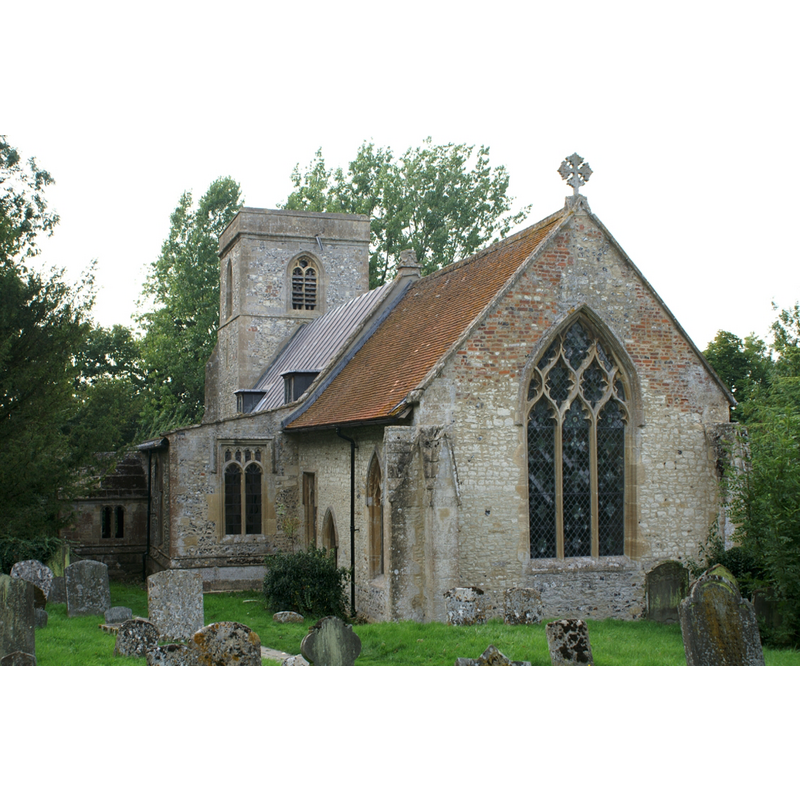
Copyright Statement: Image copyright © Vitrearum [Alan Barton], 2006
Image Source: digital photograph taken 6 September 2006 by Vitrearum [Alan Barton] [http://www.flickr.com/photos/vitrearum/238402115/] [accessed 8 November 2011]
Copyright Instructions: CC-BY-SA-3.0
view of font and cover in context
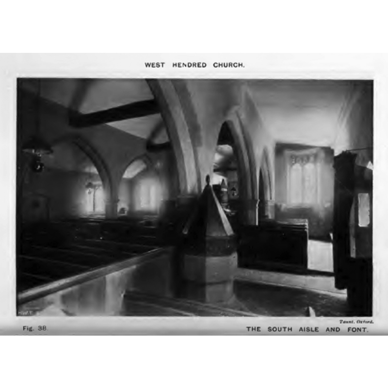
Copyright Statement: Image copyright © [in the public domain]
Image Source: B&W photograph by Taunt, Oxford, in Keyser (1918)
Copyright Instructions: PD
INFORMATION
Font ID: 11906HEN
Object Type: Baptismal Font1
Font Century and Period/Style: 13th - 15th century, Medieval
Church / Chapel Name: Parish Church of the Holy Trinity
Font Location in Church: Inside the church
Church Patron Saint(s): The Holy Trinity
Church Address: West Hendred, Oxfordshire, OX12 8RS, UK
Site Location: Oxfordshire, South East, England, United Kingdom
Directions to Site: Located off the A417, 5 km E of Wantage
Ecclesiastic Region: Diocese of Oxford
Historical Region: Hundred of Sutton [in Domesday] -- formerly Berkshire -- Hundred of Wantage
Additional Comments: disappeared font? (the one from the original pre-Conquest church here)
Font Notes:
Click to view
There are eight entries for [East and West] Hendred [variant spelling] in the Domesday survey [http://opendomesday.org/place/XX0000/east-and-west-hendred/] [accessed 27 May 2015], two of which mention a church in each. Drawing of a font in the Harvey Pridham Drawings of English Fonts (MS 56). [Folder Number, Item Description]. University of Colorado at Boulder Libraries. Special Collections Dept., done by Harvey Pridham June 1888 accompanied by the following description: "Octagonal. Circular bowl, very roughly lined with lead, vertical sides, 12 3/4 deep, 4" margin: Heavy oak pyramidal cover, carved panels at foot, and date 1630, with initials. Position, S. side of W. pier, S. arcade." Noted and illustrated in Keyser (1918), the date on the cover recorded as well. The Victoria County History (Berkshire, vol. 4, 1924) notes: "There was a church in West Hendred at the time of the Norman Conquest. [...] The church appears to have been entirely rebuilt during the 14th century [...] The font has a plain octagonal bowl and stem and an octagonal pyramidal cover capped with an acorn and having carved panels, one being inscribed 'A.D. 1630 I.P, TS.'"
Credit and Acknowledgements: We are grateful to John Wilkes, of www.allthecotswolds.com, for the photograph of this font.
COORDINATES
UTM: 30U 613873 5716817
Latitude & Longitude (Decimal): 51.590885, -1.356153
Latitude & Longitude (DMS): 51° 35′ 27.19″ N, 1° 21′ 22.15″ W
MEDIUM AND MEASUREMENTS
Material: stone
Font Shape: octagonal, mounted
Basin Interior Shape: round
Basin Exterior Shape: octagonal
Drainage Notes: lead-lined
Basin Depth: 32 cm*
Notes on Measurements: * [in inches in Harvey Fridham [cf. FontNotes]]
LID INFORMATION
Date: 1630
Material: wood, oak
Apparatus: no
Notes: [cf. FontNotes]
REFERENCES
- Victoria County History [online], University of London, 1993-. URL: https://www.british-history.ac.uk.
- Keyser, Charles E., "Notes on the churches of East and West Hendred, Ardington and Lockinge", 24, No.1 (April and July 1919), Berks, Bucks & Oxon Archaeological Journal, 1918, pp. 1-15; p. 15 and fig. 38