East Hendred / Esthanreth / Hanred / Henred / Henret
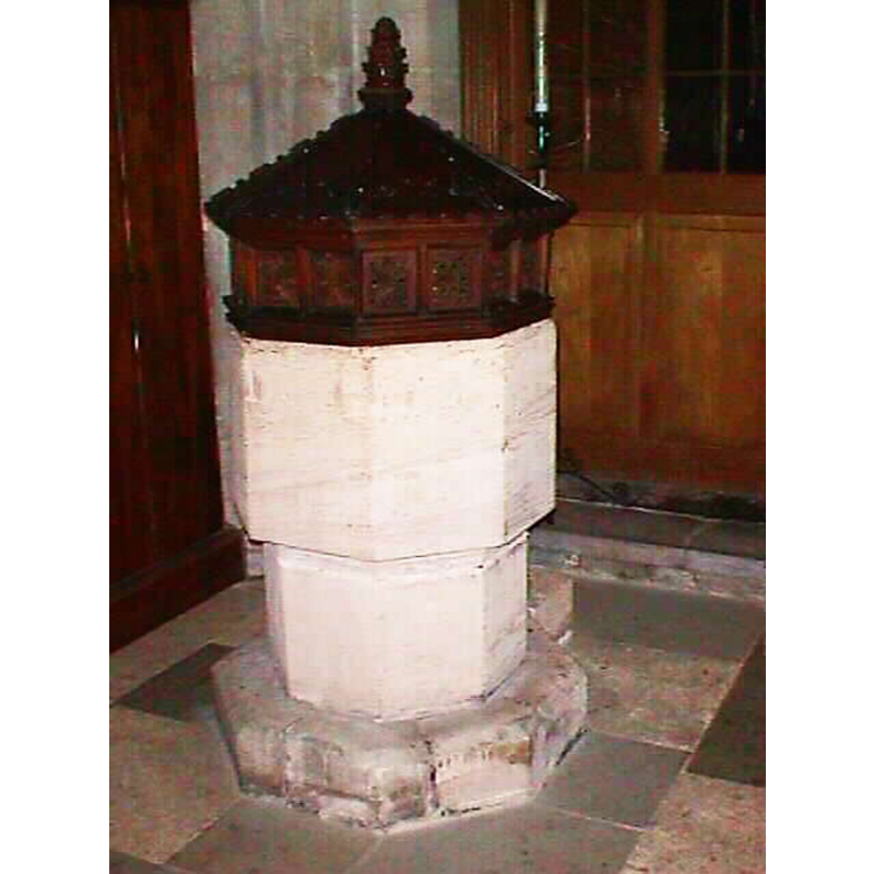
Image copyright © John Wilkes, 2006
Standing permission
Results: 5 records
view of font and cover
Copyright Statement: Image copyright © John Wilkes, 2006
Image Source: digital photograph by John Wilkes, 2006 [www.allthecotswolds.com]
Copyright Instructions: Standing permission
view of font and context
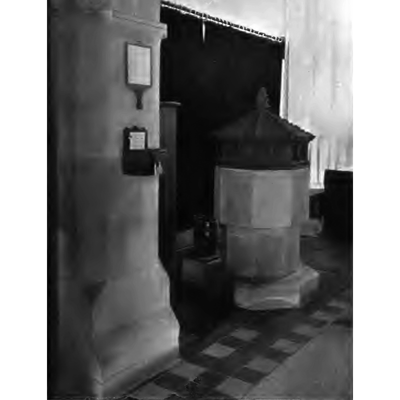
Copyright Statement: Image copyright © [in the public domain]
Image Source: B&W photograph by Taunt, Oxford, in Keyser (1918)
Copyright Instructions: PD
view of church exterior - south view
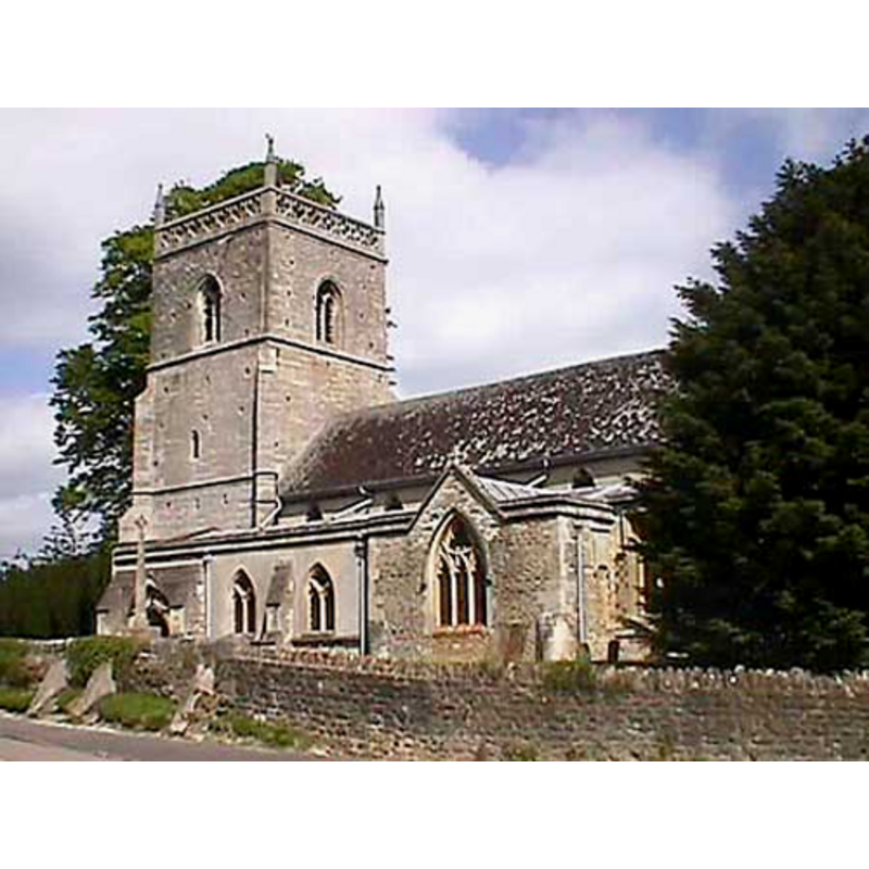
Copyright Statement: Image copyright © John Wilkes, 2006
Image Source: digital photograph by John Wilkes, 2006 [www.allthecotswolds.com]
Copyright Instructions: Standing permission
view of church exterior - southeast view
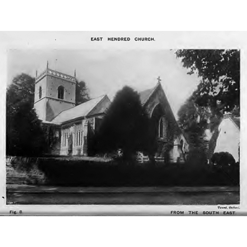
Copyright Statement: Image copyright © [in the public domain]
Image Source: B&W photograph by Taunt, Oxford, in Keyser (1918)
Copyright Instructions: PD
view of church interior - nave - looking east
![the top of the font and cover in the foreground, right [south] side](/static-50478a99ec6f36a15d6234548c59f63da52304e5/compressed/0111111017_compressed.png)
Scene Description: the top of the font and cover in the foreground, right [south] side
Copyright Statement: Image copyright © [in the public domain]
Image Source: B&W photograph by Taunt, Oxford, in Keyser (1918)
Copyright Instructions: PD
INFORMATION
Font ID: 11905HEN
Object Type: Baptismal Font1
Font Century and Period/Style: 12th - 14th century [basin only] [re-cut?], Medieval [composite]
Church / Chapel Name: Parish Church of St. Augustine of Canterbury
Font Location in Church: Inside the church
Church Patron Saint(s): St. Augustine of Canterbury
Church Address: Church Street, East Hendred, Oxfordshire, OX12 8LA, UK
Site Location: Oxfordshire, South East, England, United Kingdom
Directions to Site: Located off the A417, 5 km E of Wantage
Ecclesiastic Region: Diocese of Oxford
Historical Region: Hundred of Sutton [in Domesday] -- formerly Berkshire -- Hundred of Wantage
Additional Comments: altered font? (the present one; re-cut?) -- disappeared font? (the one from the Domesday-time church here)
Font Notes:
Click to view
There are eight entries for [East and West] Hendred [variant spelling] in the Domesday survey [http://opendomesday.org/place/XX0000/east-and-west-hendred/] [accessed 27 May 2015], two of which mention a church in each. The Archaeological Journal (vol. XLIV, 1887: 296) reports: "The font is a plain octagon". Drawing of a font in the Harvey Pridham Drawings of English Fonts (MS 56). [Folder Number, Item Description]. University of Colorado at Boulder Libraries. Special Collections Dept., done by Harvey Pridham in June 1888 accompanied by the following description: "Octagonal, circular bowl, lead lined, vertical sides, flat at bottom, 12 1/2 deep, 3 1/2 margin. Position, half way down nave on N. side. The base is modern. Modern cover." Noted and illustrated in Keyser (1918). The Victoria County History (Berkshire, vol. 4, 1924) notes: "The church of East Hendred belonged in 1086 to the fee of the Count of Evreux [...] The earliest existing work is the south arcade of the nave, which dates from the late 12th century. [...] The font has a plain octagonal bowl." The plain octagonal font is probably from the 13th or 14th century, although it appears to have been re-cut or re-tooled [perhaps during the rebuilding of the chancel in the Victorian period?]. Octagonal wooden cover with low dome and turned finial; the sides of the lower volume have carved motifs in panels.
Credit and Acknowledgements: We are grateful to John Wilkes, of www.allthecotswolds.com, for his photographs of church and font
COORDINATES
UTM: 30U 615669 5717142
Latitude & Longitude (Decimal): 51.59344, -1.33013
Latitude & Longitude (DMS): 51° 35′ 36.38″ N, 1° 19′ 48.47″ W
MEDIUM AND MEASUREMENTS
Material: stone
Font Shape: octagonal, mounted
Basin Interior Shape: round
Basin Exterior Shape: octagonal
Basin Depth: 31.25 cm*
Notes on Measurements: * [in inches in Harvey Pridham [cf. FontNotes]]
LID INFORMATION
Date: unknown
Material: wood
Apparatus: no
Notes: [cf. FontNotes]
REFERENCES
- Victoria County History [online], University of London, 1993-. URL: https://www.british-history.ac.uk.
- Keyser, Charles E., "Notes on the churches of East and West Hendred, Ardington and Lockinge", 24, No.1 (April and July 1919), Berks, Bucks & Oxon Archaeological Journal, 1918, pp. 1-15; p. 10 and fig. 21