Havering-atte-Bower / Haueringas / Hauering atte Bower / Havering atte Bower
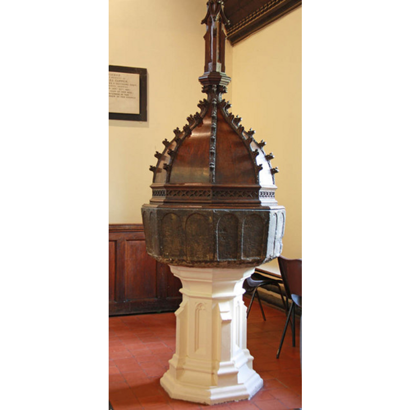
Image copyright © John Salmon, 2011
CC-BY-SA-3.0
Results: 7 records
view of font and cover
Copyright Statement: Image copyright © John Salmon, 2011
Image Source: digital photograph taken 31 May 2011 by John Salmon [www.geograph.org.uk/photo/2444337] [accessed 22 March 2012]
Copyright Instructions: CC-BY-SA-3.0
design element - architectural - arcade - blind - round arches - 16 arches
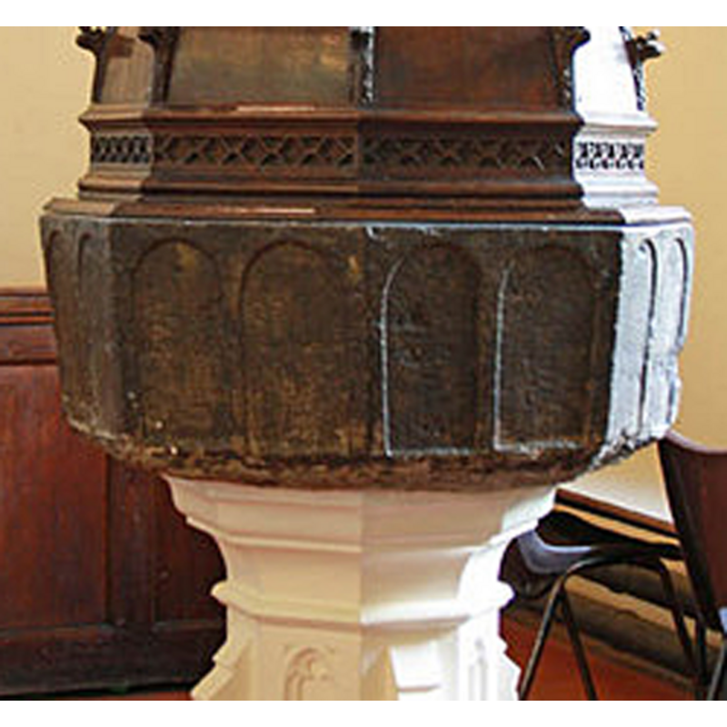
Scene Description: two shallow arches on each side of the octagonal basin
Copyright Statement: Image copyright © John Salmon, 2011
Image Source: detail of a digital photograph taken 31 May 2011 by John Salmon [www.geograph.org.uk/photo/2444337] [accessed 22 March 2012]
Copyright Instructions: CC-BY-SA-3.0
view of church exterior - southeast view
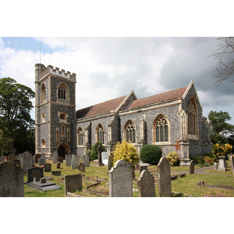
Copyright Statement: Image copyright © John Salmon, 2011
Image Source: digital photograph taken 31 May 2011 by John Salmon [www.geograph.org.uk/photo/2444278] [accessed 22 March 2012]
Copyright Instructions: CC-BY-SA-3.0
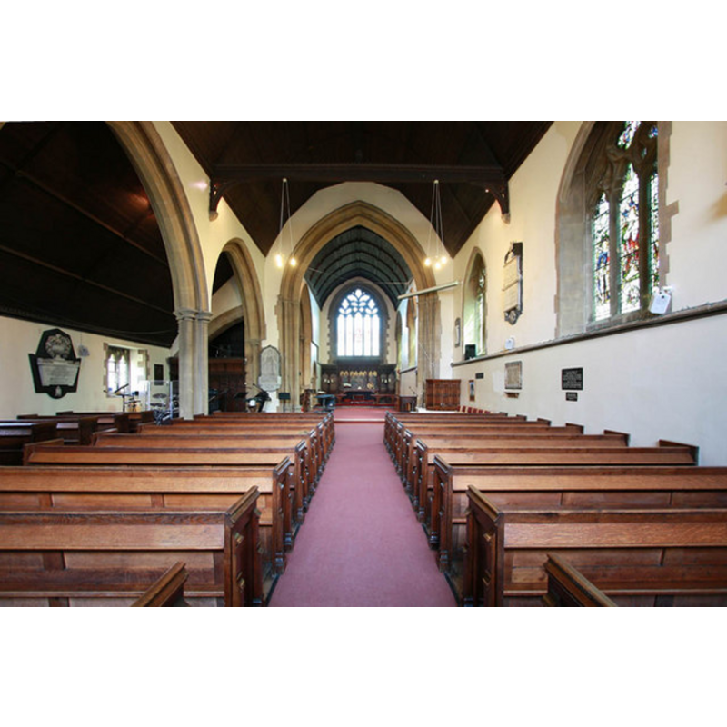
view of font and cover in context
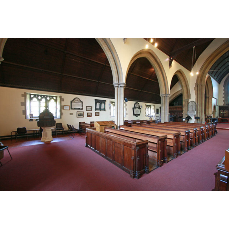
Scene Description: the font and the north arcade
Copyright Statement: Image copyright © John Salmon, 2011
Image Source: digital photograph taken 31 May 2011 by John Salmon [www.geograph.org.uk/photo/2444303] [accessed 22 March 2012]
Copyright Instructions: CC-BY-SA-3.0
view of church interior - nave - looking west
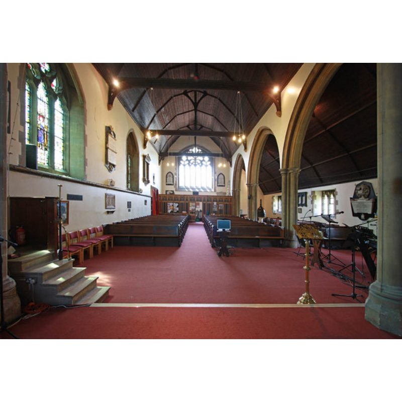
Copyright Statement: Image copyright © John Salmon, 2011
Image Source: digital photograph taken 31 May 2011 by John Salmon [www.geograph.org.uk/photo/2444315] [accessed 22 March 2012]
Copyright Instructions: CC-BY-SA-3.0
view of church interior - nave - looking east
Copyright Statement: Image copyright © John Salmon, 2011
Image Source: digital photograph taken 31 May 2011 by John Salmon [www.geograph.org.uk/photo/2444309] [accessed 22 March 2012]
Copyright Instructions: CC-BY-SA-3.0
view of font cover
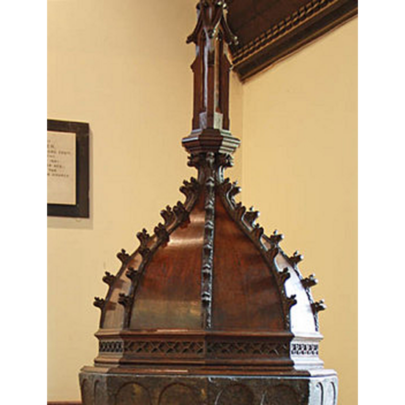
Copyright Statement: Image copyright © John Salmon, 2011
Image Source: detail of a digital photograph taken 31 May 2011 by John Salmon [www.geograph.org.uk/photo/2444337] [accessed 22 March 2012]
Copyright Instructions: CC-BY-SA-3.0
INFORMATION
Font ID: 11831HAV
Object Type: Baptismal Font1
Font Century and Period/Style: 12th century (late?) [basin only] [composite font], Medieval [altered font] [compositefont]
Church / Chapel Name: Parish Church of St. John the Evangelist
Font Location in Church: Inside the entirely rebuilt church, at the W end
Church Patron Saint(s): St. John the Evangelist [the old church demolished in 1876 was dedicated to St. Mary]
Church Address: The Green, North Road, Havering-att-Bower, London, RM4 1PL
Site Location: Greater London, South East, England, United Kingdom
Directions to Site: Located on the B175, 5 km N of Romford, 24 km NE of Charing Cross
Ecclesiastic Region: Diocese of Chelmsford
Historical Region: Liberty of Havering-atte-Bower -- formerly in Essex
Additional Comments: painted font: formerly painted [cf. FontNotes] -- altered font: only the basin is original
Font Notes:
Click to view
Lewis' Dictionary (1848) entry for Havering-Atte-Bower reports: "the font is very large, and of great antiquity." Reported also in Wilson's Gazetteer of 1870-1972 and in Kelly's Essex Directory of 1902. Noted in the Royal Commission on Historical Monuments (Essex, 1916-1923): "Font: octagonal, tapering bowl of Purbeck marble, each face with two round-headed panels, formerly painted, late 12th-century". Listed in Leach (1975) as a font made of Purbeck marble. The Victoria County History (Essex, vol. 7, 1978) notes that the font came from "the old parish church of St. Mary, later of St. John the Evangelist, demolished in 1876", that "stood west of Havering Green, on the site of the present church." The VCH (ibid.) adds: "The font, which dates from the late 12th century, has an octagonal bowl of Purbeck marble [...] In 1836, after long disuse, it was replaced in St. Mary's church [...] Its base, of Bath stone, was added when the font was removed to the new church." The wooden cover is octagonal, the sides of the dome decorated with crockets; tall finial; appears modern.
COORDINATES
UTM: 31U 305323 5722555
MEDIUM AND MEASUREMENTS
Material: stone, limestone (Purbeck marble) [basin only]
Font Shape: octagonal, mounted
Basin Interior Shape: round
Basin Exterior Shape: octagonal
LID INFORMATION
Date: modern?
Material: wood, oak
Notes: [cf. FontNotes]
REFERENCES
- Victoria County History [online], University of London, 1993-. URL: https://www.british-history.ac.uk.
- Great Britain. Royal Commission on Historical Monuments, An Inventory of the historical monuments in Essex, London: H.M. Stationary Office, 1916-1923, vol. 2: 126
- Leach, Rosemary, A Investigation into the use of Purbeck Marble in Medieval England, Hartlepool: E.W. Harrisons & Sons, 1975, p. 77
- Lewis, Samuel, A Topographical Dictionary of England, Comprising the Several Counties, Cities, Boroughs, Corporate and Market Towns, Parishes, Chapelries, and Townships, and the Islands of Guernsy, Jersey, and Man, with Historical and Statistical Descriptions [...], London: S. Lewis, 1831, [www.british-history.ac.uk/report.asp?compid=51015] [accessed 8 February 2007]
- Wilson, John Marius, Imperial Gazetteer of England and Wales: embracing recent changes in counties, dioceses, parishes, and boroughs [...], Edinburgh: A. Fullarton & Co., 1870-1872, [cited in www.visionofbritain.org.uk/place/place_page.jsp?p_id=1349 [accessed 22 March 2012]]