Greensted / Gernesteda / Greensted-juxta-Ongar / Greenstead / Greenstead-juxta-Ongar
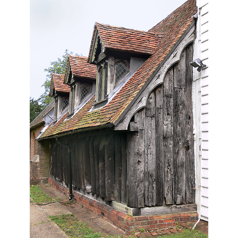
Image copyright © [in the public domain]
PD
Results: 7 records
view of church exterior - northwest view
Copyright Statement: Image copyright © [in the public domain]
Image Source: digital photograph taken 5 August 2009 by SiGarb [http://en.wikipedia.org/wiki/File:Greensted_Church_North_Side.jpg] [accessed 26 March 2012]
Copyright Instructions: PD
view of church exterior - north side - detail
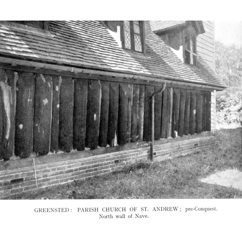
Scene Description: corresponding to the N side of the nave
Copyright Statement: Image copyright © H.M.S.O., 1923
Image Source: B&W photograph in the Royal Commission on Historical Monuments (Essex, 1916-1923)
Copyright Instructions: PD
view of church exterior - south view
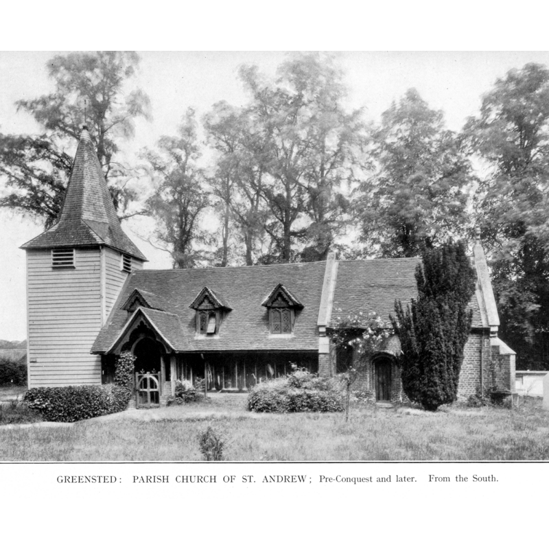
Copyright Statement: Image copyright © H.M.S.O., 1923
Image Source: B&W photograph in the Royal Commission on Historical Monuments (Essex, 1916-1923)
Copyright Instructions: PD
view of church exterior - southeast view
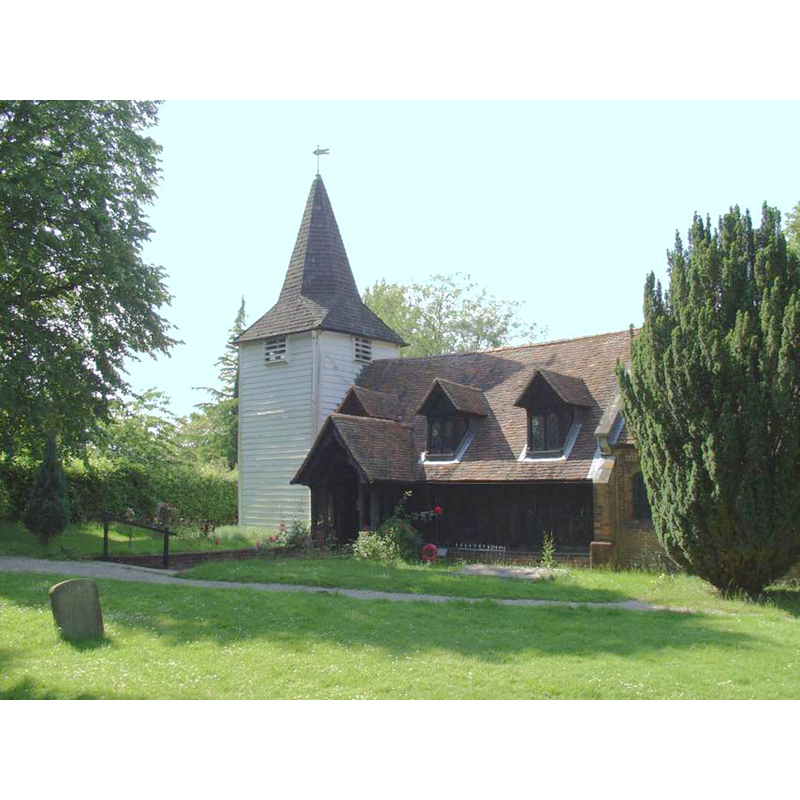
Copyright Statement: Image copyright © www.beenthere-donethat.org.uk, 2006
Image Source: digital image from www.beenthere-donethat.org.uk
Copyright Instructions: Standing permission
view of church interior - plan
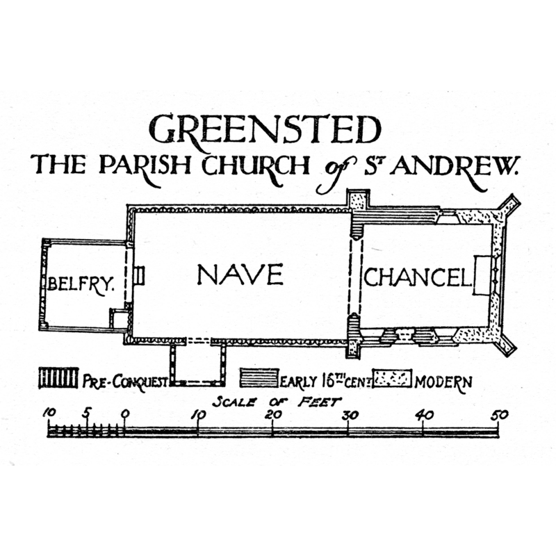
Copyright Statement: Image copyright © H.M.S.O., 1923
Image Source: B&W engraving in the Royal Commission on Historical Monuments (Essex, 1916-1923)
Copyright Instructions: PD
view of font and cover
![the modern wooden font [cf. FontNotes]](/static-50478a99ec6f36a15d6234548c59f63da52304e5/others/permission_not_available.jpg)
Scene Description: the modern wooden font [cf. FontNotes]
Copyright Statement: Image copyright © Oldpicruss, 2009
Image Source: digital photograph taken 14 August 2009 by Oldpicruss [www.flickr.com/photos/60445511@N05/6226835573/] [accessed 26 March 2012]
Copyright Instructions: PERMISSION NOT AVAILABLE -- IMAGE NOT FOR PUBLIC USE
view of stoup
Copyright Statement: Image copyright © Greensted Parish, 2006
Image Source: digital image in www.greenstedchurch.com
Copyright Instructions: PERMISSION NOT AVAILABLE -- IMAGE NOT FOR PUBLIC USE
INFORMATION
Font ID: 11820GRE
Object Type: Stoup
Font Century and Period/Style: 13th - 14th century, Medieval
Church / Chapel Name: Parish Church of St. Andrew, Greensted
Font Location in Church: Just W of the former N doorway
Church Patron Saint(s): St. Andrew [may have been dedicated to St. Edmund at some point]
Church Notes: Wooden church / log church: actually only the split-log walls are Anglo-Saxon, probably ca. 1013 -- the rest is 16th-19th century
Church Address: Church Ln, Ongar CM5 9LD, United Kingdom -- Tel.: +44 1277 532770
Site Location: Essex, East, England, United Kingdom
Directions to Site: Located 3 km W of Chipping Ongar -- Not to be mistaken with Greenstead, near Colchester, also with a church dedicated to St. Andrew
Ecclesiastic Region: Diocese of Chelmsford
Historical Region: Hundred of Ongar
Additional Comments: disappeared font(s)? the earlier font(s) of this church
Font Notes:
Click to view
There is an entry for Greensted [variant spelling] in the Domesday survey [http://opendomesday.org/place/TL5302/greensted/] [accessed 12 June 2018], but it mentions neither priest nor church in it. The Royal Commission on Historical Monuments (Essex, 1916-1923) reports: "Stoup: In log, W. of former N. doorway, recess with splayed jambs and pointed head, base repaired in cement, probably stoup, 13th or 14th-century." The Victoria County History (Essex, vol. 4, 1956) notes: "The parish church of St. Andrew [...] was probably built, in or soon after 1013 [...] The small stoup with a pointed head to the west of the former north door probably dates from the 13th or 14th century [...] The stone font is of the 19th century." Bettley & Pevsner (2007), however, write: "Font. Of oak, shaped with a hand adze, 1987; by by Sir Hugh Casson, made by Russell Thomas." This modern font has a square basin with chamfered angles and upper rim, resting on four legs that are constructional; the inner basin is round and is covered with a round lid, also wooden; the font is made of multiple planks of wood joined together. The Parish web site [www.greenstedchurch.com] shows an image of the 'stoup' and notes: "Many people know the hole as a leper squint, but archaeologists doubt this. It is more likely, given the fact it is adjacent to the original doorway, to have been a small window, or that the ledge held a holy water stoup in the Middle Ages." [NB: we have no information on the earlier font(s) of this church]. [NB: the spelling of this village varies and both 'Greensted' and 'Greenstead' have been used [e.g., the VCH uses 'Greenstead', in Ongar Hundred]. There is another 'Greenstead', also with a parish church dedicated to St. Andrew, just SE of Colchester]
Credit and Acknowledgements: We are grateful to the webmaster of www.beenthere-donethat.org.uk, for the photograph of this church.
COORDINATES
UTM: 31U 308298 5731801
Latitude & Longitude (Decimal): 51.70436, 0.22555
Latitude & Longitude (DMS): 51° 42′ 15.7″ N, 0° 13′ 31.98″ E
MEDIUM AND MEASUREMENTS
Material: wood
REFERENCES
- Victoria County History [online], University of London, 1993-. URL: https://www.british-history.ac.uk.
- Bettley, James, Essex, New Haven and London: Yale University Press, 2007, p. 436
- Great Britain. Royal Commission on Historical Monuments, An Inventory of the historical monuments in Essex, London: H.M. Stationary Office, 1916-1923, vol. 2: 112, plan on p. 112 and pl. between p. 112-113