Gunton in Lowestoft
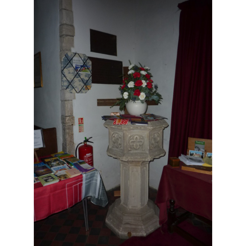
Image copyright © Peggy Cannell, 2013
CC-BY-SA-3.0
Results: 2 records
view of font and cover
Scene Description: the font of the ca.1700 re-building of the church? [cf. FontNotes]
Copyright Statement: Image copyright © Peggy Cannell, 2013
Image Source: digital photograph taken by Peggy Cannell [www.picturesofengland.com/img/X/1162078.jpg] [accessed 19 September 2013] CCL
Copyright Instructions: CC-BY-SA-3.0
view of church exterior - southeast view
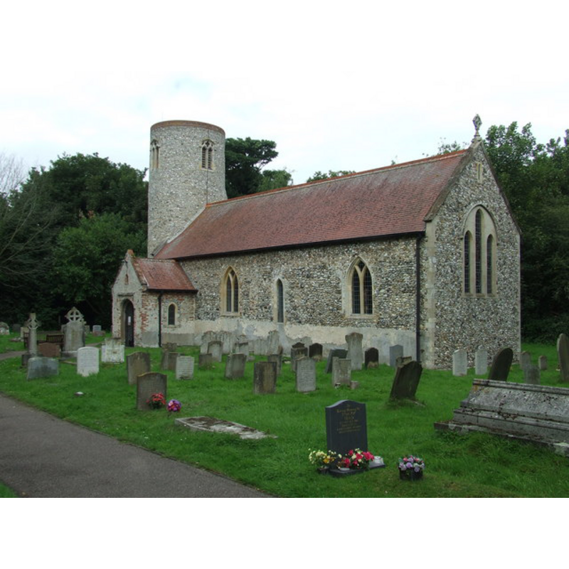
Copyright Statement: Image copyright © Keith Evans, 2008
Image Source: digital photograph taken 29 June 2008 by Keith Evans [www.geograph.org.uk/photo/1420311] [accessed 19 September 2013]
Copyright Instructions: CC-BY-SA-3.0
INFORMATION
Font ID: 11713GUN
Object Type: Baptismal Font1, fragment?
Font Century and Period/Style: 12th century, Norman
Church / Chapel Name: Parish Church of St. Peter
Font Location in Church: In the churchyard ca. 1846 [cf. FontNotes]
Church Patron Saint(s): St. Peter
Church Notes: round-tower church
Church Address: Church Lane, Lowestoft, Suffolk, NR32 4LE, UK
Site Location: Suffolk, East Anglia, England, United Kingdom
Directions to Site: Located on the A12, 3 km NW of Lowestoft, a suburb of it now
Ecclesiastic Region: Diocese of St Edmundsbury and Ipswich
Historical Region: Hundred of Mutford
Additional Comments: damaged font / broken font : is it the Norman font of this church reported in 1846 in the churchyard?
Font Notes:
Click to view
Suckling (1846-1848) writes: "There is a modern font in the interior, which is neatly fitted up; and a holy-water stoup may be discerned at the entrance by the south door [...] and a broken font [...] on the south side of the church-yard". The original medieval church had been re-built ca. 1700, the possible date of the modern font inside, and has been renovated since; the new font, an octagonal one, is located at the west end of the nave, behind the bank of benches on the north side; we have no information on the whereabouts of the font and stoup noted in Suckling [cf. supra]. [NB: the fabric of the church goes back to the late Norman period, so the broken font may belong to that period -- we have no information on the date of the stoup, and therefore is not listed separately in the Index].
COORDINATES
UTM: 31U 415148 5817386
Latitude & Longitude (Decimal): 52.5, 1.75
Latitude & Longitude (DMS): 52° 30′ 0″ N, 1° 45′ 0″ E
MEDIUM AND MEASUREMENTS
Material: stone
REFERENCES
- Suckling, Alfred, The History and Antiquities of the County of Suffolk, with genealogical and architectural notices of its several towns and villages, London: John Weale [...], 1846-1848, vol. 2: 8