Hopton / Hopton-on-Sea / Hopton by Lowestoft / Hotuna
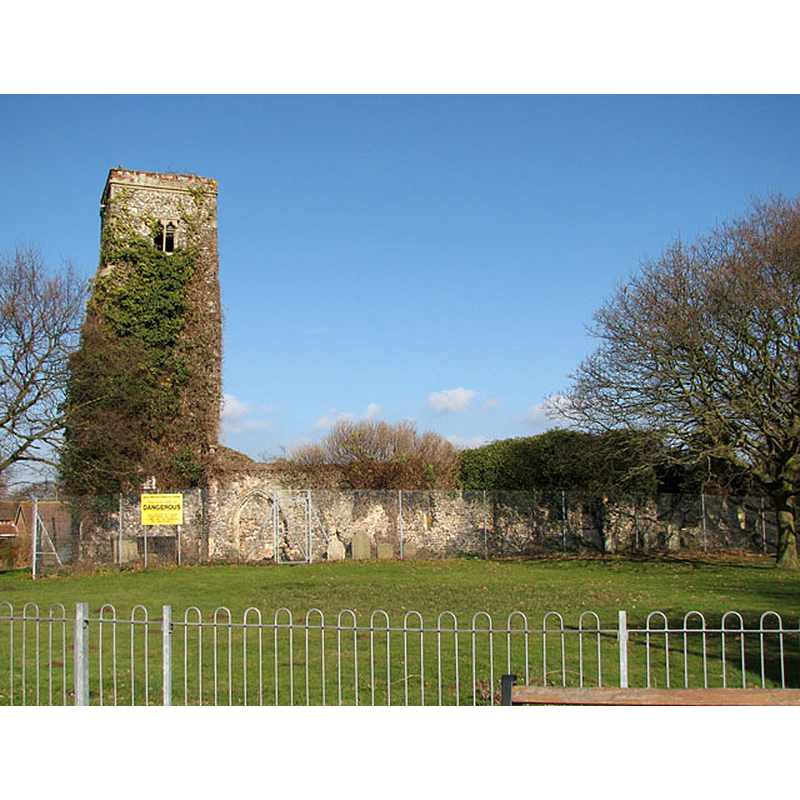
Image copyright © Evelyn Simak, 2010
CC-BY-SA-2.0
Results: 4 records
view of church exterior
Scene Description: Source caption: "The preserved ruin of St Margaret's church, consisting of chancel and north chapel, nave and north aisle, dates from the first half of the 14th century. The building caught fire in 1865. [...] A new church was built at a different site in 1866."
Copyright Statement: Image copyright © Evelyn Simak, 2010
Image Source: digital photograph taken 20 February 2010 by Evelyn Simak [www.geograph.org.uk/photo/1717781] [accessed 7 September 2015]
Copyright Instructions: CC-BY-SA-2.0
information
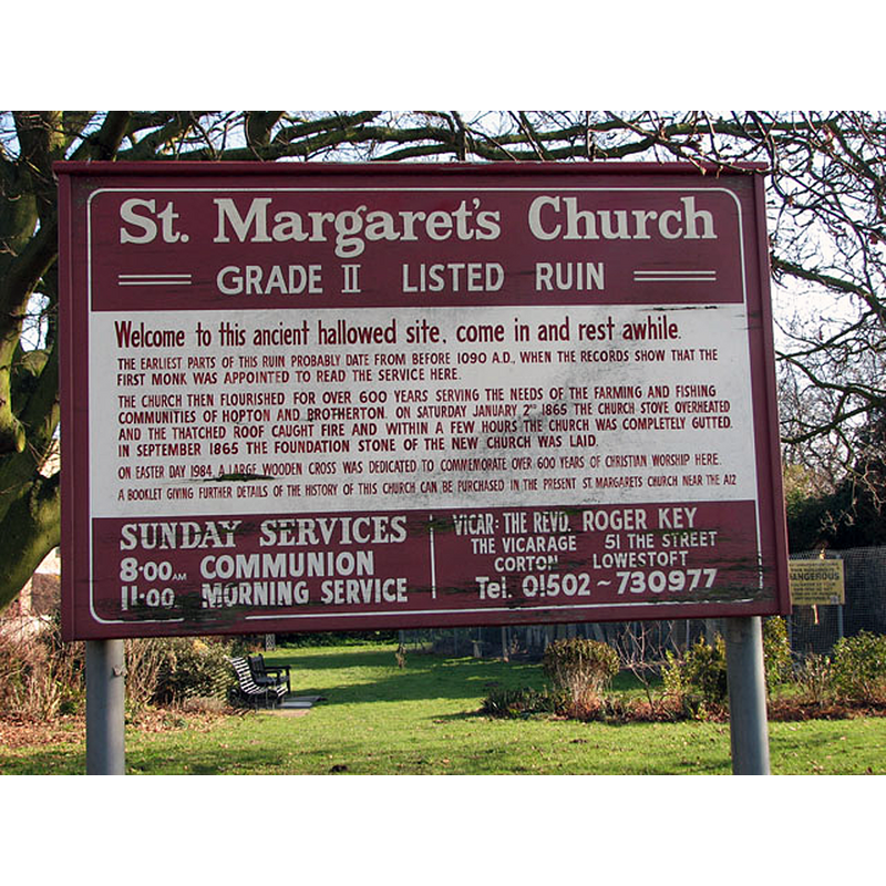
Scene Description: Source caption: "The ruined church of St Margaret - information board"
Copyright Statement: Image copyright © Evelyn Simak, 2010
Image Source: digital photograph taken 20 February 2010 by Evelyn Simak [www.geograph.org.uk/photo/1717785] [accessed 7 September 2015]
Copyright Instructions: CC-BY-SA-2.0
symbol - shield - the instruments of the Passion
![[cf. Font notes]](/static-50478a99ec6f36a15d6234548c59f63da52304e5/others/image_not_available.jpg)
Scene Description: [cf. Font notes]
![[cf. Font notes]](/static-50478a99ec6f36a15d6234548c59f63da52304e5/bsi-testing-site/others/image_not_available.jpg)
symbol - shield - Trinity
Scene Description: [cf. Font notes]
INFORMATION
Font ID: 11712HOP
Object Type: Baptismal Font1
Font Century and Period/Style: 15th century, Perpendicular
Workshop/Group/Artisan: heraldic font
Church / Chapel Name: Parish Church of St. Margaret
Font Location in Church: Inside the church ca. 1850
Church Patron Saint(s): St. Margaret of Antioch [aka Margaret the Virgin, Marina]
Church Address: Lowestoft Road, Hopton on Sea, Norfolk NR31 9BB, United KIngdom
Site Location: Norfolk, East Anglia, England, United Kingdom
Directions to Site: Located off the A12, half way between Lowestoft to the S, and Gt. Yarmouth to the N [NB: not to be mistaken with the other Hopton, between Barningham and Garboldisham]
Ecclesiastic Region: Diocese of Norfolk
Historical Region: Hundred of Blackburn [in Domesday] -- formerly Suffolk?
Additional Comments: destroyed font? (was the old font destroyed in the 1865 fire?)
Font Notes:
Click to view
There is an entry for Hopton, in the Hundred of Blackburn, in the Domesday survey [http://opendomesday.org/place/TG5200/hopton/] [accessed 7 September 2015], that matches the location of Hopton on Sea, just east of the A12, and the Lowestoft Road; it mentions neither cleric nor church in it. The present font here is noted in Suckling (1846-1848): "The font is octangular, of a very usual pattern. On shields in some of its panels are the emblems of the Passion, and of the Trinity." Parker (1855) notes a Perpendicular font in this church. [NB: the National Gazetter of 1868 puts this Hopton in Suffolk -- the re-drawing of the borders in 1974 put this Hopton in Norfolk]. The present whereabouts of this font are unknown. The entry for the parish church at Hopton-on-Sea in English Heritage [Listing NGR: TG5241500040] (1954) has: "Hexagonal lobed font with central drum and orbiting marble shafts." [NB: this is a modern font introduced in Teulon's 1866-1867 new church, buil;t in a different location from the ruins of Old St Margaret's].
COORDINATES
UTM: 31U 413822 5821652
Latitude & Longitude (Decimal): 52.538134, 1.729368
Latitude & Longitude (DMS): 52° 32′ 17.28″ N, 1° 43′ 45.73″ E
MEDIUM AND MEASUREMENTS
Material: stone
Font Shape: octagonal, mounted
Basin Interior Shape: round
Basin Exterior Shape: octagonal
REFERENCES
- Parker, John Henry, The Ecclesiastical and architectural topography of England [...] Suffolk, 1855, [unpaged]
- Suckling, Alfred, The History and Antiquities of the County of Suffolk, with genealogical and architectural notices of its several towns and villages, London: John Weale [...], 1846-1848, vol. 2: 26