Steeple Bumpstead / Bumsted / Bumstede / Bumstede ad Trim
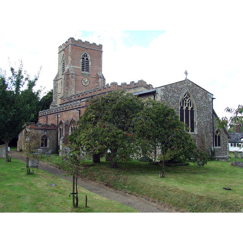
Image copyright © Keith Evans, 2012
CC-BY-SA-2.0
Results: 4 records
view of church exterior - southeast view
Copyright Statement: Image copyright © Keith Evans, 2012
Image Source: digital phptphgraph taken 4 October 2012 by Keith Evans [www.geograph.org.uk/photo/3240737] [accessed 18 November 2017]
Copyright Instructions: CC-BY-SA-2.0
view of church interior - nave - looking east
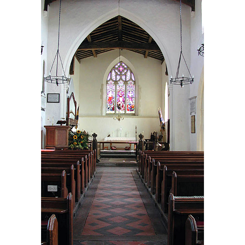
Copyright Statement: Image copyright © John Salmon, 2007
Image Source: digital image of a photograph taken in 2001 by John Salmon [www.geograph.org.uk/photo/334755] [accessed 18 November 2017]
Copyright Instructions: CC-BY-SA-2.0
view of font

Copyright Statement: Image copyright © David Robarts, 2010
Image Source: digital photograph taken 12 October 2010 by David Robarts [www.flickriver.com/places/United+Kingdom/England/Steeple+Bumpstead/recent/] [accessed 18 November 2017]
Copyright Instructions: PERMISSION NOT AVAILABLE -- IMAGE NOT FOR PUBLIC USE
symbol - shield - blank - in a quatrefoil - 7
Scene Description: [cf. Font notes]
Copyright Statement: Image copyright © David Robarts, 2010
Image Source: digital photograph taken 12 October 2010 by David Robarts [www.flickriver.com/places/United+Kingdom/England/Steeple+Bumpstead/recent/] [accessed 18 November 2017]
Copyright Instructions: PERMISSION NOT AVAILABLE -- IMAGE NOT FOR PUBLIC USE
INFORMATION
Font ID: 11707STE
Object Type: Baptismal Font1
Font Century and Period/Style: 15th century, Perpendicular
Workshop/Group/Artisan: heraldic font
Church / Chapel Name: Parish Church of St. Mary
Font Location in Church: Inside the church, beneath the tower
Church Patron Saint(s): St. Mary the Virgin
Church Notes: original church 11thC
Church Address: 3 Church Street, Steeple Bumpstead, Essex, CB9 7DG, United Kingdom -- Tel.: +44 1440 731687
Site Location: Essex, East, England, United Kingdom
Directions to Site: Located off the B1054-B1057 crossroads, 5 km S of Haverhill, about 15 km ENE of Saffron Walden
Ecclesiastic Region: Diocese of Chelmsford
Historical Region: Hundred of Hinckford
Additional Comments: disappeared font? (the one from the 11thC church here)
Font Notes:
Click to view
There are six entries for [Steeple] Bumpstead [variant spelling] in the Domesday survey [http://opendomesday.org/place/TL6741/steeple-bumpstead/] [accessed 18 November 2017], none of which mentions priest or church in it. The Royal Commission on Historical Monuments (Essex, 1916-1923) notes: "Font: In tower, with octagonal stem and bowl, seven faces of bowl with quatrefoil panels and plain shields, 15th-century." In Pevsner (1976) and in Bettley & Pevsner (2007): "Font. Octagonal, Perp[endicular], with quatrefoils carrying shields."
COORDINATES
UTM: 31U 324896 5768824
Latitude & Longitude (Decimal): 52.042332, 0.446726
Latitude & Longitude (DMS): 52° 2′ 32.39″ N, 0° 26′ 48.22″ E
MEDIUM AND MEASUREMENTS
Material: stone
Font Shape: octagonal, mounted
Basin Interior Shape: round
Basin Exterior Shape: octagonal
REFERENCES
- Bettley, James, Essex, New Haven and London: Yale University Press, 2007, p. 748
- Great Britain. Royal Commission on Historical Monuments, An Inventory of the historical monuments in Essex, London: H.M. Stationary Office, 1916-1923, vol. 1: 290
- Pevsner, Nikolaus, Essex, Harmondsworth: Penguin, 1976, p. 370