Stanford Rivers
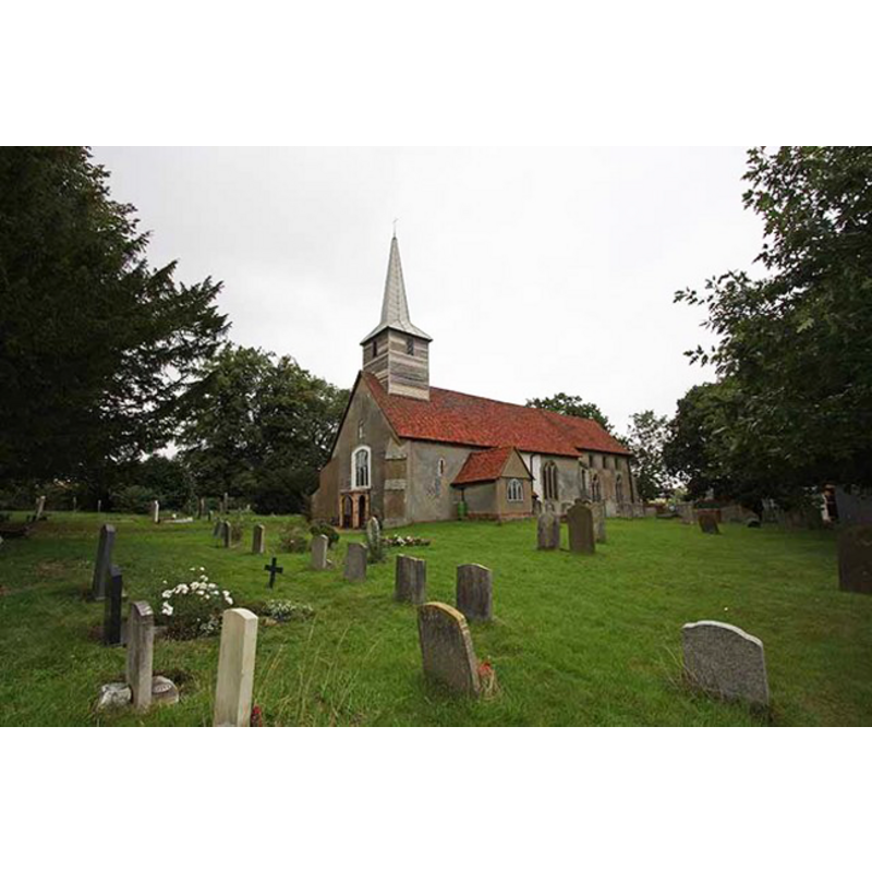
Image copyright © John Salmon, 2008
CC-BY-SA-3.0
Results: 5 records
B01: design element - architectural - arcade - blind - pointed arches - 16

Scene Description: two per side

view of church exterior - southwest view
Copyright Statement: Image copyright © John Salmon, 2008
Image Source: digital photograph taken 13 September 2008 by John Salmon [www.geograph.org.uk/photo/962484] [accessed 28 March 2012]
Copyright Instructions: CC-BY-SA-3.0
view of church interior - west gallery
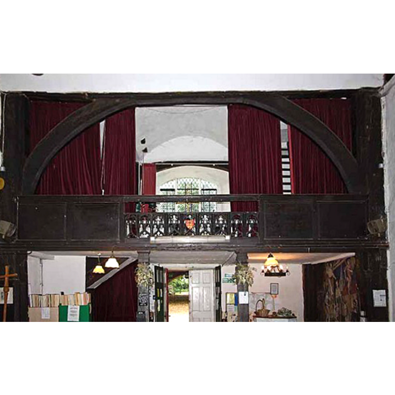
Scene Description: the top of the basin and its cover are discernible right under the gallery, on the north (right) side
Copyright Statement: Image copyright © John Salmon, 2008
Image Source: digital photograph taken 13 September 2008 by John Salmon [www.geograph.org.uk/photo/962523] [accessed 28 March 2012]
Copyright Instructions: CC-BY-SA-3.0
view of church interior - nave - looking west
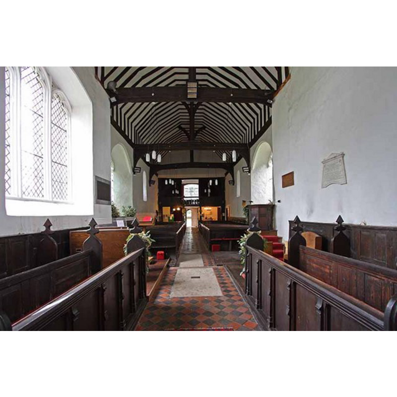
Copyright Statement: Image copyright © John Salmon, 2008
Image Source: digital photograph taken 13 September 2008 by John Salmon [www.geograph.org.uk/photo/962515] [accessed 28 March 2012]
Copyright Instructions: CC-BY-SA-3.0
view of church interior - nave - looking east
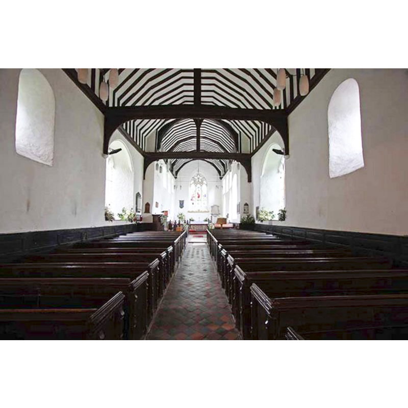
Copyright Statement: Image copyright © John Salmon, 2008
Image Source: digital photograph taken 13 September 2008 by John Salmon [www.geograph.org.uk/photo/962507] [accessed 28 March 2012]
Copyright Instructions: CC-BY-SA-3.0
INFORMATION
Font ID: 11706STA
Object Type: Baptismal Font1
Font Date: ca. 1200?
Font Century and Period/Style: 12th - 13th century, Early English
Church / Chapel Name: Parish Church of St. Margaret of Antioch
Font Location in Church: Inside the church, at the W end of the nave, N side
Church Patron Saint(s): St. Margaret of Antioch [aka Margaret the Virgin, Marina]
Church Address: Mutton Row, Stanford Rivers, Essex CM5 9QS, UK
Site Location: Essex, East, England, United Kingdom
Directions to Site: Located 3 km SW of Chipping Ongar
Ecclesiastic Region: Diocese of Chelmsford
Historical Region: Hundred of Ongar
Font Notes:
Click to view
Noted in the Royal Commission on Historical Monuments (Essex, 1916-1923): "Font: of Barnack stone, octagonal font with two pointed panels in each face, round stem with eight detached shafts, early 13th-century." The Victoria County History (Essex, vol. 4, 1956) notes: "The advowson of Stanford Rivers was acquired soon after the Norman Conquest by the priory of Rumilly-le-Comte, which probably had it from Eustace, Count of Boulogne. [...] The nave was built in the middle of the 12th century. [...] The early-13th-century font is of Barnack stone, the octagonal bowl having sunk panels with pointed heads and the stem having eight detached shafts." In Pevsner (1976): "Font. Of the usual Purbeck type of c.1200, but of Barnack stone. Octagonal with two shallow pointed arches to each side." Noted much the same in Bettley & Pevsner (2007).
COORDINATES
UTM: 31U 307668 5729670
Latitude & Longitude (Decimal): 51.68501, 0.21763
Latitude & Longitude (DMS): 51° 41′ 6.04″ N, 0° 13′ 3.47″ E
MEDIUM AND MEASUREMENTS
Material: stone, limestone (Barnack stone)
Font Shape: octagonal, mounted
Basin Interior Shape: round
Basin Exterior Shape: octagonal
REFERENCES
- Victoria County History [online], University of London, 1993-. URL: https://www.british-history.ac.uk.
- Bettley, James, Essex, New Haven and London: Yale University Press, 2007, p. 734
- Great Britain. Royal Commission on Historical Monuments, An Inventory of the historical monuments in Essex, London: H.M. Stationary Office, 1916-1923, vol. 2: 221
- Pevsner, Nikolaus, Essex, Harmondsworth: Penguin, 1976, p. 365