Lawford / Laleforda / Leleforda
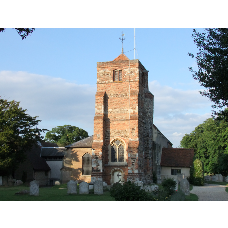
Image copyright © Paul Farner, 2010
CC-BY-SA-2.0
Results: 1 records
view of church exterior - west view
Scene Description: Source caption: "St. Mary the Virgin church, Lawford. St Mary's is at the end of Church Hill, it is a 13th/14th Century building steeped in history. The church has changed little over the centuries."
Copyright Statement: Image copyright © Paul Farner, 2010
Image Source: digital photograph taken 12 June 2010 by Paul Farner [www.geograph.org.uk/photo/1917448] accessed 29 January 2015]
Copyright Instructions: CC-BY-SA-2.0
INFORMATION
Font ID: 11683LAW
Object Type: Stoup
Font Century and Period/Style: 14th century (late?), Medieval
Church / Chapel Name: Parish Church of St. Mary
Font Location in Church: In the S porch
Church Patron Saint(s): St. Mary the Virgin
Church Address: Church Hill, Lawford, Essex, CO112JX, UK
Site Location: Essex, East, England, United Kingdom
Directions to Site: Located 12 km NE of Colchester, on the S bank of the Stour
Ecclesiastic Region: Diocese of Chelmsford
Historical Region: Hundred of Tendring [in Domesday]
Additional Comments: disappeared font? (the original font of the 14thC church here)
Font Notes:
Click to view
There are three entries for Lawford [variant spelling] in the Domesday survey [http://domesdaymap.co.uk/place/TM0831/lawford/] [accessed 29 January 2015], neither of which mention cleric or church in it. A holy-water stoup is reported in this church in the Royal Commission on Historical Monuments (Essex, 1916-1923): "Stoup: In S. porch--with moulded jambs and cinquefoiled head, broken bowl, late 14th-century". Only a late font is mentioned in Pevsner (1976) and in Bettley & Pevsner (2007): "Font. C18 on baluster stem." English Heritage [Listing NGR: TM0890331571] (1966) reports a "Stone/cement urn font, moulded base, moulded petal base with ringed bowl stem and moulded rim" in this 14th-century church. This modern font is located at the W end of the nave. [NB: we have no information on the earlier font(s) of this church]
COORDINATES
UTM: 31U 365144 5756561
Latitude & Longitude (Decimal): 51.9434, 1.038
Latitude & Longitude (DMS): 51° 56′ 36.24″ N, 1° 2′ 16.8″ E
MEDIUM AND MEASUREMENTS
Material: stone
REFERENCES
- Great Britain. Royal Commission on Historical Monuments, An Inventory of the historical monuments in Essex, London: H.M. Stationary Office, 1916-1923, vol. 3: 153
- Pevsner, Nikolaus, Essex, Harmondsworth: Penguin, 1976, p. 260