Lambourne / Lamborn / Lamborne / Lamburn / Lamburne
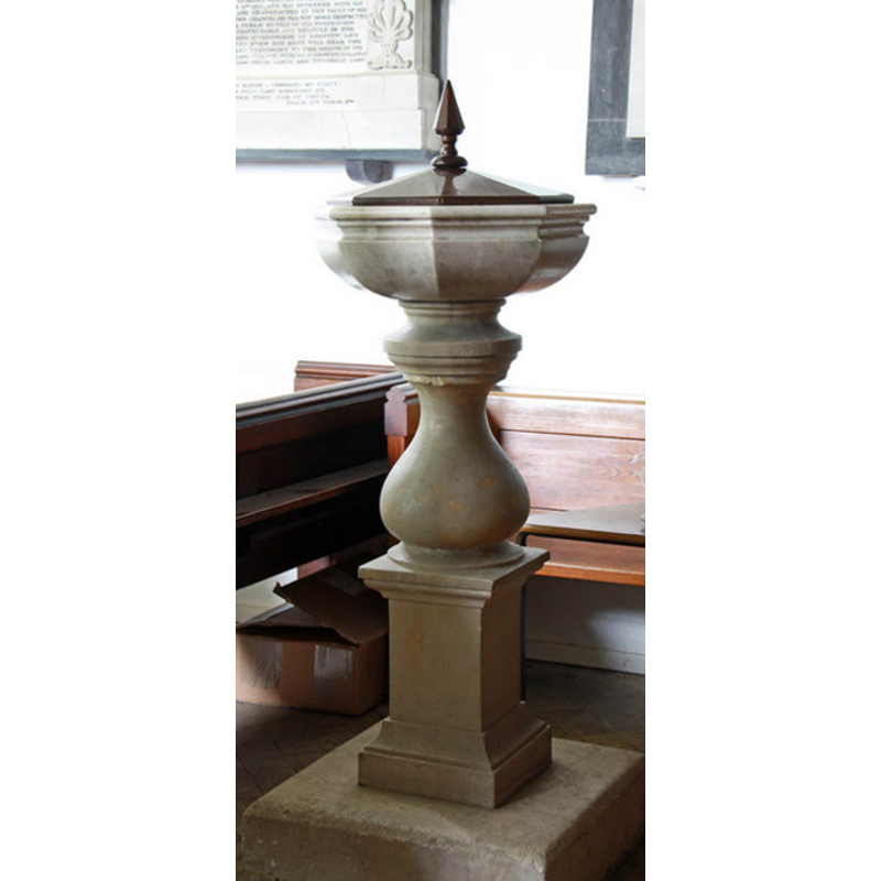
Image copyright © John Salmon, 2010
CC-BY-SA-3.0
Results: 6 records
view of font and cover
Scene Description: the modern font
Copyright Statement: Image copyright © John Salmon, 2010
Image Source: digital photograph taken 20 May 2010 by John Salmon [www.geograph.org.uk/photo/1875154] [accessed 26 March 2012]
Copyright Instructions: CC-BY-SA-3.0
view of church exterior - north portal
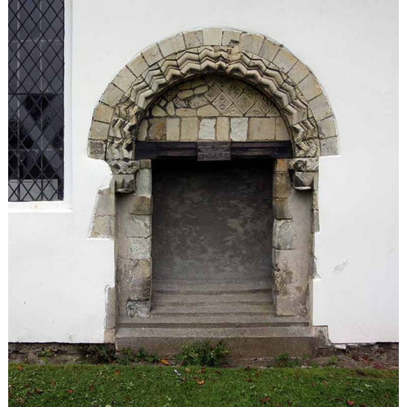
Scene Description: the Norman portal, now blocked
Copyright Statement: Image copyright © John Salmon, 2008
Image Source: digital photograph taken 13 September 2008 by John Salmon [www.geograph.org.uk/photo/962375] [accessed 26 March 2012]
Copyright Instructions: CC-BY-SA-3.0
view of church exterior - northwest view
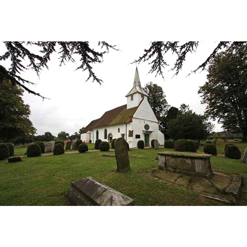
Copyright Statement: Image copyright © John Salmon, 2008
Image Source: digital photograph taken 13 September 2008 by John Salmon [www.geograph.org.uk/photo/962372] [accessed 26 March 2012]
Copyright Instructions: CC-BY-SA-3.0
view of church interior - nave - looking west
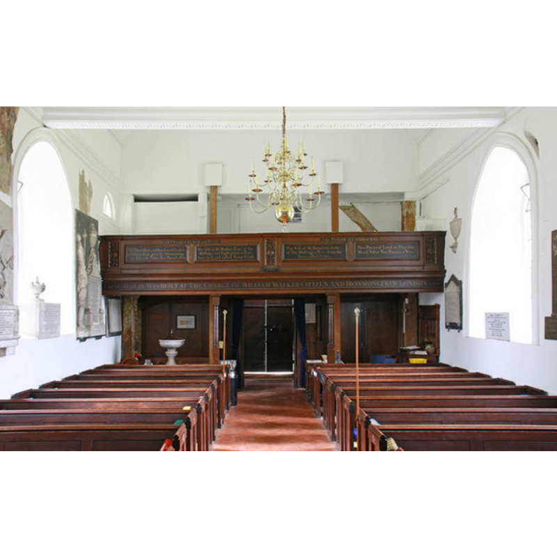
Scene Description: the font is visible at the back (west), left (south) side
Copyright Statement: Image copyright © John Salmon, 2010
Image Source: digital photograph taken 20 May 2010 by John Salmon [www.geograph.org.uk/photo/1875167] [accessed 26 March 2012]
Copyright Instructions: CC-BY-SA-3.0
view of church interior - nave - looking east
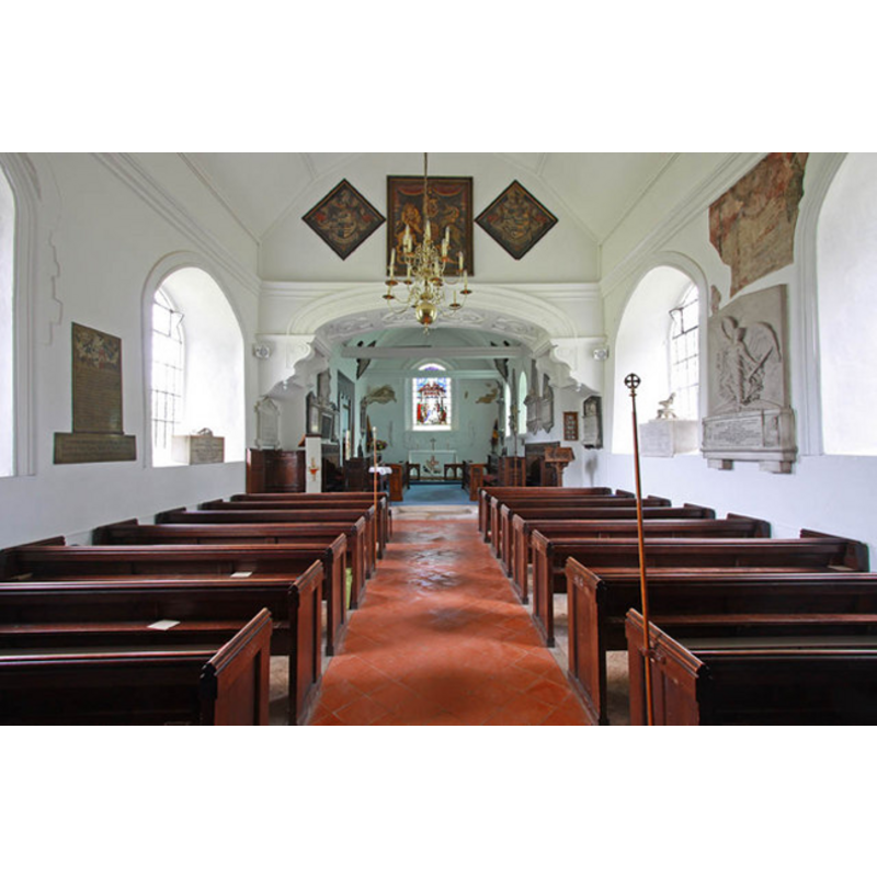
Copyright Statement: Image copyright © John Salmon, 2010
Image Source: digital photograph taken 20 May 2010 by John Salmon [www.geograph.org.uk/photo/1875150] [accessed 26 March 2012]
Copyright Instructions: CC-BY-SA-3.0
view of font and cover in context

Copyright Statement: Image copyright © www.oldlambourne.co.uk, [2006?]
Image Source: digital image in www.oldlambourne.co.uk
Copyright Instructions: PERMISSION NOT AVAILABLE -- IMAGE NOT FOR PUBLIC USE
INFORMATION
Font ID: 11674LAM
Object Type: Baptismal Font1?
Font Century and Period/Style: 12th century, Late Norman? / Transitional?
Church / Chapel Name: Parish Church of St. Mary and All Saints
Church Patron Saint(s): St. Mary the Virgin & All Saints
Church Address: Church Lane, Lambourne, Essex, RM4 1AH, UK
Site Location: Essex, East, England, United Kingdom
Directions to Site: Located off (S) the A113 [aka London Rd / Ongar Rd], SW of Chipping Ongar, NNE of central London
Ecclesiastic Region: Diocese of Chelmsford
Historical Region: Hundred of Ongar
Additional Comments: disappeared font(s) -- cf. FontNotes [contact for permit attempted but web link to webmaster is broken]
Font Notes:
Click to view
There is an entry for Lambourne [variant spelling] in the Domesday survey [http://opendomesday.org/place/TQ4796/lambourne/], but it mentions neither cleric nor church in it. The Victoria County History (Essex, vol. 4, 1956) notes the 12th-century fabric of the church, but reports a modern font in it: "The font has an 18th-century marble bowl on a tall moulded stone base." Noted in Pevsner (1976) and in Bettley & Pevsner (2007): "Font. C18 with baluster stem." The font, located in the west gallery, has a polygonal basin raised on a baluster pedestal base. [NB: the fabric of the church goes back to the 12th century but we have no information on the earlier fonts of this church]
COORDINATES
UTM: 31U 301487 5725783
Latitude & Longitude (Decimal): 51.64795, 0.13053
Latitude & Longitude (DMS): 51° 38′ 52.62″ N,, 0° 7′ 49.91″ E
LID INFORMATION
Date: 18th century?
Notes: low dome with finial
REFERENCES
- Victoria County History [online], University of London, 1993-. URL: https://www.british-history.ac.uk.
- Bettley, James, Essex, New Haven and London: Yale University Press, 2007, p. 516
- Pevsner, Nikolaus, Essex, Harmondsworth: Penguin, 1976, p. 257