Horndon-on-the-Hill / Hornindune
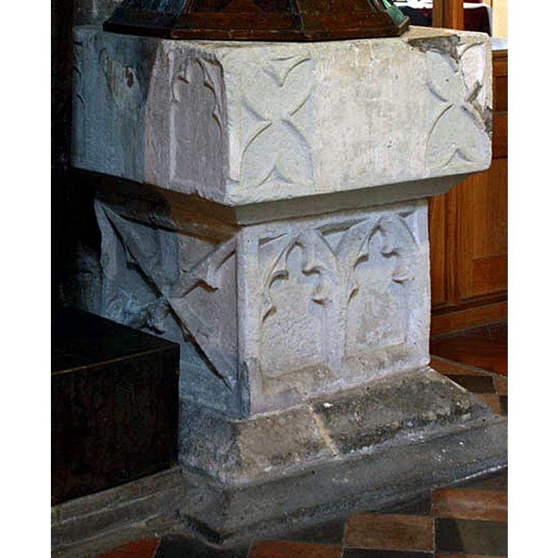
Image copyright © John Salmon, 2010
CC-BY-SA-2.5
Results: 9 records
view of font
Scene Description: notice the large damage area to the basin top left side, clearly damage caused by s metal staple in the upper rim; there is also evidence of repair damage to the top-right corner
Copyright Statement: Image copyright © John Salmon, 2010
Image Source: edited detail of a digital photograph taken 12 May 2010 by John Salmon [www.geograph.org.uk/photo/1890083] [accessed 23 December 2020]
Copyright Instructions: CC-BY-SA-2.5
view of font and cover in context
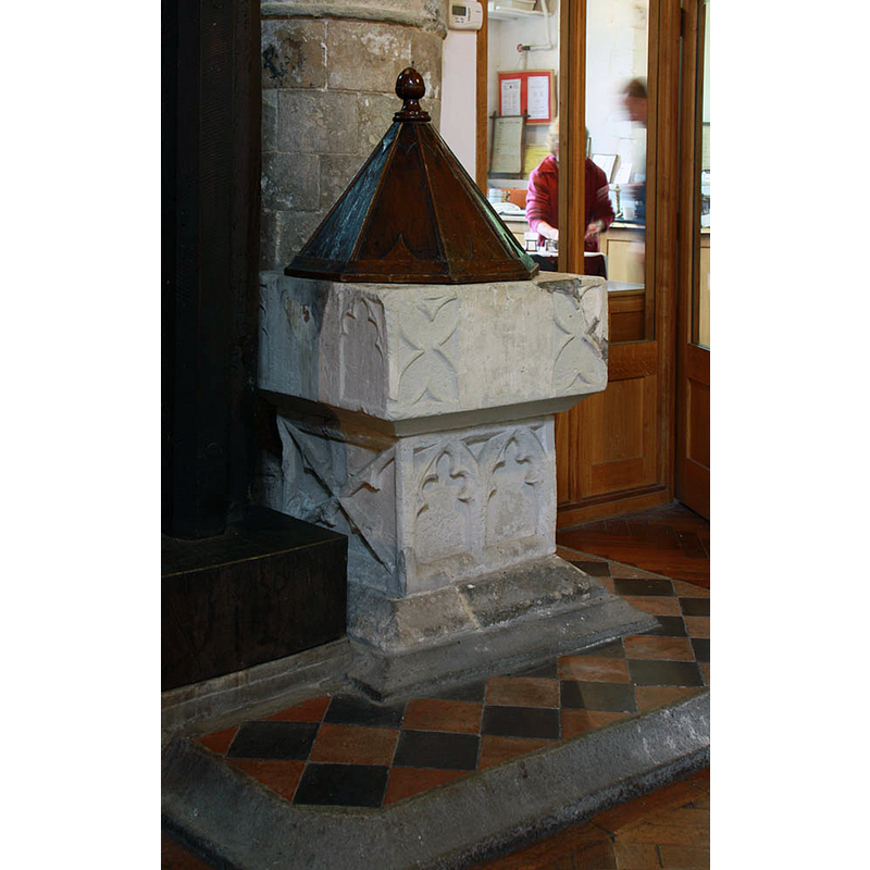
Copyright Statement: Image copyright © John Salmon, 2010
Image Source: digital photograph taken 12 May 2010 by John Salmon [www.geograph.org.uk/photo/1890083] [accessed 23 December 2020]
Copyright Instructions: CC-BY-SA-2.5
view of font
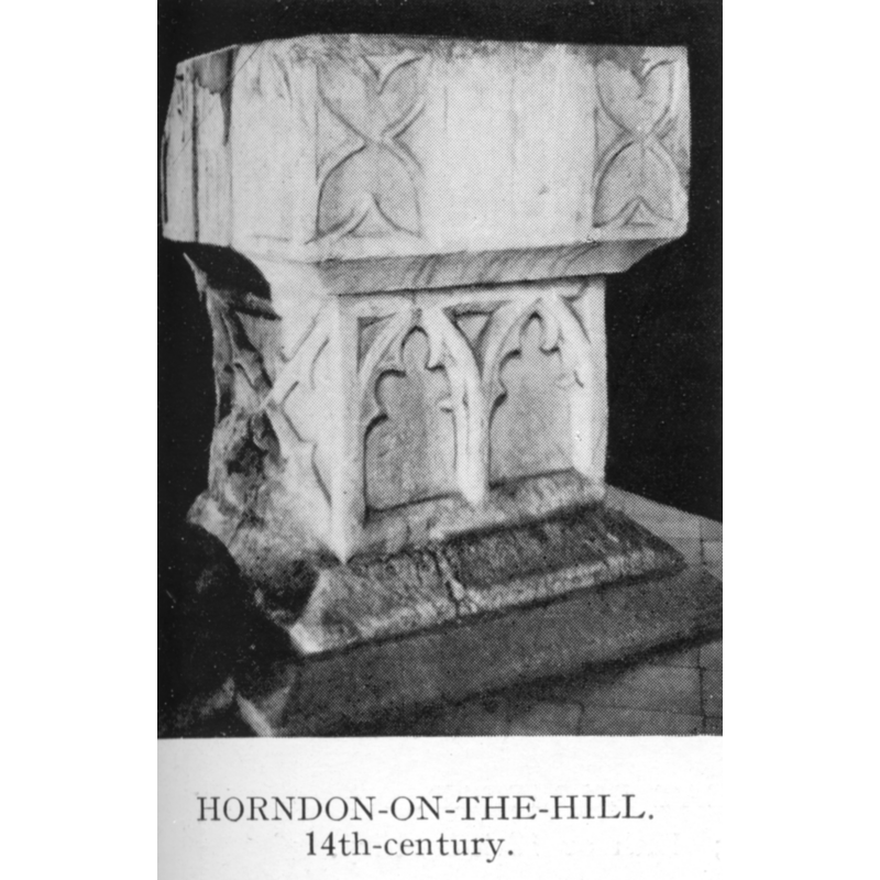
Copyright Statement: Image copyright © H.M.S.O., 1923
Image Source: digital image of an illustration in the Royal Commission on Historical Monuments (Essex, 1916-1923)
Copyright Instructions: PD
design element - motifs - panel - cusped
Scene Description: [cf. Font notes]
Copyright Statement: Image copyright © John Salmon, 2010
Image Source: edited detail of a digital photograph taken 12 May 2010 by John Salmon [www.geograph.org.uk/photo/1890083] [accessed 23 December 2020]
Copyright Instructions: CC-BY-SA-2.5
view of church exterior - southwest view
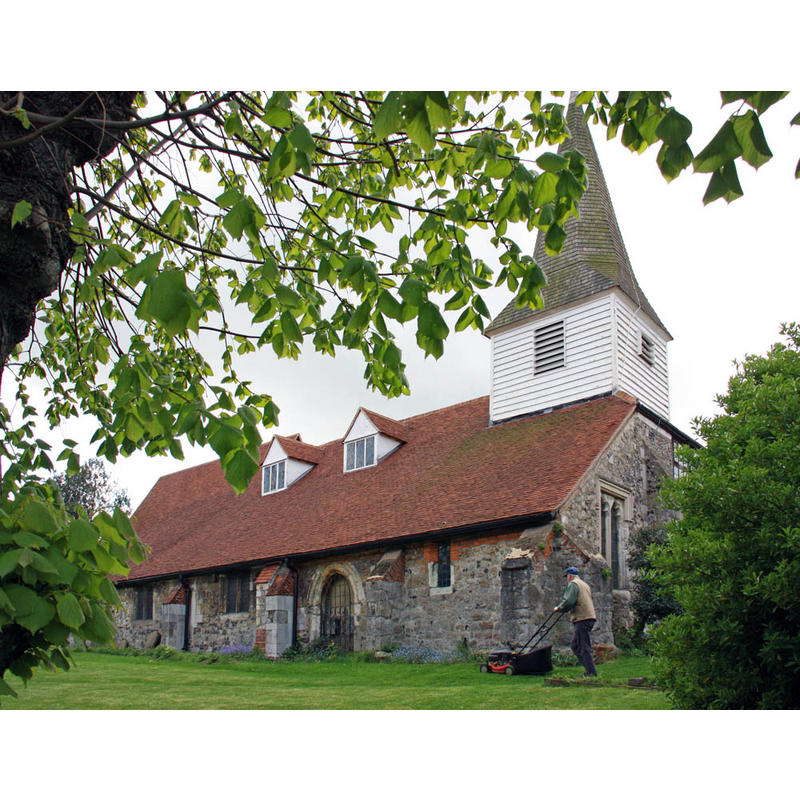
Copyright Statement: Image copyright © John Salmon, 2010
Image Source: digital photograph taken 12 May 2010 by John Salmon [www.geograph.org.uk/photo/1890104] [accessed 23 December 2020]
Copyright Instructions: CC-BY-SA-2.5
view of church exterior in context - southeast view
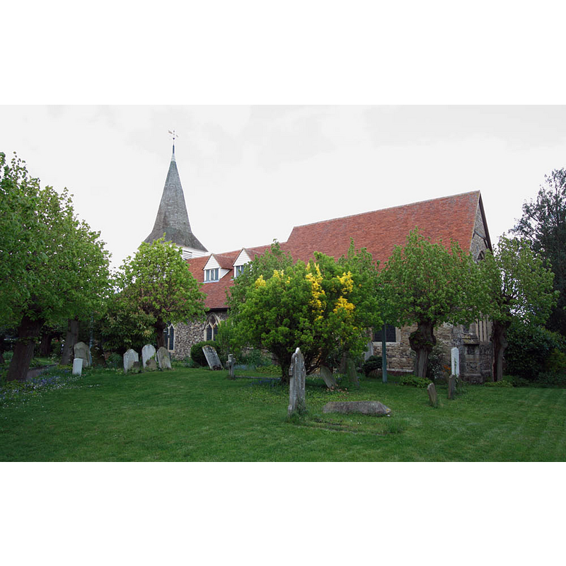
Copyright Statement: Image copyright © John Salmon, 2010
Image Source: digital photograph taken 12 May 2010 by John Salmon [www.geograph.org.uk/photo/1890050] [accessed 23 December 2020]
Copyright Instructions: CC-BY-SA-2.5
view of church interior - looking east
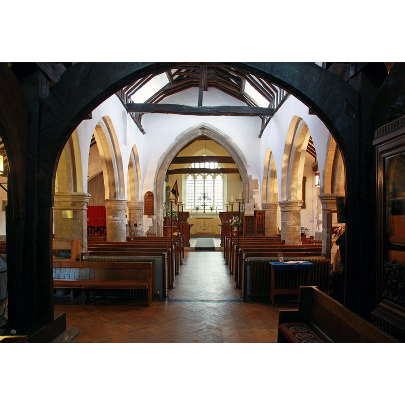
Copyright Statement: Image copyright © John Salmon, 2010
Image Source: digital photograph taken 12 May 2010 by John Salmon [www.geograph.org.uk/photo/1890100] [accessed 23 December 2020]
Copyright Instructions: CC-BY-SA-2.5
design element - motifs - tracery
Scene Description: [cf. Font notes]
Copyright Statement: Image copyright © John Salmon, 2010
Image Source: edited detail of a digital photograph taken 12 May 2010 by John Salmon [www.geograph.org.uk/photo/1890083] [accessed 23 December 2020]
Copyright Instructions: CC-BY-SA-2.5
view of church interior - plan
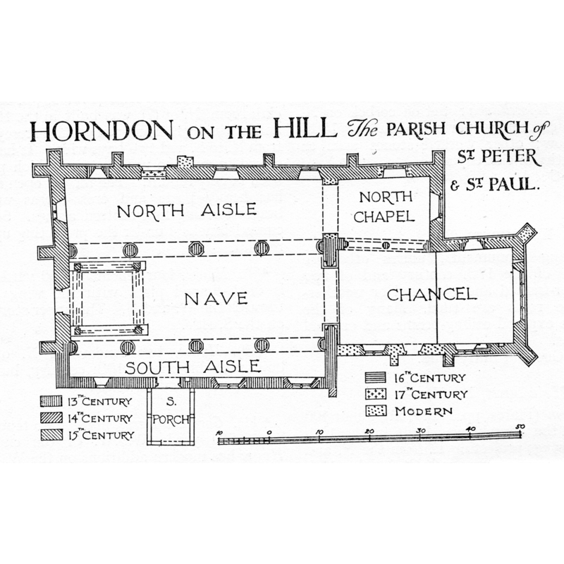
Copyright Statement: Image copyright © H.M.S.O., 1923
Image Source: digital image of an illustration in the Royal Commission on Historical Monuments (Essex, 1916-1923)
Copyright Instructions: PD
INFORMATION
Font ID: 11671HOR
Object Type: Baptismal Font1
Font Century and Period/Style: 14th century, Decorated
Church / Chapel Name: Parish Church of St. Peter and St. Paul
Font Location in Church: Inside the church, at the W end
Church Patron Saint(s): St. Peter & St. Paul
Church Notes: present building 13thC, possibly on the site of a Saxon church of which no evidence remains
Church Address: Orsett Rd, Horndon on the Hill, Stanford-le-Hope SS17 8NT, UK -- Tel.: +44 1375 891254
Site Location: Essex, East, England, United Kingdom
Directions to Site: Located off (W) theB1007, W of the A13, 8 km NNE of Tilbury, 25-30 km SSW of Chelmsford
Ecclesiastic Region: Diocese of Chelmsford [formerly Diocese of London]
Historical Region: Hiundred of Barstable
Additional Comments: disappeared font? (was there a pre-Domesday church here, as some sources suggest?)
Font Notes:
Click to view
Horndon-on-the-Hill appears in the Domesday Book of 1086 as Hornindune, but no church is mentioned in it. Noted with an illustration in the Royal Commission on Historical Monuments (Essex, 1916-1923): "The church is of some architectural interest and amongst the fittings the font is noteworthy. [...] Font: square bowl, cusped panels cut at each end of each side, square stem with similar panelling, hollow-chamfered base, 14th-century." In Pevsner (1976) and in Bettley & Pevsner (2007): "Font. C14, square bowl with some panelling; on square stem." The wooden cover is an octagonal pyramid with a ball finial. The RCHM (ibid.) also inventories a holy-water stoup, possibly of the 16th century, in the south aisle, east of the south doorway [no separate entry in this Index]
COORDINATES
UTM: 31U 319922 5711288
Latitude & Longitude (Decimal): 51.52396, 0.40413
Latitude & Longitude (DMS): 51° 31′ 26.26″ N, 0° 24′ 14.87″ E
MEDIUM AND MEASUREMENTS
Material: stone
Font Shape: square, mounted
Basin Interior Shape: round
Basin Exterior Shape: square
LID INFORMATION
Material: wood, oak?
Apparatus: no
Notes: octagonal pyramid with ball finial
REFERENCES
- Bettley, James, Essex, New Haven and London: Yale University Press, 2007, p. 498
- Great Britain. Royal Commission on Historical Monuments, An Inventory of the historical monuments in Essex, London: H.M. Stationary Office, 1916-1923, vol. 4: xliii, 75 and pl. between pp. xlii-xliii
- Pevsner, Nikolaus, Essex, Harmondsworth: Penguin, 1976, p. 146