Billericay / Byllyrica
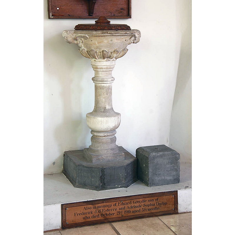
Image copyright © John Salmon, 2012
CC-BY-SA-3.0
Results: 3 records
view of font
Scene Description: Source caption: "St Mary Magdalene, Billericay - Font" -- "Font. Bowl with two cherubs' heads; C18" [cf. FontNotes]
Copyright Statement: Image copyright © John Salmon, 2012
Image Source: digital photograph 13 September 2012 by John Salmon [https://www.geograph.org.uk/photo/3150560] [accessed 5 November 2022]
Copyright Instructions: CC-BY-SA-3.0
view of church exterior - southwest view
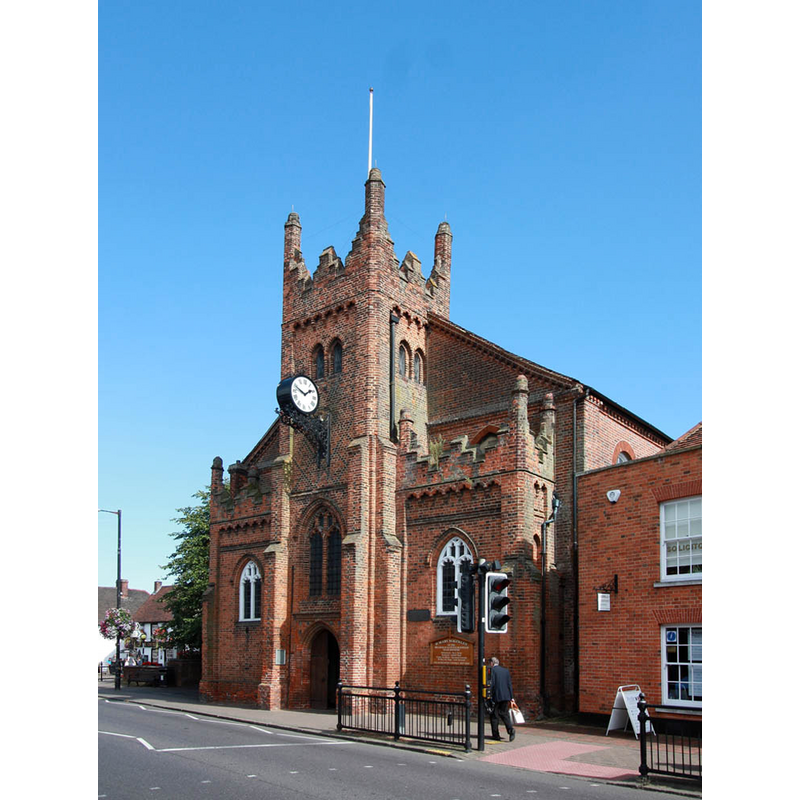
Scene Description: Source caption: "St Mary Magdalene, Billericay"
Copyright Statement: Image copyright © John Salmon, 2012
Image Source: digital photograph 13 September 2012 by John Salmon [https://www.geograph.org.uk/photo/3150571] [accessed 5 November 2022]
Copyright Instructions: CC-BY-SA-3.0
view of church interior - looking west
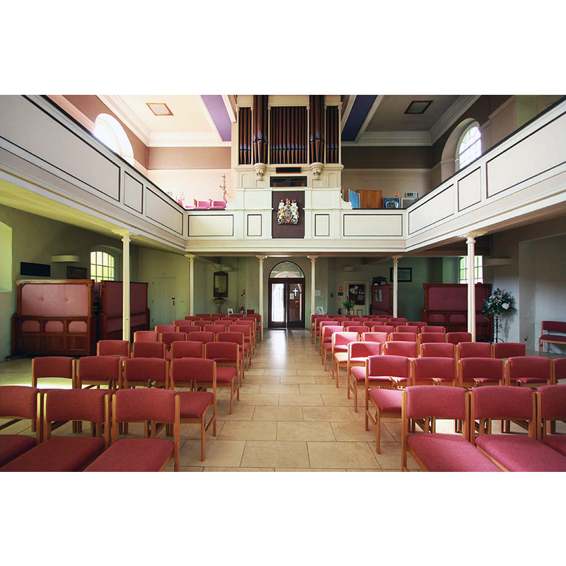
Scene Description: Source caption: "St Mary Magdalene, Billericay - West end"
Copyright Statement: Image copyright © John Salmon, 2012
Image Source: digital photograph 13 September 2012 by John Salmon [https://www.geograph.org.uk/photo/3150548] [accessed 5 November 2022]
Copyright Instructions: CC-BY-SA-3.0
INFORMATION
Font ID: 11619BIL
Object Type: Stoup
Font Century and Period/Style: 15th century, Perpendicular
Church / Chapel Name: Parish Church of St. Mary Magdalene
Font Location in Church: wall-mounted on the S jamb of the W doorway
Church Patron Saint(s): St. Mary Margdalene
Church Notes: "St. Mary Magdalen has not been used as a mainstream church since 1992 when the congregation moved to the then newly built Emmanuel." [www.billericaychurches.org -- consulted 5 April 2006]
Church Address: High St., Billericay CM12 9DZ, United Kingdom
Site Location: Essex, East, England, United Kingdom
Directions to Site: Located off the B1007, 12 km S of Chelmsford, 40 km E of London
Ecclesiastic Region: Diocese of Chelmsford
Additional Comments: disappeared font? the pre-18th century font(s)? -- disused / unused font: the 18th-century one, after 1992
Font Notes:
Click to view
There is no entry for Billericay in the Dmesday survey. A holy-water stoup is noted in the Royal Commission on Historical Monuments (Essex, 1916-1923): "In N. porch--recess with moulded four-centred arch in a square head with rosettes in the spandrels and a moulded label, 15th-century." An 18th-century font is noted in Pevsner (1976): "Font. Bowl with two cherubs' heads; C18" [not listed in this Index on account of its late date]. The entry for Great Bursted in he BHO ['Great Burstead', in An Inventory of the Historical Monuments in Essex, Volume 4, South east (London, 1923), pp. 52-58. British History Online http://www.british-history.ac.uk/rchme/essex/vol4/pp52-58 [accessed 5 November 2022]] includes a brief entry for the church in Billirecay; it mentions the stoup: "Stoup: S. of W. doorway, externally, recess with square head and stone sill, basin destroyed, late 15th-century." The church web site [https://www.billericaychurches.org/stmm/st-marys-history.html] [accessed 5 November 2022] notes: "On the south jamb of the doorway are seen the remains of a holy water stoup." [NB: the original church was built ca. 1342, later rebuilt in the late 15th century and changes made in the 18th century -- we have no information about the original font of this church]
COORDINATES
UTM: 31U 321320 5722821
Latitude & Longitude (Decimal): 51.628, 0.4184
Latitude & Longitude (DMS): 51° 37′ 40.8″ N, 0° 25′ 6.24″ E
MEDIUM AND MEASUREMENTS
Material: stone
REFERENCES
- Great Britain. Royal Commission on Historical Monuments, An Inventory of the historical monuments in Essex, London: H.M. Stationary Office, 1916-1923, vol. 4: 55
- Pevsner, Nikolaus, Essex, Harmondsworth: Penguin, 1976, p. 86