Whitchurch nr. Aldeminster / Witecerce
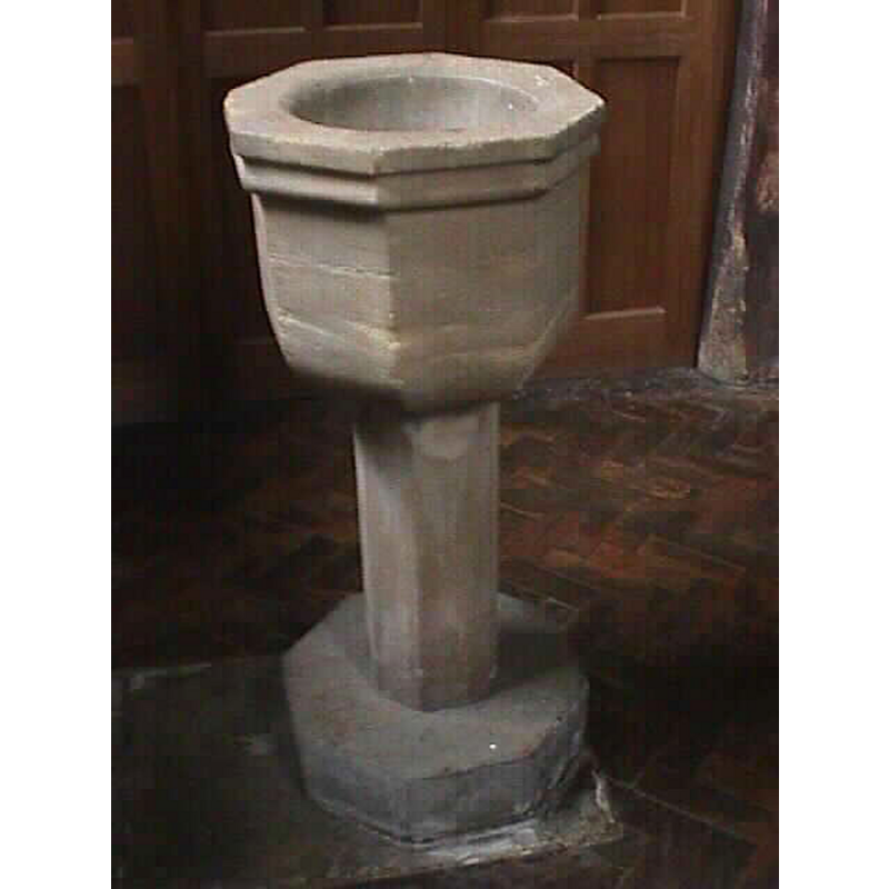
Image copyright © John Wilkes, 2006
Image and permission received (e-mail of 17 March 2006)
Results: 5 records
view of font
Scene Description: the 18th-century font
Copyright Statement: Image copyright © John Wilkes, 2006
Image Source: digital photograph by John Wilkes [www.allthecotswolds.com]
Copyright Instructions: Image and permission received (e-mail of 17 March 2006)
view of church exterior - west view
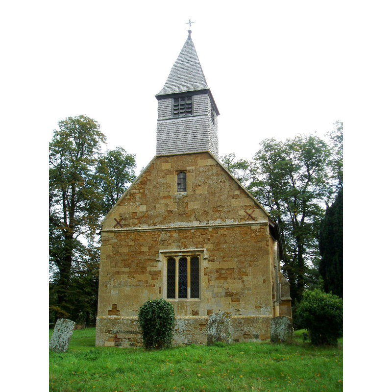
Copyright Statement: Image copyright © Aidan McRae Thomson, 2015
Image Source: digital photograph taken by Aidan McRae Thomson [http://warwickshirechurches.weebly.com/uploads/1/3/2/1/13210589/6499337_orig.jpg] [accessed 19 January 2015]
Copyright Instructions: Standing permission
view of church exterior - southeast view
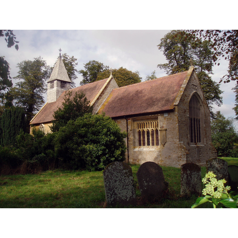
Copyright Statement: Image copyright © Aidan McRae Thomson, 2015
Image Source: digital photograph taken by Aidan McRae Thomson [http://warwickshirechurches.weebly.com/whitchurch---st-mary.html] [accessed 19 January 2015]
Copyright Instructions: Standing permission
view of church exterior in context
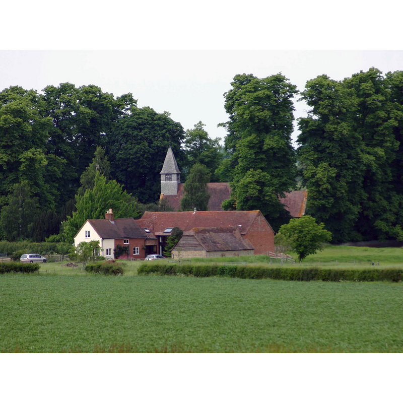
Scene Description: Source caption: "The Medieval village of Whitchurch. Looking NNW from the lane from Crimscote to Wimpstone. All that appears to remain of the village is the church and a farm."
Copyright Statement: Image copyright © David P Howard, 2010
Image Source: digital photograph taken 5 June 2010 by David P Howard [www.geograph.org.uk/photo/1901917] [accessed 19 January 2015]
Copyright Instructions: CC-BY-SA-2.0
view of church interior - nave - looking east
![Source caption: "St Mary's church near Alderminster in Warwickshire used to be surrounded by the village of Whitchurch. The village was cleared by the 16th century for sheep farming but the church remains in use, despite its splendid near-isolation. [...] The church can trace its history back to circa 908AD and the windows shown on the side wall of the church reputedly came from Evesham Cathedral."](/static-50478a99ec6f36a15d6234548c59f63da52304e5/compressed/1150208033_compressed.png)
Scene Description: Source caption: "St Mary's church near Alderminster in Warwickshire used to be surrounded by the village of Whitchurch. The village was cleared by the 16th century for sheep farming but the church remains in use, despite its splendid near-isolation. [...] The church can trace its history back to circa 908AD and the windows shown on the side wall of the church reputedly came from Evesham Cathedral."
Copyright Statement: Image copyright © Colin Craig, 2010
Image Source: digital photograph taken 11 April 2010 by Colin Craig [www.geograph.org.uk/photo/1798518] [accessed 19 January 2015]
Copyright Instructions: CC-BY-SA-2.0
INFORMATION
Font ID: 11588WHI
Object Type: Baptismal Font1?
Font Century and Period/Style: 11th century, Pre-Conquest? / Norman
Church / Chapel Name: Parish Church of St. Mary
Church Patron Saint(s): St. Mary the Virgin
Church Address: Whitchurch, Warwickshire CV37 8NU, UK
Site Location: Warwickshire, West Midlands, England, United Kingdom
Directions to Site: Located near Aldeminster, between Wimpstone and Crimscote
Ecclesiastic Region: Diocese of Coventry
Historical Region: Hundred of Barcheston [in Domesday] -- Hundred of Kington
Additional Comments: disappeared font? (the font from the Domesday-time church here)
Font Notes:
Click to view
There are two entries for this Whitchurch [variant spelling] in Folio: 240r of the Great Domesday Book [http://domesdaymap.co.uk/place/SP2247/whitchurch/] [accessed 19 January 2015]; it mentions a priest in it, but not a church, though there probably was one there. The Victoria County History (Warwick, vol. 5, 1949) notes: "The story of the development of the [church] plan is rather complicated. The west half of the nave, which is about a yard wider than the east half, is undoubtedly the earliest part, probably of the end of the 11th century. [...] Much repair was done in the 17th century and it was probably then that the nave was shortened and the present west wall built. The reset Norman doorway at the extreme west end of the south wall was most likely in the original west wall. [...] The font is a plain octagonal one of the 18th century." [NB: we have no information on the original font of this church].
Credit and Acknowledgements: We are grateful to John Wilkes, of www.allthecotswolds.com, for his photograph of this modern font; we are also grateful to Aidan McRae Thomson [http://warwickshirechurches.weebly.com] for his photographs of this church
COORDINATES
UTM: 30U 591014 5776914
Latitude & Longitude (Decimal): 52.135239, -1.670203
Latitude & Longitude (DMS): 52° 8′ 6.86″ N, 1° 40′ 12.73″ W
REFERENCES
- Victoria County History [online], University of London, 1993-. URL: https://www.british-history.ac.uk.