Much Wenlock No. 1 / Wenloch
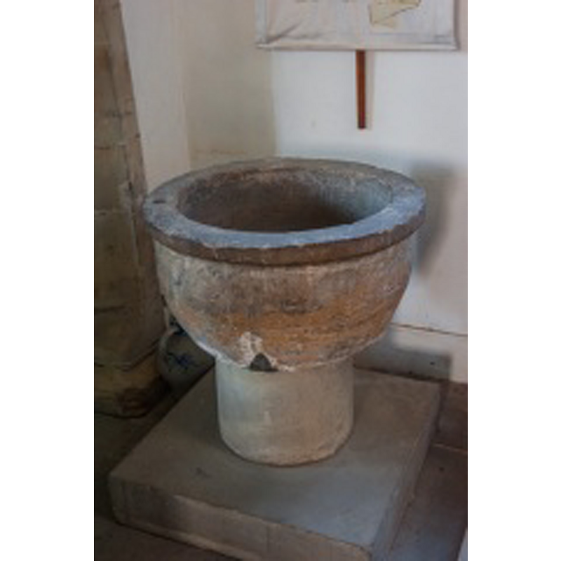
Image copyright © David Ross & Britain Express Ltd, 2015
Standing permission
Results: 4 records
view of font
Scene Description: the 12thC(?) basin on a modern pedestal base
Copyright Statement: Image copyright © David Ross & Britain Express Ltd, 2015
Image Source: digital photograph taken by David Ross [www.britainexpress.com/counties/shropshire/churches/much-wenlock.htm] [accessed 9 July 2015]
Copyright Instructions: Standing permission
design element - motifs - flat moulding
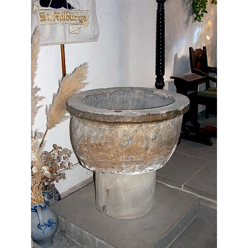
Copyright Statement: Image copyright © David Taylor, 2006
Image Source: digital photograph taken in Febryary 2006
Copyright Instructions: Image and permission received (e-mail of 13 March 2006)
view of church exterior - south view
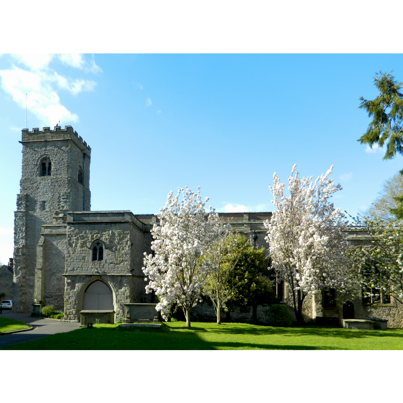
Copyright Statement: Image copyright © John Lord, 2015
Image Source: digital photograph taken 30 April 2015 by John Lord [www.geograph.org.uk/photo/4467884] [accessed 9 July 2015]
Copyright Instructions: CC-BY-SA-2.0
view of church interior - nave - looking east
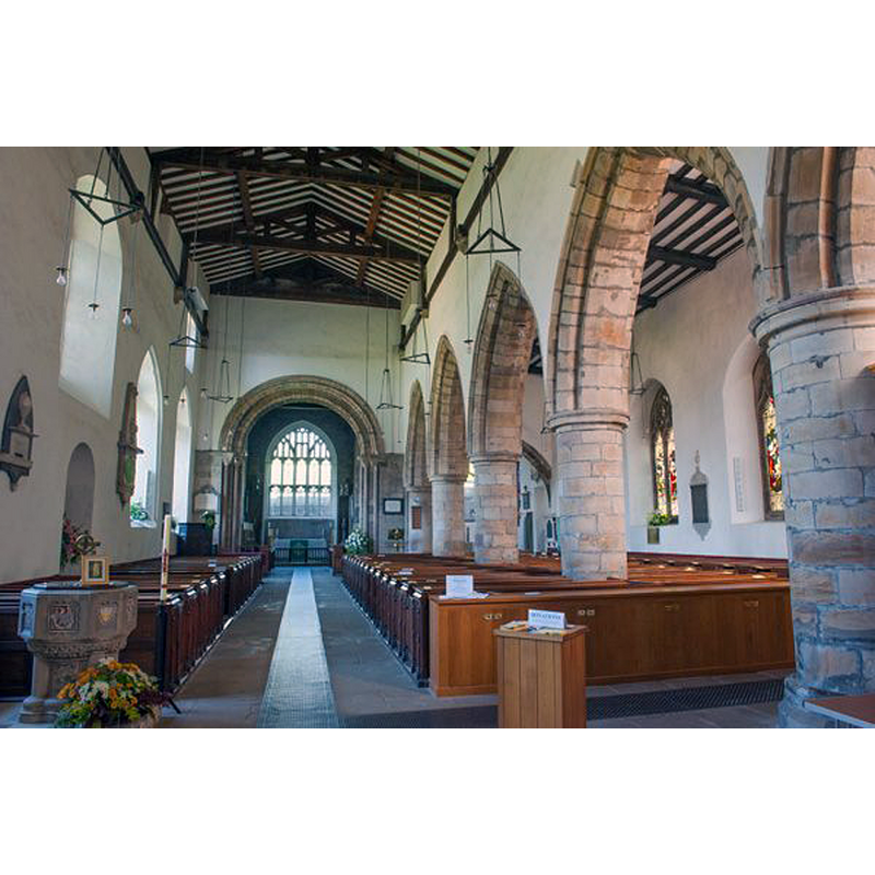
Scene Description: the font in the foreground, left side, is 19th-century
Copyright Statement: Image copyright © David Ross & Britain Express Ltd, 2015
Image Source: digital photograph taken by David Ross [www.britainexpress.com/counties/shropshire/churches/much-wenlock.htm] [accessed 9 July 2015]
Copyright Instructions: Standing permission
INFORMATION
Font ID: 11578MUC
Object Type: Baptismal Font1
Font Century and Period/Style: 12th century [basin only], Medieval [composite]
Church / Chapel Name: Parish Church of the Holy Trinity [formerly St. Milburga]
Font Location in Church: Inside the church, in the S chapel
Church Patron Saint(s): The Holy Trinity [formerly dedicated to St. Milburga [aka Milburh, Milburgha]]
Church Address: Wilmore Street, Much Wenlock, Shropshire TF13 6HR, UK
Site Location: Shropshire, West Midlands, England, United Kingdom
Directions to Site: Located at the A458-A4169 crossroads, 11 km NW of Bridgnorth, 18-20 km SE of Shrewsbury
Ecclesiastic Region: Diocese of Hereford
Historical Region: Hundred of Patton [in Domesday] -- Hundred of Munslow, Liberty and Borough of Wenlock
Additional Comments: altered font? (the presdent one: a Norman basin on a modern base) -- disappeared font? (the one from the 10th-11thC church here)
Font Notes:
Click to view
There are two entries for [Much] Wenlock [variant spelling] in the Domesday survey [http://opendomesday.org/place/SO6299/much-wenlock/] [accessed 9 July 2015], neither of which mentions cleric or church in it. The Victoria County History (Shropshire, vol. 10, 1998) notes: "Holy Trinity may have been the survivor of a pair of churches and was presumably the minster that existed in 901 [...] and probably came to be served by secular priests; [...] Holy Trinity was called a minster c. 1101. [...] It may have become redundant in the 11th century [...] and in 1101 Holy Trinity was dilapidated and under repair. [...] The reconstitution of the new minster as a Cluniac priory probably led in the early 12th century to the reinstatement of Holy Trinity as a parish church [...] and to its complete rebuilding. [...] The spacious parish church of the HOLY TRINITY replaced a church so dedicated by 1101. [...] A gothic font in Caen stone, inlaid with ceramic plaques, had been given in 1875; [...] it remained in the church after its plain Norman predecessor was brought inside c. 1920. [...] The nave seems from its south doorway (integral with the nave plinth) to have been built in the 12th century. The plain cylindrical font seems contemporary with it." The older of two fonts found in this church consists of a roughly hemispherical basin raised on a modern concrete pedestal; the basin is so crude, irregular and ill-shaped that it is difficult to guess a date for it; it has a protruding upper rim. Newman & Pevsner (2006) date it C12.
Credit and Acknowledgements: We are grateful to David Ross, of Britain Express Ltd [www.britainexpress.com] and to David Taylor, for their photographs of this church and font
COORDINATES
UTM: 30U 530038 5827457
Latitude & Longitude (Decimal): 52.596304, -2.556526
Latitude & Longitude (DMS): 52° 35′ 46.69″ N, 2° 33′ 23.5″ W
MEDIUM AND MEASUREMENTS
Material: stone
Font Shape: tub-shaped
Basin Interior Shape: round
Basin Exterior Shape: round
REFERENCES
- Victoria County History [online], University of London, 1993-. URL: https://www.british-history.ac.uk.
- Newman, John, Shropshire, New Haven: Yale University Press, 2006, p. 428