Weston nr. Retford / Westone
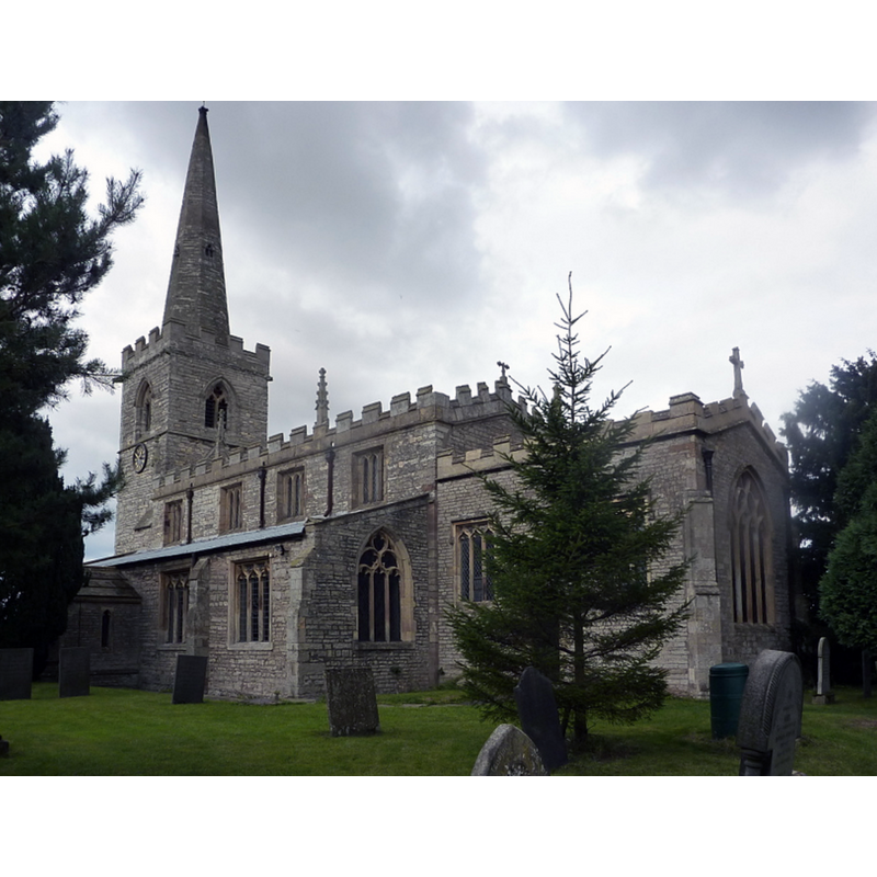
Image copyright © Andrew Hill, 2010
CC-BY-SA-2.0
Results: 4 records
view of church exterior - southeast view
Copyright Statement: Image copyright © Andrew Hill, 2010
Image Source: digital photograph taken 18 September 2010 by Andrew Hill [www.geograph.org.uk/photo/2071574] [accessed 10 August 2019]
Copyright Instructions: CC-BY-SA-2.0
view of church exterior in context - north view
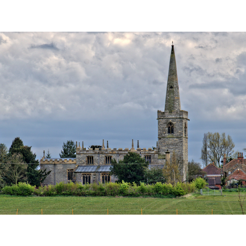
Scene Description: Source caption: "The body of the church dates from the 13th century, in Early English style, including aisles and the lower part of the tower. The spire and chancel date from the 14th century, the latter being rebuilt in 1840. The clerestory is a 16th century addition, and the nave roof is of this date, although restored in 1768. There was further extensive restoration in 1880."
Copyright Statement: Image copyright © Jules & Jenny, 2016
Image Source: digital photograph taken 24 April 2016 by Jules & Jenny [www.flickr.com/photos/78914786@N06/26685893062] [accessed 10 August 2019]
Copyright Instructions: CC-BY-SA-2.0
view of church interior - looking west
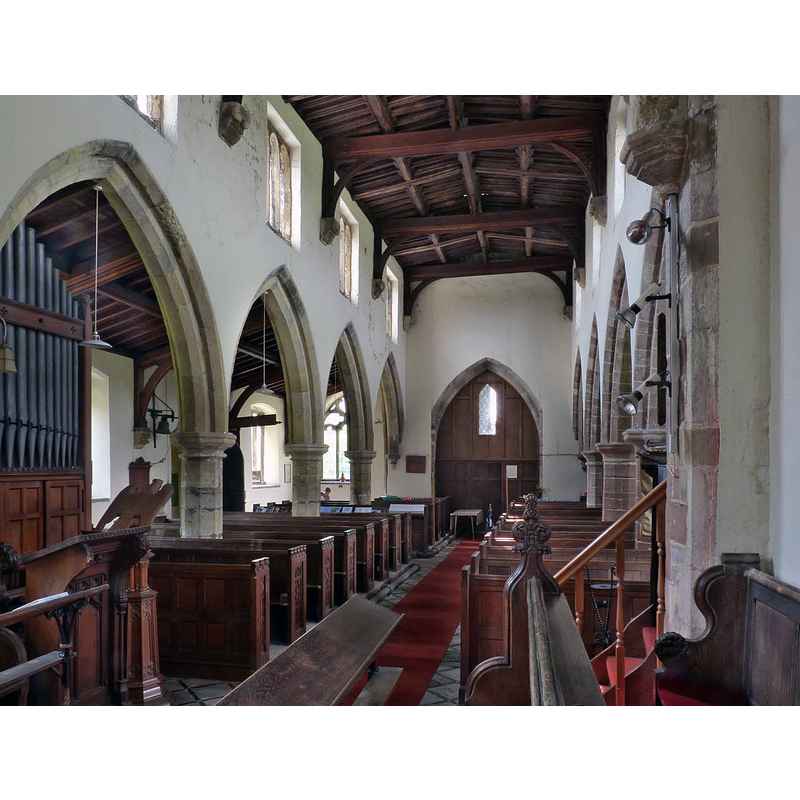
Copyright Statement: Image copyright © Alan Murray-Rust, 2014
Image Source: digital photograph taken 1 August 2014 by Alan Murray-Rust [www.geograph.org.uk/photo/4104572] [accessed 10 August 2019]
Copyright Instructions: CC-BY-SA-2.0
view of church interior - looking east
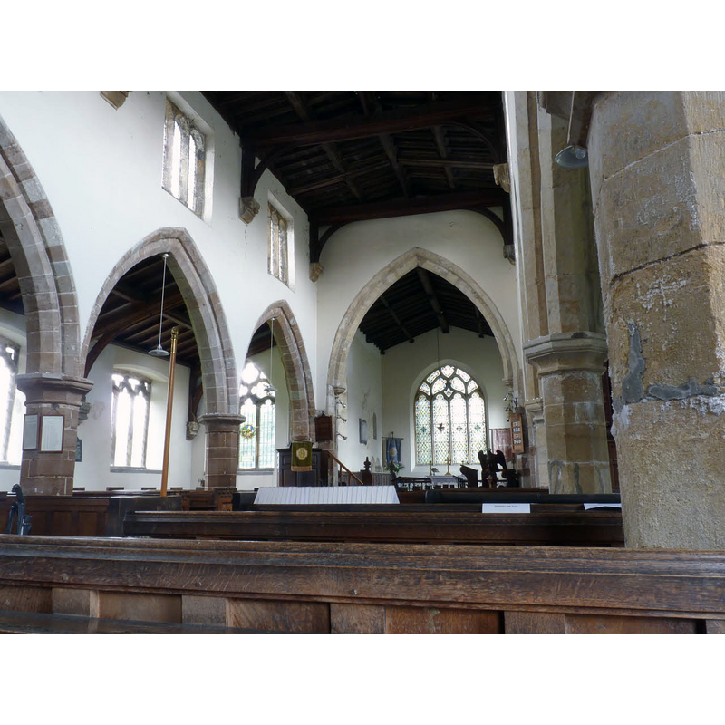
Copyright Statement: Image copyright © Alan Murray-Rust, 2014
Image Source: digital photograph taken 1 August 2014 by Alan Murray-Rust [www.geograph.org.uk/photo/4104569] [accessed 10 August 2019]
Copyright Instructions: CC-BY-SA-2.0
INFORMATION
Font ID: 11564NOT
Object Type: Baptismal Font1
Font Century and Period/Style: 12th century, Late Norman
Church / Chapel Name: Parish Church of All Saints
Font Location in Church: Inside the church [cf. FontNotes]
Church Patron Saint(s): All Saints
Church Address: Main St, Weston NG23 6ST, UK -- Tel.: +44 777872917
Site Location: Nottinghamshire, East Midlands, England, United Kingdom
Directions to Site: Located off (N) the B1164, 16 km S of Retford
Ecclesiastic Region: Diocese of Southwell & Nottingham
Historical Region: Hundred of Lythe
Additional Comments: disappeared font? (the one from the Domesday-time church here)
Font Notes:
Click to view
There is an entry for this Weston [variant spelling] in the Domesday survey [https://opendomesday.org/place/SK7767/weston/] [accessed 10 August 2019]; it reports a church in it. Cox (1912) reports a "plain tub font Norm[an]" in this church. Not mentioned in Pevsner & Williamson (1979). The entry for this church in the Southwell & Nottingham Church History Project [http://southwellchurches.nottingham.ac.uk/weston/hhistory.php] [accessed 10 August 2019] notes that in the 1880s general restoration, "The font was removed to the west end of the south aisle to form a baptistery". It further notes that "Several [...] interesting aspects to the church were recorded by the Rev. T. W. Swift who became the priest-in-charge of Weston church in 1966 [...] Other items of note recorded by Swift included the font, the chest and the plate. The Norman tub font was most likely in the church during the 12th century". The entry for this church in Historic England [Listing NGR: SK7741668015] notes: "Parish church. C13, C14, C15, C16, restored 1768 and C19. [...] Fittings include plain C12 tub font with chamfered round base".
COORDINATES
UTM: 30U 644087 5897075
Latitude & Longitude (Decimal): 53.203447, -0.842692
Latitude & Longitude (DMS): 53° 12′ 12.41″ N, 0° 50′ 33.69″ W
MEDIUM AND MEASUREMENTS
Material: stone
Font Shape: tub-shaped
Basin Interior Shape: round
Basin Exterior Shape: round
REFERENCES
- Cox, John Charles, Nottinghamshire, London: Allen, 1912, p. 229