Brockdish / Broad-ditch / Brodiso
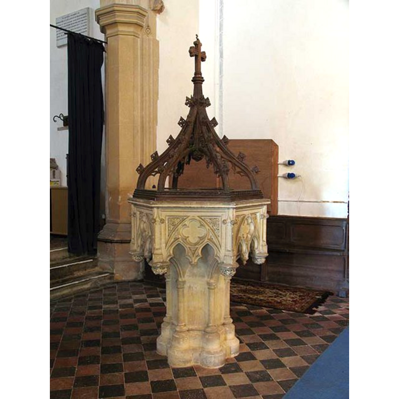
Image copyright © John Salmon, 2008
CC-BY-SA-3.0
Results: 4 records
view of font and cover
Scene Description: the old cover on the modern font [cf. FontNotes]
Copyright Statement: Image copyright © John Salmon, 2008
Image Source: digital photograph taken 2 May 2008 by John Salmon [www.geograph.org.uk/photo/804898] [accessed 16 April 2013]
Copyright Instructions: CC-BY-SA-3.0
view of church exterior - southeast view
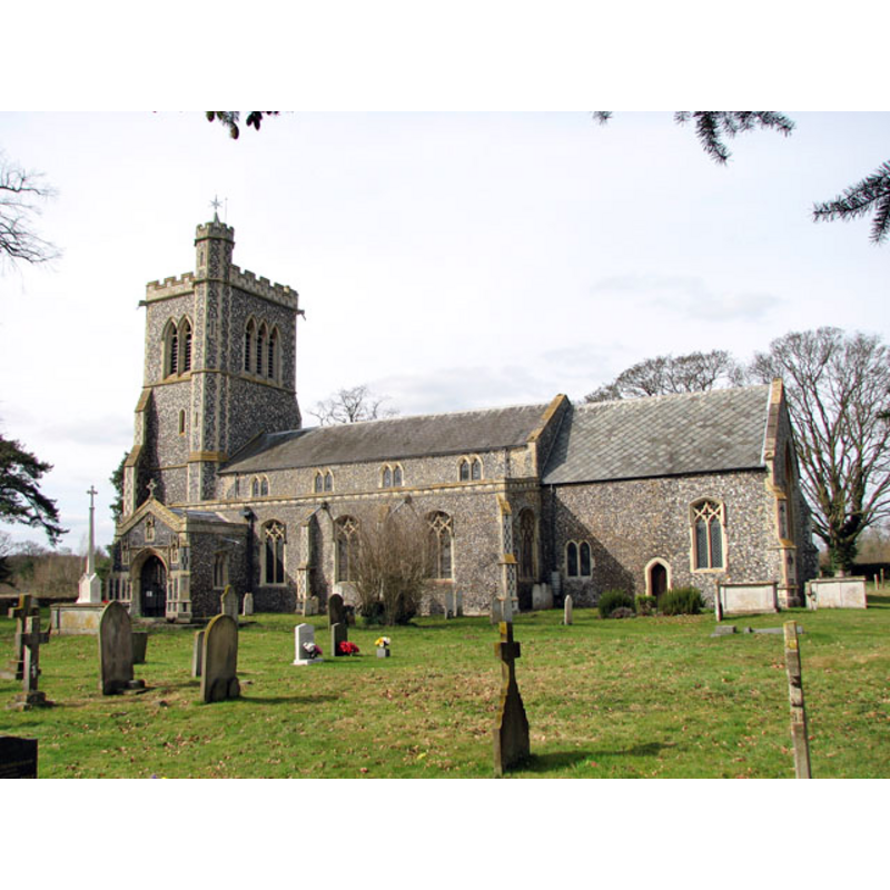
Copyright Statement: Image copyright © Evelyn Simak, 2010
Image Source: digital photograph taken 21 March 2010 by Evelyn Simak [www.geograph.org.uk/photo/1768049] [accessed 16 April 2013]
Copyright Instructions: CC-BY-SA-3.0
view of font and cover in context
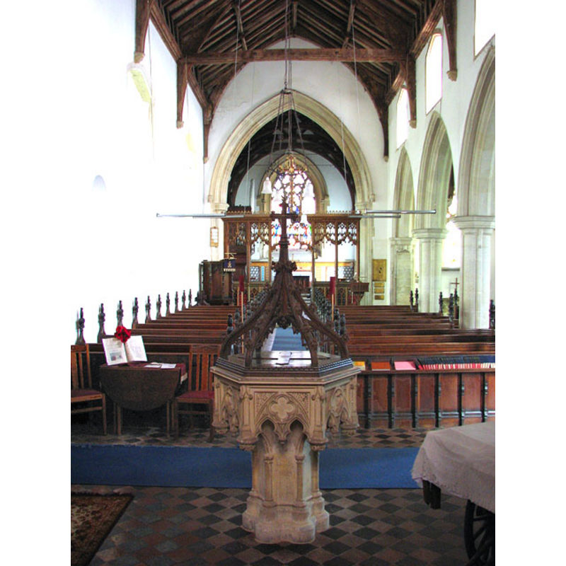
Scene Description: the modern font at the west end of the nave, looking east
Copyright Statement: Image copyright © Evelyn Simak, 2010
Image Source: digital photograph taken 21 March 2010 by Evelyn Simak [www.geograph.org.uk/photo/1768053] [accessed 16 April 2013]
Copyright Instructions: CC-BY-SA-3.0
view of church interior - nave - looking east
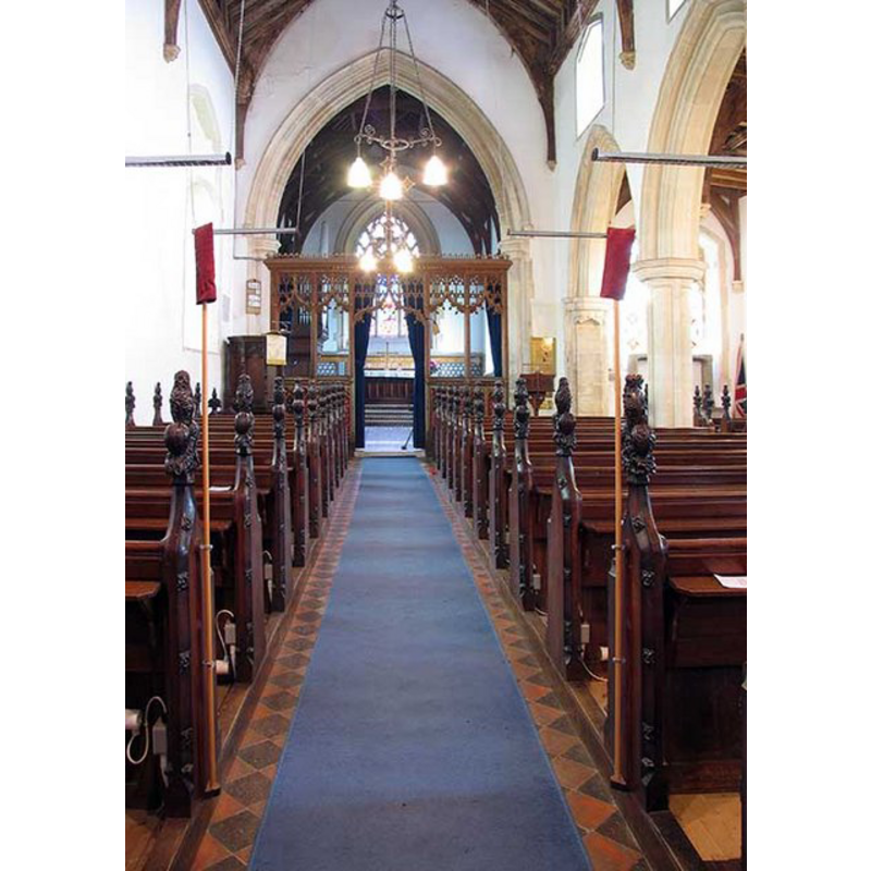
Copyright Statement: Image copyright © John Salmon, 2008
Image Source: digital photograph taken 2 May 2008 by John Salmon [www.geograph.org.uk/photo/804908] [accessed 16 April 2013]
Copyright Instructions: CC-BY-SA-3.0
INFORMATION
Font ID: 11539BRO
Object Type: Baptismal Font1
Font Century and Period/Style: Medieval
Church / Chapel Name: Parish Church of St. Peter and St Paul
Font Location in Church: [cf. FontNotes]
Church Patron Saint(s): St. Peter & St. Paul
Church Address: Brockdish, Norfolk, IP21 4JJ, UK
Site Location: Norfolk, East Anglia, England, United Kingdom
Directions to Site: Located off the A143, 9-20 km E of Diss
Ecclesiastic Region: Diocese of Norwich
Historical Region: Hundred of Earsham [in Domesday]
Additional Comments: buried font? / disused font? [cf. FontNotes]
Font Notes:
Click to view
There are two multiple-place entries that include Brockdish in the Domesday survey [https://opendomesday.org/place/TM2179/brockdish/] [accessed 22 June 2025]; the one for the land of the abbey of Busy St Edmunds reports "1 church. 0.1 church lands" in it. Gough (1792) cites Blomefield on the issue of a cover being "bought for Brockdish font so late as 1553". Blomefield (1805-1810) writes of a church that stands, at Brockdish, on the left side of the road to Yarmouth, and cites the Domesday (1086) entry which reports "that the rector had a house and 30 acres of land," The Blomefield (ibid.) reference to the font reads: "1553, 1st Queen Mary, paid for a book called a manuel 2s. 6d.; for two days making the altar and the holy-water stope, and for a lock for the font." Blomefield (ibid.) further names the first two recorded rectors in Brockdish. one "Robert" and "Sir Ralf de Creping", both of whom are recorded without and accurate date in the 13th century. Dugdale (1819) transcribes the same reference reported in Blomefield [cf. supra]. White's Directory of 1854 (p. 377-378) reports: "A handsome font has been erected in lieu of a singular pile of stones purloined from a neighbouring tomb, and amalgamated into the required form. The bowl of the ancient font was found inverted, and set in the pavement at the chancel door." Rector George France, at the time of the major renovation of the church in the 1870s, had installed the baptistery beneath the tower; by this time the old basin had already been 'buried' into the pavement [cf. supra], and we have not found any further reference to it. Simon Knott (2005) reports: "The font has recently been moved back into the body of the church", again, referring to the 19th-century font. [NB: the fabric of the church goes back to Domesday times, but we have no confirmation of the date of the present font, nor do we have confirmation of the whereabouts of the medieval cover].
COORDINATES
UTM: 31U 379916 5803666
Latitude & Longitude (Decimal): 52.370089, 1.236143
Latitude & Longitude (DMS): 52° 22′ 12.32″ N, 1° 14′ 10.12″ E
MEDIUM AND MEASUREMENTS
Material: stone
LID INFORMATION
Date: 1553?
Notes: [cf. FontNotes]
REFERENCES
- Blomefield, Francis, An essay towards a history of Norfolk, Fersfield, Norwich and Lynn: [Printed in the author's own press], 1739-1755, vol. III: 228
- Blomefield, Francis, An essay towards a topographical history of Norfolk, 1805-1810, vol. 5: 327-339 / [www.british-history.ac.uk/report.aspx?compid=78190] [accessed 16 April 2013]
- Dugdale, James, The New British Traveller; or, a modern panorama of England and Wales; exhibiting an account […], London: J. Robins, 1819, p. 605 / http://books.google.ca/books?id=-OfGAAAAMAAJ&pg=RA1-PA605&lpg=RA1-PA605&dq=brockdish+church+font&source=bl&ots=5XJFg1LSre&sig=1_k69Z3ehfaJpiBFyRdpzWc2230&hl=en&ei=Ks5gSqCAJp6itgfU0rjXDA&sa=X&oi=book_result&ct=result&resnum=4 [accessed 17 July 2009]
- Gough, Richard, "Description of the old font in the Church of East Meon, Hampshire, 1789: with some observations on fonts", X, Archaeologia, 1792, pp. 183-209; p. 207 and fn
- Knott, Simon, The Norfolk Churches Site, Simon Knott, 2004. [standing permission to reproduce images received from Simon (February 2005]. URL: www.norfolkchurches.co.uk.